Pete's Walks - A Dales Walk
If you are considering walking this route yourself, please see my disclaimer. You may also like to see these notes about the maps and GPX files.
Day 5 15/06/06 Keld to Reeth (12.5 miles, approximately)
This was another fine, dry and warm day – we were really lucky with the weather throughout this holiday! Today we took the high-level option (as we did most days except for the very long option over Wild Boar Fell) which entailed a climb from Gunnerside up over the moors to explore the old lead mine workings, rather than take the low-level option which simply followed the river down Swaledale to Reeth.
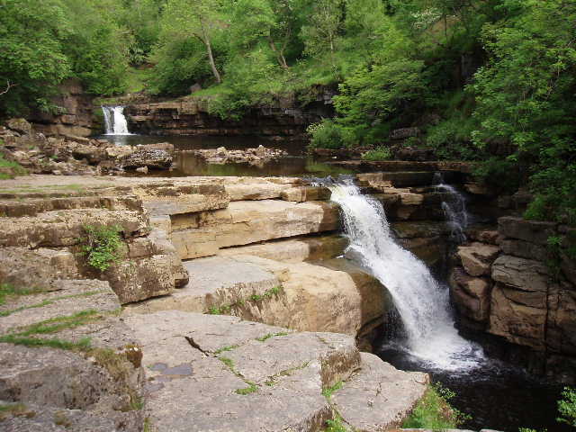
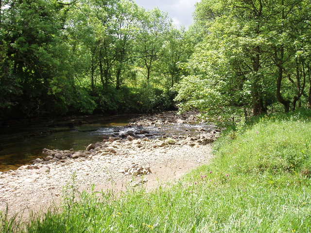
[1] Kisdon Force
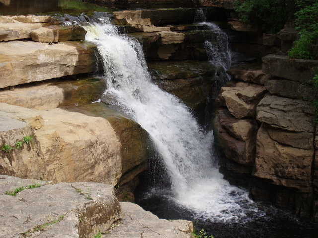
[2] Kisdon Force
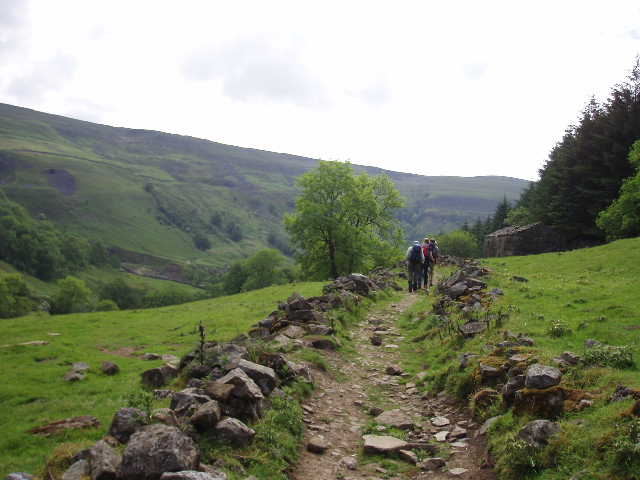
[3] The path round the side of Kisdon Hill
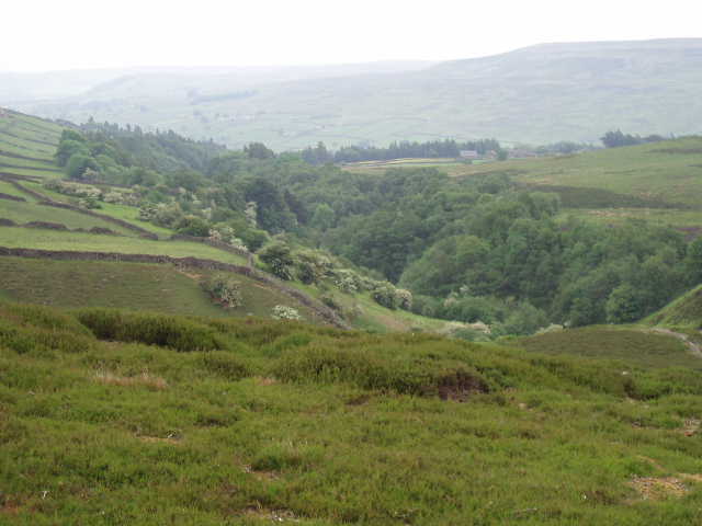
At Keld, the large mound of Kisdon Hill rises in the middle of the dale, leaving narrow valleys either side – the river Swale goes round it by going across the northern end of the hill and taking the valley on the eastern side, whereas the road goes south down the western valley before turning west, the two routes re-converging near the southern end of Kisdon Hill close to Muker, where Swaledale becomes a broad valley once again. Our route followed the river round the northern and eastern sides of Kisdon Hill. Initially we retraced our steps towards where we had joined the Pennine Way yesterday, before bearing right and following the southern bank of the river through its narrow valley. We soon heard the waterfall of Kisdon Force, and took a small diversion down a path to get a closer look at the falls [1,2]. We then carried on as the river turned south, with Kisdon Hill now on our right [3,4], walking through pleasant grass meadows cropped by sheep, beside the river as it tumbled along on its stony course.
[4] The river Swale, near Kisdon Hill

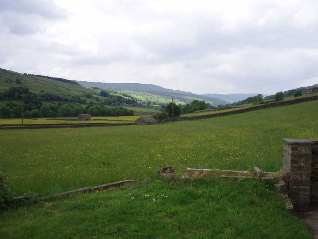
[5] Walking through typical Swaledale scenery, near Muker
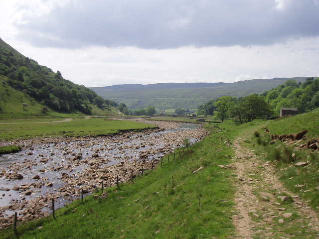
[6] The river Swale
We crossed the sturdy footbridge at Ramps Holme, and continued along the north bank of the river as it now headed eastwards. We were now walking through archetypal Swaledale scenery – small hay meadows full of flowers, predominantly yellow, surrounded by dry stone walls, each meadow having its own small stone barn where the hay is stored to dry. In the warm sunshine, it was idyllic to be walking through these beautiful meadows with the river never far away [5]. When we stopped for a water break, a passing Coast-to-Coast walker told us she’d seen some trout in the river [6] (we saw and spoke to this lady several more times today). We’d already seen Pied Wagtails and Common Sandpipers on the river, but not any fish. We soon put this right as we carried on. I saw one trout, then I thought I saw a second – the funny thing, was they were moving exactly the same. So we decided the second ‘fish’ was actually the shadow of the first fish – either that, or else the trout were absolutely excellent at synchronised swimming! We continued along on this very enjoyable section of the walk for several miles, passing through countless colourful meadows and never more than 100 yards from the lovely river Swale, until we reached the pleasant village of Gunnerside [7], where we stopped to eat our packed lunches.
[7] Looking back along Swaledale from Gunnerside
[8] Looking back over Gunnerside and along Swaledale
[9] Moorland track above Gunnerside
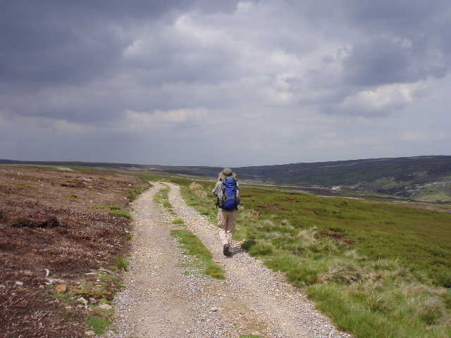
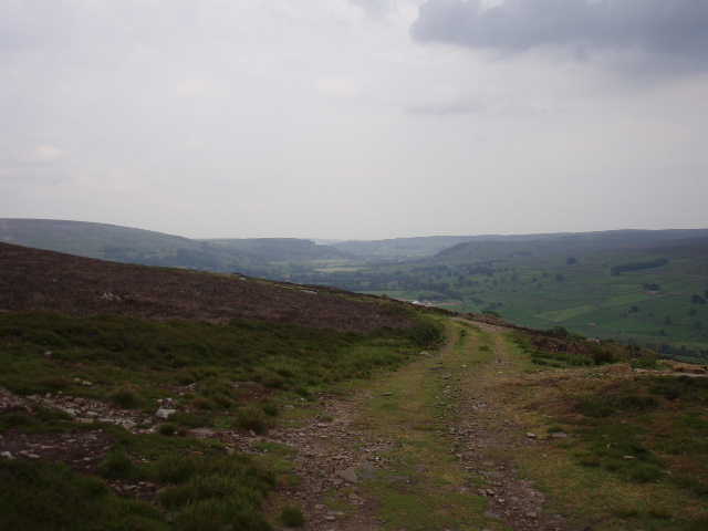
Now the hard work began! From Gunnerside, we took a narrow lane that zigzagged steeply up the hillside northwards, passing only a few slightly isolated cottages [8]. This was certainly the steepest prolonged climb of the holiday. Again, we all took it at our own pace, and slowly but steadily we gained more and more height until we reached the intake wall, where the fields ended and the open moorland began. After a quick breather, we continued on a broad track, still climbing steadily but less steeply now. We bore left at a junction of tracks, and then turned right when we came out on another new shooter’s track. The gradient was now much easier, but still uphill. Hereabouts we saw our first Red Grouse, a cock flying off from close to the track, then some young birds and the hen scampering away across the heather. As the track eventually levelled out [9], a section of moorland ahead shimmered in a heat haze – it was now very warm and sunny, although in only about quarter of an hour the sun had gone in and it was appreciably cooler. We followed the shooter’s track a short distance further, then turned right and followed a line of shooting butts slowly downhill [10], to reach a broad track. Here we turned right and followed the track along the bottom of a narrow valley, heading back down towards Swaledale.
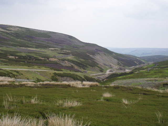
[10]Moorland around Old Gang Lead Smelt Mill
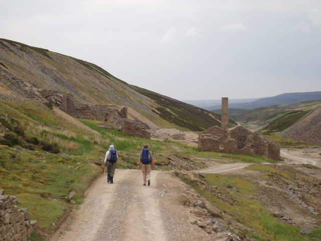
[11] Walking towards the Old Gang Lead Smelt Mill
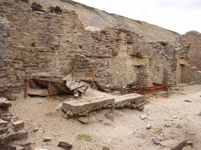
[12] Part of the remains of the Old Gang Lead Smelt Mill
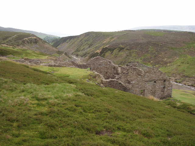
Almost immediately we were walking through the remains of the Old Gang Lead Smelt Mill [11,12], where a number of buildings were in various states of decay or restoration. On the hillside above us, one building consisted of a series of triangular walls, so that we said it looked like a Toast Rack or a Toblerone – apparently it was where they stored the peat they used in the fires. We saw the rusty remains of some old machinery in one building, and saw where flues came down from higher up the hillside. We carried on down the track [13] for almost a mile until we reached Surrender Bridge [14] – I asked the inevitable question and James said ‘Why’s it called Surrender Bridge? I don’t know, I give up!’. (I’ve just done a quick Google on the internet but couldn’t find anything that explained the intriguing name.
[13]Track between Old Gang Lead Smelt Mill and Surrender Bridge
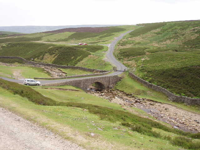
[14] Surrender Bridge
[15] Ruins of Surrender Bridge Smelt Mill
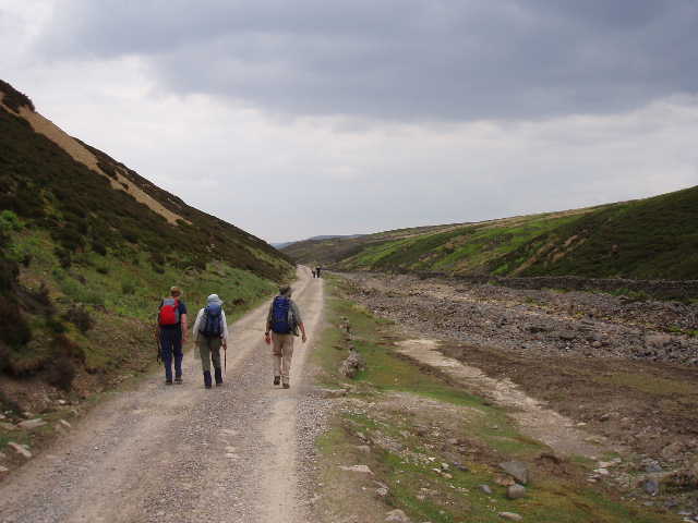
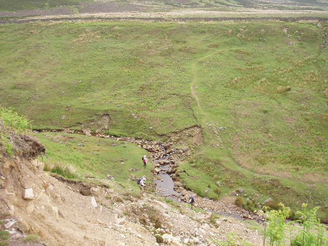
We continued on another track across a road, with the ruins of the Surrender Bridge Smelt Mill below us on the right [15]. Soon we came to the steep-sided gulley of Cringley Bottom [16,17,18] (another intriguing name!) blocking our way forward. The path down was steep and tricky, the climb the other side not so steep and more on grass. When we looked back, we could see that the path we’d taken down looked in imminent danger of a landslip and speculated on how the path could be rerouted to find a safer way down. Anne told us that on one occasion the party she was with had been unable to cross at this point because the stream at the bottom was in flood (it was a mere trickle today) and they had had to make their way through the undergrowth on the western side of the gulley for about half a mile to reach a bridge. A good path now lead us onwards, with an intake wall to our right and moorland on our left. After a while we turned away from the wall and took a path through the heather [19], only to return to the wall further on. We followed the wall onwards, now on a good stony track, passing one or two isolated buildings. At one point we came across a Lapwing sitting on the wall – bizarrely, it remained there as we passed within a few feet of it, even allowing me to take a photo of it.
[16] Swaledale, near Cringley Bottom
[17] Cringley Bottom
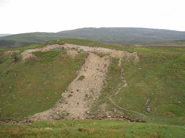
[18] Cringley Bottom
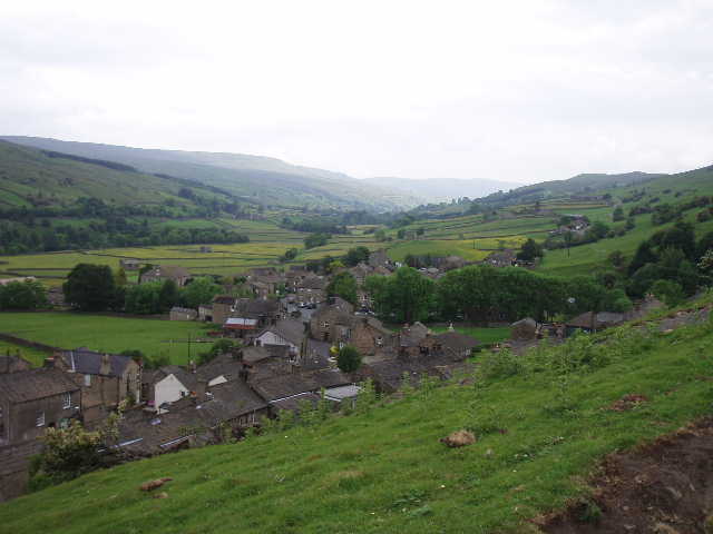
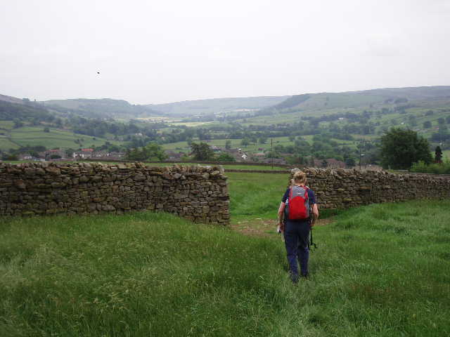
Just past a farm, we turned right into Skelgate Lane, a narrow track between walls that was heavily overgrown with nettles, brambles and other plants, although the path through the centre of it was reasonably clear. We followed this steadily downhill, with Reeth clearly in view a short distance away, before taking a path [20] across a field to a road by a school. We followed the road to the left, and were soon in the centre of Reeth [21]. I remembered the large green in the centre of the village from numerous previous visits, and recognised the hotel where I’d stayed on my Coast-to-Coast walk 29 years ago.
[19] Moorland path, just beyond Cringley Bottom
[20] Path heading towards Reeth
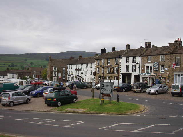
[21] Reeth
Total Distance: 62.5 miles approximately