Pete's Walks - The Chiltern Chain Walk, Walk 18
If you are considering walking this route yourself, please see my disclaimer. You may also like to see these notes about the maps and GPX files.
Google map of the walkDownload GPX file of the walk
Walk 18 13/06/08 – Stoke Row and Nuffield (12.9 miles approximately)
Parked in Stoke Row.
If you are interested in walking this route yourself, click here to see the route description (but only if you have already read my disclaimer and notes regarding route descriptions).
It took almost an hour and a quarter to drive to Stoke Row, and I started the walk at 10.12am, having parked near the Village Hall. It was much cooler today, the temperature being around 16-18C all day. It was fairly grey to start off with, brightened up a bit around midday, but then became very grey in the afternoon although remaining dry. I started off by walking eastwards along the road through Stoke Row, passing the Village Hall and shop on my right, and further on the Cherry Tree pub on my left [1].
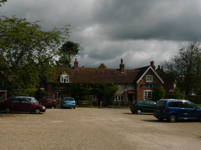
[1]The Cherry Tree pub, Stoke Row
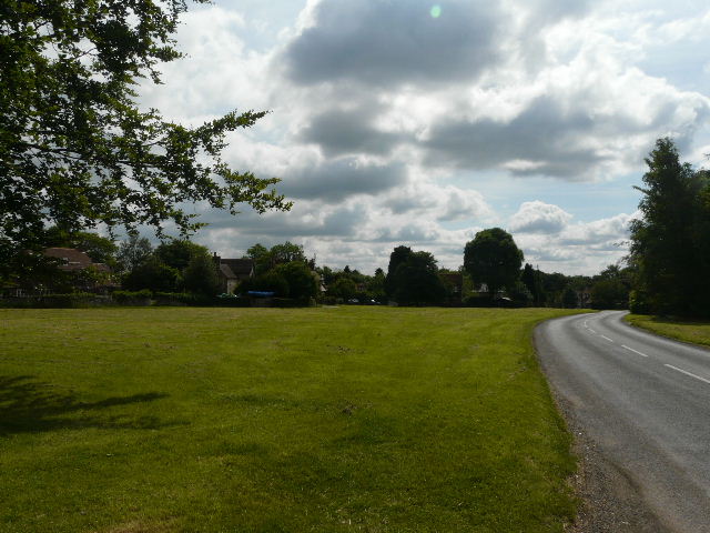
[2]The village green, Stoke Row
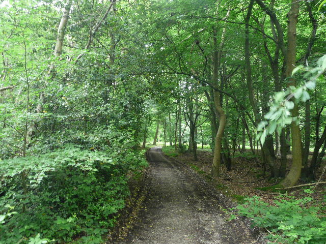
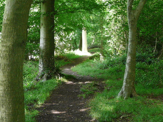
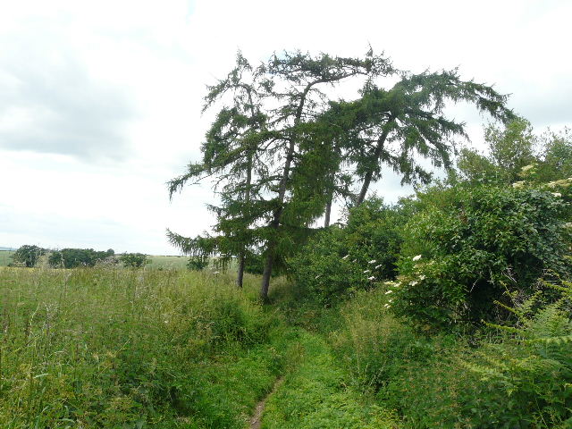
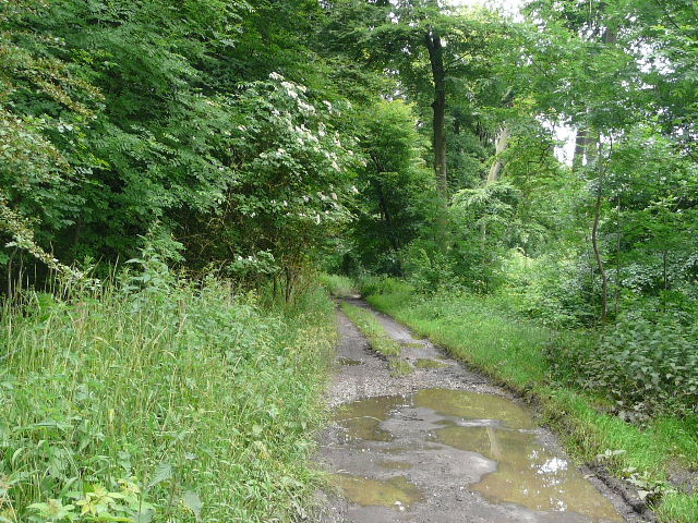
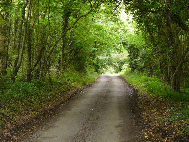
I turned left down Newlands Lane, initially with a large green on my right [2]. The lane turned sharply to the right and then to the left, passing several houses and cottages. Where the lane then turned left again, I went straight ahead on a bridleway that headed steeply downhill through a wood [3]. A path soon forked left, but I stayed on the bridleway and followed it all the way to the bottom of the slope where I reached a lane. I continue through the trees on the other side and within a hundred yards or so came to a second lane (the two lanes converged a short distance to my right). I crossed over and carried on along a very long tarmac drive, initially a footpath but becoming a bridleway after a hundred yards or so. I followed the drive for about half a mile [4], with various fields beyond the hedges on either side. I passed one or two residences along the way, and beyond the last one the drive entered Nott Wood.
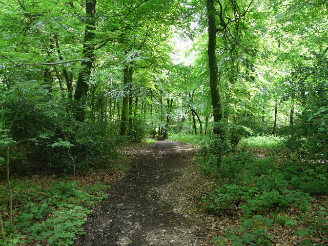
[3]The bridleway from Stoke Row
[4]The bridleway along the drive, heading to Nott Wood
The tarmac ended here, but the drive was still well-surfaced as it went through the wood [5]. At one point I saw a Buzzard fly off through the trees ahead of me. On the far side of the wood I reached a junction where I turned right, following another tarmac farm drive steadily downhill beside the wood on my right, and with a rather unkempt corn field to my left. Looking ahead I could see across the fields to the tower of Nettlebed church [6]. In the valley bottom the drive turned right and went uphill slightly, still with the wood on one side. It then turned left, running between hedges with cornfield or meadows on either side [7]. I had some close up views of Red Kites here and managed to get some photos – unfortunately I then realised that I’d left the camera in ‘Scene’ mode rather than switching to ‘Aperture Priority’, so they were nowhere near as sharp as they might have been! Doh! There was also another Buzzard here, or possibly it was the one I’d seen fly out of the wood.
[5]The track through Nott Wood
[6]The farm drive, looking towards Nettlebed church
[7]The farm drive heading towards Nettlebed
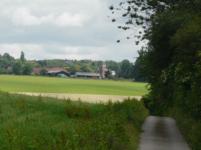
The drive led on to reach a main road near the edge of Nettlebed, next to the church [8]. I continued almost opposite, alongside a field on my left and then passing through some allotments [9] to reach another road (the one from Watlington which I’d driven along earlier). Here I turned sharp left onto another bridleway (Bushes Lane) that started from the road at the same point. This soon passed a few houses then left Nettlebed behind, then ran on between hedgerows.
[8] Nettlebed church
Archaeological finds have shown that the area around Nettlebed has been settled since Palaeolithic times. It has long been frequently travelled through, as it lies on the main route between Oxford and Henley. There is a tradition of pottery making here that is first recorded in the 9th century, with several clay pits in the vicinity, and brick making was recorded here as early as the 14th century. The last pottery closed in 1930, though there is one pottery kiln still standing in the village. The sand used for the first Flint Glass, a high-quality optical glass, was taken from Nettlebed in 1674 by George Ravencroft.
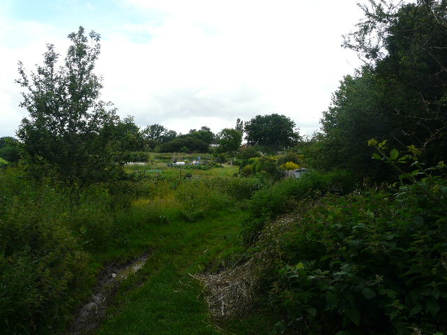
[9]The path through the allotments at Nettlebed
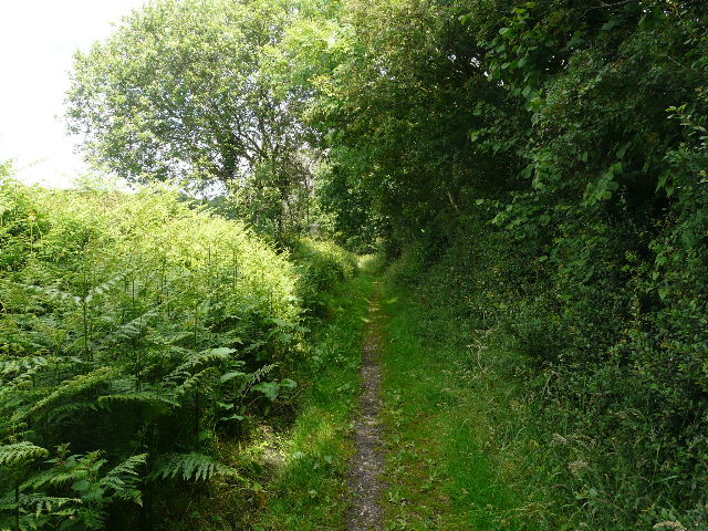
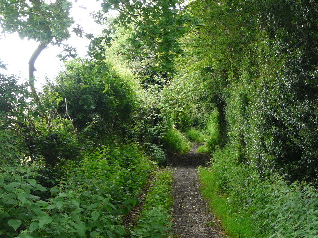
The bridleway [10] then passed through some woodland and finally went through a farmyard to reach Huntercombe End lane. I turned right and followed the narrow and twisting lane for about a quarter of a mile [11]. Where it turned sharply to the right, I turned left onto another bridleway (this one is called Digberry Lane on the map). I passed two or three cottages on my right, then the bridleway changed from a surfaced track to a path running through a thin belt of trees. I kept right at a minor fork in the path, and soon came to a T-junction of paths, where I turned left, starting to retrace part of Walk 17 (if I’d turned right I’d have soon come to Park Corner). The path ran through another thin belt of trees, mainly beech, and was quite muddy in places. I soon passed the junction where the last walk had come in from my right, and carried on very gently descending along a valley bottom. The tree belt had now expanded to become a wood on my left. I got a very brief glimpse of the back of a Fallow deer in the bracken to my right at one point – I’d seen them near here before. The path here was very familiar to me, as it’s part of the Chiltern Way.
[10]The bridleway between Nettlebed and Huntercombe End Lane
[11] Huntercombe End Lane
After about half a mile the wood ended, and the path continued between a narrower tree belt, again mainly beech – I remembered seeing masses of Wood Anemones when I last walked here a couple of months ago [12]. After another quarter of a mile I came to a crossing path, where I turned left, leaving the Chiltern Way but joining the Ridgeway instead. The path went through a field of oil-seed rape [13] – I had to thread my way through where the crop spilled over onto the path – and then went half-left and uphill through a small wood. Here I saw what was probably a Marsh Tit (although possibly a Willow Tit, they are very difficult to tell apart) – I spent a few minutes trying to photograph it, but it kept flying to a different branch every time I focussed on it, and I only got a couple of very blurry images.
[12]The long path heading towards the Ridgeway
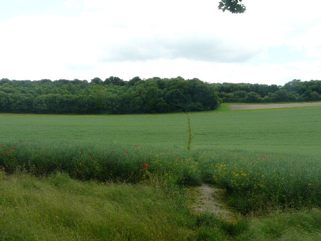
[13]The start of the section along the Ridgeway
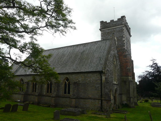
Beyond the wood I crossed over a busy main road and continued along a path, passing directly in front of an old house before crossing three or four fairways of a golf course – the route here was shown by white-topped wooden marker posts, which also had waymarks and the white acorn symbol that denoted the Ridgeway National Trail. I passed to the right of the clubhouse and went diagonally across a large meadow. There were great views over the Oxfordshire Plain to my right – the skies had brightened up now, so that the views were quite extensive [14]. On the far side of the meadow [15] I reached a lane in Nuffield, where I turned right and soon passed the ancient church on my left (where a drinking tap is kindly provided for thirsty walkers!).
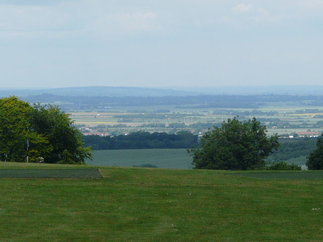
[14] View over the Oxfordshire Plain from the golf course at Nuffield
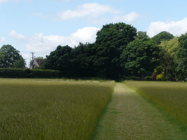
[15]The path approaching Nuffield
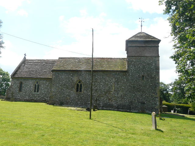
[16] Nuffield Church
At 700 feet above sea level, Nuffield sits at the highest point in the southern Chilterns. It was the home from 1933 to 1963 of William Morris, 1st Lord Nuffield, founder of the Morris Motor Company and the philanthropist behind the Nuffield Foundation (which promotes education and social welfare). He also founded Nuffield College, Oxford. His home at Nuffield Place is open to the public. He was buried in the village church, parts of which are thought to date back as far as 640AD (though most of it is a mere 900 years old!). It has a simple stone font, which may possibly be Saxon.
Shortly beyond the church [16] I turned left on a footpath following the edge of a very recently mown hay meadow. Again there were lovely views to my right over the Oxfordshire Plain, towards the monstrosity that is Didcot Power Station [17] and the more attractive feature of Wittenham Clumps (a pair of tree crowned hills where Time Team once did an archaeological dig). The path then ran through a belt of beech trees, with more meadows either side, to reach a junction where a signpost pointing right said “Grim’s Ditch for 3.4 miles” - I'd be following it for a couple of those miles.
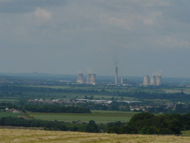
[17] Didcot Power Station dominating the Oxfordshire Plain, from the edge of Nuffield
There are several ancient earthworks called Grim’s Ditch (alternatively Grim’s Dyke or Grimsdyke) in the chalk hills of southern England, and also in Yorkshire. Their exact age and purpose are unknown, though they are thought to be too small to have been military defences and so were most probably some type of boundary. They are thought to pre-date the Saxons, who supposed these extensive earthworks were the work of their god of the underground, hence the name. The earthwork here extends for about five miles from Mongewell on the Thames to near Nettlebed, and is believed to date from the late Iron Age/early Roman period.
[18]Near the start of the path along Grim's Ditch
I turned right to follow the ancient earthwork (still on the route of the Ridgeway), which ran through another thin belt of mainly beech trees [18]. This was a nice easy part of the walk, as the path very slowly and easily descended down towards the flatter lands of the Thames Valley and Oxfordshire Plain at the foot of the Chilterns. The path was initially on the bank right of the ditch, soon running beside the meadow to the right of the trees. After crossing a drive by an isolated house on the left, the path ran for a short distance along the bottom of the ditch, where I saw some Cuckoo-pint growing (green ‘berries’ on a spike). The path soon returned to the bank right of the ditch [19]. I then went through a kissing gate in a wire fence, and the path continued on the bank left of the ditch [20], running through a belt of mainly beech trees. Again I remembered seeing numerous Wood Anemones here a couple of months ago.
[19]The path along Grim's Ditch
[20]The path along Grim's Ditch
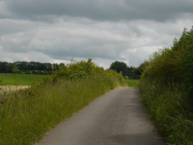
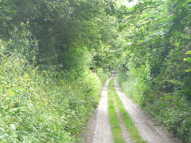
Further on, the tree belt ended and the path ran a short distance between hedges – the earthwork was no more than a slight bump in the ground here. The path then went through a small wood, where I stopped and sat on some logs to eat my lunch as it was now almost 1pm. Just as I was finishing, a lady walker passed me, going in the opposite direction. I carried on, the path soon leaving the wood and following a line of pine trees [21] beside a corn field on my left. At the end of the field I reached a lane, where I turned left, finally leaving Grim’s Ditch after accompanying it for a couple of miles, and also switching back from the Ridgeway to the Chiltern Way (or at least it’s Southern Extension).
[21]The pine trees near the end of the section along Grim's Ditch
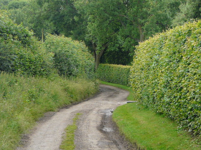
After a quarter of a mile I turned left again, onto the drive to Woodhouse Farm. As usual, I saw a Red Kite over the corn field to my left. On reaching the farmyard I continued between long sheds on each side, and then turned right on a good track going slightly uphill into a wood. On the far side of the wood, the path crossed a corn field [22] and then continued along a broad farm track between fences. Again there were good views to my right, across the Thames Valley to the Berkshire Downs on the far side [23]. I saw some Sainfoin growing along the edge of the corn field on my right. The track, known as Poors Lane, continued on past Poors Farm [24] and past a couple of houses to eventually reach the hamlet of Hailey.

[22]The path across the corn field heading for Poors Lane
[23]The Berkshire Downs across the Thames Valley from Poors Lane
[24] Poors Lane approaching Poors Farm
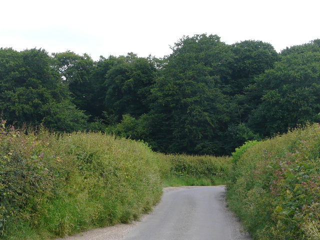
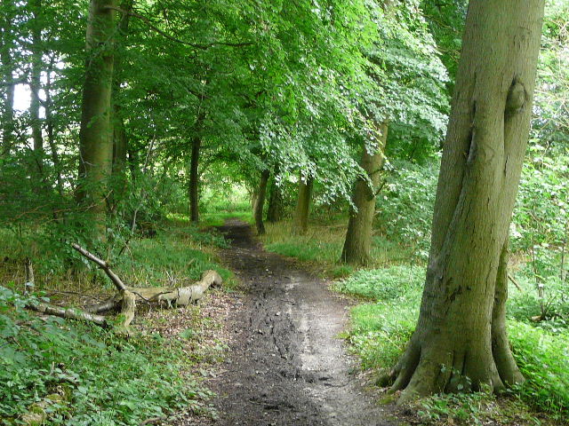
I turned left along the lane, soon passing the King William pub on my left. Just beyond a couple of houses on the right, the surfaced lane became more of a track, and the Chiltern Way soon turned right. I continued ahead along the track, almost imperceptibly going uphill over a long distance [25]. There were some rather noisy sheep in a pasture on my right at one point. After a while the track ran through a wood [26], where I spotted some Honeysuckle and some Rhododendrons. I then came to a fork, where I couldn’t remember which way I should go – and unfortunately I’d forgotten my map this morning. I remembered having to check my map here when I first came here on one of my exploratory walks, but couldn’t quite recall which was the right way. I thought it was the left fork and so took that one, but it was only after I’d gone a quarter of a mile or so that the track became familiar to me again and I knew I’d made the right choice.
[25]The bridleway from Hailey
[26]The bridleway from Hailey
[27]The lane beyond Homer End
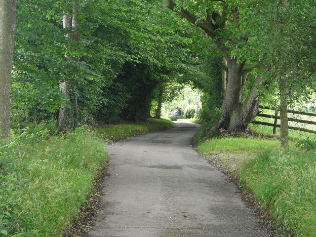
The track eventually reached the hamlet of Homer End, a farm and a couple of cottages. Another walker emerged from the left here – it was the red-haired lady who’d passed me when I stopped for lunch, and she asked if the track I was on was the way to Hailey. The track was now a surfaced lane again [27], which soon curved right with a wood on either side and ended at a road. I continued on the other side, passing an untidy yard where there were many skips and piles of scrap, and then a cottage on the left. The bridleway then continued rather muddily between hedgerows for about three quarters of a mile – I saw another Chicken of the Woods fungus along here [28] (it was on a Silver Birch this time). The bridleway [29] eventually passed a farm on the left and became a surfaced lane, Coxs Lane [30], which soon led me back into Stoke Row, reaching the main road alongside the Cherry Orchard donated by the Maharajah for the upkeep of the well.

[28] Chicken of the Woods fungus, along the bridleway to Stoke Row
[29]The bridleway to Stoke Row
[30]The start of Coxs Lane, Stoke Row
It was about 2.45pm when I got back to my car, so allowing for my lunch stop the almost thirteen miles had taken me just over 4½ hours. I was quite pleased as that was more like my usual walking pace than some recent walks – today, because I had a lengthy drive before and after the walk, I’d consciously taken fewer photographs, especially of wildflowers. I still took just over 100 shots, but recently I’ve frequently taken 150-170 on a walk (it was over 190 on the last walk).
This was an enjoyable walk on a fairly straightforward route, much of it on broad bridleways, and a sizeable portion of it following the Ridgeway or the Chiltern Way. There were some nice views over the Thames Valley and the Oxfordshire Plain, and some historic interest in Nuffield church and Grim’s Ditch. It was a flatter walk than most that I’ve done recently – just a couple of very minor ups and downs, with a very long and easy descent along Grim’s Ditch and then an almost unnoticeable re-ascent along the lane from Hailey.
Total distance: 225.3 miles
(To see this walk repeated IN THE OPPOSITE DIRECTION on 1/9/12, CLICK HERE)