Pete's Walks - The Chiltern Chain Walk, Walk 4
If you are considering walking this route yourself, please see my disclaimer. You may also like to see these notes about the maps and GPX files.
Google map of the walkDownload GPX file of the walk
Walk 4 3/05/08 – Pitstone Hill and Wigginton (11.6 miles approximately)
Parked at the car park at Pitstone Hill.
If you are interested in walking this route yourself, click here to see the route description (but only if you have already read my disclaimer and notes regarding route descriptions).
Again I was able to get off to an early start, walking out of the car park at Pitstone Hill about 9.20am. It was a pleasant day, a lot of cloud with just a few blue patches, reasonably warm but initially with a cool wind.
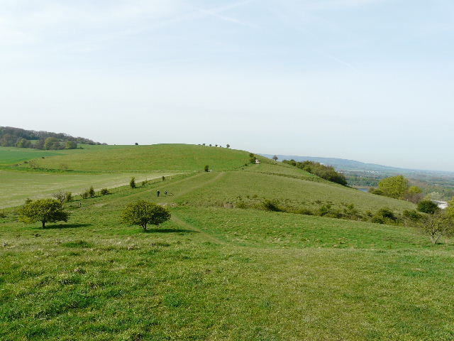
[1] View towards Pitstone Hill from the hillock
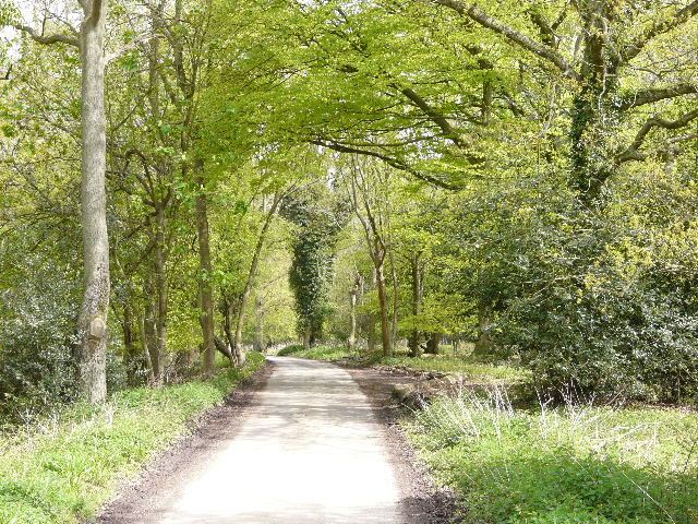
I began by going straight up a small hillock, quite a steep start to the walk but I was soon at the top and was amply rewarded by some nice views [1]. Ahead of me I could see the path heading up Pitstone Hill, behind me were Steps Hill and Ivinghoe Beacon beyond, to my left I could see the valley leading to Aldbury backed by the wooded slopes of Ashridge, while to my right I could see for miles over the Vale of Aylesbury. I headed down the other side, and started the gentle ascent of Pitstone Hill, close to a fence on my left. I was now on the route of the Ridgeway, which I’d be following as far as Wigginton. There were fields to my left – this side of Pitstone Hill is very gentle with fields almost to the top of the hill, whereas the far side is a steep slope of grass and scrub. There were a few Cowslips growing here, but I didn’t see any other wildflowers – in a month or two’s time there will be a good selection of chalk downland plants growing here.
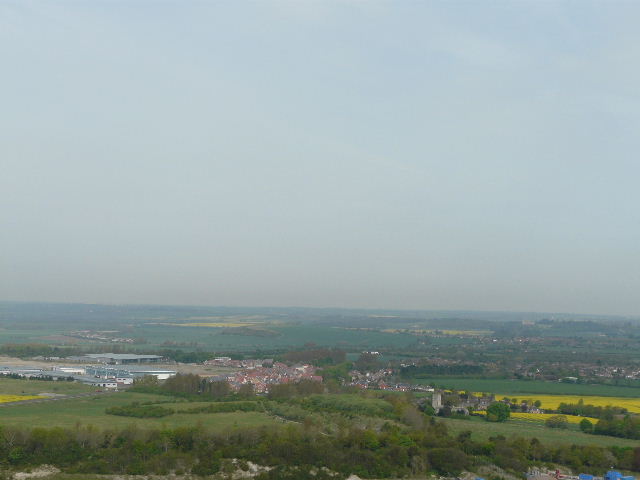
[2] View over Pitstone and the Vale of Aylesbury from Pitstone Hill
I stopped at the top of Pitstone Hill to briefly admire the views [2]. In front of me, looking south-west, I could see across the Tring Gap to Wigginton where I was headed – the Tring Gap is an important breach in the Chiltern escarpment, being a major transport route with a road dating back to the Romans, the Grand Union Canal and a major railway line. Again to my right there were extensive views over the Vale of Aylesbury.
Pitstone Hillhas impressive views over the Vale of Aylesbury, and is a good site for wildflowers such as Clustered Bellflower. In the middle of a field to the northwest is Pitstone Windmill. This post-mill has the date 1627 carved on its framework, the earliest date on any windmill in Britain - as this could be the date of repair work, the windmill could be even older than that. It belonged to the Ashridge Estate for many years, but in 1902 it was damaged beyond economic repair in a storm. In 1922 it was bought by a neighbouring farmer who donated it to the National Trust fifteen years later. A keen band of enthusiasts started restoring it in 1963, and it ground corn in 1970 for the first time in 68 years. It is open on Sunday afternoons in the summer.
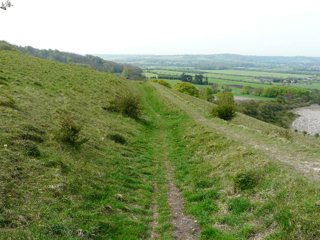
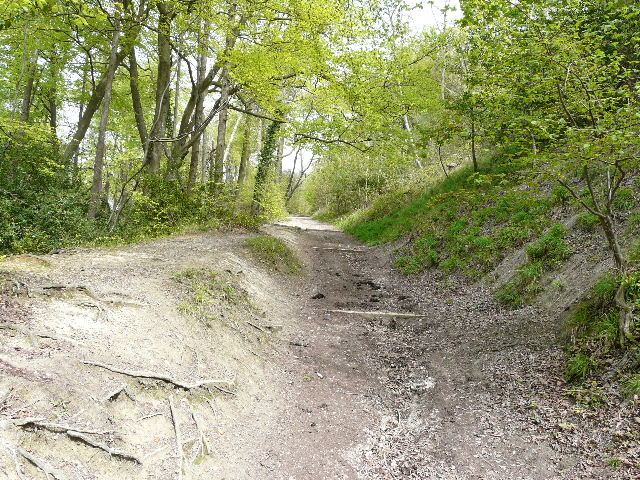
[3] The path along Grim's Ditch on Pitstone Hill
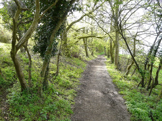
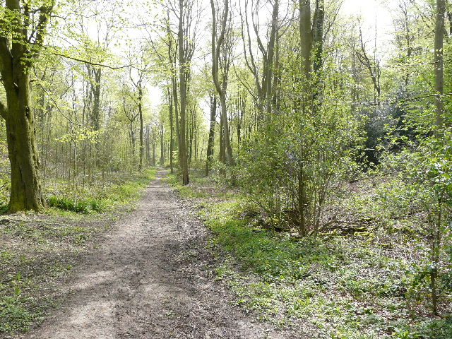
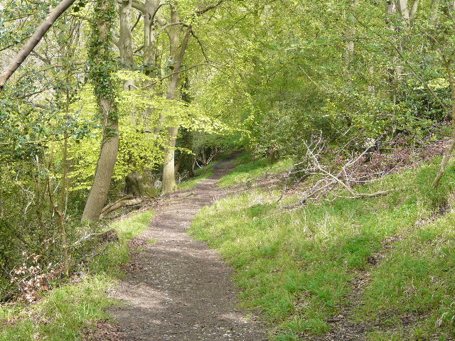
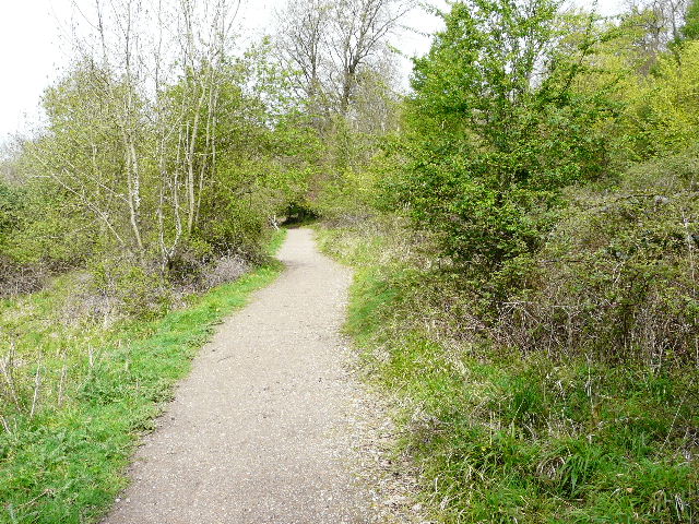
I turned slightly left and followed part of the ancient Grim’s Ditch [3] as it gently descended across the hillside – signs requested people to walk in the ditch rather than on the bank, as the latter was gradually being eroded away. Through a kissing-gate the path continued through the woodlands of Aldbury Nowers (to be honest, I don’t know if that is the name of the wood or the hill). I was surprised to see more Cowslips here amongst the trees, though they were close to some scrubland that was occasionally to the right of the path. I have walked this path many times over the years, and it is always a very pleasant experience. The path wends it way through the trees [4], with the hillside sloping down to the right, generally following the line of Grim’s Ditch although the earthwork isn’t apparent too often. After about half a mile the path went down some steps, went past a junction where a path went off to the right, and then a few yards further on reached a second junction where a wooden finger post showed that the Ridgeway went right.
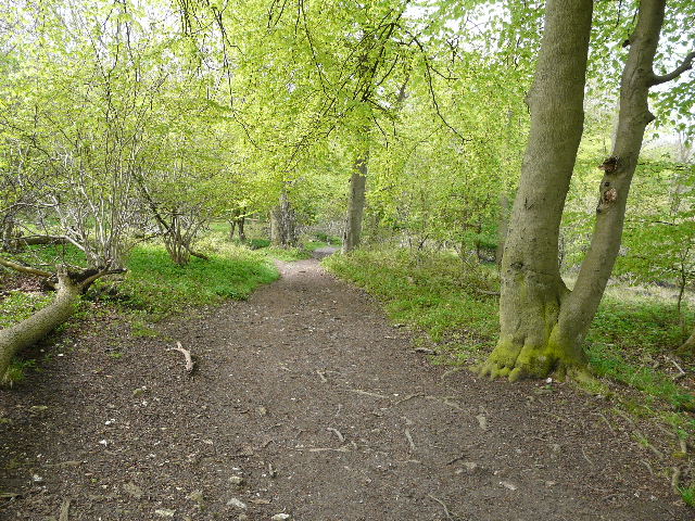
[4] The path through the woods of Aldbury Nowers
Grim’s Ditch(or Grim’s Dyke or just Grimsdyke) is the name shared by a number of ancient linear earthworks, mainly in the south of England but also as far afield as Yorkshire. They are believed to date back to the Iron Age, and as they are too small for military purposes are thought to demarcate territory. The name derives from the Saxon word for the devil or the God of the Underground, Grim (or Odin). There are intermittent sections of Grim’s Ditch from Pitstone and Ivinghoe as far west as Bradenham near High Wycombe, a distance of almost 20 miles.

[5] Sheep grazing the Nature Reserve at Aldbury Nowers
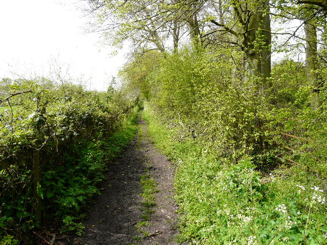
Following the Ridgeway right, I almost immediately came to a notice board for a nature reserve, the snappily titled “Queen Elizabeth the Queen Mother’s Nature Reserve, Duchie’s Piece (Aldbury Nowers)”. It is run by the Herts and Middlesex Wildlife Trust, and is renowned for the butterflies that are found there. Today there were a flock of sheep grazing there [5] – the wildlife trusts and other such bodies often use them to help maintain the ecology of such sites. The path ran slightly downhill between fences, with sections of the reserve either side, to reach a path crossroads at the foot of the hill where I turned left. The path was now a good level track between hedges [6], which I followed for almost half a mile. I spotted a very good example of Cowslip along here, and there was a lot of Garlic Mustard. Today was the first day of a Bank Holiday weekend, and the only day of the three where the weather was meant to be good, so there were a lot of other walkers about. I’d passed several already, and met several more along this stretch.
[6] The track heading towards Tring Station
On reaching another path crossroads, I turned right – I soon joined a cement farm drive that led to a road. I turned right and followed the road for a few hundred yards, going over a railway line (the west coast main line) and passing Tring Station, which is actually about 1.5 miles south of the town itself. I passed a group of six or seven young lads here, all carrying heavy rucksacks, and there’d been another small group of hikers assembling at the station. A little further on, the road crossed the Grand Union Canal [7] and then I turned left at a junction. There were road works going on here, but I assumed the red light didn’t apply to pedestrians and carried on. I soon turned right on to a footpath, which immediately crossed an artificial horse gallop then continued in a straight line between fences and hedges [8]. Either side were sheep pastures, dotted here and there by large trees, evidence that it was once the parkland around a grand house. For a while the path followed a farm drive again, before continuing between another fence and a wood – I saw a good example of Lords-and-Ladies here.
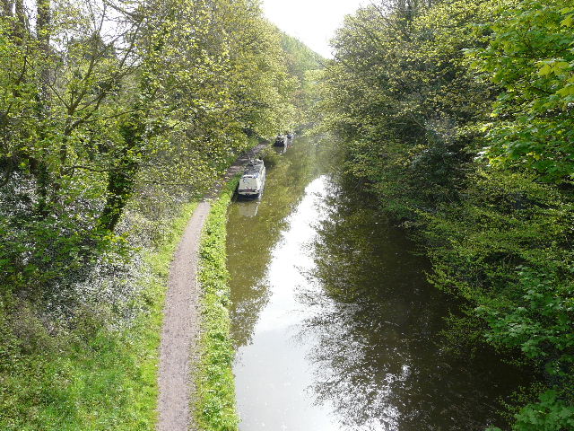
[7] Grand Union Canal, at Tring Station
[8] Path from Tring Station to the A41
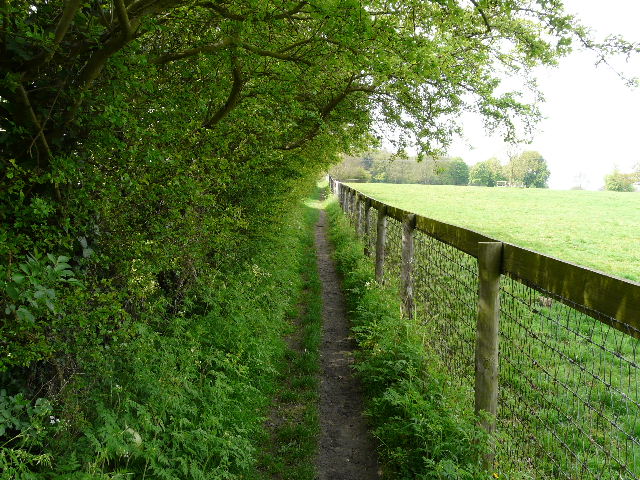
The path ended at a road, which had been the A41 before the building of the new dual carriageway and which was on the course of a Roman road called Akeman Street. I crossed over and went a few yards to the right before continuing on another footpath – there were a couple of horses here beside a kissing-gate. I soon reached the impressive footbridge [9] that carries the Ridgeway over the A41 dual carriageway. On the other side, the path soon reached another kissing gate [10] then went across a gap between two pastures to another kissing gate, beyond which it continued between fences and hedges [11]. The path ended at an old lane called ‘The Twist’, where I had to go a few yards right before another path started on the other side. There was a good selection of wildflowers in the hedgerow along the lane – Lesser Celandine, Greater Stitchwort, Yellow Archangel, Bluebells, Dog’s Mercury and a new yellow flower I’d not seen before (tentatively identified on a website as Goldilocks Buttercup).
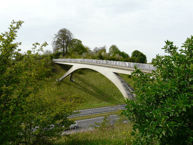
[9] Footbridge carrying the Ridgeway over the A41 dual carriageway
[10] The path to Wigginton
[11] The path to Wigginton
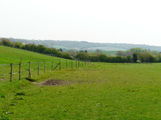
The route now took me along a fenced path beside a ploughed field on my left, then slightly right to follow the edge of a small meadow with a wood on my right. Beyond the wood there were good views over the Vale of Aylesbury [12], as the path followed a garden hedge on the left to reach a road on the edge of Wigginton. Here I turned left, finally leaving the route of the Ridgeway. A gentleman carrying two shopping bags commented on how muddy the last section of the path was, and we got talking as we followed the road through the village. We chatted mainly about wildflowers, particularly orchids, and he mentioned a site for Pyramidal Orchids near Hemel Hempstead. I parted from him where the road turned left – I went ahead through a gate into a small playing field, turning left alongside the hedge then going right in the next corner. The path continued from the playing field along a short residential street, then continued on the other side of a road through a much larger sports field to reach another road.
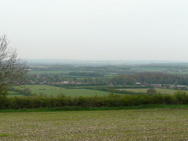
[12] View from the edge of Wigginton, over the Vale of Aylesbury
[13] The path through meadows from Wigginton towards Lower Wood
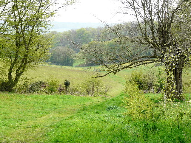
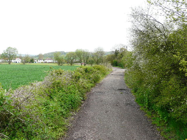
I turned left here for a few yards, then took a footpath on the right. Having crossed the Tring Gap from northeast to southwest, I was now heading back to cross it in the opposite direction. The next section was quite delightful, as the path gently descended a hillside through some charming hay meadows [13]. These were full of daisies, buttercups and especially dandelions, a few of which had already turned to seed heads. The path continued gently downhill through an empty pasture to reach Lower Wood [14]. Here there was an abundance of Wood Anemones either side of the path. On the far side of the wood (now on the route of the Chiltern Way, which I’d follow as far as the edge of Aldbury) I followed the edge of a large paddock [15], and then crossed the corner of an arable field. A track then led right, parallel to the noisy A41 dual carriageway, to reach a lane. I turned left, passing under the dual carriageway, then took a byway on the right. There was some Green Alkanet growing here, though presumably escaped from a nearby garden. Further on I passed more sports fields on either side, the byway [16] taking me to the small village of Cow Roast.
[14] The path through Lower Wood
[15] Paddock beyond Lower Wood
[16] The byway leading into Cow Roast
The name Cow Roast is thought to be a corruption of ‘Cow Rest’, as in the 1770’s the inn here was a stopping point for cattle drovers from the Midlands on their way to Smithfields Market in London. The inn is on the site of a Roman settlement, and in a later period of history it supplied horses for pulling the barges on the adjacent Grand Union Canal.
I turned right, passing the Cow Roast Inn, then turned left down a narrow lane that soon crossed the Grand Union canal by a lock [17]. The lane turned sharply right beyond the canal bridge, and after a further 200 yards or so I took a footpath on the right. This crossed a ploughed field, then went across a footbridge over the railway line [18]. I went across a field of young green corn, then turned right with a paddock containing a few Alpacas on my left. The path turned left to continue round another side of the paddock, and then passed through the yard of Norcott Court Farm.
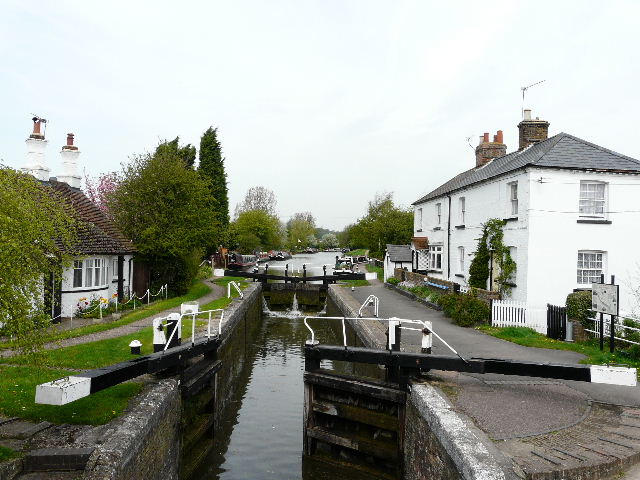
[17] The lock on the Grand Union Canal at Cow Roast
[18] The path from the footbridge over the railway
The path then turned half-left, going diagonally across a large meadow that sloped up to my right. The path here was initially indistinct, but it soon appeared as a narrow line through the grass. To my left was a view over the Tring Gap, towards the Ridgeway footbridge over the A41 that I’d crossed earlier [19]. I went over a stile in the field corner, and continued alongside a fence and then hedge on my right [20]. In a corner where the hedge turned left, the path went through the hedge to a stile, and continued across another meadow, again rising diagonally to the far corner. Across another stile, I only went a few yards into the next pasture before turning right, going through a tall gate to join a good track heading uphill through trees [21]. Again there were a number of wildflowers here, including Germander Speedwell, Primroses and Wood Anemones.
[19] Looking back across the Tring Gap to the footbridge I'd crossed earlier, from just past Norcott Court Farm
[20] The field edge path from Norcott Court Farm
[21] The track to Tom's Hill
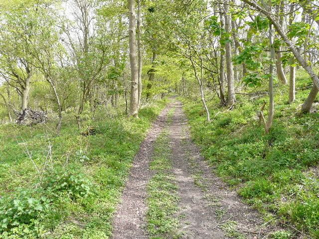
Near the top of the hill the track reached the hamlet of Tom’s Hill, a small cluster of houses and, somewhat incongruously in the sylvan surroundings, a small industrial estate. The track became a surfaced lane leading away from the hamlet, back into the trees [22]. There was a lot of Garlic Mustard and Dog’s Mercury along here – these two have now been officially added to my list of ‘usual suspects’, the flowers I see almost everywhere on my walks at this time of year. Later in the year there will be masses of Small Balsam growing here. The lane came to a junction at a hairpin bend on a minor road. I went ahead for a few yards, then went slightly left on a path descending steadily through the trees [23]. At the bottom of the slope, I parted from the Chiltern Way (which goes right here, back uphill into Ashridge) and went ahead for a hundred yards or so into Aldbury, turning right along a path between garden hedges (where I saw a lot more Lords-and-Ladies). I then passed through the village’s allotments [24] to reach another road, where I turned right and soon found myself at the village centre [25]. Across the duck pond, there were a few people on horseback outside the pub, and as usual there were large numbers of visitors wandering around.
[22] The lane from Tom's Hill
[23] The path down to Aldbury
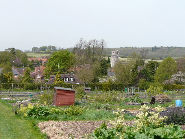
[24] Aldbury from its allotments
Aldbury is an understandably popular village, with its charming old cottages, village pond and combined whipping post and stocks, all set against the backdrop of the steep wooded slopes of Ashridge. The village is frequently used as a setting for TV and films (several episodes of The Avengers were filmed here, and so too was part of the second Bridget Jones film). The village church, restored in 1867, contains a memorial to Sir Robert Whittingham, slain at the Battle of Tewkesbury in 1471 (a major battle in the Wars of the Roses).
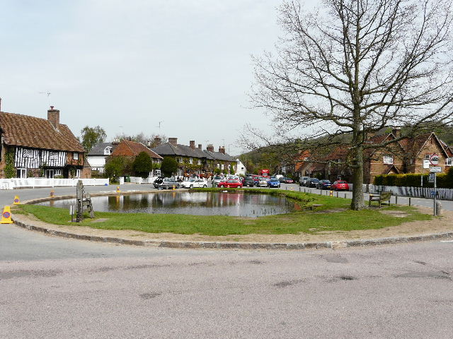
[25] Aldbury
I turned right, but very quickly went left on a broad track. There was some more Oregon Grape growing here, as I passed a couple of cottages. The track started to ascend quite steeply heading back into the woods of Ashridge [26] – I have calculated that it is a 1-in-6 gradient for half a mile to the Bridgewater Monument (where the previous walk started and finished) at the end, though I wouldn’t be following it quite that far today. I met several more walkers coming the other way as I plodded steadily on, passing two or three junctions where paths went off on either side. Shortly after reaching a stretch where the gradient eased considerably, I took a bridleway forking left (the monument and the National Trust teashop would have been just a bit further on if I’d stayed on the main path).
[26] The path from Aldbury towards the Monument (it is steeper than it appears in the photo!)
[27] The bridleway contouring round below the Monument
The bridleway [27] contoured round just below the top of the escarpment, and was a very pleasant path to walk as it wound its way amongst the trees. It soon reached a drive to some isolated cottages in the woods, and continued ahead with the garden boundary of one of the cottages on my left. I found some Cuckooflower growing here, the first time I’d come across it. A path then came in sharply from the right, and the bridleway turned slightly left, now descending the escarpment. At the bottom of the slope it turned left and exited the woods. A short distance further on, I turned right on to a path across a field of young corn. This then went half-left across a second similar field. I could see Pitstone Hill away to my left, while to my right and ahead of me the wooded Chiltern escarpment curved round the small but attractive valley of Duncombe [28].
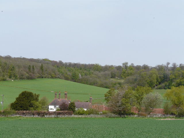
[28] Duncombe Farm with the valley of Duncombe beyond - Walk 3 follows the main Ashridge-Ivinghoe Beacon track through the trees at the top of the slope
I turned left along the lane to Duncombe Farm for 100-200 yards, then turned right on a footpath that ran for a hundred yards or so between hedges to a stile and farm gate. Over the stile, the path turned left in a large meadow that sloped up the escarpment to the right. The path followed a clear groove through the grass, curving to the right and gently going uphill. The meadow was full of Cowslips – I have never seen so many before, they were as numerous here as Dandelions had been in the other meadows I’d passed through today [29]. Beyond this large and colourful meadow, the path continued through another grassy field beside a fence, then went over a stile and followed a short track through trees.
[29] Towards the end of the large meadow - all the small yellow dots are cowslips
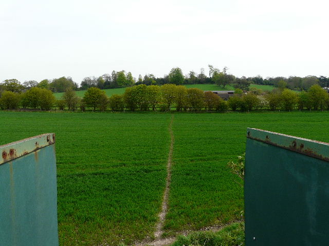
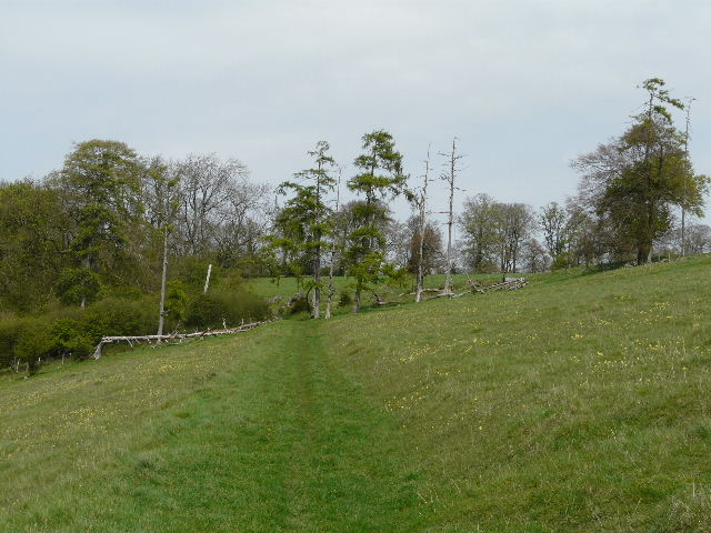
This soon came to the main track from the Monument to Ivinghoe Beacon, which I’d followed at the start of my previous walk (the kennels were just to my right). I turned left here, the drive from the kennels descending slightly to a junction, where I left the route of Walk 3 by forking left. This path led downhill through the trees to a stile, beyond which it descended more gently through an area of scrub. It then emerged into a more open and flatter area of grass, where it followed a fence on my left with a large arable field beyond. Ahead and to my right I could see Steps Hill rising above the deep cleft of Incombe Hollow – there were a dozen or so people on the curving path that carries the Ridgeway to the top of the hill. I soon reached a path crossroads, where I turned left, back on the Ridgeway again. I now followed the fence through another vast meadow [30] – today it was full of Dandelions, but I remembered walking through it last summer with a friend when it was full of different wildflowers and the wonderful scent was almost overpowering. At the end of the path I crossed a lane to return to the car park where I’d started.
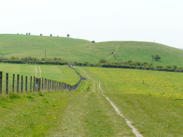
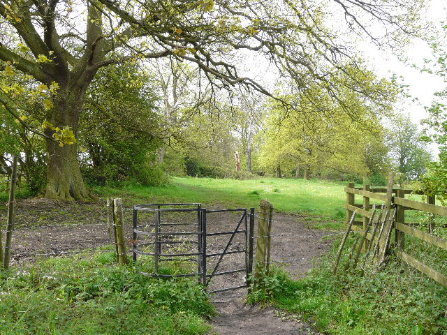
[30] The path back to the car park, with the hillock beyond
It was now about 1.20pm, the walk having taken about 4 hours (despite me taking about 160 photos). I hadn’t bothered stopping for lunch, as I’d realised I’d be home well before 2pm. Having changed out of my walking boots, I was just about to get into the car and drive off when I saw a Red Kite drifting round to the left of the hillock that I’d gone up at the start of the walk. A very nice way to finish today’s walk!
This was another very good walk, on a very pleasant day for walking. There was a good amount of up and down, a bit of history in Grim’s Ditch, lots of wildflowers, very good views in several places and Aldbury is always very charming, though a bit too popular perhaps. I thoroughly enjoyed the walk, my only regret being that it wasn’t a few miles longer. I think I’ve been spoiling myself only doing 12-mile walks in recent months, when I finish the Chiltern Chain Walk I’ll definitely have to get back to walking 15 miles a day.
Total distance: 46.7 miles
(To see this walk repeated IN THE OPPOSITE DIRECTION on 29/7/12, CLICK HERE)