Pete's Walks - The Chiltern Chain Walk, Walk 6
If you are considering walking this route yourself, please see my disclaimer. You may also like to see these notes about the maps and GPX files.
Google map of the walkDownload GPX file of the walk
Walk 6 8/05/08 – Buckland Common and Chartridge (12.1 miles approximately)
Parked at Buckland Common, at the small parking area by the telephone box.
If you are interested in walking this route yourself, click here to see the route description (but only if you have already read my disclaimer and notes regarding route descriptions).
This was another glorious Spring day, with clear blue skies and the temperature forecast to reach 24C – it was already 16C as I left home. Fortunately there was a strong breeze to take the edge off the temperature, and parts of the walk were well-shaded, so I was rarely uncomfortably hot.
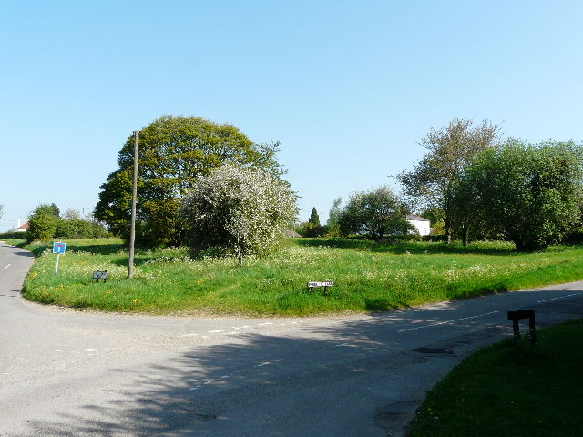
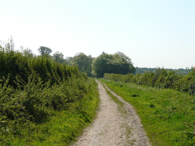
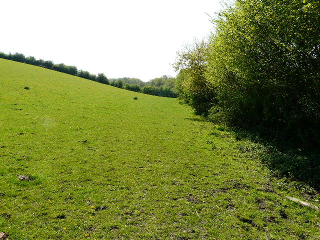
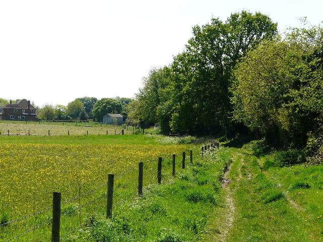
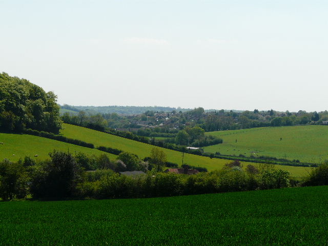
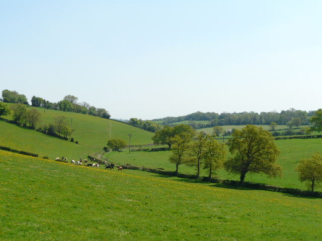
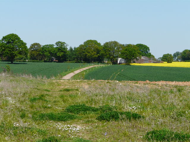
[1] Buckland Common
I set off from Buckland Common [1] about 9.40am, initially following the route of the Chiltern Way (my penultimate walk on that Long Distance path started here). I followed a lane past a small green on my right, continuing past a house that I believe was once a pub. As the lane turned right, I took a footpath continuing ahead, crossing a small ploughed field and then going across a drive (going to a blue-painted farmhouse to my left). Over a stile, I continued alongside a hedge on my right, through a small paddock with a solitary horse [2]. Across another stile, I turned right alongside the hedgerow. The field here was a large empty pasture dotted with dandelions and buttercups, with a wood on the far side. I went over a stile in the field corner, the path continuing between a hedge on my right and a wooden fence on my left, with paddocks beyond. There are usually a number of Alpaca in these paddocks, but as on the last time I walked here, there seemed to be just one Alpaca in each paddock. There was no sign of the large pig that blocked the path when I walked the Chiltern Way here last Spring!
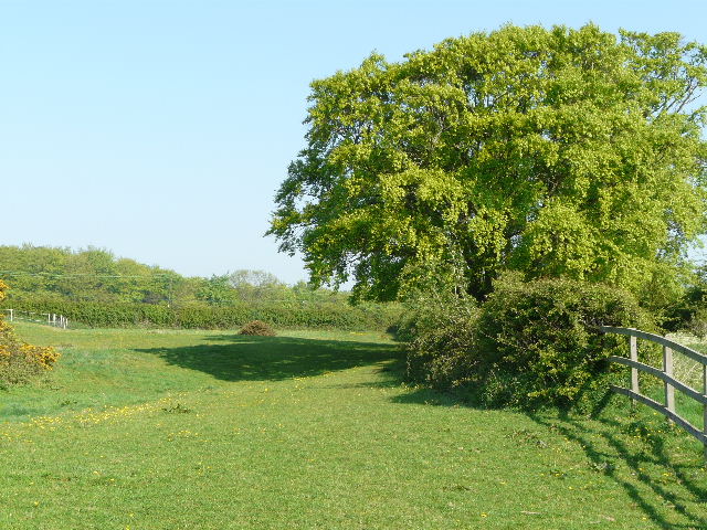
[2] Paddock near Buckland Common
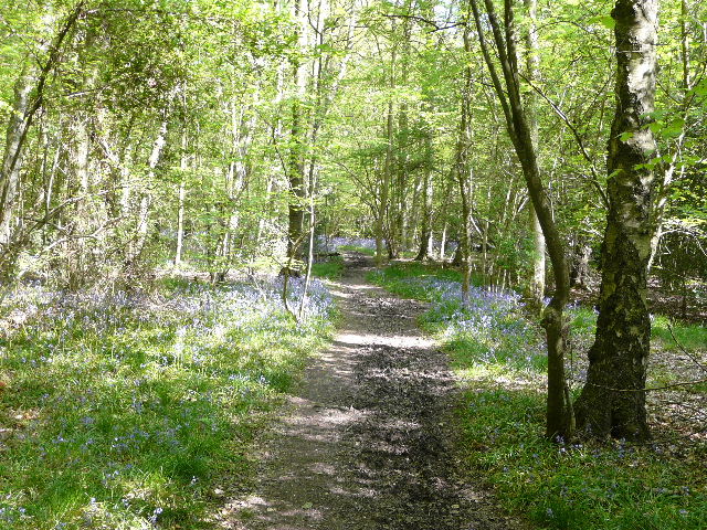
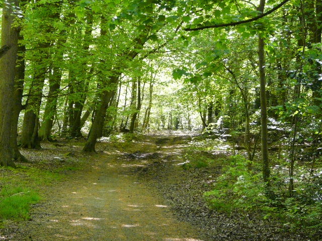
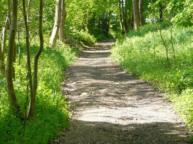
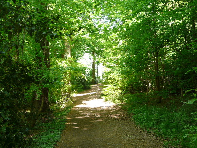
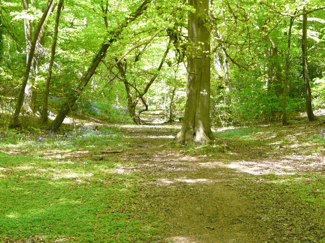
[3] Path through Drayton Wood
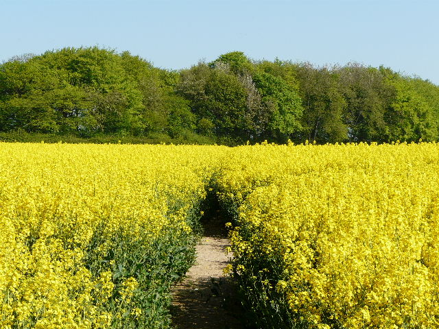
[4] Path through rape field, heading towards the line of Grim's Ditch, running through the trees ahead
The path dipped down and up again beside the paddocks to reach Drayton Wood. I followed the waymarks for the Chiltern Way [3], turning left at one junction and then right at a second one. There was a good display of Bluebells in the wood (as there would be in most of the woods I’d pass through today) and also some Greater Stitchwort. The path next passed between the fences of some small paddocks, and crossed Shire Lane (thus changing county from Buckinghamshire to Hertfordshire). I went half-left through a small wood containing many holly bushes, and continued across a field of oil-seed rape [4] to reach the end of a thin tree belt. As I turned right onto a path running through the trees, following a section of Grim’s Ditch, I was repeating part of my previous walk. But at the end of the tree belt I turned right onto a hedge-lined track, leaving the routes of both Walk 5 and the Chiltern Way.
[5] The track heading towards Shrubb's Wood
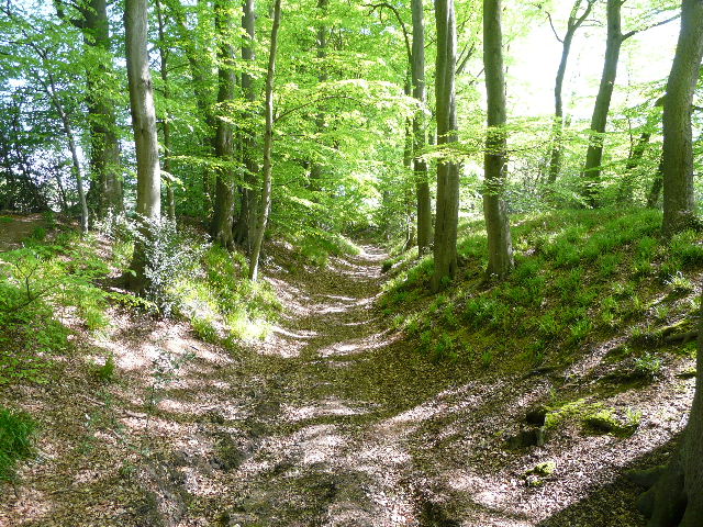
I followed the track [5] southeast for about quarter of a mile, towards a gate which marked the entrance to a wood. As I neared the gate, I saw a male Muntjac Deer in the corner of the field on my right. I managed to get a photo as it crossed the track in front of me, but it was in too dark a shadow for the photo to be any good. The track continued with Shrubb’s Wood on my left, and a field beyond the trees on my right. I managed to photograph a Speckled Wood butterfly here. As well as many of the usual wildflowers, I came across two here that were new to me, I think – Yellow Pimpernel and Wood Speedwell. They were both tiny flowers next to the path, and I knelt on my plastic map cover to get close-up photos of them. I also came across some Wavy Bittercress, something that I’d only spotted once before. Further on the field a few yards to my right ended, and I moved into High Scrubs Wood, which was on both sides of the path [6]. I met a lady coming the other way with an enormous dog, an English Mastiff I think – she held it by its collar as I went by, but it was clearly friendly as it was wagging its tail.
[6] The path through High Scrub's Wood
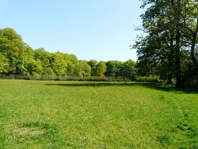
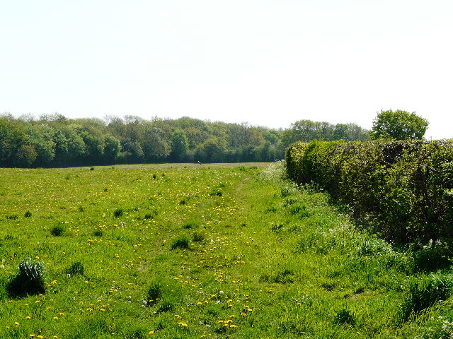
Further on, there was a large grassy field just to my right. At a path junction I turned right, leaving the wood, and followed a hedge on my left across the field. There were several jumps for horses in this field and the one on the other side of the hedge – there were even jumps IN the hedge, so it could be rather dangerous following this path when there are show jumpers practising here. On the other side of the field I re-crossed Shire Lane to return to Buckinghamshire, and took a path almost opposite. This ran initially between stables on my left and a garden fence, before running along the edge of wood with paddocks on my left. Where the paddocks ended, I went over a stile and crossed the paddocks beside a hedge on the right. I then went through another small section of beech wood and then an area of scrubby bushes to reach Cholesbury Camp [7].
[7] The earthworks around Cholesbury Camp
Cholesbury Camp is an Iron Age hill fort, one of the best preserved in the Chilterns. A large ditch between two high banks runs almost the complete circuit of the oval enclosure, with a second ditch and further banks visible in the west and south-east. The ramparts are now crowned by a belt of beech trees, except in the southernmost section where the houses and gardens of Cholesbury have encroached. The camp is thought to have been in use from between about 300BC to 50 AD, but excavations have shown that it was only ever sparsely populated, and perhaps only used in times of danger. St Laurence’s church was built within the enclosure in the 13th century, but was much modified in the 1870’s.
[8] Paddock within Cholesbury Camp - the curving line of trees follow part of its boundary
I turned left and walked along the bottom of the ditch surrounding the hill fort, between two large embankments with several beech trees. The ditch curved round to the right, and after a while I reached a crossing path, where I started to follow a path along the right-hand embankment. I then went over two stiles in quick succession, and crossed a small paddock within the Camp [8]. Over another stile, I went a few yards into a larger paddock, before going through a gate into St Laurence’s churchyard. There were two or three people here who were clearly doing a detailed study of the architecture of the church [9,10], looking at the stone window frames and referring to a plan of the church (although originally built in the 13th and 14th centuries, the church was almost totally rebuilt in the 1870’s).
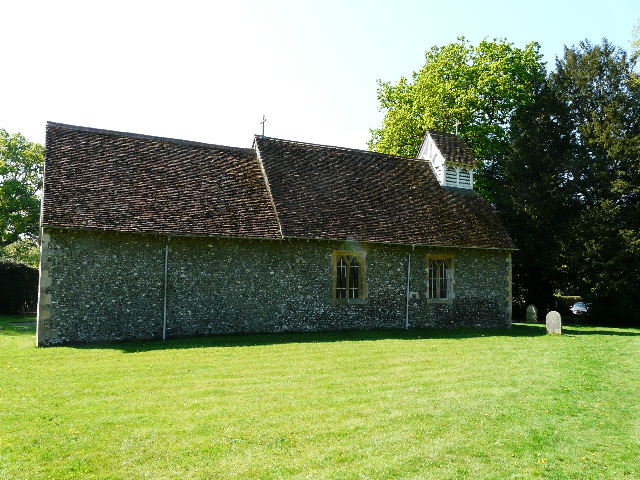
[9] St Laurence's church, within Cholesbury Camp
When I first walked past Cholesbury Church a few months ago as I was exploring possible routes for the Chiltern Chain Walk, I got talking to the church warden here, who very kindly told me some of the village history and showed me an interesting grave in the churchyard. David Newton had served as a Royal Marine on HMS Revenge at the Battle of Trafalgar and lived to the ripe old age of 99, but he was in great poverty towards the end of his life until the vicar approached the Admiralty on his behalf and he was awarded a pension. There was a lot of poverty here in the 1800’s, and Cholesbury became the first parish in the country to go bankrupt, because it could not afford to support the poor of the parish.
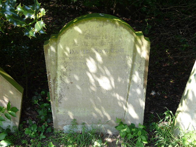
[10] Grave of a Trafalgar veteran in Cholesbury churchyard
The path went to the right of the church. I then turned right, to continue along the ditch and embankments surrounding the hill fort. Here in its south-western corner there was still some evidence of a second ditch and further bank surrounding the fort. On returning to the point where I had first reached the fort, I took the path across the Camp. On the far side I passed the village hall on my left as I reached the road through the village. I went a few yards to the right, then took a path on the other side of the road. This passed between garden fences (there was some Lords-and-Ladies or Cuckoo-pint here), then followed a hedgeline down into a pleasant green valley of meadows and sheep pastures, with a wood visible away to my right. At the bottom of the slope, I turned left, and followed a wooden fence along the valley bottom, through a succession of sheep pastures, with the top of Cholesbury Windmill visible in the trees ahead and to my left [11].
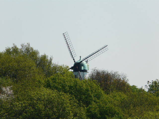
[11] Cholesbury Windmill
Cholesbury Windmill, originally built as a smock mill in 1863 but rebuilt as a tower mill twenty years later, is a private residence with an interesting history. It was associated with the Bloomsbury Group around the time of the First World War and a number of well-known artists of the period frequented it. According to Wikipedia, "Gilbert Cannan who rented the mill for a time and whose wife Mary was previously married to J.M Barrie, the author of Peter Pan, invited his friends including D.H.Lawrence, Katherine Mansfield and John Middleton Murry to stay there. The artist Mark Gertler, also lived there for a time and painted a famous picture of the mill now on show in the Ashmolean Museum in Oxford with Cannan and his dogs in the foreground. One of the dogs is understood to have been the model for the original illustrations of Nana the dog in the first edition of Peter Pan."
[12] Looking back at a fallen branch across the path
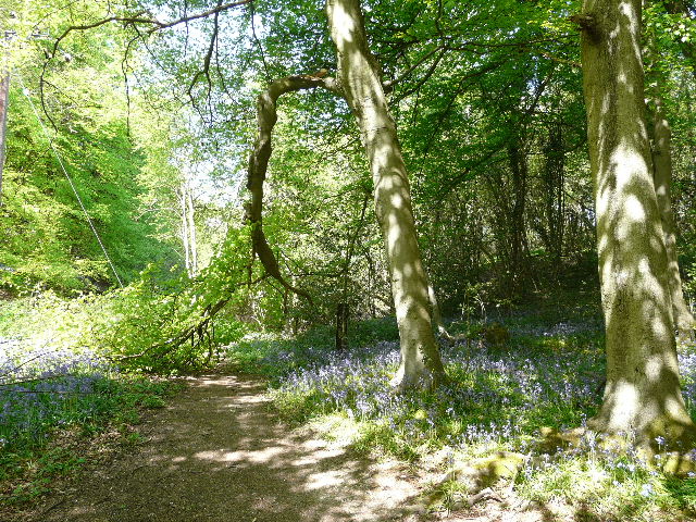
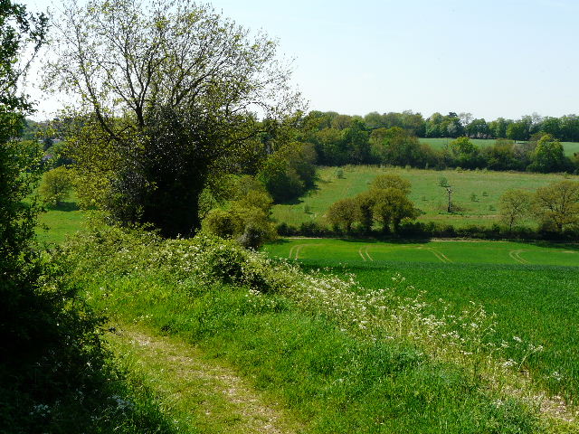
The path passed a shed containing a few bullocks and then reached a road. I went down a drive opposite, where I got a not very good photo of an Orange-Tip butterfly that was fluttering amongst the Garlic Mustard here. The path continued past a house on the left and its large garden or smallholding, and soon after entered a wooded area as it continued on down the valley. A large branch had broken from a beech tree and almost blocked the path at one point [12]. Further on I left the mature trees behind and passed through a fairly young plantation, where I saw some Yellow Archangel growing. On leaving the plantation, the path continued through the valley beside a broad hedge on the right. I went through three grassy fields that sloped up to my left [13], and then crossed over Hawridge Lane, a broad track. In the next pasture the path briefly ran to the right of a hedge, before switching back to the left. The hedge was now actually a thin belt of trees between wire fences either side, with Bluebells growing in several places. The trees overhung the path, so I was walking in shade for much of the way [14] as I progressed through a further sequence of empty cattle pastures. I heard my second cuckoo of the spring in a tree to the right of the path, and I saw a fair number of Cowslips in one of the pastures. The path finally passed through a large green meadow, before turning right and entering a wood where it immediately ended at a junction with a wide bridleway.
[13] Steep meadow beside the path through White Hawridge Bottom
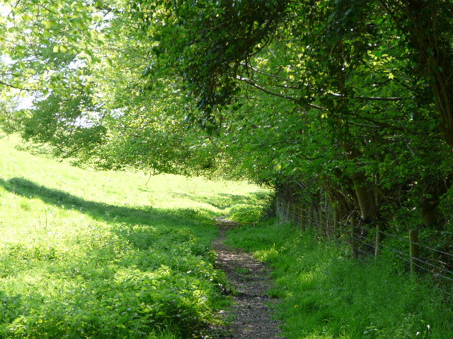
[14] The path through White Hawridge Bottom
Having followed the valley of White Hawridge Bottom for about a mile and a half, I now turned right and followed the bridleway as it gradually climbed the hillside through the trees of Ramscoat Wood [15] – again there was a lot of Yellow Archangel here. When I’d originally planned the Chiltern Chain Walk, I’d intended to go a little further along the valley, but the bridleway there was impassably muddy so I decided to go this way instead. On a later walk that went a little further down the valley, I’d passed the vehicles of some contractors who were evidently resurfacing the bridleway to make it passable again. They’re work seemed to have continued into the wood, as the section uphill through the wood looked as if it had been recently re-surfaced. On reaching the edge of the wood, the bridleway went right, between a hedge and the wood. It continued alongside the edge of the wood, as it turned to the left and then to the right again. Just before the wood ended, I turned left on a path beside a hedge through a large meadow, dotted once more with yellow buttercups and dandelions. In the field corner the path turned left along the hedgerow – I paused here to drink some water and to don my sunglasses.
[15] The track through Ramscoat Wood
[16] Meadow path, with Ramscoat Wood to the left
[17] Path beside small meadows, near edge of Chesham
It was very pleasant following the hedgerow [16], with the meadow sloping very slightly down to Ramscoat Wood, which was now over to my left. Beyond the meadow the path continued in the same direction, with a stables and then garden fences on the right, and some paddocks and then some small meadows or pastures on the left [17]. It ended at a minor road, where the outskirts of Chesham were a short distance to my left. I crossed over and followed a farm drive. Where this turned left into the farm, I carried on ahead on a path across a small meadow [Update: you now have to go through a couple of gates and then the path runs between hedges] to reach Captain’s Wood, which is a fairly typical Chiltern beech wood and a nature reserve. I turned right and followed a path through the beech trees and holly bushes [18]. After one or two hundred yards I turned left and exited the wood [19]. I then followed a hedgerow descending steeply into a valley [20], with a pleasant view along the valley to my right. The path continued up the equally steep opposite side of the valley, switching to the left of the hedgerow partway up. There were now nice views left, along the valley towards Chesham [21].
[18] Path through Captain's Wood
[19] View from edge of Captain's Wood
[20] Path across valley after Captain's Wood
[21] View towards Chesham from far side of the valley
At the top of the hill, I turned right along a minor road for a couple of hundred yard or so – I managed to get a poor quality photo of a Holly Blue butterfly here. I then turned left beyond a solitary house, on a bridleway heading down into another valley. There was a nice view across the corn field here and up the valley to my right. The bridleway [22] soon switched to the left of the hedgerow, and again I could see the outskirts of Chesham along the valley to my left. It was again quite steep going down here (OK, not exactly mountainous, but steep enough to hurt my arthritic knees). In the valley bottom the bridleway continued between hedges (the one on the left having been trimmed very short), and then it climbed the opposite side of the valley, with a caravan park beyond the now mature hedge on the left. It joined the drive to the caravan park for a few yards, before reaching the minor road running through the village of Chartridge.
[22] Looking across the next valley towards Chartridge
I turned right, and followed the road through the village, passing a pub and a small Mission Church on the right [23]. I turned left into Cogdells Lane – this soon changed from a residential street to a farm drive. Where it turned left towards the farm, I went straight ahead on a bridleway between hedges. This soon turned right, where a footpath continued ahead – I stopped on the stile here to eat my lunch. There was a very nice view over green fields in the valley before me, leading to yet another wood [24]. As I munched my favourite Corned Beef and Branston pickle sarnies, I saw a Red Kite flying low over the fields. A few minutes later, a procession of cows and calves ambled into view along the valley bottom.
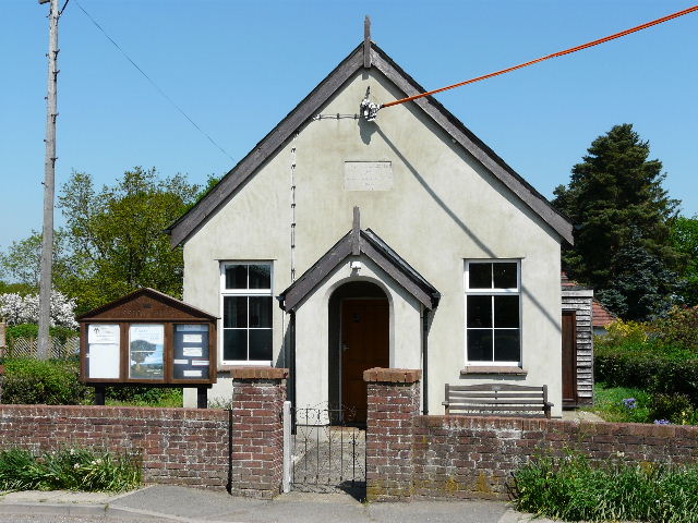
[23] Mission church, Chartridge
[24] The view from my lunch spot, just outside Chartridge
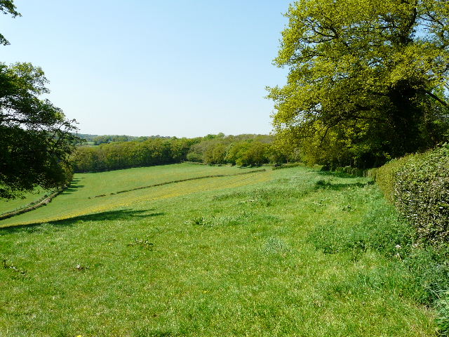
Lunch over, I continued on my way, staying on the bridleway as it ran between hedges parallel to the valley on my left. The left hedge was again trimmed very short, while the one on the right contained mature bushes and trees that often overhung the bridleway, so that at times I was almost in a green tunnel. Yellow Archangel and Greater Stitchwort were among the wildflowers I saw along here. The bridleway reached a wood, where I stopped to look back and admire the view along the green valley [25]. I then carried on along a path through the wood, before turning right on a bridleway that ran along just inside its far edge.
[25] Looking back from the edge of the wood
After a while I came to a junction, where the bridleway turned right but I continued ahead on a footpath, now with the wood on either side. At one point I recognised a path junction where I crossed the route of the Chiltern Heritage Trail [26]. From where I’d turned right onto the bridleway, I probably walked about three quarters of a mile through the wood, the path slowly curving to the left, from almost due north to west. Eventually I reached a metal kissing-gate on the edge of the wood (now called Lownde's Wood), and the path then continued across a green pasture [27], currently grazed by sheep though there had obviously been cows there not too long ago. Beyond another metal kissing-gate, the path continued alongside the right-hand boundary of a larger pasture to reach a road.
[26] Path through the wood - the arrows on the tree indicate the junction where I crossed the Chiltern Heritage Trail
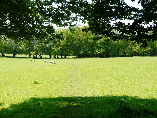
[27] Path across the sheep pasture, from the edge of Lownde's Wood
I turned right along the road, to reach a T-junction after about quarter of a mile. I took a path almost opposite the junction, running alongside a hedgerow on my right through another grassy meadow dotted with yellow dandelions. The path started to go downhill, with a wood ahead on the other side of the small valley, and a farm across the fields to my left. In the corner of the meadow, I went through a kissing-gate, and continued downhill, now with a fence separating me from a horse paddock on my left. The path then went up the opposite slope, with the wood on the left and a nice view over a ploughed field and along the valley on my right. The path continued alongside a hedge on the left, and went down into another slight dip where it switched to the other side of the hedge shortly before ending at a track carrying a bridleway. I followed the track in roughly the same direction as before, and saw a nice combinations of blue-purple Bluebells and white Greater Stitchwort in the hedgerow to my right.
I turned right for a few yards along Arriwig Lane, before turning left on a footpath immediately before Erriwig Farm (both these odd names derive from the Saxon for ‘way to the arable fields’, if I remember the Chiltern Way guidebook correctly!). The path followed a thin headland between fields [28] and descended slightly to a long thin wood. It turned left just inside the wood and soon reached a path junction, where I turned right. I soon left the wood, and next crossed an area of rough ground [29] with some clay pits to my right. I saw a lilac flower here which I think was another Cuckooflower, but I couldn’t get a decent photo to check as the wind was blowing quite strongly at this point and so the flower was moving about too much.
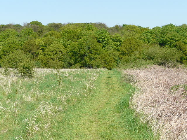
[28] The path from Erriwig Farm
[29] Looking towards Dundridge Manor Farm
My route next led me along a drive towards Dundridge Manor Farm, between fields of green corn and with a nice view over the fields on my right. Two paths diverged when I reached the farm, and I followed the one going round to the right of the farm and across a field of yellow oil-seed rape. I went through a gap in the far hedgerow, and turned left along the edge of a similar field. This brought me to the drive to Dundridge Manor, which I followed a short distance to the right. I followed the road to the left for a quarter of a mile or so [30], taking the second turning on the left to return to my start point in Buckland Common.
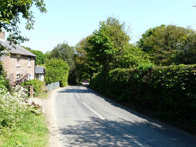
[30] The road leading back into Buckland Common
This was another very enjoyable walk. There was a nice mixture of field paths and woods, lots of small ups and downs, and a bit of historical interest in the church and hill fort at Cholesbury. Today was a good day for a walk, although occasionally perhaps I felt a little warmer than I’d have preferred, despite the cooling wind and the frequent shade. Again there was an abundance of wildflowers (I’ve tried to reduce the number of times I mention them all!), and I saw some good butterflies today and managed to photograph three of them.
Total distance: 71.4 miles
(To see this walk repeated IN THE OPPOSITE DIRECTION on 14/11/12, CLICK HERE)