Pete's Walks - Alternative Ashridge Walk (part 1)
If you are considering walking this route yourself, please see my disclaimer. You may also like to see these notes about the maps and GPX files.
This is one of my regular 'local' walks that I do several times a year (the start point at the monument in Ashridge is 7-8 miles from my home). It is a walk that I've developed over many years, being basically a merger of two shorter walks that I used to do. I have taken to calling it the 'Alternative Ashridge Walk' as I think it is a nice alternative to the National Trust's Ashridge Estate Boundary Trail, which covers roughly the same ground. This walk is very roughly 15.5 miles long.
I have done the walk many times, occasionally with slight variations here and there. I will describe the walk as I did it on 21st March 2007 - most of the photos were taken then, I have indicated where the photos have been taken on other dates.
Starting at the car park near the Bridgewater Monument in Ashridge, I headed across the grass to pass just right of the monument (which commemorates the 3rd Duke of Bridgewater, who was the chief mover behind the creation of the canal system and who lived at Ashridge House).
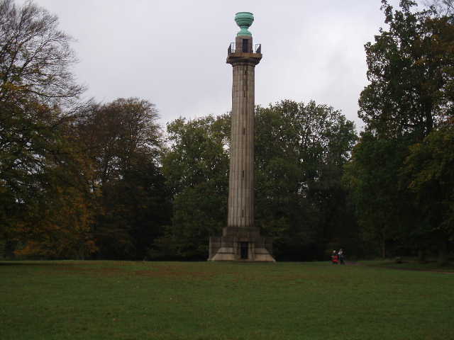
The Bridgewater Monument, Ashridge (Photo taken 29/10/05, Day 9 of my Hertfordshire Way walk)
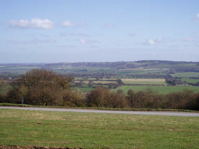
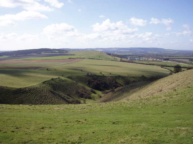
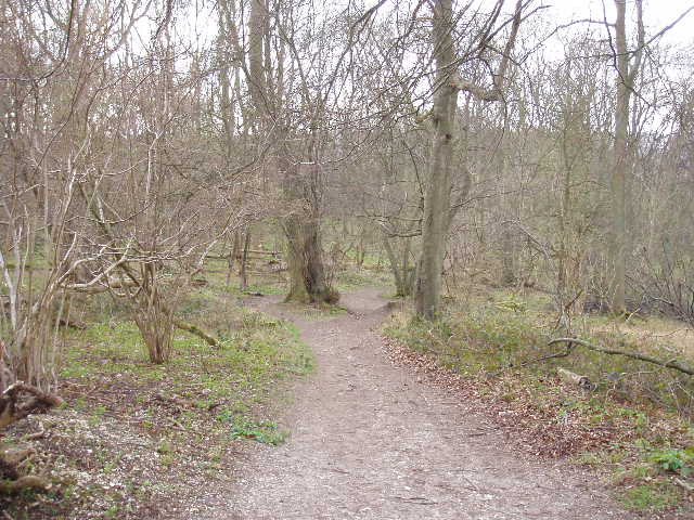
I took the track entering the woods on the right, which is the main track towards Ivinghoe Beacon (it is well surfaced, suitable for disabled buggies), but after only 100 yards or so I left it, taking a narrow path forking half-left by a wooded sign saying 'No horses'. The path steadily descended through the trees (this slope is part of the northern escarpment of the Chiltern Hills), merging with a bridleway at one point. At the bottom of the slope the path continued as a track between hedges for a short distance. Where another path crossed I turned right, going across one small field and then bearing half-left across a larger field to reach the drive to Duncombe Farm (to my right). I continued through a large cattle pasture, the path quite clear in the longish grass, steadily rising uphill to the corner of a wood and then following the edge of the wood. There are usually good views back over the farm to Aldbury at this point.
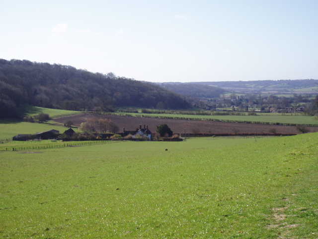
Looking back over Duncombe Farm towards Aldbury, the woods of Ashridge on the left
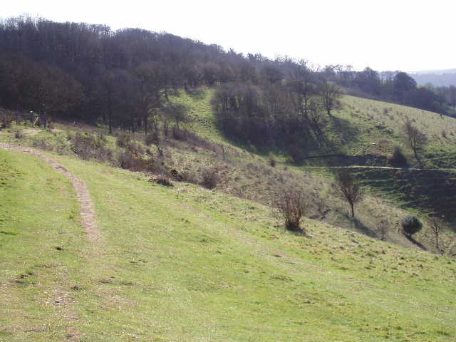
I now re-entered the woods of Ashridge, the path now dropping slightly then climbing more steeply through the trees. At the top of the slope I rejoined the main track from the monument towards Ivinghoe Beacon (the track follows a sort of semi-circular route through the trees along the top of the steep slope, whereas my up-and-down route takes a more direct line).
The path climbing up to rejoin the main track near Duncombe Terrace
I now turned left and followed the main track through the trees. I soon passed the point where the hard-surfaced ends and the disabled buggies have to turn round. There was now a field on my left, and then I passed a kennels on my right (now a boarding kennels, I think at one time it was kennels for a hunt). There was then another field on my left, with views towards Pitstone Hill and the Vale of Aylesbury. I saw some Fallow deer in this field (too distant to get a decent photo, unfortunately) and twice when I have done this walk more recently I have seen a fox here.
Looking out over the Vale of Aylesbury, from just past the kennels
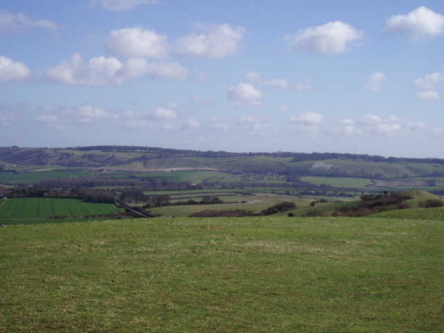
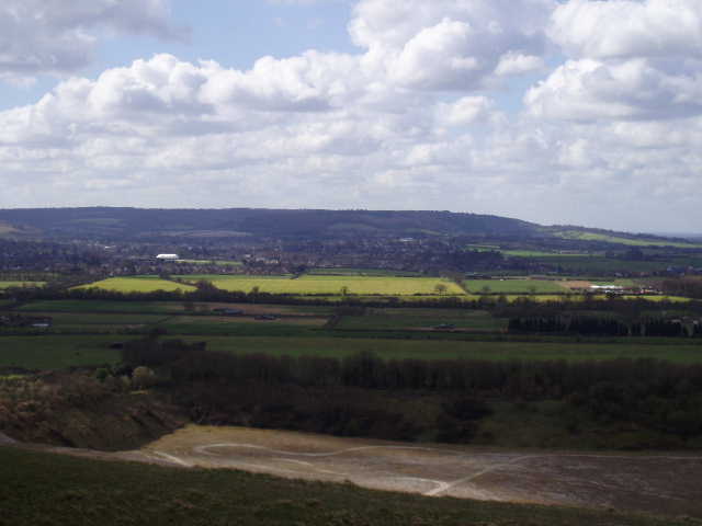
I continued on along the track, generally amongst the trees but occasionally with glimpses out over the Vale of Aylesbury, until eventually it reached a grass area and a road. Here there was the first view of the downs at Dunstable and Whipsnade.
View east towards Dunstable Downs from the end of the main track from the monument
I followed the road to the left, and then went through the car park on the far side of the road and picked up the path (beside a fence on the right) to Ivinghoe Beacon, now clearly in view ahead.
Ivinghoe Beacon, from near the Car Park
There are two subsidiary bumps before the Beacon - I usually go over them both before going up the steep chalky path to the top of the Beacon and miss them out on the way back to the road. No matter how often I see them, I always love the views from Ivinghoe Beacon on a sunny day.
Dunstable Downs and Whipsnade Downs from Ivinghoe Beacon - the White Lion carved on the hillside marks the location of Whipsnade Zoo
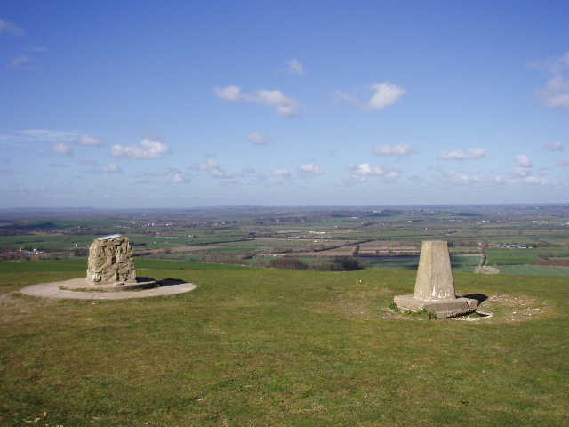
The top of Ivinghoe Beacon, looking out over the Vale of Aylesbury
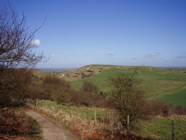
From the beacon I returned a short distance to the road, crossed it carefully by a sharp bend, and followed The Ridgeway path as it ascended the scrub covered slopes of Steps Hill (I sometimes take a parallel path just to the left). Soon I had the steep-sided gorge of Incombe Hole to my right, with Pitstone Hill beyond. I continued following The Ridgeway as it went round the head of Incombe hole, steadily descending from Steps Hill, and then continued across two very large meadows (which smell delightful when the wildflowers are at their best in early summer).
Incombe Hole, with Pitstone Hill beyond and Aston Hill in the distance
The path over Steps Hill going round the end of Incombe Hole
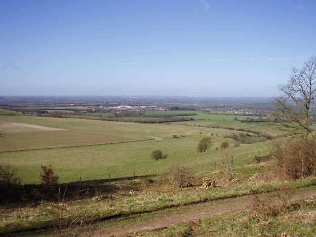
I crossed a lane (between Aldbury, to my left, and Ivinghoe) and walked through the car park. I went up and over a small hillock (most people would just follow the path round to the side, as The Ridgeway does) and then took the gently rising path up to the top of Pitstone Hill, another great place for views over the Vale of Aylesbury.
Looking towards Tring and Aston Hill from Pitstone Hill
The path down the other side of Pitstone Hill follows Grim's Ditch, an ancient earthwork, possibly a tribal boundary. A polite notice asks people to walk in the ditch rather than the raised bank, as the latter is gradually being eroded away.
The path along Grim's Ditch on Pitstone Hill
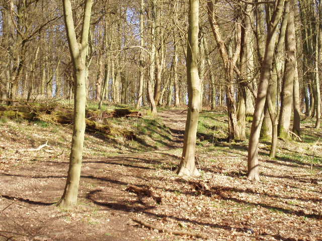
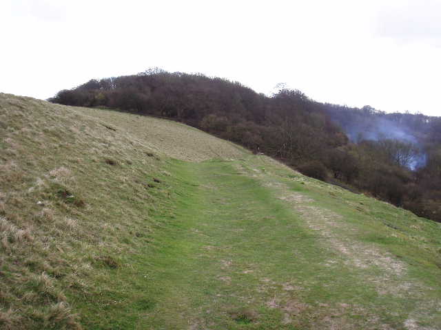
There was then a very pleasant section of path through the woods of Aldbury Nowers (this particular day people were clearing scrub and burning it in the adjacent nature reserve, which is apparently a haven for butterflies in the summer).
The path through the wood of Aldbury Nowers
Eventually, at a path junction where The Ridgeway goes right, I turned left for a few yards, then turned right on a path that steadily moved closer to edge of the wood, where I could see a golf course on my left. Through a kissing gate on the edge of the wood and over a stile, I then crossed the golf course on a clear path with a fairway to my right. On the far side of the course I went over a stile, and continued down a path with a hedge to my left and fence on my right, and paddocks beyond them - I was now on part of the Hertfordshire Way. This path led to a large stables complex, where I went through a kissing gate and followed a new stone path along the edge of a paddock, then crossed a small area of grass to reach a road by Aldbury church.
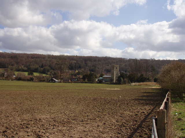
The path heading to Aldbury, from just before the stables
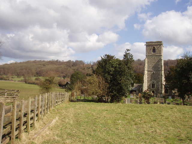
Aldbury church, with the wooded slopes of Ashridge in the background
I turned left and followed the road into the centre of Aldbury, a charmingly attractive village with its pond and old stocks and whipping post. Aldbury is often used as a setting in TV and films, and is a bit of a tourist honeypot.
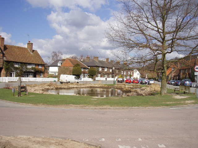
Aldbury, with its whipping post, stocks and pond. The tree was planted to replace an ancient hollow tree which I remember from my childhood