Pete's Walks - Kensworth-Ivinghoe (part 1)
If you are considering walking this route yourself, please see my disclaimer. You may also like to see these notes about the maps and GPX files.
Google map of the walkDownload GPX file of the walk
At 17.3 miles long (according to Google Maps), this is probably the longest of my local walks and at the time of writing I have only done it twice (it's also the 'newest' of my local walks). It goes from my home in Kensworth north-westwards over Dunstable Downs to Totternhoe, then heads south-west through Eaton Bray and Edlesborough to Ivinghoe, before returning in a roughly easterly direction through Ashridge and Dagnall back to Kensworth.
The text and photos on these pages describe the walk as I did it on Friday, 26th September, 2008. It was an exceptionally fine day and I took over 250 photographs - I have narrowed these down to just 85, which I have spread over the five pages that describe this walk.
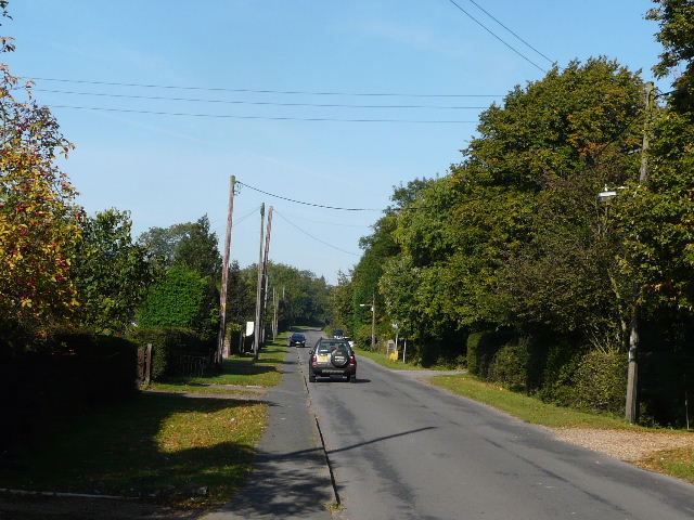
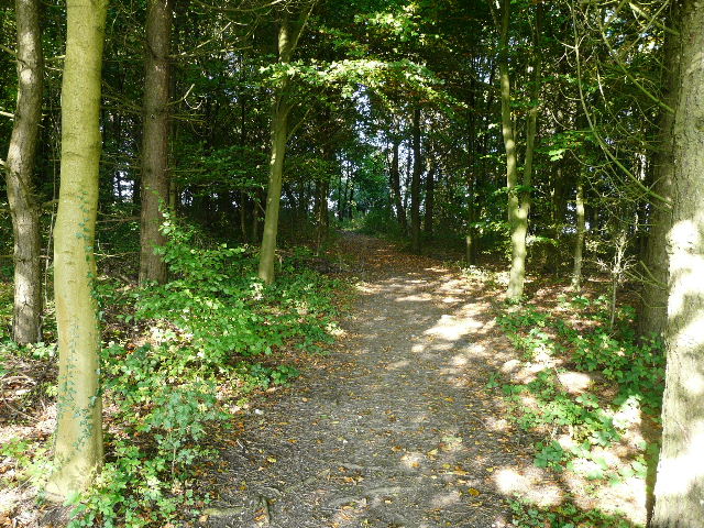
Looking up the northern end of Common Road, Kensworth
I started walking about 9.30am, heading up Common Road, Kensworth (from the junction where the road to Whipsnade forks left). It was a beautiful morning, warm with blue skies and bright sunshine. I turned right on the footpath immediately beyond the small industrial estate, which soon emerged onto a farm track and reached a large grassy field sloping downhill.
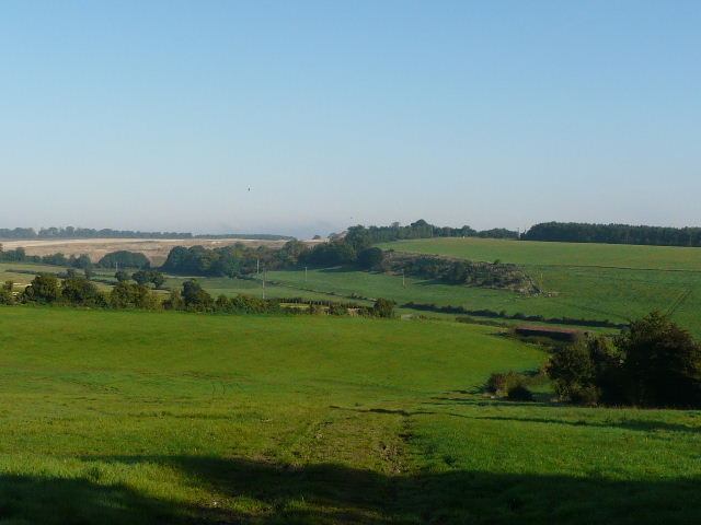
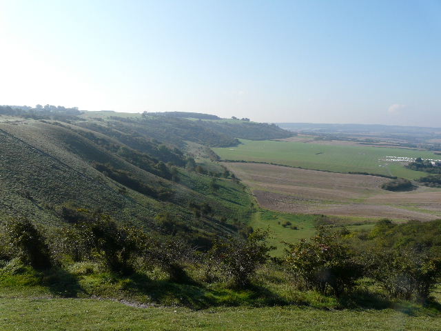
From the farm track, looking across the valley. The footpath goes across and follows the hedge on the right before rejoining the track near the bottom of the valley. Codlings Bank is the steep strip of rough grass and bushes along the opposite hillside, with part of Kensworth Quarry visible further left.
I could have followed the track downhill (it seems to be a permissive path), but instead chose to follow the footpath. This went half-right through the long grass, which was very wet with a heavy dew, and then followed the hedge down to the bottom of the hill where it rejoined the track. A little further on I turned left through a kissing gate, and followed a path through more wet grass, rising slightly uphill. The path then continued through another grassy meadow, just below the foot of Codlings Bank, a small strip of hillside that is too steep for cultivation.
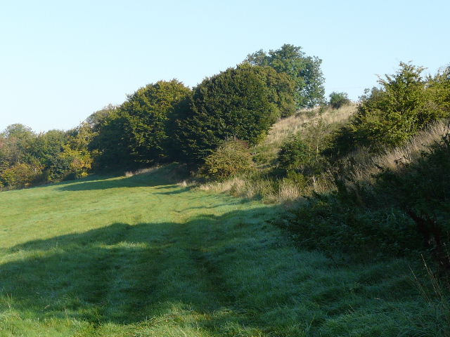
The path along the bottom of Codlings Bank
Through another kissing gate, I went more or les straight on (another path went right, steeply uphill). The path continued through a small wood or plantation and then followed a farm track back across the bottom of the valley. The path then switched to the right of a hedge (there is no right of way along the track beyond this point), and followed it as it rose back up the hillside, gradually curving right. To my right was a large stubble field and beyond that part of the enormous Kensworth Quarry. At the top of the hill, the path continued alongside the field for a while, before turning left and passing through a narrow belt of trees. On the far side of the tree belt, it turned right, to run alongside the trees. I saw a fox cross the path about 30 yards in front of me, the first one I’ve seen for a very long time.
Where the quarry path switches to the right of the hedgerow, and starts a curving ascent back up the hill.
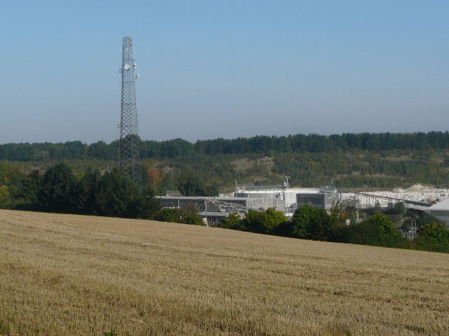
Looking across the buildings of Kensworth Quarry. The quarry path runs all along the top of the steep slope at the back, next to the trees, though today I would leave it before reaching that point..
The quarry path running behind the belt of trees. Just after putting my camera away after taking this photo, a fox ran across the path in front of me!
When I reached the tarmac drive to the quarry I turned left along it - there were 100 young trees protected by plastic tubing here, which had been planted by local schoolchildren in 2006 to celebrate the 100th anniversary of the cement company that owns the quarry. The path then continued on the far side of the drive, following the quarry fence on my right with trees and bushes on my right. I turned left by a yellow marker post, soon coming to a path running alongside Dunstable Downs Golf Club, where I again turned left. Within 200-300 yards I came to the road across the top of Dunstable Downs, which I crossed to reach the old car park.
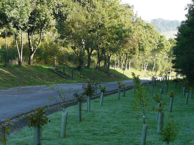
The drive to the quarry - the path continues up the steps on the other side. The 100 young trees here were planted by local schoolchildren in 2006 to celebrate the 100th anniversary of the cement company that own the quarry.
The path round the quarry, to the north of the drive.
Short path through trees linking the quarry path to a path running beside Dunstable Downs Golf Club.
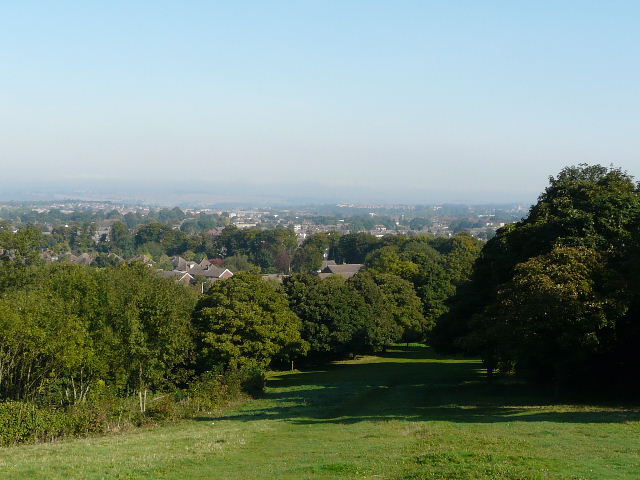
My brother Tim had called in on us shortly before I set off, and had said that when he’d driven across the Downs instead of seeing the usual extensive views (you can see for 40 miles on a clear day) all he’d seen was the top of a huge sea of fog covering all the lower lying land north of the Downs. Now, an hour or so later, the fog had receded from the foot of the Downs, but I could only see for about a mile and a half and then everything was obscured by the blanket of fog.
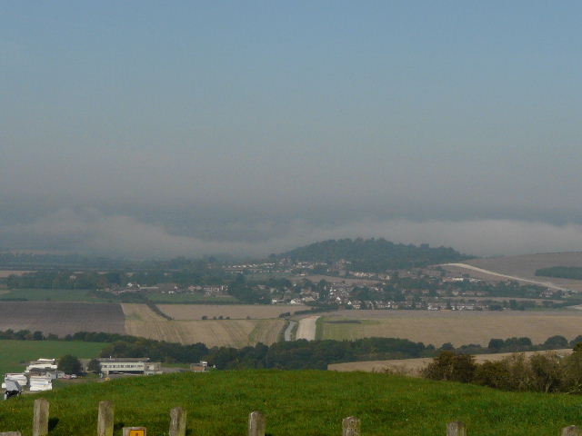
From Dunstable Downs looking towards Totternhoe. The view is severely restricted by a bank of fog lying over much of the Vale of Aylesbury.
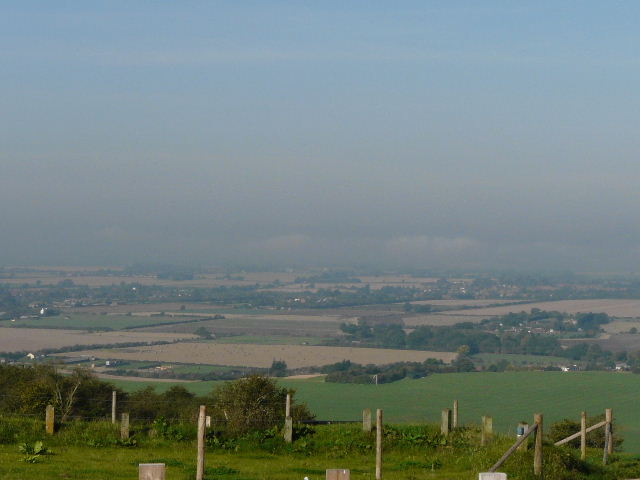
Another view of the blanket of fog over the Vale of Aylesbury. On a clear day you can see for 40 miles from here.
I turned right and walked along the top of the Downs, sticking generally to the grass or to old paths rather than the new gravel path that the National Trust has recently had created. I passed the Five Knolls ancient burial site - looking north from here, I could again only see a little way over Dunstable before the view was again blocked out by the bank of fog.
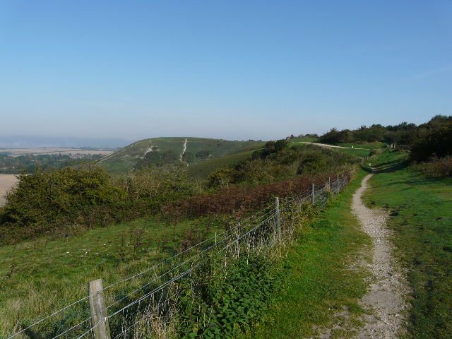
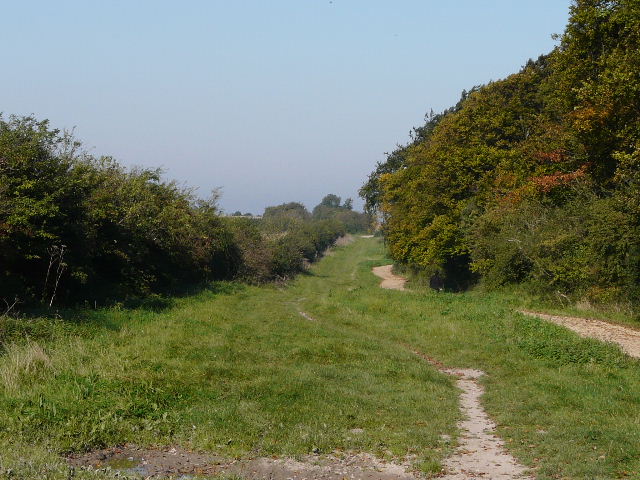
A path along the top of Dunstable Downs, with the fog again visible on the horizon ( to the left).
Looking back along Dunstable Downs.
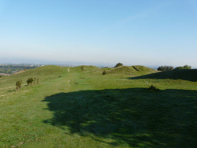
Five Knolls ancient burial mounds
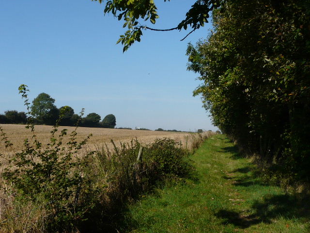
I followed the wide grassy slope down into Dunstable, crossed over West Street, went a few yards right and turned left through a small car park to continue along Green Lane. This is an old drover’s road, with hedges either side so that you can hardly tell that you are in a town. Sadly, another new hard-surfaced path has been built along here, which I think rather detracts from a historic and interesting route. I saw a Comma butterfly along here, as I passed two or three dog walkers.
The path down from Dunstable Downs to Dunstable - again the fog is visible in the distance.
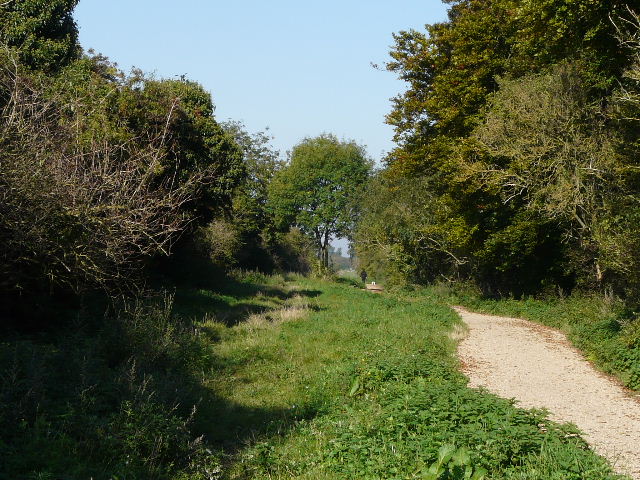
Green Lane, Dunstable
Green Lane, just beyond the edge of Dunstable