Pete's Walks - The Chiltern Way (2)
If you are considering walking this route yourself, please see my disclaimer. You may also like to see these notes about the maps and GPX files.
Day 10 13/04/07 Fields End to Flaunden (6.5 miles each way, approximately)
Parked in street on edge of Hemel Hempstead.
I parked on the edge of Hemel Hempstead just off Boxted road, and walked about a quarter of a mile to the point in Fields End Lane that I reached on my last walk. I hadn’t had far to drive this morning, so it was only about 9.30 when I started walking. It was cooler this morning, fairly misty when I left Kensworth but the sun was already burning the mist away as I started walking.
From the stile I reached last time, I went right along Fields End Lane, soon passing a pond on the left that had been badly affected by litter – there were full bin bags dumped in it. A hundred yards or so further, I turned left along an evidently well-used path [1]. This ran between hedges, briefly with arable fields or paddocks on either side, but then with a housing estate on my left. After about half a mile I crossed a road and continued on a path on the other side, still in a south-easterly direction. There was now a bit of open space beyond the hedges on either side, as I passed through one of the ‘green lungs’ built in to the design of the new town of Hemel Hempstead. There were still houses just a few yards to my right, though. The path ran just inside the edge of a wood for a brief period, before emerging to cross a broad strip of grass in a residential area, passing a children’s playground on my right. I followed the road on the far side of the grass to the left to a junction, where I turned right on the main road through this part of Hemel Hempstead.
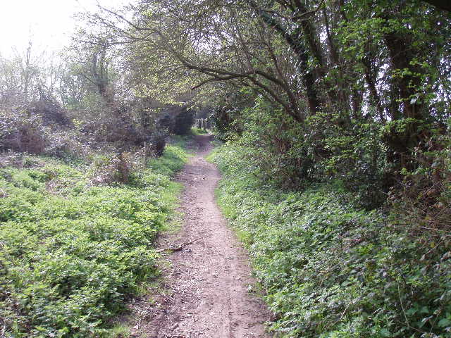
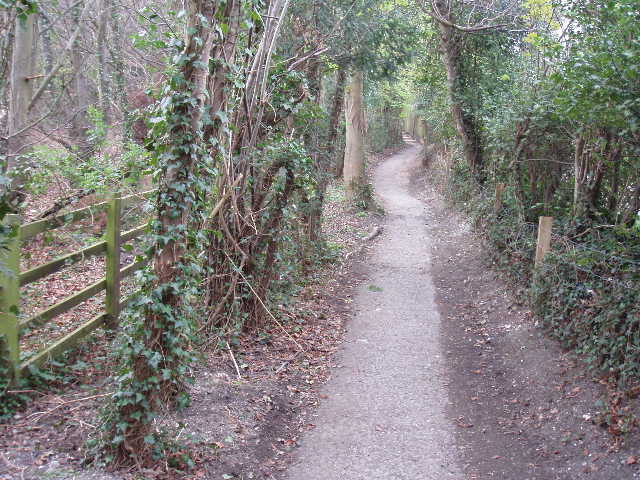
[1] Path leading from Fields End to Hemel Hempstead
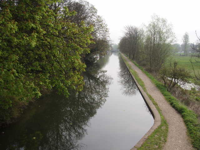
[2] Grand Union Canal in Hemel Hempstead
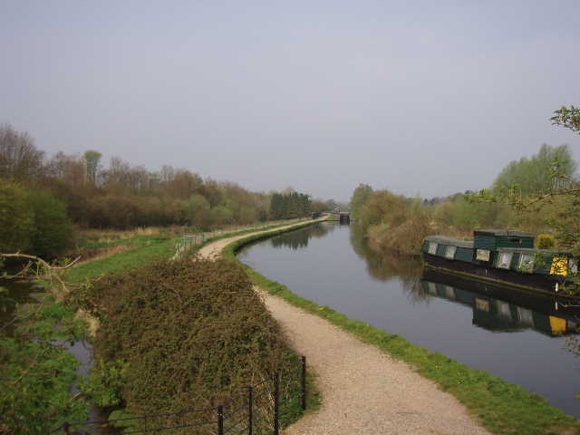
[3] Grand Union Canal in Hemel Hempstead
I followed the road downhill between the houses to where it curved left, and then turned right on to a minor road. Almost immediately, however, I forked left into the narrow ‘no through road’ of Old Fishery Lane. This went past a sports ground on my right, then between some larger houses, and soon crossed a bridge over an attractive section of the Grand Union Canal [2,3] (I had walked the towpath here on Day 10 of my Hertfordshire Way walk). The lane then passed under a railway line and then the A41 – there was a sort of mural on the walls of the bridge here, depicting a sequence of opened books. On each book, the left-hand page named an author and one of their works, while the right-hand page showed a quote from that work. On the left of the bridge were 20th century authors, with 19th century authors on the left (I was disappointed that there was no quote from Jane Austen!) [4].
Immediately after the bridge I turned left through a gate and followed a path beside the embankment carrying the A41 dual carriageway. The path went through a small meadow, with daisies, daffodils and buttercups growing amongst the grass. On the far side I reached a main road, where I took a short detour. I turned left, and went under a road bridge and a railway bridge to very soon reach Hemel Hempstead Railway Station, where I turned round and came back. This slight detour is not actually part of the Chiltern Way route, but is included in the guide book which starts and finishes at the station (because it is the nearest mainline station to the route). On the other side of the road, I took a path to the left of a small cul-de-sac. This again ran along the bottom of the embankment carrying the A41, as far as a subway. Here I went half-right, uphill beside a small wood on my left and fences on my right [5]. I didn’t really notice it now, but coming back there was a lot of road noise here from the dual carriageway.
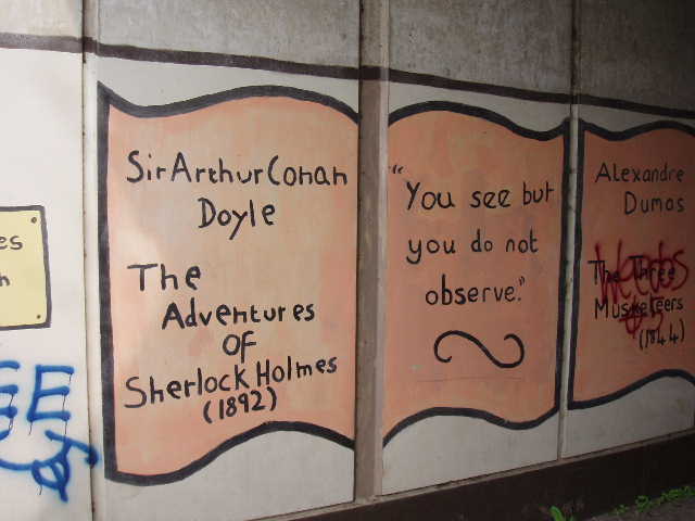
[4] Mural on underpass in Hemel Hempstead - I think the quote is probably quite apt for me!
[5] Footpath leading away from A41 in Hemel Hempstead, approaching Roughdown Common
[6] Start of footpath from Felden to Bovingdon
At a path junction, the Chiltern Way went right along a track, with houses to the right and the small wood of Roughdown Common on my left. After a short distance, a path branched off slightly left through the trees, where I saw Bluebells and some Forgetmenots. The path then joined another track, which in a few yards to the right brought me out onto a minor road. Here I turned left, quite steeply uphill, taking care as there were no pavements or verges, just steep banks either side. Just past a junction on the left, I forked right along the drive to Felden Lodge. A sign at the start of the drive announced that this is the headquarters and national training centre for the Boys Brigade. I followed the drive for a couple of hundred yards, to where it started to cross a golf course. Here I had to check my guide book for the only time today – I had to go half-left across a fairway, while for some reason I had thought I needed to go right. Other than this, I did the rest of the walk by memory (well, combined with a little help from waymarks and signs!).
At this point I saw a group of about 30 young people with a few leaders, obviously from the Boys Brigade HQ, setting off along a bridleway going to my left. When I reached the far side of the fairway, I crossed the bridleway and continued through an empty meadow. The path then ran a short distance between some cottages, then followed the right-hand hedge of another meadow to reach a lane. I turned right, passing some large properties on my left that are part of the village of Felden, and at a left-hand bend took a footpath going straight on [6], across a field of beans. The path crossed the field to a hedge gap into another bean field, where it went half-right to reach a wood. The Chiltern Way now went half-left, to follow the side of the field next to the wood.
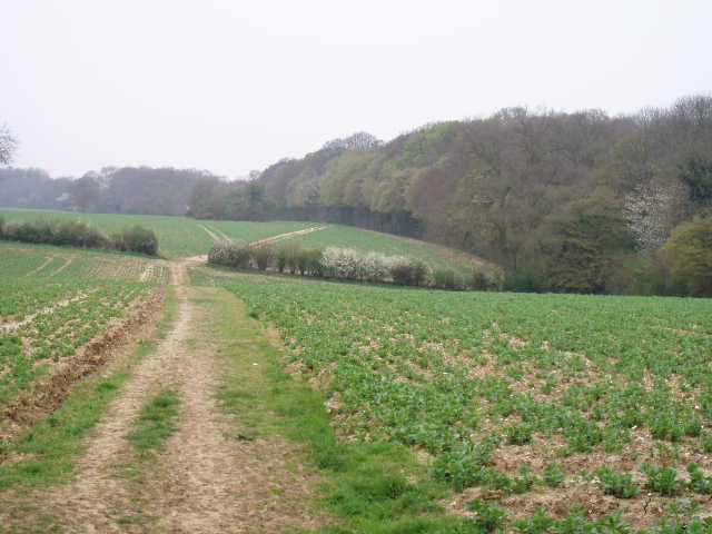
[7] Path between Felden and Bovingdon
[8] View from path between Felden and Bovingdon
[9] Bovingdon
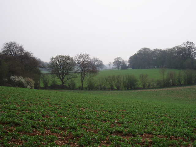
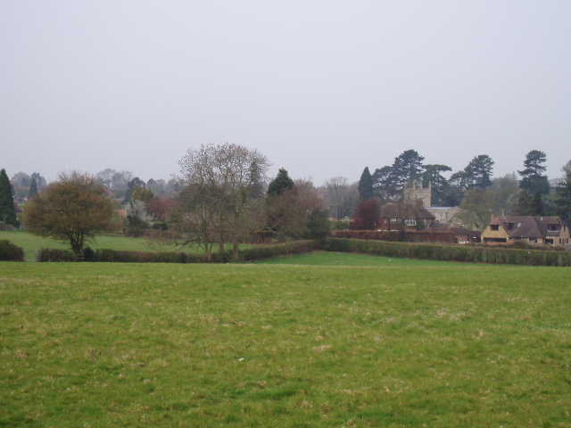
The next mile or so was very pleasant and very straightforward. The path followed the right edge of a series of bean fields, at first alongside a wood [7], and then alongside a stout hedge [8]. Sometimes there were fields or paddocks behind the hedge, other times large gardens – I was walking parallel to a private road with some large residences along it. I well remembered this section of the walk from when I did it almost two years ago – that day was extremely hot, 27-29C, and I’d needed to stop often to drink water and apply sun cream. Today was pleasantly warm, but still rather hazy. Eventually I went through a gate in a crossing hedge, entering a grassy field. Ahead and to my right I could now see the village of Bovingdon and its church [9]. I crossed the field, on a path through the grass close to the left-hand hedge – I passed two young cows lying by the hedge, black with a broad white belt round the middle, and long rather woolly hair (Belted Galloways, I’ve just checked on the internet). From the far corner of the field, a path led between garden hedges to a road, with the centre of Bovingdon to my right.
I went right for a few yards, before crossing the road and walking down a residential street opposite – I was now on the route of the Hertfordshire Way again. I walked down an alley between houses to reach a kissing gate. Some changes had obviously been made in the next three grassy fields since I was last here almost 18 months ago. A new wire fence now bordered the path through the first field as it followed the right hand hedge. In the second field, where the path went half-left to the diagonally opposite corner, the new fence continued to the left of the path, dividing the field in two. In the third field, the path turned half-left again, still alongside the new fence on the left but enclosed again by another new fence on the right. The fields were empty today, but in the past when I’ve been through here they’ve contained sheep and cows – presumably the new fencing is to protect the livestock from walkers and their dogs.
In the next arable field I followed a left-hand hedge, with the glass houses of a nursery over to my right. Where the hedge turned sharp left, the path went slightly right across the field to a projecting hedge corner, where it continued with a hedge to the right [10] until it reached a minor road with a lane continuing ahead. Here the Hertfordshire Way continued along the lane, but the Chiltern Way turned right along the minor road – this was surprisingly busy as at least seven cars passed me as I followed it for about three hundred yards. I then took a footpath on the left, following the right hand hedge of a pasture where a herd of cows munched the grass contentedly to my left. I would later have a good view of a fox in this field on my way back. I kept alongside the hedge through the subsequent field where five horses were grazing. At the next field corner, I went through a hedge gap and immediately turned left alongside the hedge – in fact there were several large gaps in this hedge, allowing the horses to wander between the two fields.
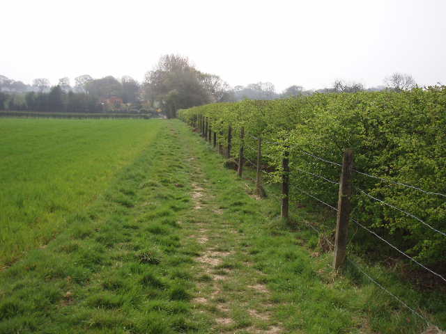
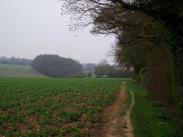
[10] Path from Bovingdon, approaching road junction where Holly Hedges Lane begins
[11] Footpath leading back to Holly Hedges Lane
[12] Path through Lower Plantation, near Flaunden
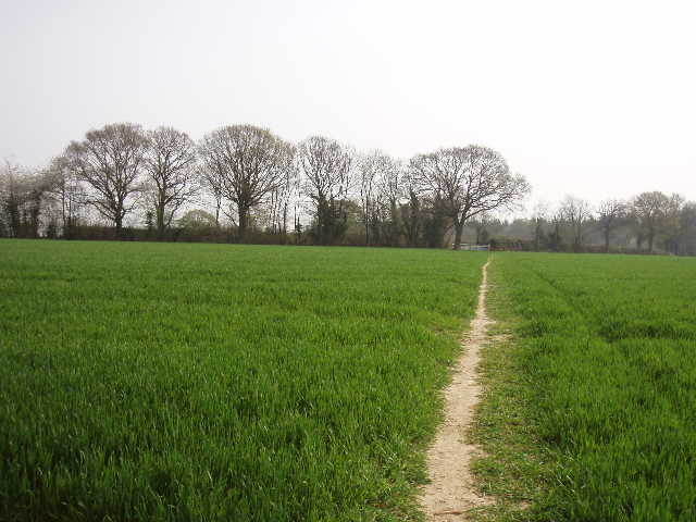
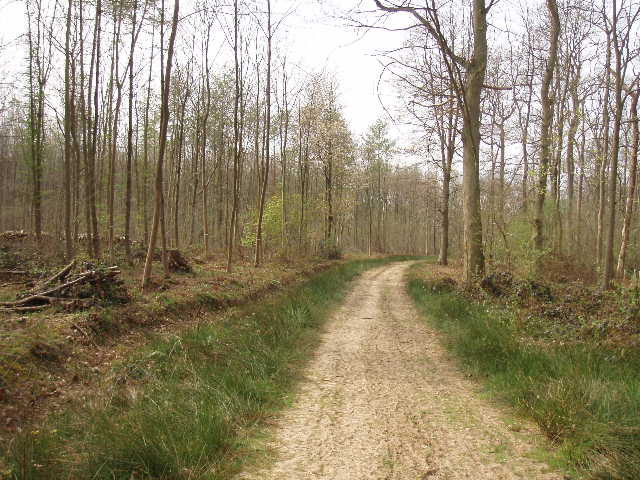
The path next crossed a green arable field to a gate [11] and the lane I’d seen earlier, where I briefly rejoined the Hertfordshire Way as I turned right. The lane is called Holly Hedges Lane, and it wasn’t difficult to see why – most of the hedgerows did indeed consist of holly. After a couple of hundred yards I said goodbye to the Hertfordshire Way once more (I won’t see it again until the penultimate day of this walk) as I turned right along a well-surfaced track. At first this had a field on the right and a wood, Lower Plantation, on the left. Where the field ended the wood widened out to my right, and the track continued ahead through the trees – this was obviously a managed wood, with almost all the trees being fairly young [12]. I saw several Peacock butterflies here, and on my way back the first Red Admiral I’ve seen for a while. The path reached a lane junction on the far edge of the wood, where I took the lane ahead of me, and walked the quarter of a mile or so to the edge of the village of Flaunden, where a footpath sign indicated where my next walk would begin. I didn’t bother to go further into Flaunden, as I’ll park there and walk through the village at the start of my next walk.
I turned and headed back. Almost straightaway I heard and then saw a Buzzard, flying over the edge of Lower Plantation. I stopped for a rather early lunch soon after the start of the long field-side path between Bovingdon and Felden, sitting on a chopped up log beside the path. I rather hurried my lunch, as I saw the large party of young walkers from the Boys Brigade heading my way, and I didn’t want to get stuck behind them – in fact as I stood up and put my rucksack, they appeared round the corner just yards from me, and I scurried off like a startled rabbit. The walk back was very pleasant – it was a nice afternoon, although very hazy. This walk was a bit shorter than usual, and I was actually back at my car before 2pm.
This was another enjoyable walk. The section through Hemel Hempstead wasn’t too bad and didn’t take too long. From then on, it was a very nice route all the way to Flaunden. As with the previous walk, it wasn’t quite as good as I remembered it, but again that’s probably a case of familiarity breeding contempt – part of the route I’d done twice before, as it’s also part of the Hertfordshire Way.
Total Distance: 74 miles each way