Pete's Walks - The Chiltern Way
If you are considering walking this route yourself, please see my disclaimer. You may also like to see these notes about the maps and GPX files.
Day 19 22/7/05 Whitchurch Hill to Woodcote (7.5 miles)
Parked by village green in Whitchurch Hill.
This was a warm but very grey day, also very humid, with the sky completely overcast except for the last hour or so when the sun finally broke through the clouds. Unfortunately the grey murk meant that I missed out on the extensive views over Oxfordshire that are described in the guide book. Still, every cloud has its silver lining - I also missed out on seeing Didcot Power Station!
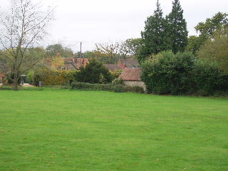
Whitchurch Hill 26/10/05
From Whitchurch Hill, the southern extension of the Chiltern Way led across a horse paddock, through a small wood (lots of holly) and across a couple of cow pastures to the farm and hamlet of Coombe End. It then followed a lane until it reached a partially derelict farm, where it turned off down a fenced bridleway to enter a large wood called Great Chalk Wood (more about this wood later!). After a long time in the wood (where I saw a Muntjac deer), the path finally emerged to follow the hedge of a large corn field uphill, and then along the top of the hill before going downhill to enter a recreation ground on the edge of Goring.
The section through Goring wasn’t as long or as tedious as I’d imagined from the guide book. I took a detour from by the railway bridge, to walk through the village centre and over the bridge over the Thames (actually two bridges with an island in the middle) to Streatley in Berkshire. On returning to the railway bridge and making my way through he outskirts of Goring, I then followed a fenced path between horse paddocks on my left and woods on my right, before another walk through woodland.
Where this emerged onto an unmade road (Beech Lane), I should have been able to enjoy good views over Oxfordshire but they were severely limited by the grey, murky conditions. Having followed Beech Lane for a mile or so, the way led across a field and through another wood to a lane. This was left almost immediately, the path following a hedge and then the edge of a wood before descending to pass through the garden of a farm (actually a very impressive house with tennis court) and then finally follow the entrance track to the farm for a quarter of a mile into Woodcote.
Very embarrassing! On the return trip this afternoon, I managed to get lost in Great Chalk Wood! I don’t get lost too often and this was the first time it’s happened on the Chiltern Way. I’ve been ‘temporarily misplaced’ several times, where I’ve missed a turning or taken the wrong path at a fork, but have always realised my mistake within 100 yards or so and have known how to get back on to the right path. This time, I had no idea where I had gone wrong, or which way I needed to go. Obviously I should have just retraced my steps until I reached a point I recognised (I remembered a junction several hundred yards back where I‘d definitely taken the right path), but I stubbornly refused to accept that I‘d gone wrong and carried on in the same direction.
Eventually, I did come across a Chiltern Way marker, but my joy was short-lived when I realised that I was back at the point where I had entered the wood! I had somehow gone round in a mile-long circle to finish up where I’d started! In my defence, this isn’t quite as bad as it sounds, as the correct path through the wood was more or less the shape of an inverted ‘V’, so although the walk through the wood was about a mile long, the exit and entrance points were only a third of a mile apart. Rather than turn and retrace my (erroneous) footsteps, I followed the correct Chiltern Way route again (although I knew this would be longer) as I wanted to find out how I‘d managed to go so wrong. I must have been completely lost in a daydream when I got lost, because it turned out that I had apparently totally missed an obvious and well-marked fork in the path and taken the right fork instead of the left one.
With the extra walk to cross the Thames in Goring, plus getting lost this afternoon, today’s planned 15 mile walk probably ended up nearer 17 miles. It was a very pleasant walk, without too much of special interest (other than the detour across the Thames to Berkshire, and getting lost in the wood - but both of these were ‘optional extras’!). I suspect it would have been much better on a day with clear blue skies, when the views over Oxfordshire and the Wessex Downs would have been seen at their best. The walk’s one feature of note was that it probably went through more woodland than any other walk so far.
Today’s drive took about 1hour and 20 minutes, in both directions. This should be the longest drive of the whole trip, from now on the driving should get shorter and shorter as I get nearer to Dunstable.
I have now walked further on the Chiltern Way than I have ever walked on any other path. When I was about 19, I walked about 270 miles on the Pennine Way (including extra bits to reach Youth Hostels), although that was a continuous walk done in 14 days rather than a section walk like this one.
Total Distance: 139.4 miles (each way)