Pete's Walks - The Chiltern Way
Post-walk comments
I thoroughly enjoyed walking the Chiltern Way. I would recommend it as a route to anyone who enjoys rolling English countryside. There was nothing exciting or dramatic about the scenery, but the hills and woods made for a very charming landscape that was a pleasure to walk through.
Some days walks were more enjoyable than others (and I appreciate my feelings towards walks are very much affected by the weather conditions!) but there were no walks that I didn’t enjoy or that I regretted doing. If I had to pick one section to walk again, I would combine parts of two of my walks. I would start in the picturesque village of Hambleden (where there is a convenient car park) and follow the valley of the same name northwards to Skirmett, and then progress on to Fingest, Turville and Southend, before turning round in Stonor Park when I’d reached a good viewpoint of Stonor House and its chapel. This walk would include all the things that made my journey so enjoyable – hills, valleys, beech woods, quaint villages, historic churches, grand houses and, of course, Red Kites.
Other highlights of the walk for me were the charming and secluded village of Mapledurham, Swyncombe Down, the ancient earthwork of Grim’s Ditch, the Chess Valley near Sarratt, the Barton Hills and the area around Great and Little Hampden.
If anyone reading this is thinking of walking the Chiltern Way, I would have to say that the guide book by Nick Moon is absolutely essential. The route is not currently shown on the OS maps, so the guide book is the only way of knowing where to go. The way is generally well marked by signposts and waymarks, but most days I would need to refer to the book several times to check where I should go (I was always wary that some unkind person might have altered the direction of such signs, although the only place I came across this was in Turville where, I later found out, the signpost had been put back wrongly by a film crew). I walked with the guide book in hand every morning, putting it away in my rucksack when I reached my ‘turning point’ and started to retrace my steps. I always carried the relevant OS Explorer map in my rucksack, but only ever had to refer to them three or four times on the whole route as the guide was normally sufficiently clear to make the way ahead obvious. The guide also contains interesting information about the places passed (it is where I have got most of my info from).
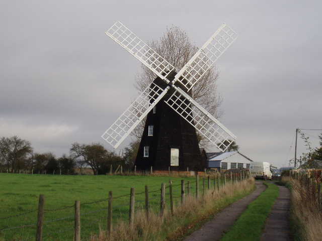
Lacey Green windmill, on Day 23 (photo taken 5/11/05)
This has been my first attempt at writing a journal, and I have enjoyed this too – I will continue to write journals for the walks I do in the future. Obviously, walking by myself has the disadvantage, so far as a journal goes, in that I can’t report on the quirks and idiosyncrasies of my fellow travellers, nor can I report on the profound (or otherwise) comments they might make. I seem to be limited to describing the route, what I see, the weather, and any odd incidents that might happen, with a few snippets of unrelated matter thrown in occasionally. But I hope my journals will serve as a reminder to myself of the walks I’ve done and the places I’ve seen. If other people read them and enjoy them, so much the better!
(NOTE: In 2010, a few years after I did this walk, the Chiltern Society celebrated the 10th anniversary of the Chiltern Way by opening a further extension to it, through the part of the Chiltern Hills Area Of Outstanding Natural Beauty that lies in Berkshire. Click here to read about my subsequent walk on the 'Berkshire Loop').