Pete's Walks - Cross Bucks Way
If you are considering walking this route yourself, please see my disclaimer. You may also like to see these notes about the maps and GPX files.
Day 1 8/02/06 Stratton Audley to Hillesden (8 miles each way, approximately)
Parked in Stratton Audley.
It took me about an hour to drive to Stratton Audley – a very frustrating journey, I seemed to be always in a queue of traffic behind someone doing 40mph where it was safe and legal to do 60mph. Stratton Audley seemed a very pretty village, with almost all the buildings built from the same greyish/yellow stone, a totally different style of architecture from that in the villages and towns in Hertfordshire where I’ve been walking the last few months.
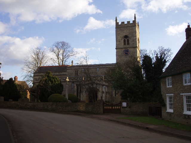
[1] Stratton Audley church
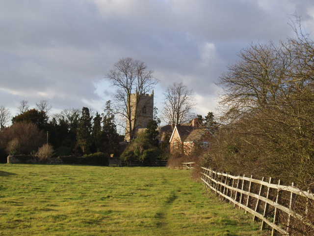
[2] View back to Stratton Audley (photo taken in afternoon)
There was a Cross Bucks Way sign near the church [1], pointing the way over a stile and across a paddock [2]. The path then continued in a more or less straight line, heading south-east, following a fence or hedge on the left. I heard and then saw a Red Kite at this point – it was being driven off by a crow, as it flew along some trees to my left. The path then crossed a couple of fields that had been ploughed and sown with some cereal crop – the path though had been clearly marked out and was easy to follow. The next couple of fields, either side of a lane, obviously belonged to a different landowner, as though there were waymarks there was no evidence of the path itself and I had to walk straight across the crop. Across a railway line, still heading south-east, I walked across a couple of pastures [3] and then had to make my way across another field where the path had been ploughed and sown over. After another couple of fields (a farmer and two dogs were rounding up sheep in the second), the path turned left near the village of Marsh Gibbon [4]. Nearby there was a Stump Well, ‘a post mediaeval stone well house covering a mineral spring’ according to the leaflet (Update: see Day 2 of my Bernwood Jubilee Way walk for a photo of the well).
[3] Path heading towards Marsh Gibbon, just beyond the first crossing of the railway
[4] Path near Marsh Gibbon
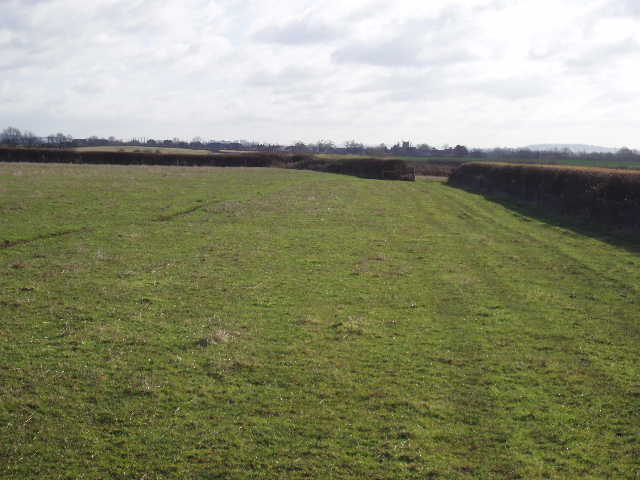
It felt quite warm now compared to the cold I’ve been used to walking in recently, so I took my coat off. Having walked south east for a couple of miles, the Cross Bucks Way now took me in a northerly direction. It crossed a couple more sheep pastures and another arable field (at least the path was clear here) before reaching a ploughed field. No sign of the path, so I walked round the wide margin of the field – this added a few hundred yards to my walk, but it was better than struggling through the furrows. The funny thing was that here and in the previous field where the path wasn’t visible, there were signs saying the landowner welcomed walkers! It seems almost as if they are happy for people to walk round the field edges whether there is a right of way or not, rather than use the correct paths where they go across fields. Having crossed the same railway line again, I then crossed a huge open field on Beacon Hill – there was now quite a chilly wind, so my coat went back on and stayed on for the rest of the day. Although Beacon Hill was only a small rise, there were quite extensive views over the surrounding lower land [5]. In the next paddock, there was a pond with a notice board [6]. As well as information on ponds and pond life, this told about the Bernwood forest and the Bernwood Jubilee Trail. I’d been following signs for this for about a mile or so, its course obviously being the same as the Cross Bucks Way hereabouts. I’d come across the Bernwood Jubilee Trail before, when walking the North Bucks Way – I’d decided then that I wouldn’t walk it as I thought parts of it were too far distant from my home, but looking on the map on the board I could see that none of it was any further away than other walks I’ve done. So I’ve now added the Bernwood Jubilee Trail to my list of possible future walks.
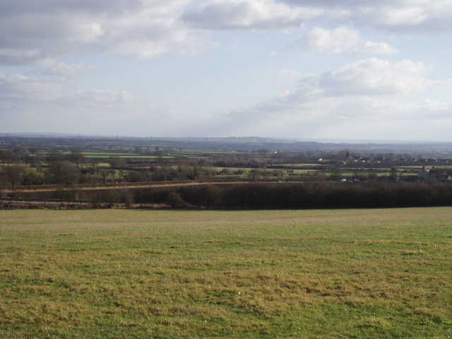
[5] View east from Beacon Hill (photo taken in the afternoon)
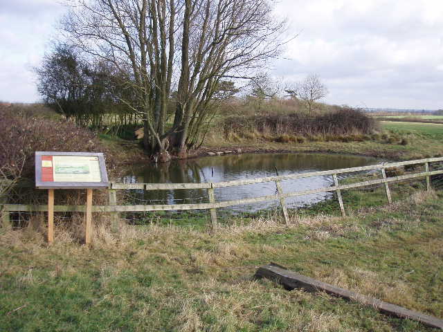
[6] Pond and information board near Poundon
There were a couple of horses in the next paddock. Over to my left I could see the impressive Poundon House [7]. The Cross Bucks Way then took me through a field of very tall grass with a small flock of sheep in it, then across the corner of another grass field and then through a garden to reach a road in Poundon. The route now turned towards north-east, the direction I’d follow all the way to Hillesden. Immediately after Poundon, another sheep inhabited field of rough grass took me to a stile in a hedge. Across this, I had to traverse a corner of a field planted with wheat or some such (no visible path again) – oddly there were a few more sheep in this field, I’m not at all sure they should have been there. Across another stile in a hedge row, I then crossed a very large paddock with three or four horses away off in a corner, to emerge on a farm drive by a sharp corner in a road. Across the drive, a stile took me into another tall grass field with sheep, only this one had an all-weather track for horses running round it.
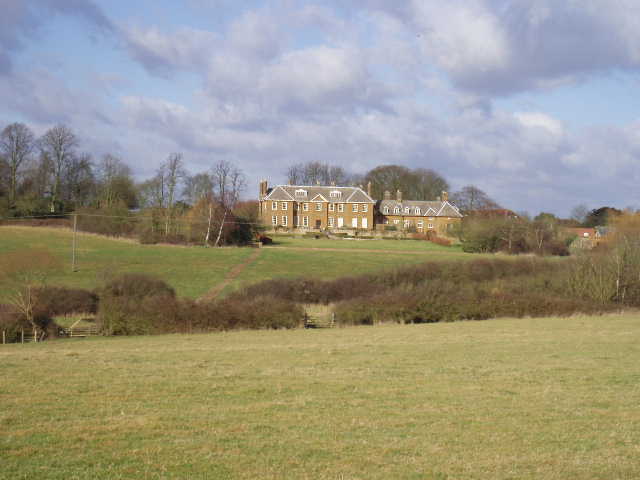
[7] View towards Poundon House
After another paddock, I came to another freshly planted arable field, again with no footpath. I could see the tower of Twyford church ahead and thought the path would be in that direction – the map confirmed this, and so I set off in that direction. I soon came across some footprints going that way, and followed them to the next stile. On my way back in the afternoon, I noticed that the Cross Bucks Way was going in a straight line towards not only Twyford church but in almost exactly the same line to Hillesden church, visible on a ridge on the horizon. The paths earlier had been heading towards the church at Marsh Gibbon. This confirms one of the reasons why I seem to photograph so many churches – the footpath network arose historically mainly because people needed ways of getting to church each Sunday, and so the long distance footpaths visit the church in almost every village I pass through (Poundon being the only exception today). After another field of rough grass (no sheep this time), a short track with two gates across it led me through farm buildings into Twyford.
[8] Twyford church
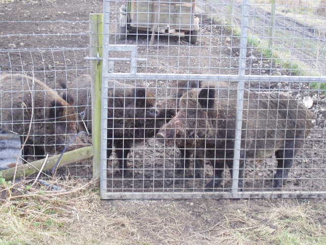
[9] Wild boar, near Twyford
I followed School Lane to its end and then continued along a track, passing the graveyard and church on my left [8]. Across a disused railway track, I passed the end of a long thin enclosure containing some Wild Boar [9] – I’ve seen them truly wild in France and Spain, but never before come across them being farmed. The Cross Bucks Way continued across a couple of pastures and then another field of rough grass that brought me to Three Bridge Mill. There has been a water powered mill on this site since at least the time of the Domesday Book, but it now seems to be a scrap merchant’s yard.
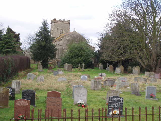
Across a road, a footpath led past a small fishing lake. Then came a long sequence of fields planted with some cereal crop, with the paths clearly marked out across them (if only all farmers/landowners were so good at fulfilling their legal obligations towards footpaths!). These went on for over a mile [10], the last field path taking me uphill to reach a lane by the impressive Hillesden church [11]. The tower is older, but most of the church was rebuilt by the monks of Nutley abbey in the 15th century in the ‘Perpendicular style’ with lots of pinnacles and battlements. Hillesden House was a royalist stronghold during the civil war until it was burned down by Cromwell in 1643 It was rebuilt in 1648 but demolished in the 18th century.
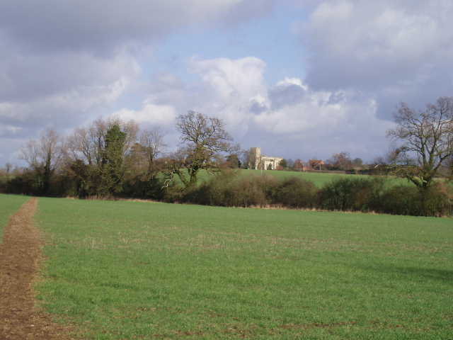
[10] Path heading towards Hillesden church
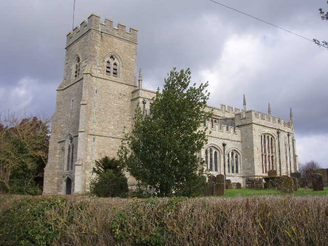
[11] Hillesden church
I turned round at Hillesden, and retraced my steps. I had lunch near Twyford, sitting on a stile in a hedgerow. It was an uneventful return trip, although I saw a Sparrowhawk near Marsh Gibbon. This was a slightly longer walk than I’d been used to lately (it took about five hours and 20 minutes of walking), and I felt quite tired by the time I got back to Stratton Audley. On my previous walk, the Hertfordshire Way, it was almost always fairly obvious where the path went and I had a guide book giving instructions – today I had to do a lot more navigating, at almost every stile or gate I came to I needed to look at the map to work out whereabouts in the next hedgerow I should be aiming for. I’d forgotten how much easier it is with a guide book telling you which way to go! Despite the planted over paths, I enjoyed this walk a bit more than I’d expected to, possibly because the weather was better than I’d had for some time – very sunny and warmer than of late, although there was a stiff breeze and always some clouds in the sky. Compared to the Hertfordshire Way and the Chiltern Way, the area I walked through today was very flat, with just the slight rise over Beacon Hill and then the ridge surmounted by Hillesden church. There were no woods either, just paths alongside or across fields. But I enjoyed the walk, and was glad I’d decided to try the Cross Bucks Way.
Total Distance: 8 miles each way