Pete's Walks - Cross Bucks Way
If you are considering walking this route yourself, please see my disclaimer. You may also like to see these notes about the maps and GPX files.
Day 3 14/02/06 Swanbourne to Old Linslade (8 miles each way, approximately)
Parked in Swanbourne.
I was very lucky again with the weather today. It had been raining in the early morning, but stopped about 9.30 as I was driving to Swanbourne, and stayed dry all the time I was walking. There was some slight rain as I drove home (and a double rainbow). It was a much shorter drive today, and I managed to start walking by 9.50am.
From Swanbourne I took a tarmac footpath on the right that ran between the main road and a quiet lane with cottages and a Methodist chapel. I followed the lane to the left, and continued ahead on a ‘No through road’ when the lane turned sharply to the left, passing a few more cottages. After a hundred yards or so, I turned right onto a farm track running between hedges [1]. This soon turned to the left, and ran on in that direction, almost due east, for about a mile. The land here was very flat, though there were low ridges to be seen to south and north. The track ran alongside at least one hedge all the way (I passed a farmer in his tractor trimming the hedge at one point) in fields of grass or stubble, eventually becoming a green lane [2] that the leaflet said was an old drove road – part of this was very churned up by horses.
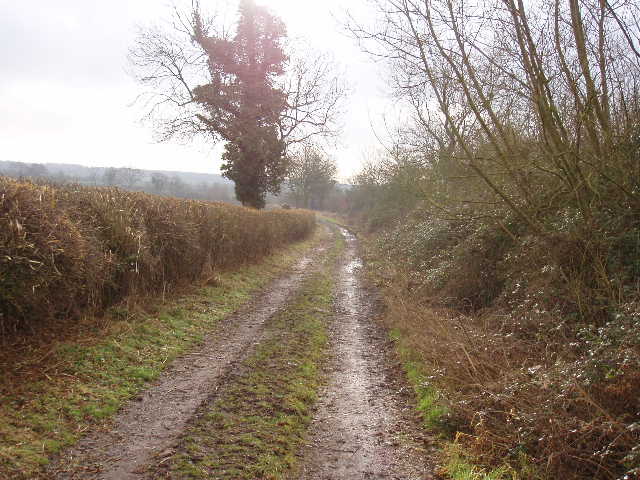
[1] Near the start of the track from Swanbourne
The track came to a T-Junction with another wide hedged track. A few yards to the left, signposts indicated a junction where 5 or 6 rights of way met. I took a path continuing in the same easterly direction across a huge open field, rising slightly uphill, and then across a smaller connected grass field. I then went diagonally across a paddock containing four horses, with the drive to a couple of farms and a house on my left. I left the paddock where the drive met a minor road, and followed the road for a couple of hundred yards to the left. I then took a concrete farm drive on the right for a few hundred yards, before a stile on the left gave access to another field path. I followed the right hand hedge to the corner of the field, where another stile took me into the field on the right. Another stile in the right hand hedge soon took me into a larger grass field, which I crossed diagonally to a corner. A sequence of stiles quickly took me on to a path between a fence and a hedge, before another stile took me to the other side of a hedge. I followed this left-hand hedge through a sequence of three or four grass fields (the penultimate one had sheep with lambs in it) to reach the large village of Stewkley.
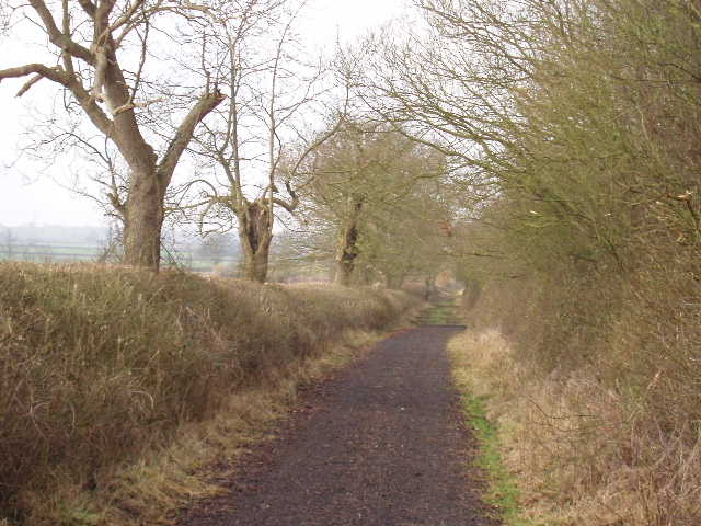
[2] The track between Swanbourne and Stewkley
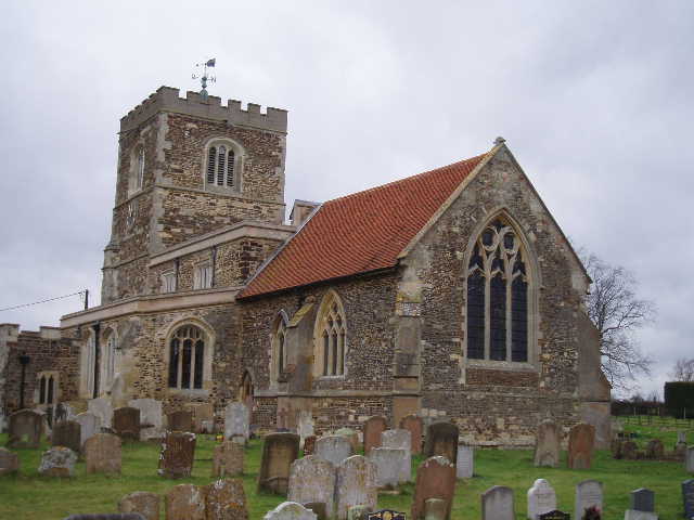
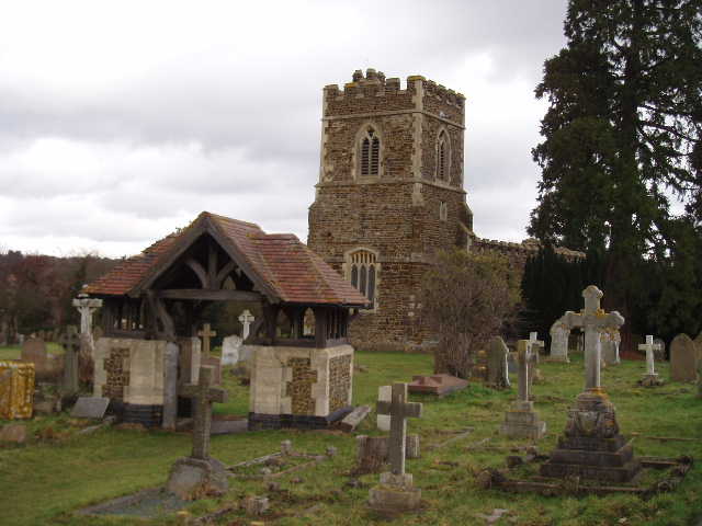
Stewkley has many interesting buildings spread along its 1.5 mile long high street, according to the Cross Bucks Way leaflet. I took a detour here to wander an extra quarter of a mile along the road to reach Stewkley church [3]. Built about 1150, the leaflet says St Michael’s church is one of the few Norman churches to have survived unaltered. It certainly looked convincingly Norman to my untutored eyes, with its rounded arches and massive square tower.
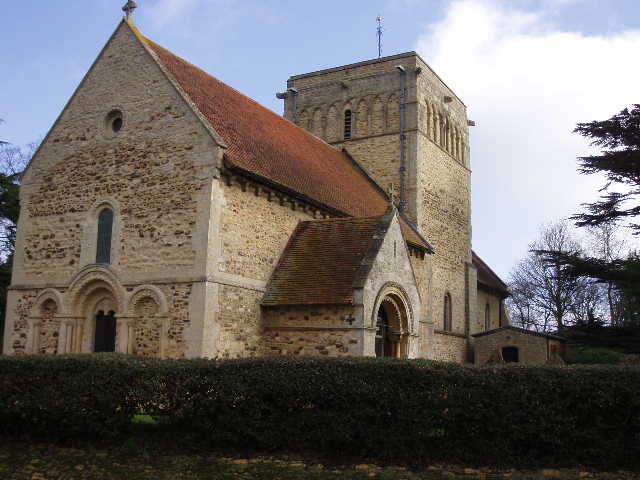
[3] Stewkley church
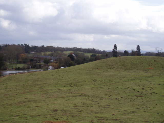
Returning to the signpost that indicated where the Cross Bucks Way left Stewkley, I found the next section of the walk very pleasant indeed. It was obviously well used by the locals, with the path being quite clear through a succession of grass fields with modern metal kissing gates through all the hedges. The path went up and down slightly too, and passed a hole in the ground that was marked as a disused pit on the map. Views opened up ahead and to the left, towards the flat plain where Milton Keynes is situated (I could see the Ski slope) and towards the ridge of wooded hills where Great and Little Brickhill lie [4]. Eventually, after passing through a small bit of scrub, the path reached the hamlet of Hillingdon.
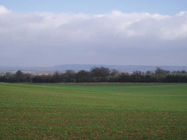
[4] View towards the Brickhills
I followed the lane through Hillingdon for a quarter of a mile or so, then took a footpath on the right. The next field was all mud, as if it was being prepared for some housing or other development, then a field of coarse grass went uphill to where the path passed through the grounds of a house (a very affectionate terrier puppy greeted me here on my way back) to reach a farm drive. Across this, the path went through another large and muddy pasture to reach a road, with Soulbury church visible about a quarter of a mile away. A sequence of grass pastures led to the churchyard [5,6], and the main road through the village.
[5] Soulbury church
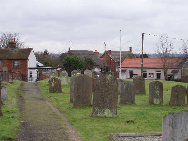
[6]Soulbury from the churchyard
A private drive and then a fenced track took me out of Soulbury. I went slightly wrong at the next gateway – there was a footpath sign and a Cross Bucks Way sign, both at an angle rather than pointing straight up, but I didn’t twig that they were deliberately at slightly different angles. I went slightly left across the paddock to an obvious footbridge in a hedge, before checking the map and realising I’d gone wrong. I returned almost to the gate, before heading much further left across the large paddock until I saw another footbridge, by three horses. The path had been cleared across the next three arable fields, so even I couldn’t go wrong here. The path then went beside a hedge round the next field, and then across a slight valley. Here, a new dual carriageway was being made – where its route had been marked out, it was incredibly muddy. I met a runner coming the other way, who asked if I knew whether the path would be diverted or a bridge or underpass put in. As it was a footpath rather than a bridle way, my guess was that a gap in the central safety barrier would be provided, but otherwise footpath users would have to brave the traffic as best they could. Beyond the quagmire, and after a short section through a small plantation, I soon reached another road where I got my first glimpse of the Grand Union Canal.
[7] Approaching the Grand Union Canal at Old Linslade
[8] View across the canal near Old Linslade
The Cross Bucks Way then crossed two paddocks (three or four horses in the first one), passing close to a small kennels where several assorted dogs barked away at me. The path across the next arable field was clearly marked, but when it reached a wide strip of grass along the far side of the field there were no further indications of where the footpath went. I had to more or less make my own way across this and the next field, just following the map, to reach a bridge over a main railway line. I then crossed a large paddock [7,8] beside the canal to reach a minor road. I then took a footpath beside Old Linslade church [9], which cut across a loop in the canal before rejoining it. I then followed the canal for a few hundred yards to a bridge. I think this was the actual end of the Cross Bucks Way, although there were no signs there whatsoever, but I crossed the bridge and walked a couple of hundred yards to the Globe pub anyway to make sure – the leaflet just says the Cross Bucks Way ends near the pub, and the map on the leaflet seems to show the path ending at the bridge.
[9] Old Linslade church
It was almost one o’clock when I turned round, and I stopped for lunch by Old Linslade church (according to the Cross Bucks Way leaflet, Old Linslade was a busy market town and a place of pilgrimage in the middle ages – now there is only the church and a few farms left). It was a long walk back in the afternoon, but as usual it seemed to pass quite quickly, probably as I didn’t have to worry about navigating anymore. There were occasionally dark clouds in the sky, but the showers that had been forecast never materialised. I was walking for about five and a half hours today, and I felt pretty tired by the time I got back to Swanbourne – I think that ploughing through the mud seems to be tiring my legs out more than when I walk on dry paths.
This was a very pleasant walk, generally on good paths although some care had to be taken with navigating through the numerous pastures. It passed through some interesting hamlets and villages, and I thought Stewkley church was well worth visiting even though it was slightly off the route.
Total Distance: 24 miles each way (Note that all distances for this route are very approximate)