Pete's Walks - The Cumbria Way
If you are considering walking this route yourself, please see my disclaimer. You may also like to see these notes about the maps and GPX files.
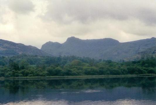
View over Elterwater, toward the Langdale Pikes
Day 5 9/6/05 Great Langdale to Sunny Bank (Coniston Water) (15 miles)
The morning’s minibus ride was interesting, to say the least. We had a different driver, for some reason, and I can only assume he was very inexperienced. Instead of entering the hotel grounds, he picked us up at the entrance to the hotel’s drive. I thought it strange that he didn’t turn round there and take the main road through Coniston to Great Langdale, but instead continued in the direction he’d parked, up a very steep hill and then down some narrow lanes. At one point he pulled over to the side to let a car coming the other way get by, and in so doing dislodged someone’s house sign – we found this out when the irate owner pursued us in his 4x4 flashing his lights. Eventually our driver noticed this, pulled over and exchanged details with the unhappy house owner. Having reached the main road at Clappergates, near Ambleside, the driver then proceeded to miss the turning for Great Langdale at Skelwith Bridge! It took him two attempts at finding a place to turn round, the first attempt only causing him to scrape his rear nearside wheel arch (judging by the sound of it). I think we were all quite relieved to finally get out safely near the New Dungeon Ghyll Hotel. For me, the one good thing about this journey was that Nick kindly pointed out a Grey Wagtail to me, on the river Brathay near Clappergates, while the driver was talking to the angry house owner.
We walked through fields, following the course of Great Langdale beck, until we reached Chapel Stile where we had a brief stop. There were just a few spots of rain at this point, but they were all we had, the skies being overcast throughout the morning but brightening up in the afternoon. From Chapel Stile we continued on down Great Langdale, passing through the village of Elterwater to reach the lake of the same name. We paused here for some photographs, and chatted to some elderly gentlemen who were also out walking. We soon reached Skelwith Bridge, and shortly after the impressive Colwith Force, where again we paused to photograph the impressive water fall. The Cumbria Way then meandered through undulating scenery until we reached the famous and popular beauty spot of Tarn Hows, where we had our lunch near the side of the water.
From Tarn Hows, it was mainly downhill, partly through woodland, to the village of Coniston. Here we had a break for 30-40 minutes, our party dividing into two groups, one visiting a tea-shop the other heading for a pub. I had an Orange Juice and Lemonade at the pub, resisting the temptation of trying a local beer named Cumbria Way! From Coniston, we crossed fields to pass by Coniston Hall with its massive chimneys, and then walked through a campsite to reach the western shore of Coniston Water. The next couple of miles or so was very pleasant, as we followed a path through woodland along the lakeside. At one point Patience told us a little about the charcoal burning that was done here (which reminded me of an episode in one of Arthur Ransome’s wonderful children’s books). After a couple of miles or so, we turned away from the lake and shortly reached the road where we met our minibus (fortunately with a different driver!).
This was our second successive 15-mile day, and after our exertions yesterday this was the one day when I felt quite weary in the afternoon. Several of us commented on the fact that we had no energy – our ‘get up and go’ had ‘got up and gone’! But it was a very good walk, especially the finale along the side of Coniston Water.
Total distance: 62 miles