Pete's Walks - Hertfordshire Chain Walk
If you are considering walking this route yourself, please see my disclaimer. You may also like to see these notes about the maps and GPX files.
Walk 3 19/10/06 Bayford to Little Berkhamsted (5.5 miles each way)
Parked on main road in Bayford.
It was raining as I had breakfast this morning, but the weather forecasters said it would soon clear leaving only occasional showers and so it proved. Having criticised them for getting it wrong in a recent journal entry, it’s only fair to mention when they get it right (as they seem to at least 90% of the time). The sky was a strange mixture of patches of blue and very threatening dark grey clouds, so that the walk alternated between bright sunshine and rather gloomy conditions.
Something different about the Hertfordshire Chain Walk is that, being a series of linked loops, the walks don’t begin where the previous walk finished. So it seemed a bit strange starting this walk in Bayford, although I’d been there before on the Hertfordshire Way. The only bit of information I could glean from the internet about Bayford was the following quote from Wikipedia: “The Lord of Bayford was Sam, but he was recently deposed following a coup by the local pheasants.” Wikipedia is an online encyclopedia where anybody can enter or edit entries – obviously some entries are more trustworthy than others!
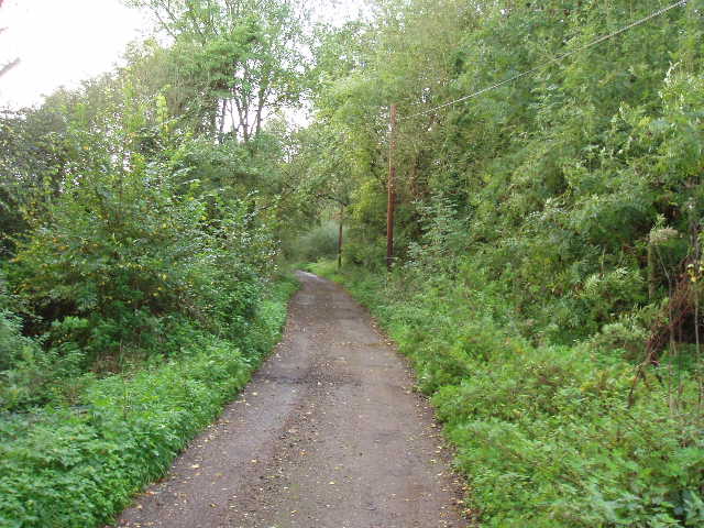
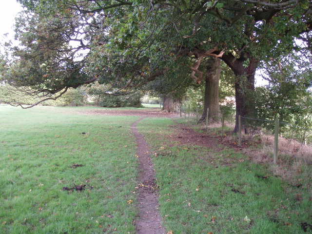
[1] Bridleway heading south from Bayford
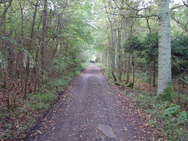
[2] Bridleway through Blackfan Wood
From Bayford, the Hertfordshire Chain Walk takes a bridleway heading south, on a broad and well-drained gravel track [1]. This runs between hedges before entering Blackfan Wood [2]. By a lone house in the centre of the wood, the tracks turns to the right. Beyond the wood it runs through a belt of trees, to reach a road after about one and a quarter miles, opposite a garden centre (memories of Crews Hill!). Here I turned left and carefully followed the road a short distance as it twisted and turned, descending a short dip and rising again. There were nice woods either side of the road. I then turned right onto another bridleway on a good track - this was the bridleway through Ponsbourne Park that I walked on the previous walk [3]. I followed it through an avenue of trees (lots of conkers on the ground), and again noticed a couple more of the air shafts for the railway tunnel running under the estate. The track was much muddier today than on Monday, obviously because of the rain we have had in the last two days. The track turned sharply to the right, passed a pond on the left [4], then quickly turned sharply to the left.
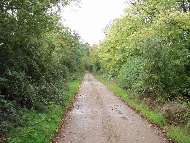
[3] Track through Ponsbourne Park estate
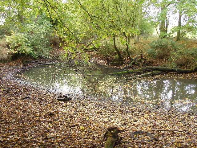
[4] Pond on Ponsbourne Park estate
After passing a few cottages on my left, I turned right on another good track (leaving the route of Walk 2). This track went down hill between trees, with estate buildings on the left and a field to the right, then entered a wood. It passed close to a house in the wood, where a German Shepherd dog barked aggressively from behind the fence, and continued on a short distance to reach a road at a junction. There was a lodge house here at this entrance to the Ponsbourne Park estate, as there had been at the entrance where I entered the estate. I crossed over a road and took the road ahead of me, called Tyler’s Causeway – I had walked a few yards of this road a bit further on when I walked the Hertfordshire Way. After passing a few houses, I turned right on a footpath. This followed a right hand hedge, containing many mature trees [5], through three grassy fields – there were about half a dozen horses in the second field. Halfway across the third field, the Hertfordshire Chain Walk went through a kissing gate in the hedge and turned left along the drive of a large modern house to reach a lane in Epping Green.
[5] Footpath north of Tyler's Causeway
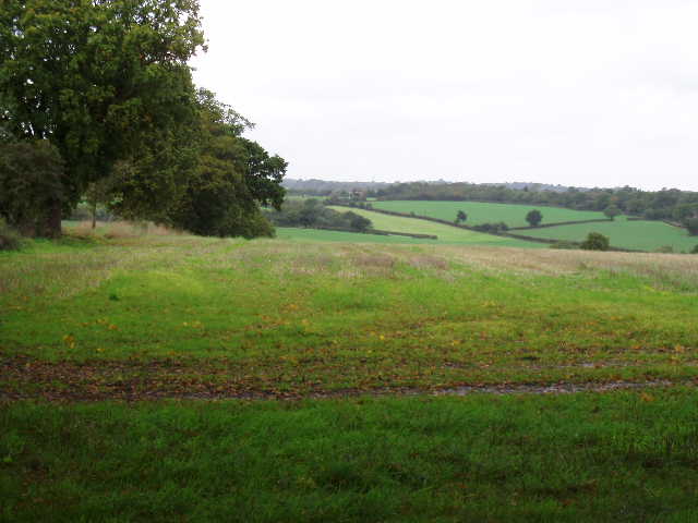
[6] View from just north of Epping Green/p>
I turned left along the lane, which immediately turned sharply to the right. I passed a number of houses on my right, with the large main building of Epping House School visible beyond them. Beyond the entrance to Woodcock Lodge, over on my left, the tarmac lane gave way to a gravel track. Where this turned right, I continued ahead on a good path, almost as wide as the track. This ran between trees, with good views over the fields and hills to the left [6]. After about half a mile [7], I turned sharply right onto another footpath – there was no sign of the gate mentioned in the guide book here, but a waymarked post indicated the junction. This path crossed two grassy fields to reach another lane, with the village of Little Berkhamsted over to my left. Across the lane, another path followed a right hand hedge, then ran between a left hand hedge and a wire fence. After passing through a small group of trees, the path followed the right hand hedge of another grassy field. In the field corner, I turned right at a path junction to reach another lane. I was now back on the route of Leg 10 of the Hertfordshire Way again, which I would now be following all the way back to Bayford. To my left I could see Stratton’s Observatory, a round brick-built tower built as a folly in 1789.
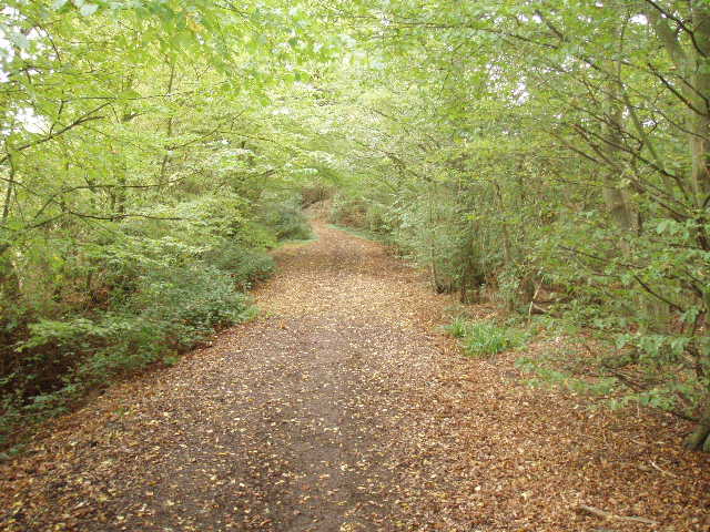
[7] Path between Epping Green and Little Berkhamsted
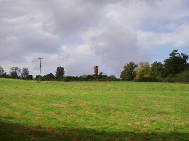
[8] View back towards Stratton's Observatory
I turned right for a few yards on this lane, before taking a path on my left. This ran between gardens for a few yards, to a stile. It had started raining at this point, and I took advantage of the shelter of a tree by the style to don my waterproofs. The path now crossed some large grassy fields [8] to reach a stile by a wood – the guide book contained a sketch showing where the path went across these fields, but it was unnecessary as the path was perfectly clear in the grass. The path now climbed steadily uphill through the wood – I noticed that a fallen tree across the path had been cleared since I walked here on the Hertfordshire Way earlier this year. Another stile at the edge of the wood gave access to another grassy field – the rain had now stopped so I took off my waterproofs. As I followed the hedge on my left, there was plentiful evidence that there had been cows in this field very recently, but I couldn’t see them – they must have been hidden by the curve of the hill over on the far side of the field, because they were standing in a group in the middle of the field when I came back about quarter of an hour later. The path followed the hedge as it turned left, then crossed a stile to join a track, where it turned right and reached a road in about a hundred yards. I followed the road left for almost half a mile into the centre of Bayford, turning round near the village pub [9].
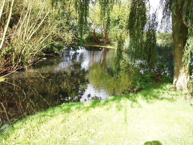
[9] Village pond, Bayford
There was only one further shower on my return trip, as I was walking the bridleway through the Ponsbourne Park estate – after a few minutes of light rain I decided to put on my waterproofs, but by the time I’d got them out of my rucksack it had stopped. I completed this much shorter walk by 1.30pm, and so I had my lunch in my car when I got back to it.
This was a very pleasant walk, despite the showers and dark skies. Much of it was on very good bridleways, wide tracks that were partly gravel and well-drained as there was little surface water or mud despite the recent rainy weather. The footpaths near Epping Green and Little Berkhamsted were clear and easy to follow too – they had recently been refurbished with metal kissing gates by the local branch of the Ramblers Association and the East Herts Footpath Society (who devised the Hertfordshire Chain Walk).
Total Distance: 21.5 miles (each way)