Pete's Walks - The Hertfordshire Way
If you are considering walking this route yourself, please see my disclaimer. You may also like to see these notes about the maps and GPX files.
Day 2 28/09/05 Sandon to Weston (7.7 miles each way)
Parked on road in Sandon, near the school.
The weather forecast said that there would be heavy rain arriving about 4pm. In case it came a bit earlier than that, I tried to make an early start. I left home at 8.15 rather than the usual 9.00 but, as I’d expected, it was a bit pointless – the rush hour traffic was so bad (especially around Hitchin), I actually only started the walk 10 minutes earlier than if I’d left at my usual time. In the event, the rain didn’t arrive until about 5pm and wasn’t very heavy or prolonged anyway.
From Sandon, the Hertfordshire Way took a path through a sequence of paddocks to reach Roe Green. This was a very attractive hamlet or village, with cottages spread along either side of a wide and very long green, with a road running through the middle of it. Having crossed the green and taken a path between houses, the path led across a small grassy field and through a hedgerow, before turning right on a track. The track followed the hedgerow for almost a mile, with a huge field on the left that was in the process of being ploughed (the ploughman was still at it when I came back in the afternoon), before reaching the village of Redhill. The path crossed a ploughed field here, and then followed a right hand hedge to a corner where there was a five-way junction of footpaths. I needed to take a path diagonally across another ploughed field, but as there was no sign of the path (a common problem at this time of year, paths not being reinstated after ploughing) I walked round two edges of the field. I then crossed a small pasture with a few cattle (including a bull) to reach a road in Wallington.
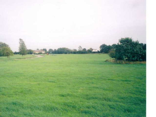
Roe Green
Walking through Wallington, I saw a very pretty thatched cottage with a plaque on it, commemorating the fact that George Orwell lived there from 1936-1940. From the road in Wallington, I took a path that led to the village church – part of this path was completely overgrown, necessitating a diversion into the adjacent meadow (as mentioned in the guide book). From the church, I followed a clear bridleway on a farm track. Unfortunately, at this point I managed to go wrong (yet again!). I knew that I had to turn right, and then just keep straight on for about a mile. I mistook a kink in the track for the right turn - an understandable mistake to make as it was a 90 degree turn to the right, and the track changed from having a hedge on the left to having hedges on both sides, but I should have checked the distance from the last junction and been alerted by the lack of a signpost. Anyway, as a consequence I walked about half a mile past the correct right turn before discovering my mistake. I was particularly annoyed with myself, as I’d wasted about 20 minutes on a day when I wanted to finish early because of the predicted rain. Still, when I did get back on the correct path it was a very pleasant section, following a hedgerow for almost half a mile and then passing through a very nice piece of woodland. A couple of fields then led onto a farm drive which soon reached a road. Beyond this, a path crossed a ploughed field diagonally to reach a corner of a hedge, where I followed the field edge to reach a lane in Clothall.
From Clothall, the Hertfordshire Way follows a path through fields, parallel to the A507, for almost a mile. This section of path was heading almost directly towards Baldock, and its church spire could be clearly seen, with the flat lands of Cambridgeshire again in view. I had been worried that the Hertfordshire Way might have been diverted as a result of the ongoing building of the Baldock by-pass, but in fact the new road is a few hundred yards closer to the town than the path. At a large group of farm buildings I turned left, heading in a westerly direction again – here I met the first of three school parties I came across in quick succession, each about 25 children (aged about 12) accompanied by three teachers. The Hertfordshire Way followed the hedge of a green field where sheep grazed, and then passed through a gate and turned left along another hedge before climbing uphill along a wide farm track. This reached a road on the outskirts of Weston after about half a mile. Across the road, I followed a hedge and then went over a stile into a large field with cattle feeding in a corner. I followed a fence and then crossed the field diagonally to another stile and a field with a few pregnant sheep (according to the warning sign about keeping dogs on their leads). Another stile gave access to another road in Weston, then a path led through a garden and across a couple of paddocks to reach a hedged path that led to Weston Church, my destination for the day.
My walk back to Sandon was very pleasant but uneventful. It had been pleasantly sunny for most of the day, but started to cloud over about 2.30. Nevertheless, I made it back to the car well before the forecasted rain appeared. All in all, it was a very enjoyable walk, marred only slightly by my own silly mistake in missing a turning and by a few ploughed field where the path had not been reinstated.
Total Distance: 16.1 miles each way