Pete's Walks - The Hertfordshire Way
If you are considering walking this route yourself, please see my disclaimer. You may also like to see these notes about the maps and GPX files.
Day 21 17/01/06 Stapleford to Wareside(7.7 miles each way)
Parked in side street in Stapleford.
This was another grey January day, although the sun started to break through just after twelve o’clock and by the end of the walk the skies were much lighter with even some patches of blue. There was a very light drizzle for 20 minutes or so just after I set off, but otherwise it remained dry. It was quite mild for the time of year, but never quite warm enough to take my coat off.
From Stapleford, a path continued alongside the river Beane for about half a mile until it came to a high ladder style over the wall surrounding the Woodhall Park estate. The house here was built in 1770 for an officer of the East India Company, and has been leased to a school since the 1920s. Over the style, the path continued in typical park land surroundings, lush grass with occasional trees dotted about. The path joined a drive [2] not far from a farm on the estate. Across a brick bridge, the drive was followed to the right to a crossroads near the stable block which had a clock tower over its entrance. A short way to the right, the drive was left for another path that led further across the park land to reach the boundary wall on the other side of the estate. Over the style, the Hertfordshire Way followed the wall and crossed a drive again, before following the edge of a ploughed field to a lane. Here I turned left, and in a few hundred yards came to the A602 Ware-Stevenage road.
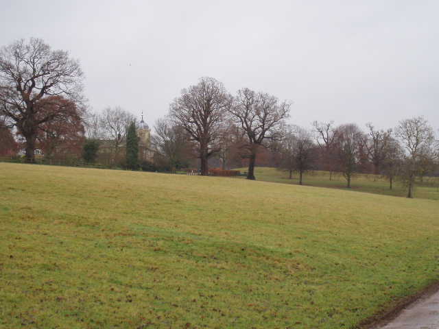
[1] Woodhall Park
Across this, I entered another estate, that of Sacombe Park. Built in the 17th-century for Sir Philip Borteler, it was later owned by Samuel Smith, one of the founders of Barclays Bank, who had bought Woodhall Park in 1800. A quarter or mile or so down the entrance drive, I turned right along a footpath. Across a stile beside a covered reservoir, a broad track led beside a field and then between hedges to a farm. The path went round a barn to continue in the same direction, alongside the right hand hedge of a grassy field. A track then led downhill, and then a path climbed steeply upwards through trees to reach another field. Here the Hertfordshire Way followed the left hand hedge for about quarter of a mile, before passing through a gap in the hedge near a wood. The next field (tall grass) was crossed diagonally, following a tractor track, passing near another farm. The well sign-posted Hertfordshire Way then took another track and then a footpath along field edges [2], before descending to the adjoining villages of Wadesmill and Thundridge.
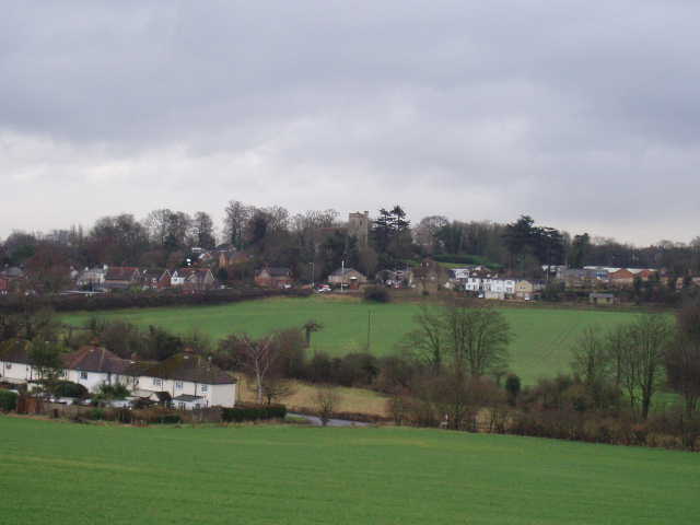
[2] Wadesmill and Thundridge
Part of the route through Thundridge was along Ermine Street, a Roman road. A footpath lead across fields and then under the new A10 bypass (opened earlier this year). The path continued between fences and hedges, passing by the ruins of Thundridge old church (only the tower with its Norman arch remains [3], although there were gravestones in the churchyard). A few fields further on, the path started to follow the bank of the river Rib [4] (which I’d crossed on a bridge in Wadesmill). After half a mile or so, where I turned right to leave the river, I saw three buzzards over a wood a little way away. A very muddy path led me uphill, to reach a lane in a small hamlet. I then followed a drive towards a house and farm, and then followed a hedge to reach a wood. The next section of about half a mile through the wood was very pleasant although, as elsewhere, the path was very muddy.
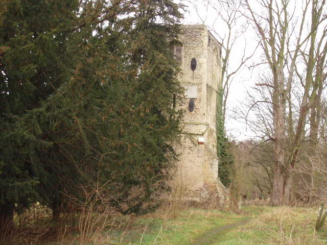
[3] Ruin of Thundridge old church
On the other side of the wood, a track past a cottage led to a lane. A stile opposite led to a fenced path beside the garden of a largish house. Three boxer dogs barked and tried to put their heads through the top of the fence, but I managed to get by safely. After following a hedgeline for a couple of hundred yards, a grassy field was crossed diagonally downhill to reach a lane on the edge of Wareside, my turn-around point for the day. I had a quick look round here, but couldn’t see anywhere suitable to park, so my next walk will have to begin in Widford and start with a walk back to Wareside.
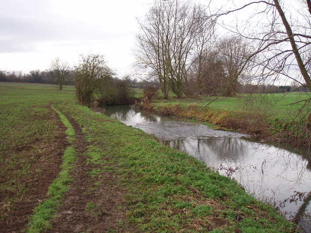
[4] Looking back along the river Rib
I enjoyed the walk back to Stapleford, although my legs definitely felt more tired than usual – maybe I’ve lost fitness, maybe it was because of having to plough through so much mud. Between Wadesmill and Sacombe Park I overtook two bird watchers. I asked if they’d seen anything interesting, but they said they’d not really seen anything. When I told them I’d seen the buzzards earlier, they said that that was what they’d been hoping to see. Funny how you see things sometimes without really trying and sometimes you specifically look for something without success. I once went on holiday to the English/Welsh borders and spent a whole day in mid-Wales on a fruitless search for Red Kites (it was the only place to see them then). The next day I went for a walk instead of bird watching, and literally as I was sitting in my car tying on my boots I saw a Red Kite!
This was a highly enjoyable walk, the first for a long time that did not pass through any built up areas. There was a variety of scenery – woods, fields, park land and a couple of riverside sections – and although there were no big hills (except perhaps the ascent from Wadesmill in the afternoon) it was quite up-and-down. The paths were quite muddy, but that is hardly surprising at this time of year. I should imagine that this would be an excellent walk on a warm summer’s day.
Total Distance: 159.4 miles each way