Pete's Walks - John Bunyan Trail
If you are considering walking this route yourself, please see my disclaimer. You may also like to see these notes about the maps and GPX files.
Day 6 18/12/06 Bromham to Clapham (8.6 miles each way)
Parked in road in Bromham.
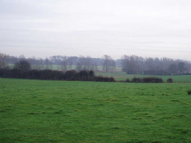
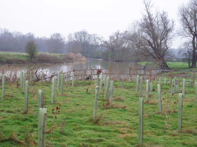
It took about an hour to drive to Bromham, so I didn’t start walking until about 10.10am. It was another cold morning but not cold enough for a frost. There was a thin layer of pale grey cloud covering most of the sky, with a few patches of blue visible. It was slightly misty, so that distant views faded into a grey background in quite an atmospheric manner. Today’s walk was roughly horseshoe-shaped, with the horseshoe tilted to the northwest and following a loop in the river Ouse, so that I’d end up only a couple of miles or so from where I’d started. I keep referring to the river and its valley as the Ouse, but to be more precise it is the Great Ouse, which drains much of the fens of Cambridgeshire and flows out into the Wash.
[1] Bromham Park
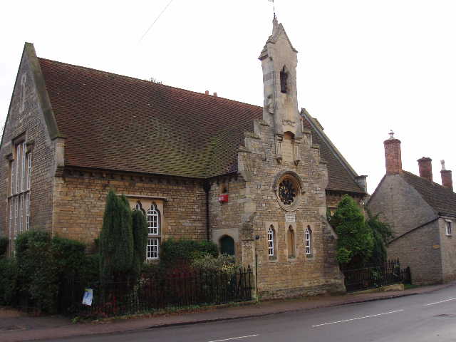
[2] Baptist church, Bromham
[3] Path heading from Bromham towards Stevington
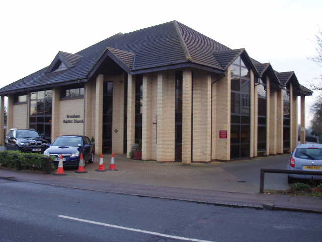
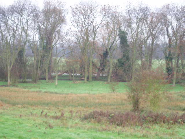
The John Bunyan Trail headed north on a footpath just west of the mediaeval Bromham bridge, passing a few residences and then entering Bromham Park [1]. I followed the clear path through the damp grass here, heading gently uphill with a view over the grass and isolated trees of the parkland towards Bromham church on my right. A man was walking his Alsatian ahead of me here – I’m pretty sure I passed the same man and dog on my way back (though I doubt they’d been wandering the park all day!). I went through a gateway on the far side of the park, and turned right along a road – there was a stylish modern Baptist church here (I was rather surprised it said church rather than chapel) [2], and a notice board with information about the Bromham Heritage Trail. On Saturday I’d noticed the mill and another property nearby both had Bromham Heritage Trail signs on them, and from the 2002 date on the signs I’d correctly guessed that the trail was created to commemorate the Queen’s Golden Jubilee. After a short distance I turned left along Mollivers Lane (once called Stevington Lane according to the notice board) and followed it for about a third of a mile to where it and the houses ended.
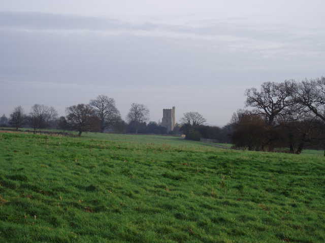
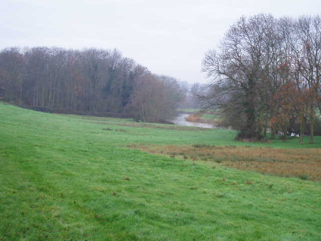
[4] Misty view of the Ouse Valley from the path to Stevington
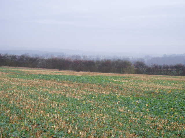
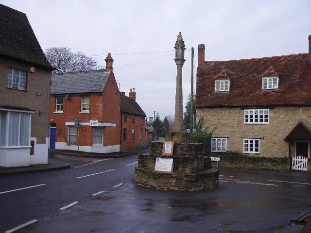
[5] Misty view of the Ouse Valley from the path to Stevington
[6] View of the Ouse Valley from the path to Stevington (photo taken in the afternoon)
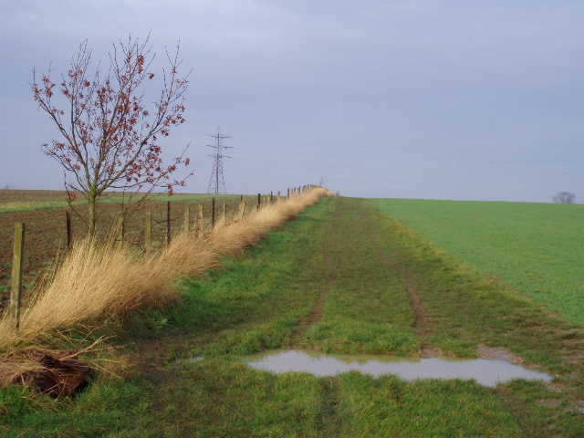
I then continued onwards in the same north-eastwards direction on a wide bridleway, at first on a hard surface alongside a wood on the left, then continuing on grass alongside a left-hand fence [3]. There were misty views over the Ouse valley to the right [4,5,6]. I came across a solitary plant with yellow flowers along here, growing in a puddle – I photographed it, but have yet to identify it. It was unusual as I’ve not seen many wildflowers at this time of year. I continued ahead at a crossroads of bridleways, descending slightly across a field of cabbages or such like. I passed the ruins of Skylark Cottage [7] and crossed the route of an old railway line, now part of the Stevington Country Walk. Once through the hedgerow on the far side, I could see Stevington Windmill [8] ahead, in the field to my left. The bridleway continued along the right-hand edge of this very large arable field, then I turned left on a footpath to continue round the field getting closer to the windmill. The John Bunyan Trail didn’t actually visit the windmill, but turned right and went past some modern houses to a road.
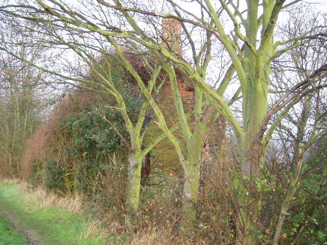
[7] Ruins of Skylark Cottage
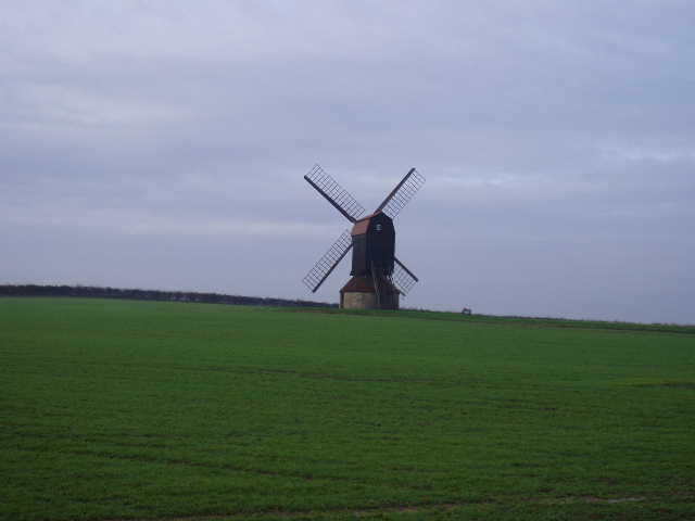
[8] The windmill at Stevington
[9] Victorian water tap, Stevington
Stevington Mill, a post mill, was operated until 1939, mainly grinding cattle feed. It was purchased and restored by Beds County Council as part of the county’s contribution to the Festival of Britain in 1951. It was probably the last windmill in Britain to operate with four common (cloth covered) sails. The village of Stevington (pronounced Stevv-ington rather than Steve-ington, according to my Dad) has a long history. It was once part of the kingdom of Mercia, and at the time of the Domesday Book it was one of the wealthiest parishes in the county. The tower of the church dates from Saxon times.
[10] Stevington
[11] Valley of the river Great Ouse, Stevington
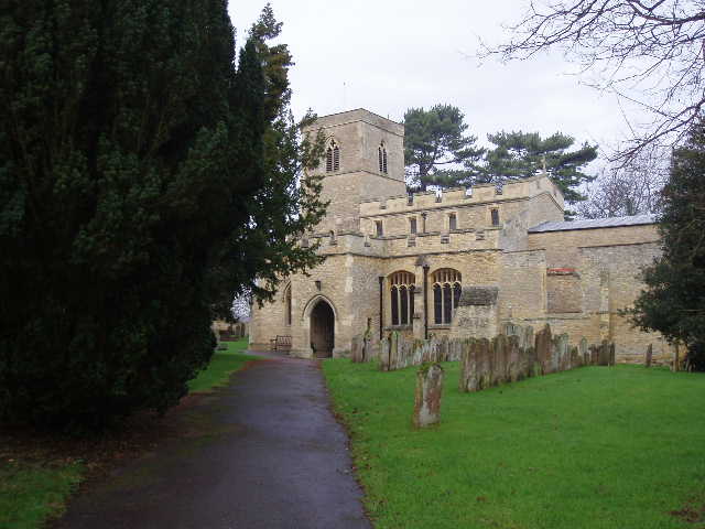
[12]
Stevington church
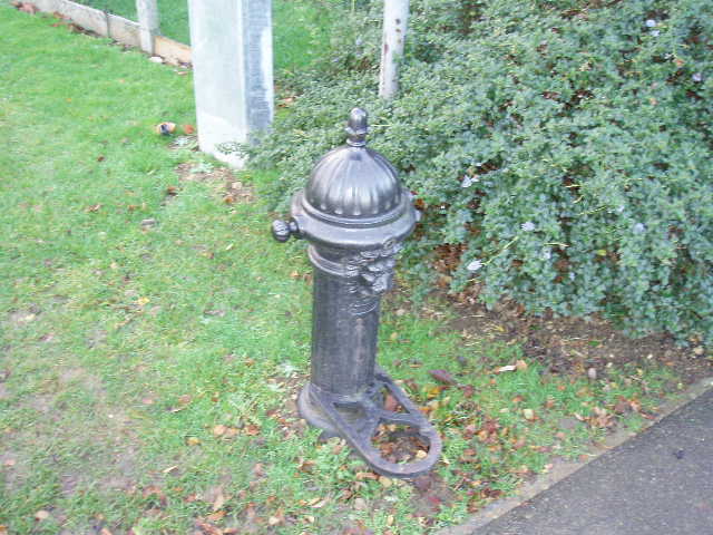
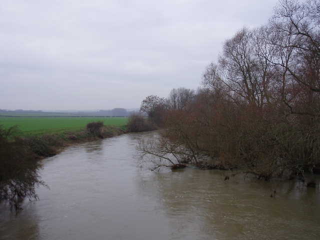
I followed the road to the left into the centre of the village, passing a Victorian water tap [9] similar to the one I saw in Bromham on the last walk, to a crossroads [10]. Here there was an impressive stone cross, a place where Bunyan preached and thought to be the cross or burden shed by Christian in Pilgrim’s Progress. I turned right and followed a lane [11] down to the village church [12], where I noticed that a side chapel at the east end was roofless. I picked up a path following the churchyard wall – there was a spring here, flowing out from under the wall [13]. Beyond the wall, I entered a water meadow, with the river Ouse over to my right, as it would be for the next few miles. The path followed a left hand hedge on a bank, a few feet higher than the rest of the meadow. After a few hundred yards, the path went through a kissing gate on the left, but continued between fences in the same north-easterly direction as before. To my right, there was a thin wooded island in the river called The Holmes [14,15], where Bunyan and his friends allegedly met in secret before walking up to the nearby Meeting Farm (I presume it had a different name then otherwise the meetings might not have been so secret!).
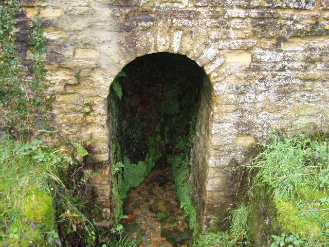
[13] Spring at Stevington church
[14] The Holmes
[15] Great Ouse, near The Holmes
I followed the fenced path to a wood where the path went left, away from the river. The path went round a corner of the wood, then entered another meadow, then went right by some more trees to enter another riverside meadow. I crossed this diagonally to the far corner, close to the river [16], passing a flock of sheep (they had gone when I returned in the afternoon). I had to duck under a thick Willow branch in order to get over a stile, then traverse a very muddy section for a few yards in the next meadow, before signposts indicated where the path left the riverside and climbed up to a hedgerow (an unofficial path obviously continued ahead alongside the river). I followed the hedgerow parallel to the river – it had been recently trimmed and a farmer was in a tractor trimming another hedge that joined this one. I followed the path through this and the next field of rough grass, to reach the end of a short lane in the village of Pavenham [17]. I followed the lane to the left, and at its end turned right to walk through the centre of the village.
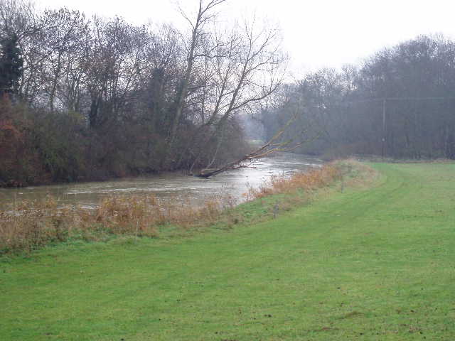
[16] Looking back along the river Great Ouse, between Stevington and Pavenham
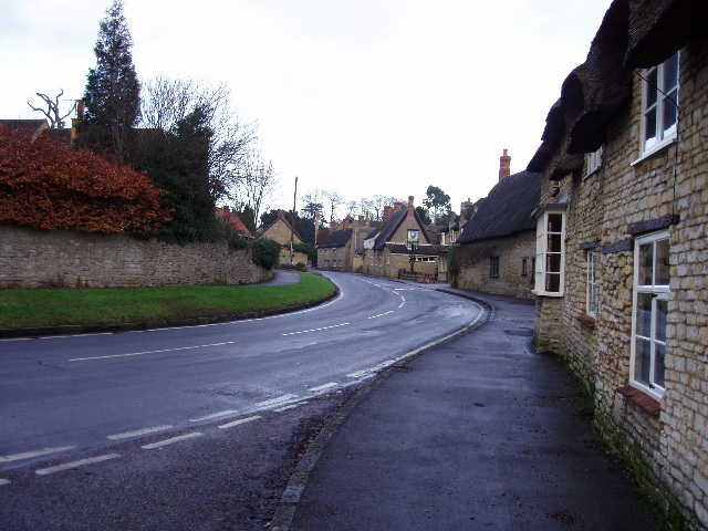
[17] Pavenham
[18] Old School, Pavenham
The print-out for the John Bunyan Trail describes Pavenham as one of Bedfordshire’s outstanding riverside villages. It certainly seemed an attractive place, with the pub and many of the houses built from the same local stone, an oolitic limestone which apparently contains many fossils of ammonites, sea urchins and bivalves. I turned right down an alley just past the Old School [18], which ran between gardens to reach a field. I turned left to follow the path round the edge of the field, eventually reaching a stile. Across this into an empty pasture, I followed the hedge to the left and crossed another stile into another empty pasture. I crossed this half-left to the edge of a farmyard where cattle were feeding, and turned right over another stile. After following a left-hand hedge for about two hundred yards, I crossed another stile and turned right on a track between a right-hand hedge and a belt of trees. This track turned left, then right, then left and then right again to come very close to the river once more [19], where it turned left and ran on for a few hundred yards to a road.
I turned right and walked down the road. I had noticed a sign saying that the fields on my right were an ‘Open Access’ area. As there was another entrance to them further down the road, just before a bridge, on my way back I walked through the fields rather than on the road (which was potentially dangerous as there was no pavement until I reached the bridge). I crossed the bridge over the Great Ouse [20] and followed the road uphill into Oakley. The sign at the entrance to the village announced that it was ‘Village of the year 2004 Eastern England and Home Counties’. The John Bunyan Trail only passes through the edge of the village, so I didn’t really find out why Oakley had won the accolade. I went straight on at a crossroads, then turned left on a track that went over a railway bridge towards some cottages, then followed a path to the right parallel to the railway. The path here has been diverted since my map was made, as it followed the railway all the way to a road rather than go half-left across the field to join the road at a different point – the reason for the diversion was obvious, as a new dual carriageway carrying the A6 has been built, as well as a modern housing estate.
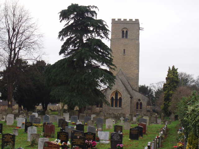
I turned left along the road into Clapham, crossing a bridge over the dual carriageway, and then went right at a junction. This road was the old A6, the main road through the village. I followed it for about half a mile, passing several brick-built terraces and many shops, and then turned left along Green Lane, just past the church. This building looked out of proportion to me, having a very high tower and relatively short nave and chancel [21]. Apparently the tower is mainly late 11th or early 12th century, and is wider than the nave. The rest of the church was rebuilt in 1861 by Sir George Gilbert Scott. Rather unusually the church is dedicated to Thomas a Becket. I walked down the lane for about a third of a mile to a footpath sign on the right, then turned round for the day.
[19] Looking back along the river Great Ouse between Pavenham and Oakley
[20] River Great Ouse from Oakley bridge
[21] Clapham church
I had a very late lunch, not eating until I reached a bench in Pavenham at exactly 2pm – I was startled by the clock in the tower of the Old School striking twice as I sat down. There hadn’t been anywhere else convenient to stop. The walk back went by very pleasantly, and I got back to Bromham at 3.35pm.
This was a very enjoyable walk, but very much a walk of two halves. The first part, as far as the road into Oakley, was very good indeed – there were nice views along the bridleway from Bromham to Stevington, then most of the route was close to the river through attractive villages and there were lots of buildings and other features of historic interest. The section through Oakley and Clapham was more mundane, though the church in Clapham was ancient and rather curious.
Total Distance: 46.2 miles (each way)