Pete's Walks - Ullswater, Beda Fell and Boredale Hause
My friend Martin and I did this walk on 8th May 2007. It was a very wet morning, but the forecast was for better weather after lunchtime. So we didn't start this walk until about 11.30am, having driven to Patterdale from the flat we were renting in Keswick. Basically we would take the popular path along the shore of Ullswater to Howtown, and then take the long ridge over Beda Fell to the pass of Boredale Hause and then back down to Patterdale.
So from the car park in Patterdale we took the path across the fields to Side Farm and turned left to take the path along the eastern side of Ullswater.
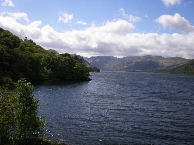
Glencoyne and Sheffield Pike from along the path beside Ullswater
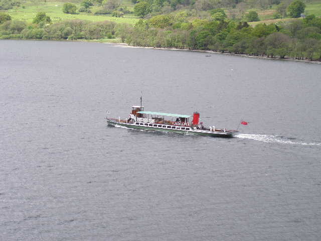
A steamer on Ullswater - a popular tourist trip is to take the ferry from Glenridding to Howtown and walk back along the lakeside path. We met several people coming the other way who were obviously doing that.
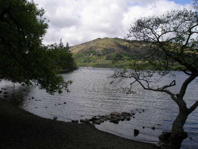
Silver Bay, where we stopped for lunch.
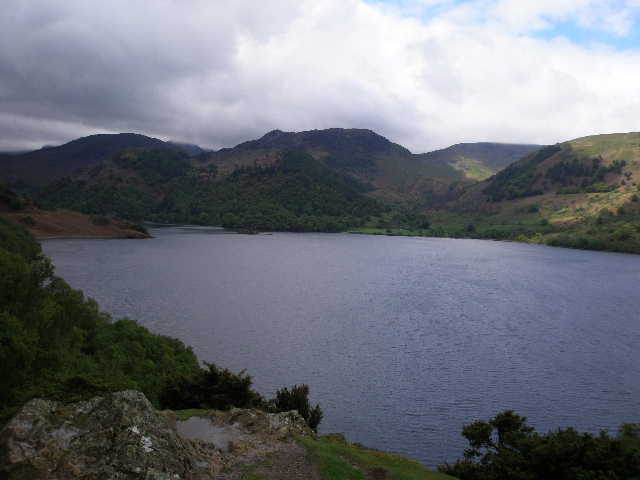
Looking back along Ullswater from near Kailpot Crag
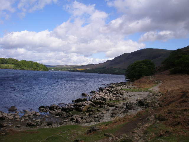
Looking towards the northern end of Ullswater from near Geordie's Crag
We didn't go quite as far as Howtown, taking a path that contoured round the fellside above the village and then crossed The Coombs, a short but steep pass between Howtown and Martindale. We passed the old church in Martindale, then took a path on the right that angled across the fellside to reach the ridge leading to Beda Fell at Howsteadbrow. It was then a long, steady climb along the ridge over Beda Head, Beda Fell and Bedafell Knott.
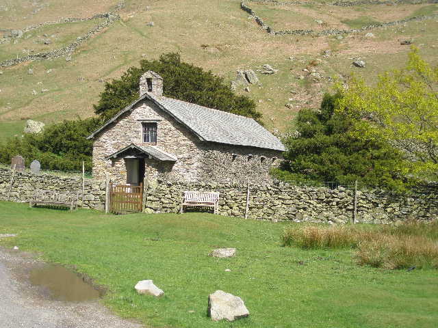
The old church in Martindale
Martindale from the old church - the fell rising from the middle of the valley is The Nab. The ridge leading to Beda Fell is to the right.
Looking back northwards to Hallin Fell (left) and Ullswater, from the path to Beda Head
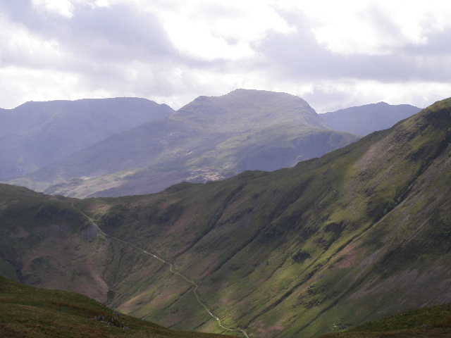
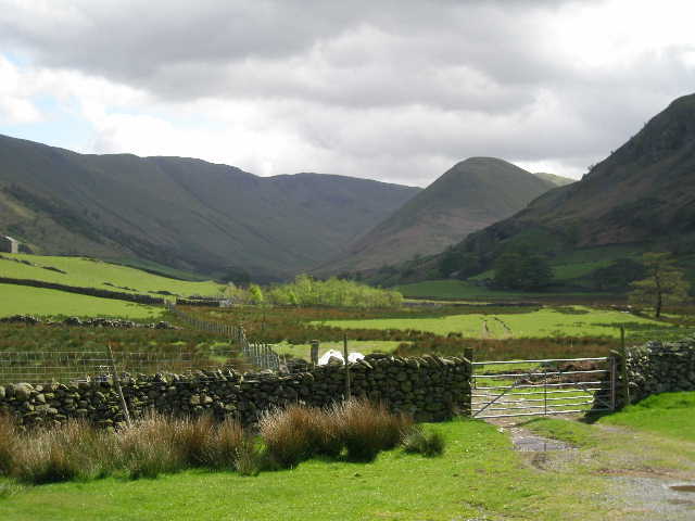
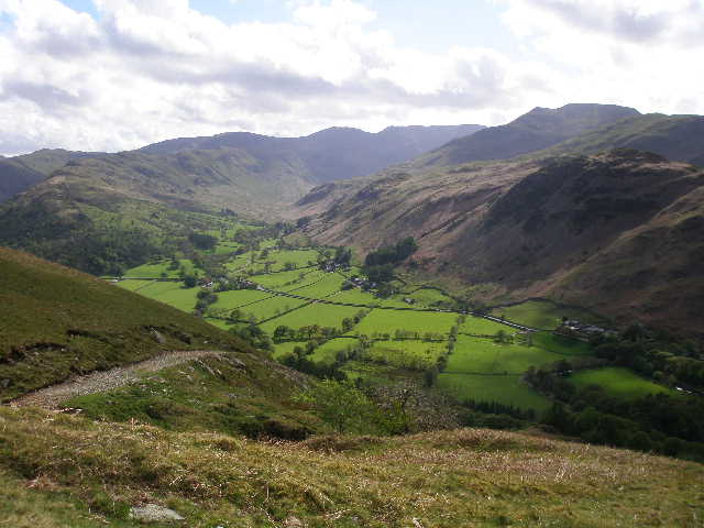
From the Beda Fell ridge, looking across Boredale and Boredale Hause to St Sunday Crag . Gavel Pike is the subsidiary summit to the left, with Cofa Pike and Fairfield further left. The slopes on the other side of Boredale are part of Place Fell.
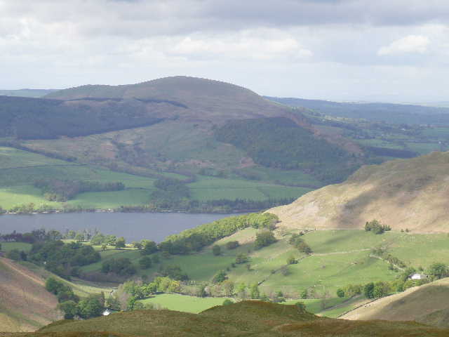
From the Beda Fell ridge, looking across the hamlet of Sandwick and Ullswater to Little Mell Fell
After crossing Bedafell Knott, we took a bridleway coming up from Martindale on our left which took us across to Boredale Hause.
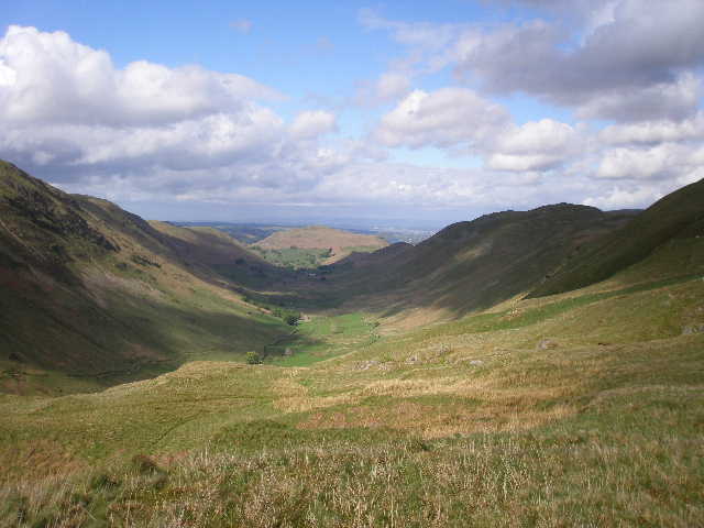
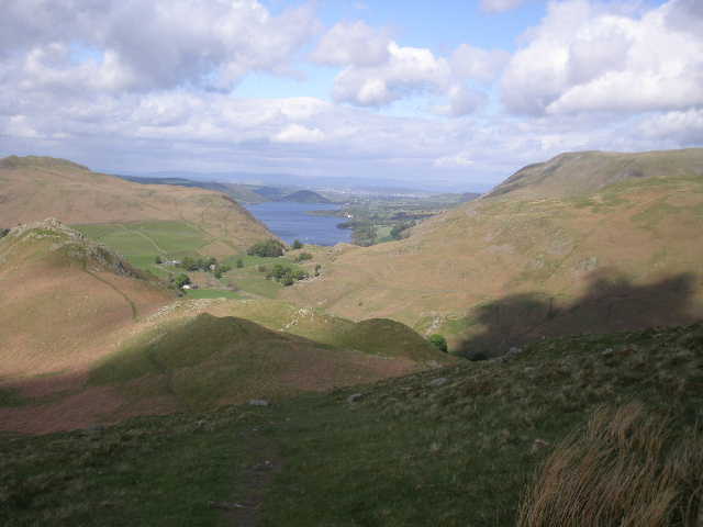
From the path to Boredale Hause, looking north along Boredale with Hallinn Fell at the end. The Beda Fell ridge that we walked is on the right, Place Fell on the left.
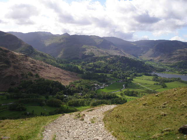
Patterdale and Glenridding from Boredale Hause. The sharp peak on the skyline is Catstycam, with Helvelyn just to its left.
From Boredale Hause, looking across the valley of Patterdale to Deepdale. To the left of Deepdale is the ridge over Hartsop above How, which we walked on an 'Alternative Fairfield Horseshoe'. Hart Crag and Fairfield can be seen at the end of Deepdale, with Gavel Pike and St Sunday Crag further right.
From Boredale Hause it was an easy walk back down to Patterdale, following the course of the Coast-to-Coast walk (which I'd walked 30 years ago!)