Pete's Walks - Kensworth, Hudnall, Dagnall
If you are considering walking this route yourself, please see my disclaimer. You may also like to see these notes about the maps and GPX files.
I did this local walk on Monday, 28th December, 2009 (a Bank Holiday, as Boxing Day had fallen on the Saturday).
There was a hard frost last night, meaning the roads were very icy so I didn't want to drive anywhere this morning. For some reason I didn't want to walk too far either, so I chose this 10-mile circular route from my home in Kensworth. I had walked the route just once before, in the Spring of 2005 just after I'd returned to Kensworth and some months before I thought of starting this web site. But all the paths were very familiar, except the one from Little Gaddesden to Dagnall which I'd only walked two or three times before.
I left home very late, about 10.15am, and set off down the road to Whipsnade. After quarter of a mile or so, I took a path on the left (starting by a field gate) which crossed a large grassy field and then followed a track along the edge of a meadow to reach Dovehouse Lane. I had to take care in places, not only were the roads icy but there was a lot of ice on the footpaths in places. I turned right and then when Dovehouse Lane ended at a junction with Buckwood Lane I went a short way right and took a path on the other side. I soon came to a path crossroads where I went left and followed the path past some gardens in Holywell (on my right). I continued straight on beyond the edge of Holywell, the path running between fences either side and then through a wood. I had a brief chat with a couple coming the other way with their two dogs, mainly about the pheasant shooting that was going on across the fields to my left. As we chatted, a Red Kite flew by, the first time I've seen one at Holywell I think.
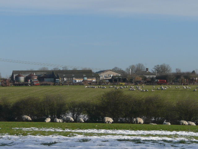
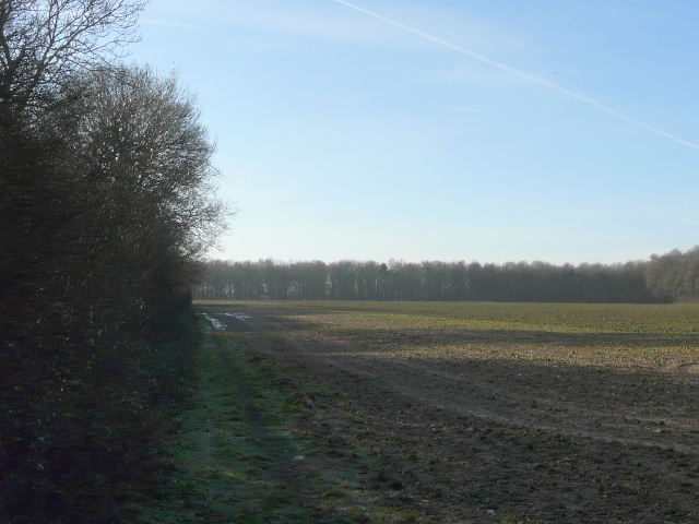
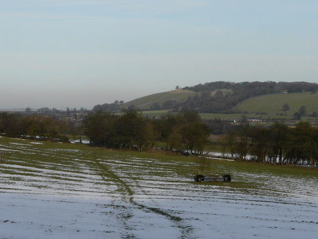
Dovehouse Farm, from the path between the Whipsnade Road and Dovehouse Lane
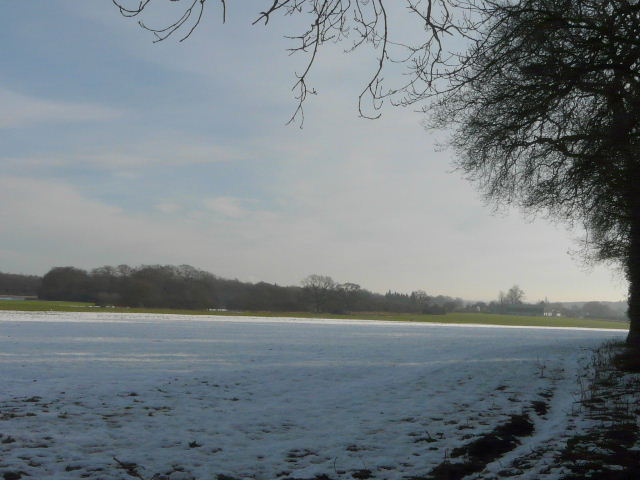
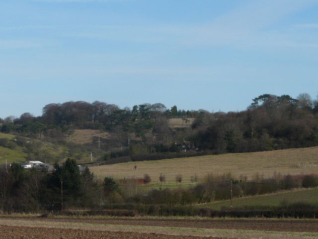
Looking towards Byslips Road from the edge of Holywell
The path ended at the minor road from Whipsnade Heath to Studham, where I went a short way left and then took a path on the opposite side. This followed a hedgerow on the right, with occasional glimpses towards Studham church. I continued straight on along this path until I reached a road in Studham close to a junction, where I took Valley Road. This soon dropped down into a valley, and at the bottom of the valley I took a path going half-right across a ploughed field to reach Common Road, Studham. Across the road (a lane leading down to Dagnall, away to my right) a bridleway led onwards, initially down a drive. Beyond a large field there was a very muddy section through the edge of a small wood, where I had to find a way round a large fallen Silver Birch tree.
A close-up of Studham Church
View from Valley Road, Studham - I would soon be going half-right across the brown field
Near the start of the bridleway from Common Road, Studham, to Hudnall
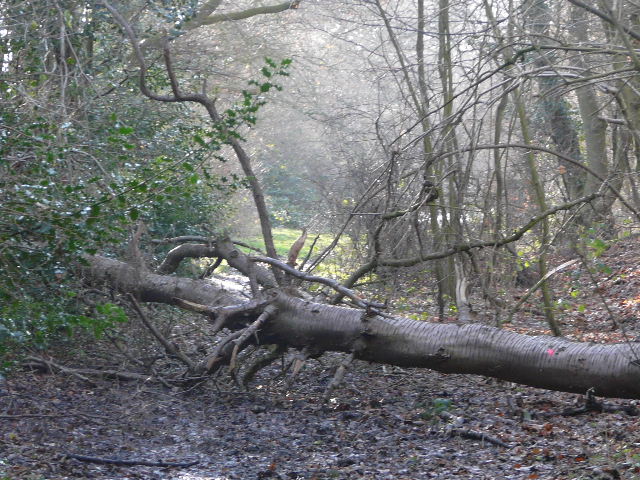
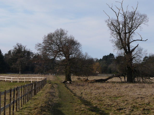
Large Silver Birch blocking the bridleway
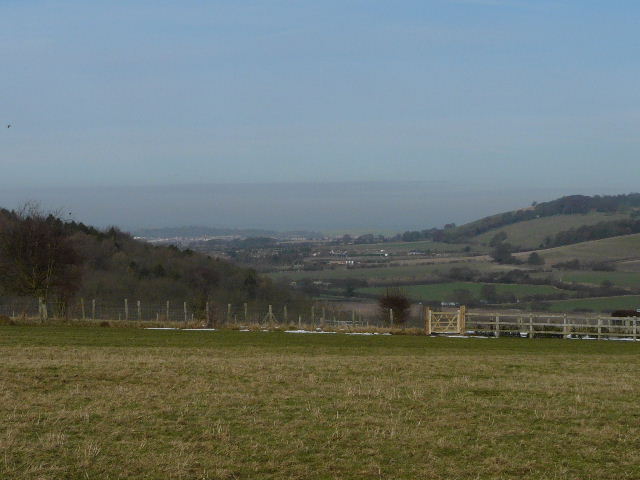
The bridleway then descended quite steeply into the Gade valley, crossing the Hemel Hempstead to Leighton Buzzard road, and rising up the opposite slope. There was a lot of snow and ice on the path at the start of this section of uphill. At a path junction at the top of the hill, I turned right along a path that continued for several hundred yards alongside a hedgerow on my right, with a very large field stretching away to my left. I saw my first Fieldfares of the winter here. The path then crossed a meadow or paddock (half-way across there was a nice view to the right, to where the valley on that side reached the Vale of Aylesbury), to reach Little Gaddesden church.
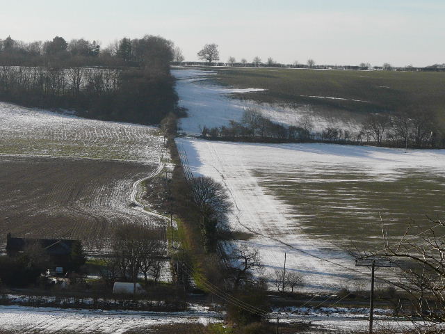
The Bridleway crossing the Gade Valley (it runs to the right of the hedgerow after crossing the road)
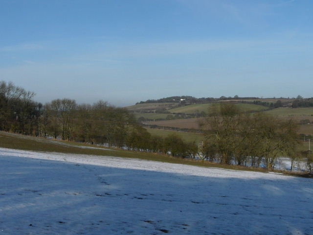
Looking back across the valley towards Whipsnade
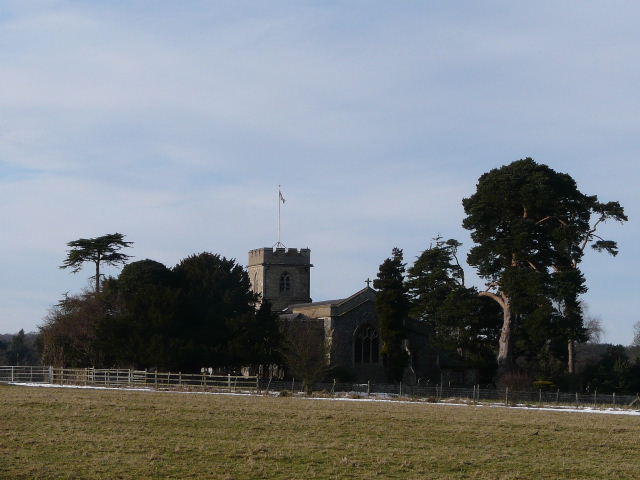
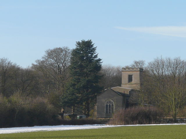
Little Gaddesden church
I passed by the churchyard on my right, then went straight on along a footpath when the drive from the church went left. The clear path soon entered a paddock, and continued on in a straight line through a sequence of paddocks or pastures until it reached a gate next to a road in Little Gaddesden. I didn't go through the gate, but turned very sharply right onto a bridleway going along the edge of the last meadow. Beyond a garden on my left, the bridleway turned left, and ran between garden fences and a fence that separated me from a huge field on the right. The bridleway then entered Hoo Wood. After a while the bridleway through the wood dropped quite steeply for a short distance to reach a gate on the edge of the wood. It then continued across a grassy field with some horse jumps in it, aiming for the far right corner. Beyond this field the bridleway crossed part of a field and then continued beside a hedgerow on my left. When I reached a drive (to Well Farm, on my left) I turned right for a hundred yards or so, but then turned left off the drive beside a hedgerow on my left. After a while I came to a junction where the bridleway turned right, but I went straight on, following a path across a field to reach the edge of a farm, where I spotted a Grey Wagtail. The path used to go through the farmyard, but has sensibly been diverted to follow the hedge and fences round it. The path ended when it reached the main road through Dagnall (this is the village where the counties of Bedfordshire, Buckinghamshire and Hertfordshire meet).
Dagnall (and a distant Totternhoe) from near Little Gaddesden church
The path from the church to Little Gaddesden
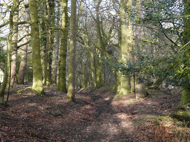
Hoo Wood, between Little Gaddesden and Ringshall
From the edge of Hoo Wood, looking towards Dagnall
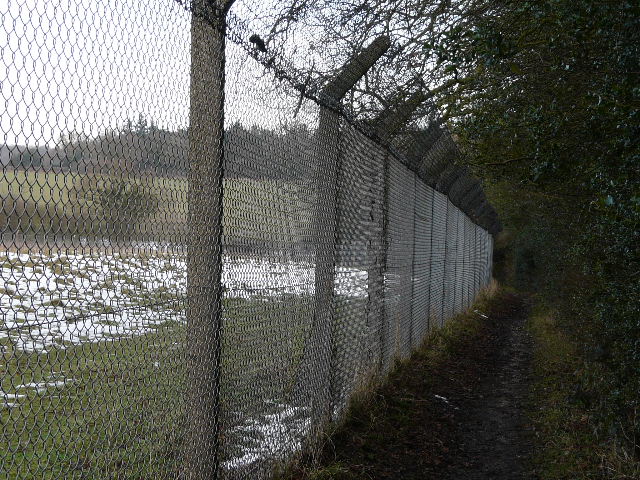
Looking across to the edge of Whipsnade Zoo - I would later follow a path to the left of the small wood to reach Whipsnade Golf Course
I turned right along the road for one or two hundred yards, then turned left immediately beyond the village school, following a path between paddocks on my left and a small field on my right. Ahead of me was a steep slope, part of the Chiltern escarpment, where there was one of the very large open paddocks of Whipsnade Zoo. The path eventually brought me to a lane, where I went a few yards to the right, then took a path on the left that went through a garden and then rose at a steady gradient up the hillside. There was a rough pasture to my left, surrounded on two sides by the tall zoo fence, and a wooded area to my right. Further up the slope, I had a garden hedge on my left and I crossed the drive to an isolated house. At the top of the hill, I emerged onto Whipsnade Golf course, with the club house just to my right. The path (which was well waymarked) crossed in front of a tee, then passed another tee. It then continued through a line of trees between two fairways. A tall marker post then indicated a path junction, where I turned left and followed the path across five or six fairways. I eventually reached the tall fence that surrounds Whipsnade Zoo, where I turned right only to almost immediately turn left. The path then continued for a long distance beside the tall zoo fence, with a mature hedgerow to my right. The path eventually moved away from the fence by a triangular bit of woodland, and I then came to a T-junction. Here I took the path going left, very soon back alongside the zoo fence again. The path took me to the old lane between Holywell and Whipsnade, which I followed to the left. It was icy in places and I had to take care. After quarter of a mile or so, just past some bollards, I turned right onto a path and followed it beside a hedgerow (on my left). I went through a gate in the field corner and immediately went left through an open gate. I was now in a small meadow, following a hedge on my right. The path continued through the churchyard of Whipsnade Church, going left of the church and passing two yew trees near the entrance. I then turned right, crossing a section of the huge village green. I headed downhill to reach the minor road by the Old Hunter’s Lodge restaurant, and continued beside the road to the roundabout at Whipsnade Heath. I crossed over, and then made my way left through the small car park and small picnic area, continuing on along the short path through the woods that comprise the greater part of Whipsnade Heath. Beyond the wood, the path ran beside a large field, between a wire fence and a hedge on the right. It then went through a kissing gate, and crossed a field of rough grass to reach Common Road, Kensworth. I turned right and followed the road back to my home.
Looking back across Dagnall, towards Ivinghoe Beacon (far right)
Path across Whipsnade Golf Course
Near the end of the path beside Whipsnade Zoo
It took me almost four hours to walk the ten miles, which was a little slow. It had been chilly but sunny throughout, and despite the mud and ice I'd really enjoyed the walk.