Pete's Walks - Whiteleaf Hill and Little Hampden (page 1 of 2)
If you are considering walking this route yourself, please see my disclaimer. You may also like to see these notes about the maps and GPX files.
Google map of the walkDownload GPX file of the walk
I did this walk of about 6 miles on Saturday, 24th March, 2012. I did it immediately after doing a 7-mile walk from Whiteleaf Hill to Loosley Row and back, the two circular walks combining to make a very pleasant 13-mile route.
It was about 12.05pm as I left the car park on Whiteleaf Hill (grid reference SP823036), taking the short path from the left end of the car park and then turning right along part of the Ridgeway National Trail. I passed some First World War practice trenches to the right of the path, then passed the 6000-year old Neolithic barrow on top of Whiteleaf Hill. After pausing to admire the extensive views out over the Vale of Aylesbury, I continued along the Ridgeway (white acorn symbols) as it turned right and entered Giles Wood and started a fairly steep and lengthy descent to Lower Cadsden. At the bottom of the hill I passed in front of the pub (The Plough at Cadsden) to reach a minor road - a path almost opposite soon led to the Grangelands And Pulpit Hill Nature Reserve, where I saw my first wild Primroses of the year. I turned left and continued along the Ridgeway through the reserve.

View over Princes Risborough from Whiteleaf Hill

The Ridgeway descending through Giles Wood towards Lower Cadsden
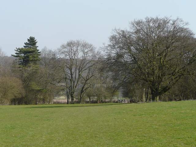
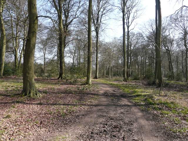
Looking back towards Whiteleaf Hill from the Grangelands and Pulpit Hill Nature Reserve

Looking towards Pulpit Hill from the Nature Reserve
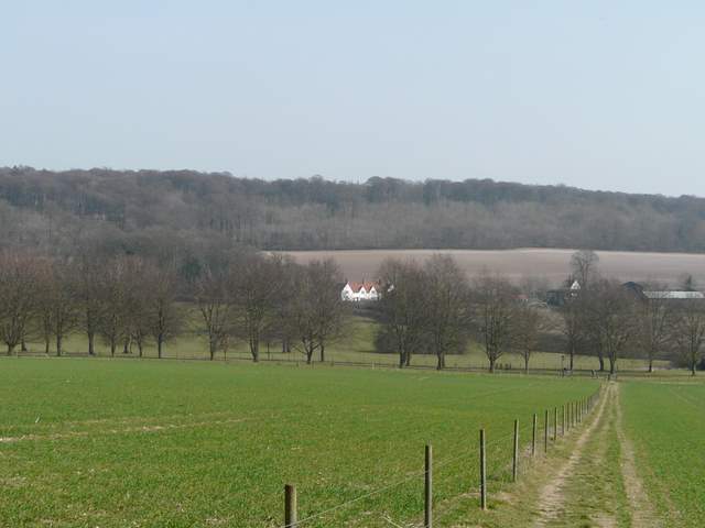
I followed a wide path through the nature reserve, and continued on along the Ridgeway past Pulpit Hill, up on my right. On reaching a bridleway (where the North Bucks Way starts on its 35 mile route to Wolverton), I went a few yards right and then went through a gate on the far side. Here I went up a short slope on the left to the top of Chequers Knap, with fine views out over the Vale of Aylesbury. I then went back down the same slope and continued on along the Ridgeway, now in a huge and irregularly shaped area of grass and scrub. On reaching a gate, the path (marked on the OS map as Cradle Footpath) then continued half-right across an empty pasture to a gate.
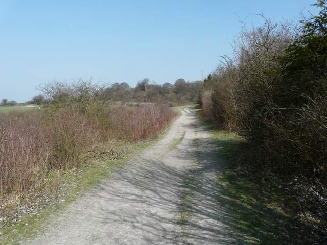
The Ridgeway, continuing past Pulpit Hill
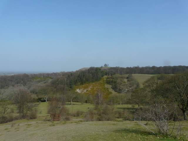
Looking towards Beacon Hill, from Chequers Knap
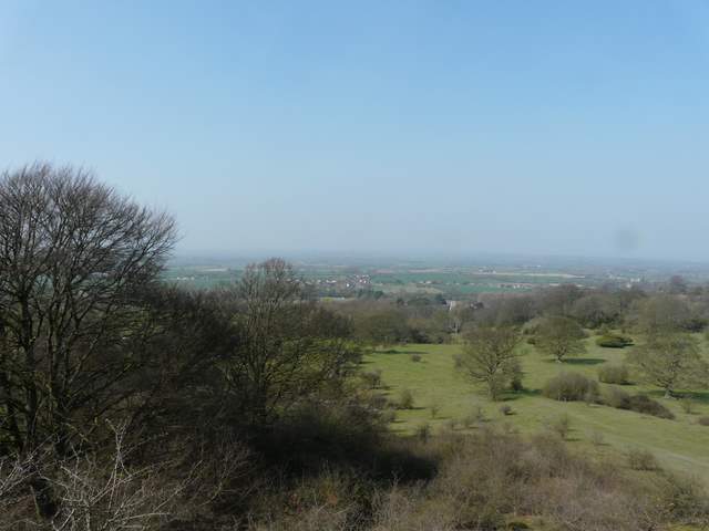
View over the Vale of Aylesbury from Chequers Knap
The Cradle Footpath, heading towards Chequers
The footpath then continued along a fence with Maple Wood on my right - to my left I could see across a field to Chequers, with Coombe Hill beyond. There was some Coltsfoot growing along here, and further on some Lesser Celandine. Beyond the wood, the path turned left, following another fence line through the Chequers estate. I crossed the main drive to the house, and continued straight on to reach a minor road at Buckmoorend.
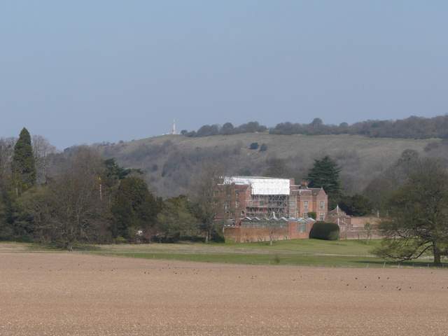
Chequers, shrouded in scaffolding, with Coombe Hill behind
The path across the Chequers estate (the line of trees marks the main drive)
A bridleway carried on across the road, amidst a tree belt. I soon came to a bridleway crossing where I turned right, leaving the Ridgeway but joining the route of the South Bucks Way (which starts nearby on Coombe Hill). This bridleway led gradually uphill through Chisley Wood, and near the top of the slope I spotted my first Comma butterfly of the year.

The Ridgeway going east from Buckmoorend

The bridleway through Chisley Wood, heading towards Little Hampden
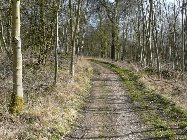
The bridleway through Chisley Wood, heading towards Little Hampden
The bridleway through Chisley Wood, heading towards Little Hampden