Pete's Walks - Milton Keynes Boundary Walk
If you are considering walking this route yourself, please see my disclaimer. You may also like to see these notes about the maps and GPX files.
Day 4 27/07/07 Near Lavendon to near Astwood (7.8 miles each way)
Parked in Turvey.
On my drive to Turvey this morning, I passed another couple of blue fields between Olney and Turvey. I assumed that they were Purple Viper’s Bugloss again, as they were only a field or two south of the blue fields I saw last time. But I was told later (by someone on a wildlife website) that they were actually fields of Borage.
This was a rather unusual walk for me. The previous walk ended in the middle of nowhere – well, a path junction somewhere between Lavendon and Threeshire Wood, to be precise. So today I needed to park somewhere along the route I’d be walking, and start the walk by walking back to where I finished last time. Nothing unusual in that, I’ve done that several times – including on Day 2 of this walk. What was unusual today was that the closest place I could park was in Turvey, which was about two-thirds along today’s route. This meant that the initial walk back took an hour and a half, so it was lunchtime by the time I got back to Turvey. Psychologically it felt as if I was doing two walks – from Turvey back to Threeshire Wood in the morning, then Turvey towards Astwood in the afternoon.
[1] The bridleway leading to Threeshire Wood
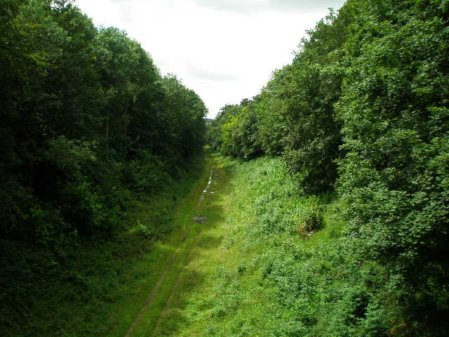
[2] Entrance to Threeshire Wood, where Northants, Bucks and Beds all meet
[3] Path through Threeshire Wood
I started walking at just a couple of minutes past 10 O’clock. I walked quite purposefully back to where I left off last time, only stopping once to take a photograph (some scarlet pimpernel, which my camera seems to struggle to focus on). It took an hour and a half to get back to the path junction near Threeshire Wood. I had a drink of water and headed back towards Turvey.
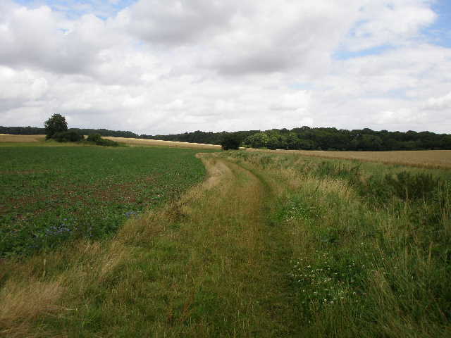
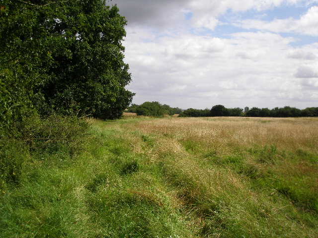
Heading north along a bridleway from the path junction [1], there was a ditch on my right initially where several wildflowers were growing, including Common Centaury, the first time I’ve seen this on one of my walks. A sign a bit further on said that the field boundaries had been deliberately planted with wildflowers. Soon I had part of Threeshire Wood on my right, and a corn field on my left. The path here was quite muddy. There was a brief shower as I walked alongside the wood – I ignored the raindrops for a couple of minutes, but then it started to come down quite heavily. Of course, by the time I’d donned my waterproof jacket and put the rain cover on my rucksack, it had more or less stopped.
[4] The path beside Threeshire Wood
[5] Meadow just beyond Threeshire Wood
[6] Start of the path overgrown with nettles
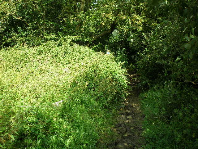
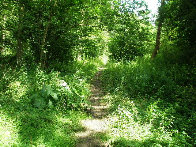
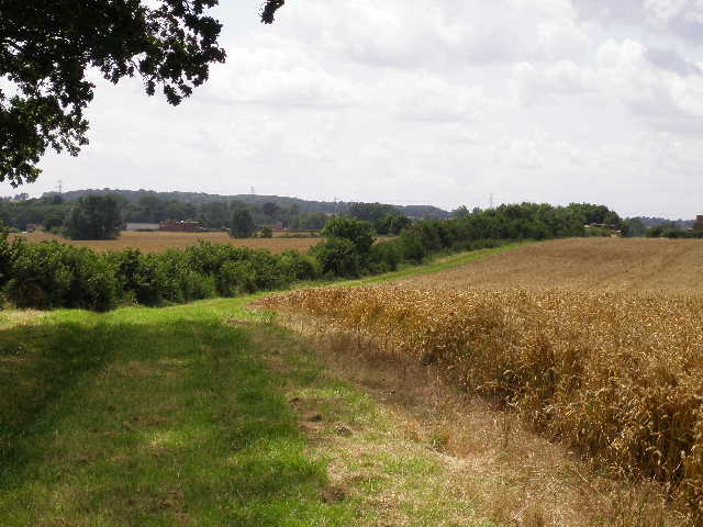
After almost half a mile, I entered Threeshire Wood at a corner where another part of the wood came in from the left in front of me [2]. This corner is the spot where Bedfordshire, Buckinghamshire and Northants meet, hence the name of the wood. The path through the wood, along the Northants-Beds boundary, was pretty muddy after the recent rainfalls [3]. I noticed a few wildflowers including Herb Robert growing here. Just after leaving the wood, I turned right through a hedge gap and followed a path beside a corn field, with the wood on my right [4]. At the end of the wood, I went through a hedge gap and continued along the far side of the hedge in a meadow of tall grass [5]. I continued along the hedge through the subsequent corn field, which brought me to a path junction where I turned right along a track that initially ran between hedges. When the right-hand hedge ended, I had a fairly typical view for this area, over a few corn fields to a couple of woods.
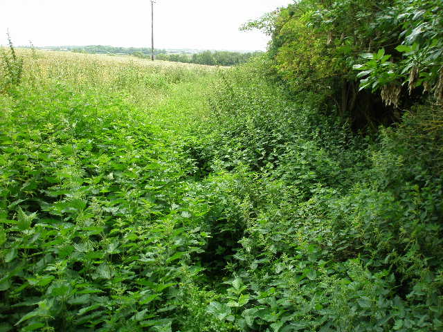
The path turned right at the next field boundary, now heading south on a farm track with a hedge on the left and a corn field to my right. This turned left by a corner of a wood, and continued on beside two more corn fields. There was then a change of scenery, as the path went over a stile and continued by a right-hand hedge through a couple of grassy meadows with a farm to my left. The meadows were subdivided into paddocks by electric fences, but there were no horses in the paddocks the footpath went through. I went over another stile and continued alongside the hedge through another large corn field. The path here was badly overgrown with nettles [6] – I resorted to wearing my waterproof trousers to protect my legs from getting stung.
[7] Bridleway heading towards Cold Brayfield
[8] Looking towards the Ouse valley from the bridleway to Cold Brayfield
[9] View from the bridleway, looking ahead towards Cold Brayfield
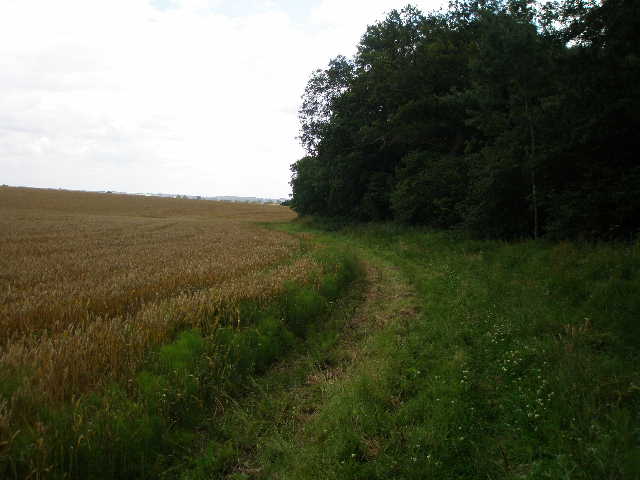
On the far side of this field, I crossed a plank bridge over a ditch to reach a minor road. I was glad to take the waterproof overtrousers off now, as despite the earlier shower it was actually quite a warm day. I turned right, soon passing Tollbar cottage as I re-entered Buckinghamshire after a short time on the border or actually in Bedfordshire. After quarter of a mile, where the road turned right, I took a bridleway continuing on southwards. This was initially between hedges, with a deciduous wood beyond the hedge on my right and plantation of conifers on the left. I then crossed a small grassy strip, with a small area planted with maize on my left – there was some Borage here, too.
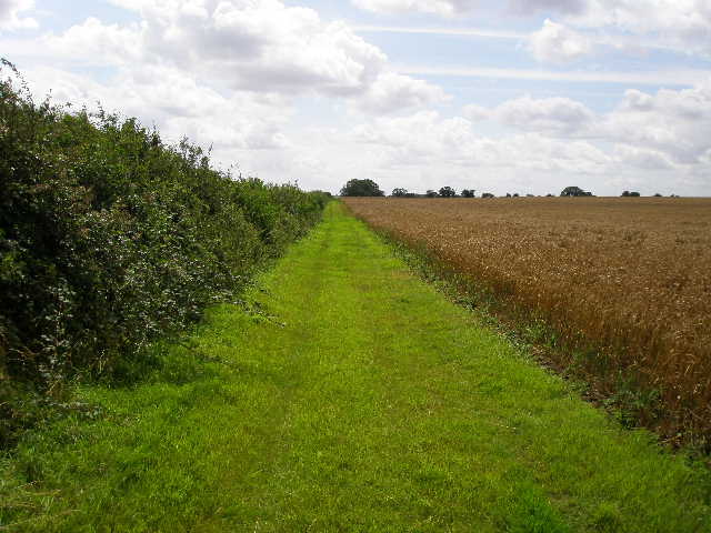
The bridleway carried on, now on a wide grass strip beside a hedge with corn fields to the right [7]. Again there were views across the corn to some woods. To my left, the ground sloped down to the valley of the Great Ouse [8], where there were a large number of willow trees growing. This was a straightforward and pleasant walk [9], the grass strip eventually giving way to a hard-surfaced farm track, which turned slight left and led on past a farm yard to the A428 main road on the edge of Cold Brayfield.
[10] The Great Ouse from Turvey Bridge
[11] Turvey House

[12] Turvey Bridge, looking towards Turvey
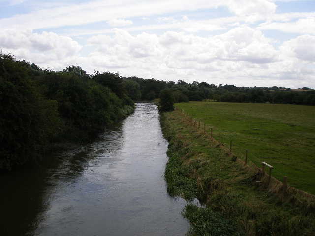
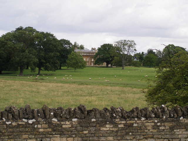
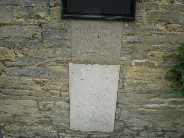
I turned left, and followed the road for half a mile to reach Turvey Bridge. This is reputed to be the oldest bridged crossing of the Great Ouse in Bedfordshire, a bridge being recorded here as far back as 1140. The current bridge, widened in 1935, spans three branches of the river [10] – there were nice views over parkland to Turvey House to the left [11], and on my right was Turvey Mill which had obviously been redeveloped as flats. Across the bridge [12] I entered both Bedfordshire and the ancient village of Turvey. I passed a pub, Ye Three Fyshes, with Flood Mark Stones on its wall recording the heights of flood water in years gone by [13]. In fact there had been a severe flood warning for this section of the Ouse a few days ago, and I’d passed a flood warning triangle lying on the pavement by the bridge, but the water was about six feet below the top of the river banks today, so the threat of flooding had clearly passed.
Turvey dates back to before the Domesday Book. Much of its history has been dominated by two families, the Morduants (who acquired the title of Earl of Peterborough) and later the Higgins. The latter replaced the Morduant’s home at Turvey Old Hall with Turvey House in 1792. In the nineteenth century John Higgins embarked on a large building programme for the benefits of his tenants, and the character of the village today owes much to his work.
[13] Flood markers on a pub wall at Turvey
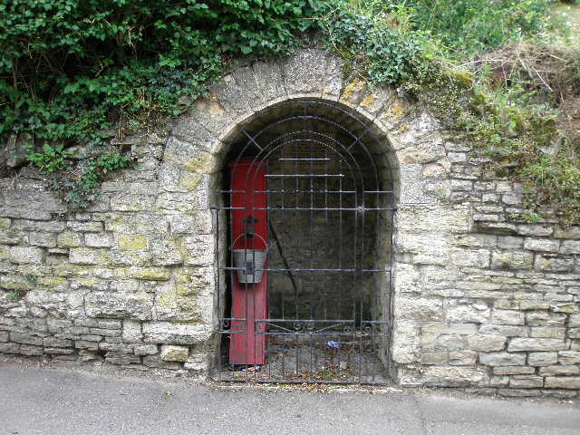
[14] Nell's Well, Turvey
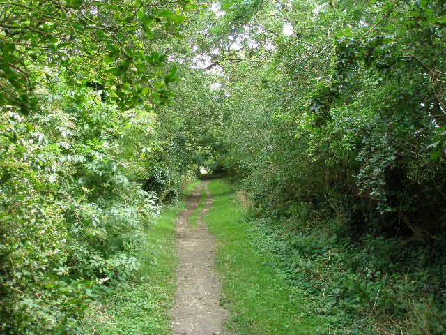
[15] Green lane leaving Turvey
I was slightly disappointed with Turvey – I’d heard that it was a particularly attractive village, but it didn’t quite come up to my expectations. It certainly wasn’t unattractive, and I passed several interesting old buildings, made of the same honey-coloured limestone I’d seen in previous villages on this walk (incidentally, this was the first village or even hamlet I’d walked through since Weston Underwood at the start of the previous walk, although I’d just touched on the edge of Cold Brayfield). To be fair, I only saw a small part of the village close to the main road, so I suspect I’d have a more favourable opinion if I’d seen the rest of the village.
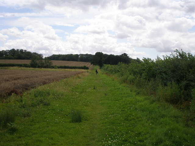
I turned right into Newton Lane, passing my parked car. I saw Nell’s Well on the right [14], and almost immediately turned left and passed some garages to enter a green lane [15]. The hedges either side overhung the track in places, almost forming a green tunnel. At the end of the green lane, I went over a stile and crossed a small grassy meadow to another stile. Over this, I followed a wire fence to the right beside another grassy meadow. To my right, there were two or three fine specimens of Beech tree. Across another stile, I started a long but very gradual ascent through two large fields of cut oil-seed rape, following a right-hand hedge in a straight line for about half a mile [16]. At first there was a very young plantation on the other side of the hedge, but about halfway through the second field this was replaced by a narrow strip of mature wood.
[16] Footpath heading slowly uphill away from Turvey
[17] The private drive
[18] The old railway line, from the bridge
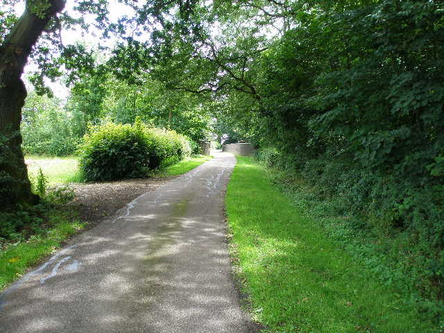
When I reached the field corner at the end of the second field, I went through a gap in the hedge and turned left on a private tarmac drive [17]. I now had the hedge on my left, and a wood on my right. The drive curved round to the right, and went over a brick bridge across a disused railway line (the old line between Bedford and Northampton, closed in 1962) [18]. Where the drive turned sharply left by a cottage, I continued ahead on a bridleway in a southerly direction. The wood on my right soon ended, as I descended an attractive valley, with a mixture of rape and corn fields and grass meadows - this was scenically the best part of the walk [19]. The farm of Turvey Hall was along the valley to my right. The grass track I was following passed through a hedge gap in the valley bottom and rose up the other side of the valley, soon with another long thin wood on my right.
Near the top of the hill, the bridleway turned left beside a hedge, and followed the hedge as it then turned right, with a small rush-filled pond by the corner. The grass track continued alongside the hedge, with a field of corn on my left and another wood further left. I saw some lovely Musk Mallow in several places along this hedgerow (I’ve seen Common Mallow frequently so far on this walk), and there was a lot of Teasel which had attracted several Peacock butterflies. I also saw some Small Tortoiseshell butterflies along this section of the walk.
[19] Attractive valley near Turvey Hall
[20] Looking back towards the Ouse valley
[21] The lane to Astwood
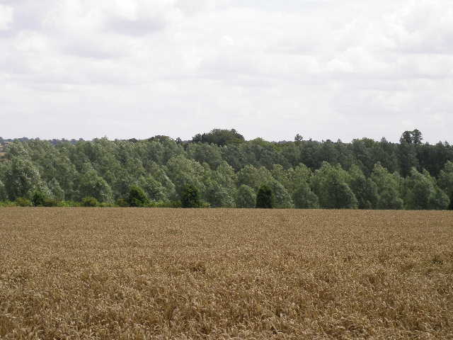
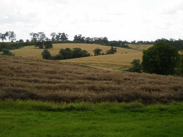
At the next field corner, the grass track gave way to a gravel farm track, which now followed a hedge on the left. It was getting near 2pm now, and I sat by the side of the track to eat a very late lunch. There were quite good views from here. I was now on a plateau, and could look back across the wide Ouse valley to the rising slopes on the other side, that were almost uniformly topped by woods [20]. Almost everywhere I looked was a mixture of golden fields of corn or the slightly darker oil-seed rape, dotted here and there by small dark green patches that were woods.
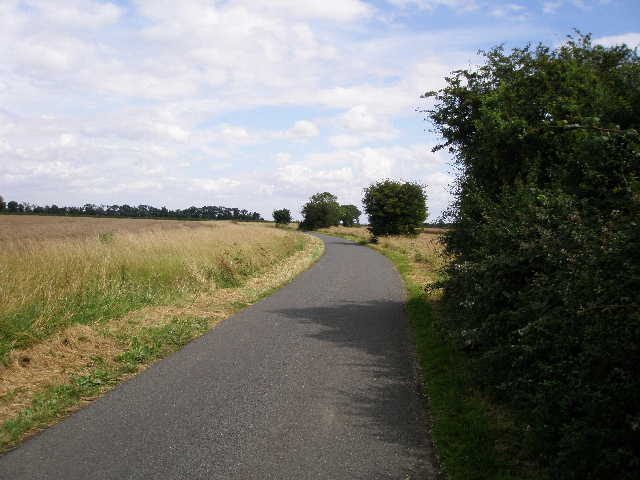
Hunger pangs satisfied, I continued along the track between golden fields to reach a lane by a junction, where I took the lane going left. Originally I’d planned to halt today’s walk at the lane junction, but my next walk would have then started with 3 miles of lane walking (as I would have to park 1½ miles down the lane in Astwood, and start the day by walking back to the lane junction). So I decided to do half the lane walk today. Three or four vehicles passed me as I walked down the lane [21], with more golden fields of corn or oil-seed rape on either side. The lane turned sharply right after a while, and at this point I left Bedfordshire and re-entered Buckinghamshire. After I’d been following the lane for almost three-quarters of a mile it turned sharply right. Here I turned round, and started to make my way back to Turvey.
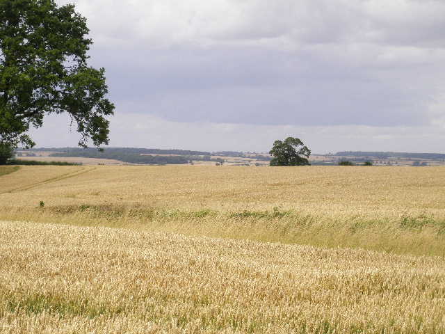
This was another good walk. Apart from the brief shower it was a nice day for walking, pleasantly warm and generally bright and sunny. The paths were generally easy to follow today, apart from the one overgrown with nettles, and navigation was very simple. There were some nice views in the afternoon, although the countryside generally is a little unvaried – all arable crops with occasional woods, very few signs of meadows or livestock. Today’s walk took me about half an hour less than the last one, which was about the same distance – probably because I took fewer photos, 54 compared to 80.
Total Distance: 30.9 miles each way (approximately)