Pete's Walks - Bernwood Jubilee Way
About the Bernwood Jubilee Way
The Bernwood Jubilee Way is a 61-mile long circular route, mainly in Buckinghamshire with a small section in Oxfordshire, set within the boundaries of the ancient hunting forest of Bernwood. It was created in 2002, the year of Queen Elizabeth II’s Golden Jubilee, as part of the ‘Bernwood Ancient Hunting Forest Project’.
There is a guide book for the Bernwood Jubilee Way (but see my comments below!), available from Buckinghamshire County Council. The route is covered by the OS Explorer maps 180, 181 and 192 (it wasn't actually marked on the maps when I walked the route, but is now).
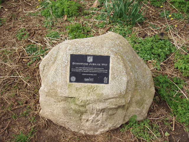
This plaque on a stone outside Brill church marks the official start and end point of the Bernwood Jubilee Way
The hunting forest of Bernwood dates back to the Anglo-Saxons, being first mentioned in written records in the early tenth century. It reached its greatest extent during the reign of Henry II, when it is believed to have covered the area of fifty modern parishes in Buckinghamshire and Oxfordshire. It was reputed to be a favourite place of both Edward the Confessor and King John.
It was not a forest in the modern sense of a very large area of woodland, but in the old sense of an area of land set aside for the King to hunt his deer – the New Forest in Hampshire is another example of a mediaeval hunting forest. There were trees in the forest, but there were also large areas of open land. As well as the pleasures of the hunt, the forests gave the King a profitable source of income from timber and venison. There were strict Forest laws governing the hunting forests, with punitive penalties for any poor peasant caught poaching the King’s deer or felling his trees. The special legal status of Bernwood as a forest remained until 1632, when it was disposed with as part of the crown’s attempt to raise revenue.
In the mediaeval period, much of the forest consisted of arable fields. As elsewhere, these were farmed in ‘strips’, each villager having a number of strips in different fields so that the good and bad land was shared out fairly. Large furrows were ploughed between each strip, both as a means of drainage and as an ownership demarcation between adjacent strips. Consequently the fields took on an undulating appearance, with parallel rows of alternating ridges and hollows, a landscape known as Ridge and Furrow. The Bernwood Jubilee Way passes through or by a surprisingly large number of fields where remnants of this centuries old field pattern can still be seen – in fact, I saw evidence of Ridge and Furrow on all but the last day of my walk. I had seen it once or twice before (for example, at Toddington on Day 8 of my Berkshire-Essex Walk) but never so extensively or so well-preserved. Ridge and Furrow became a significant point of interest for me on this walk.
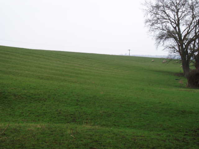
Ridge and Furrow in a field just east of Shabbington (Day 6)
About the Bernwood Ancient Hunting Forest Project
The Bernwood Ancient Hunting Forest Project was launched in 2001, with the aims of conserving and enhancing the environment of the ancient forest, and widening public access, understanding and enjoyment of the physical heritage of Bernwood. It is supported by a wide range of organisations that make up The Forest of Bernwood Partnership. The project “will offer advice and act as a vehicle for funding and supporting schemes that enhance local identity, improve access for recreation and education, benefit the environment, bolster local economies, and develop historical/landscape research”. The Bernwood Jubilee Way is seen as an important element of the project.

Poplar trees, in Eythrop Park estate south of Waddesdon (Day 5)
I have to say that the Guide Book for the Bernwood Jubilee Way is quite perverse – it manages to be both the most informative and the most useless guide book I have come across on any of my walks! Instead of describing the entire 61-mile circular route, it just describes 10 short walks based on the Bernwood Jubilee Way, mainly circular ones that are only partly on the route of the long-distance path. This means that less than half of the route of the Bernwood Jubilee Way is actually described (and the bits described are sometimes walked in the clockwise direction and sometimes in the anti-clockwise). It is therefore of very limited use to someone who wants to walk the whole route (which is surely the main idea of a long-distance path!). The only thing that shows the whole route is a scaled-down extract from an OS 1:50,000 map – far too small scale to be of any practical use. In any case, the route is marked with a very thick black line, so that it is pure guesswork trying to trace the route through built-up areas such as Buckingham. I had to try to mark the route as best I could with a marker pen on my 1:25,000 maps (sacrilege to some people, I know!).
It’s a real shame, as a lot of effort was obviously put into the production of the Guide Book. It’s ring-bound, a very sensible idea for a guide book as it can be opened at any page and put in a map case without risking breaking the spine. The descriptions of the 10 short walks are very good, and include much more in the way of information about local history and nature (especially wildflowers) than any other guide I have come across (although much of what is described isn’t actually on the route of the Bernwood Jubilee Way). Each walk also has a very detailed map that can be folded out. If the whole route of the Bernwood Jubilee Way had been treated this way, it would have been an excellent guide book.
Despite it's shortcomings, the guide book is the source of most of the historical or other data that I give in this journal.
Click here to see a very rough map of the Bernwood Jubilee Way (but only if you have already read my disclaimer and notes regarding maps).
Note: I have numbered each photograph (in red) and inserted the same number in the text to show where in the walk the photo was taken.