Pete's Walks - The Chiltern Way (2)
If you are considering walking this route yourself, please see my disclaimer. You may also like to see these notes about the maps and GPX files.
Day 1 26/03/07 Dunstable Downs to Chalton (7.4 miles each way, approximately)
Parked at new Chiltern Gateway Centre on Dunstable Downs.
I started my walk at a slightly different place this time – a new visitor centre has been built on Dunstable Downs since I walked the Chiltern Way two years ago, about a quarter mile south of the old one where I started that walk. As the new visitor centre is called the Chiltern Gateway Centre [1] (it even has details about the Chiltern Way on one of its information panels), it seemed an appropriate place to start. Actually I have somewhat mixed feelings about the new centre – like many local people, I think it is dreadful eyesore. Built right on the skyline, so that people inside it can get the most of the views through its three glass sides, it can be seen from miles away – certainly it can be seen from Ivinghoe Beacon. Quite frankly it spoils the Downs rather than adds anything to them – nobody else would be allowed to put a building there, and I think the National Trust should be ashamed of themselves. Still, I admit I took my parents to have a look round it shortly after it opened and we had a nice cup of coffee – I bought a useful little reference book on trees (I now know that the trees with the wonderful red leaves that I saw at Watton-at-Stone on the Hertfordshire Chain Walk were Red Oaks).
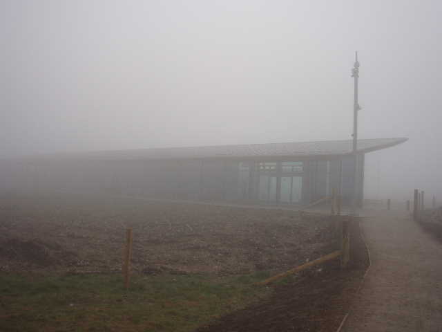
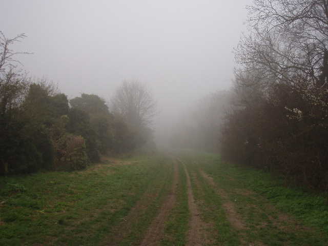
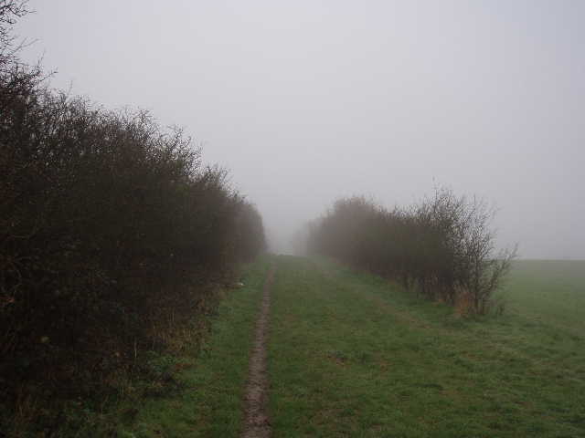
[1] The new Chiltern Gateway Visitor Centre on Dunstable Downs, lost in the fog
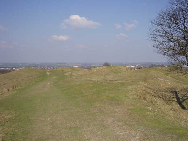
[2] Looking back along Dunstable Downs towards the visitor centre (photo taken in the afternoon)
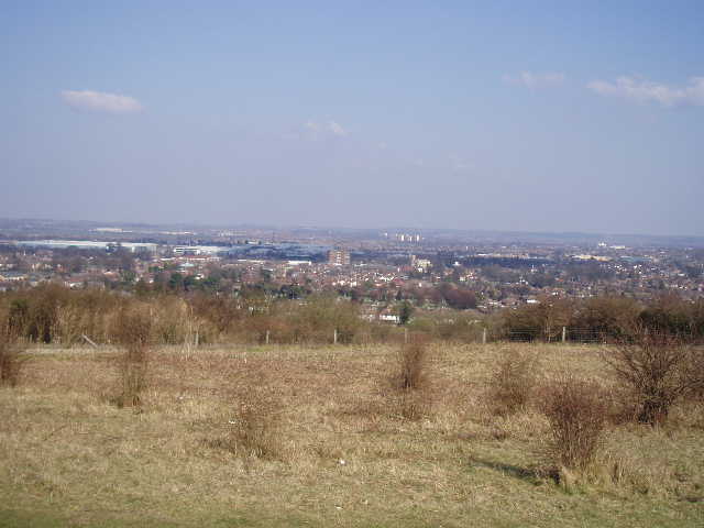
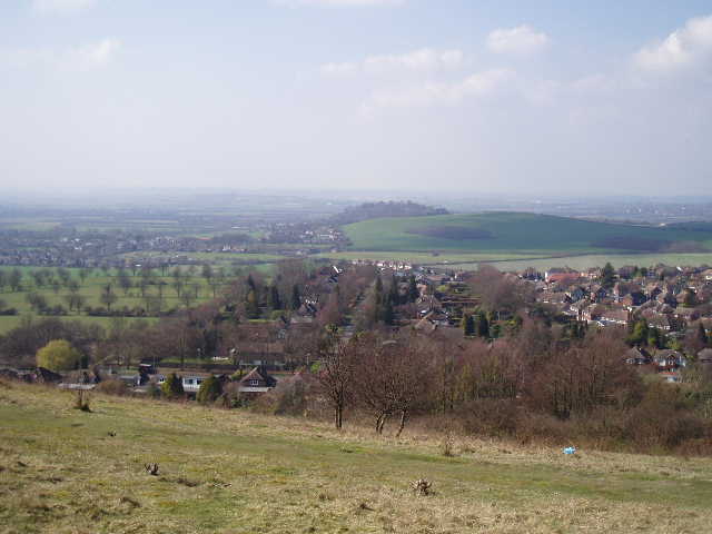
[3] View over Dunstable and Luton from near Five Knolls on Dunstable Downs (afternoon)
There were no cheering crowds to see me off on my epic adventure, but a Skylark sang loudly as I laced up my boots in the car park. I wonder if it will be there to welcome me back in a few weeks time? One reason for walking the Chiltern Way again is that this time I want to take some photographs for this journal – so it was a little dispiriting that I started the walk about 9.25am in a thick fog! It would be a slight exaggeration to say that visibility from Dunstable Downs was 50 yards instead of the usual 50 miles, but only a slight exaggeration. Visibility was certainly less than 100 yards. So I strode along the path from the new visitor centre at a good pace, resolved to take some photos on my way back in the afternoon, when it was forecast to be warm and sunny. The forecast said the temperature would reach 15C in the afternoon but it was 3C when I left home, and I was now wrapped up in all my warm winter gear. I soon passed the old visitor centre and continued eastwards along the top of the Downs [2], parallel to the road. I’d find out later that part of the area I was walking over was part of a golf course before 1900 – Dunstable Downs Golf Club, one of the best in the region, is now entirely on the other side of the road.
In the thick fog it was impossible to see very much at all. At one point, the chalky path ran quite close to a very steep slope on my left – because you could only see a few yards downhill into the fog, it somehow made it seem much more dramatic than it really was, as if I was walking close to a sheer drop. Somewhere down on my left I passed Pascomb Pit, a hollow in a corner where Orange hill juts out from the main line of the Downs. I would find out later that this was once the site of a Roman amphitheatre, something I’d never known before. I continued onwards along the path, soon reaching the ancient burial mounds called Five Knolls [3,4,5,6] which loomed out of the fog. I took a quick photo, but it was a bit pointless in the conditions. Five Knolls sit on top of a narrow promontory at the northeastern end of the Downs, so they are highly visible both from the Vale of Aylesbury and from the Luton and Dunstable area. When they were excavated, they were found to contain not only Neolithic or Bronze age burials but also late Roman or early Saxon burials as well.
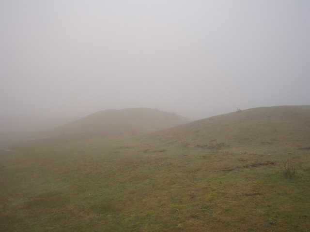
[4] Five Knolls on Dunstable Downs in thick fog
[5] Five Knolls on Dunstable Downs (in the afternoon)
[6] View towards Totternhoe from Five Knolls on Dunstable Downs (in the afternoon)
From Five Knolls the path descended to a gate in a fence. Beyond this a broad green swathe of grass led steeply downhill into Dunstable, taking me to a roundabout where the road across the Downs reaches West Street. On the other side of the road junction I walked through a small car park and entered Green Lane, a broad green trackway running between trees on either side, with the housing estates of Dunstable on the far side of both sets of trees [7]. As always, this was a surprisingly pleasant walk (as well as my previous Chiltern Way walk, the Icknield Way section of my Berks-Essex walk went along here and I’ve also walked here on one of my local walks that goes out to Totternhoe). If it wasn’t for the occasional sound of traffic, you could easily think you were out in the country rather than in a built up area. I’d started to warm up a bit now and had removed my thermal hat and one pair of gloves. Visibility had improved slightly too, but I still couldn’t see much more than 100 yards ahead.
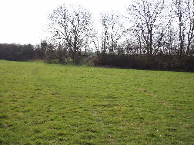
The houses behind the trees on my left soon gave way to a field, and a bit further on the houses on my right also came to an end [8]. A few hundred yards further on I came to a track crossroads, where I turned right, following the left-hand hedge of a very large arable field. The hedge soon veered to the left – through a couple of gaps in it I could see a hedge on an almost circular raised bank, the remains of an Iron Age fort called Maiden Bower [9]. Soon after, the path started to run between two hedges [10], and soon started to descend. I remembered that this was a good area for wildflowers when I walked through here on my Berks-Essex walk last summer, but it was too early in the year for them now and all I saw today were a few tiny Violets on my way back. At the bottom of the slope, I saw the remains of an old chalk quarry on my left. My local route to Totternhoe continued ahead, but today I turned right through the remains of an old railway bridge – the section of railway has fairly recently been converted into a cycle and walking path between Dunstable and the village of Stanbridge, part of the National Cycle Network created by Sustrans.
[7] Green Lane, Dunstable

[8] Looking back along Green Lane towards Dunstable (afternoon)
[9] The bank surrounding Maiden Bower (afternoon)
On the other side of the bridge the track became a surfaced lane, which I followed for a quarter mile or so through the attractive and secluded hamlet of Sewell (this dead-end lane is the only way in or out of it). A signpost indicated where both the Chiltern Way and the northern alternative of the Icknield Way went left on a fenced path between gardens. This had been somewhat overgrown when I was here two years ago, but was better last year on my Berks-Essex Walk and was perfectly clear today. I had a friendly chat with one of the house-owners on my way back – he was working on his garden just on the other side of the fence. The path turned to the right, then went left, and ended at a stile that took me into a large paddock. This had been a field of quite tall grass last summer, but now there were a dozen or horses here and the grass was almost gone – there was more bare earth than grass, so I wasn’t surprised to see that some more fodder had been brought out for the horses when I came back through here in the afternoon.
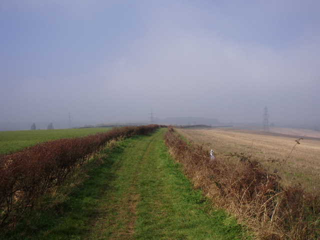
I crossed another stile on the far side of the paddock, where the path went left through bushes and trees, parallel to the paddock. There was a large pond in the corner of a field on my right, which I’m not sure if I’d noticed before. The path crossed a footbridge over a stream to enter a large field of rough grass, where I turned right to follow the hedgerow. This was pleasant and easy walking on a clear path now for several hundred yards, though there was some traffic noise from the A5 ahead of me and from a new road over to my left. The path reached the shrub covered embankment carrying the A5, where I turned right for about a hundred yards to reach a steep flight of steps that led up to the road [11]. The embankment and the chalk cutting it leads into were both created in 1837, to remove a very steep hill on this major coach route (the old Watling Street). Dunstable, on the far side of the chalk cutting, had long been a major stopping point on the London-Holyhead road, and several old coaching inns can still be seen there today.
[10] Path heading towards Sewell
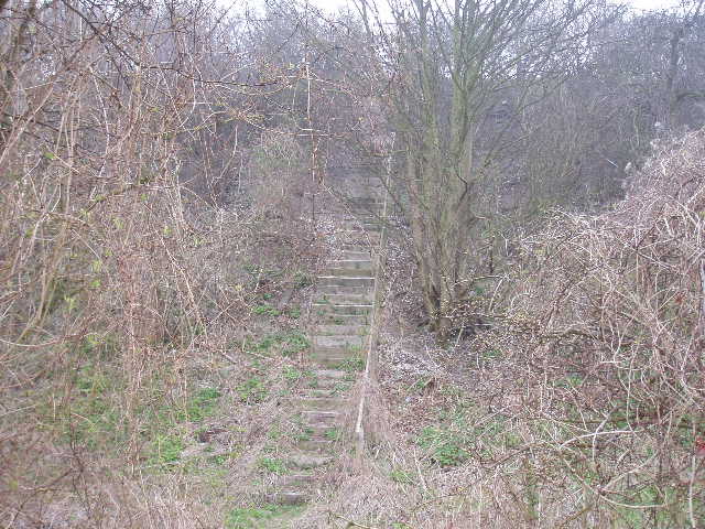
[11] The steps up the A5 embankment at Chalk Hill
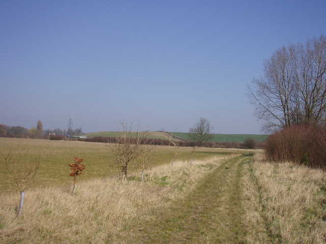
[12] Path between Chalk Hill and Bidwell (afternoon)
For some reason, there was traffic queuing towards Dunstable – not unusual at peak times, but rather surprising at this time of day. It was the same later on when I came back. I had no difficulty crossing the road, and turned right along the pavement on the far side for a hundred yards or so. Opposite a pub, I took a much shorter flight of steps down the other side of the embankment to reach a section of the old road with a few cottages. I took a footpath beside one of them which ran past a garden then entered a large field of open grass, with another old chalk quarry up the slope to my right. I continued ahead following a fence or hedge on my left [12,13], soon passing Houghton Regis sewage works. After a few hundred yards, the path reached a small area of trees where it became a wide grass track. This short section of a hundred yards or so was the only muddy section of the whole walk today. On the far side of the trees the path joined a concrete track, but almost immediately left it again to cross a field on the left. So far today the Chiltern Way had shared its route with the northern alternative route of the Icknield Way, but where the path touched the end of a projecting hedge, the Chiltern Way turned right alongside the hedge while the Icknield Way continued ahead on its way towards Toddington. I soon rejoined the concrete track I’d been on moments before, and followed it a hundred yards or so to a road in the hamlet of Bidwell.
Bidwell (locally pronounced Biddle) is a small hamlet in the parish of Houghton Regis, consisting of an inn and a few half-timbered farmhouses and cottages. It lies at the foot of a hill below its much larger neighbour, on the road to Bedford. In fact, it has almost been swallowed by its ‘mother’ village, with new houses within a hundred yards of the hamlet. Houghton Regis was a royal manor in Saxon times, which saved it from being sacked when William the Conqueror visited it shortly after the Battle of Hastings. Dunstable was then part of the parish of Houghton Regis, which is why Henry I founded his Augustinian priory there – the current Priory church in Dunstable is just a small survivor of the magnificent buildings that were once there.
13] View north from path between Chalk Hill and Bidwell (afternoon)
[14] Path leading towards Grove Farm (afternoon)
[15] Path leading away from Grove Farm
I followed the road to the right for a short distance, then took a footpath on the left. This went half left through an overgrown field, then half left again to follow a hedge on my left. I passed a paddock, then a field with two cows in it, and a bit later on passed a sports ground. The fields to my right were arable, and there were pleasant views in that direction of farmland on a low hill. I saw a Long-tailed Tit in the hedgerow – these are my second favourite birds (after Red Kites, of course!). They usually go around in small family groups, constantly calling to one another, so I often hear them before I see them. I am generally quite useless at recognising birds by their sounds, but I usually recognise these. A few yards further on I saw a Kestrel on an overhead wire – it let me get surprisingly close to it before flying off.
Across a stile in a field corner I turned right to follow the hedge of an empty meadow. In the next corner I crossed a footbridge by the confluence of two streams, and continued following the hedge on my right through the next, larger, meadow. Over another stile (where I ate my lunch on the way back) I entered a very large grass field. The path alongside the right-hand hedge now became quite a wide grass track, with some young trees planted along the left of the track, separating it from the green field. Further left I could see horses in a paddock, and ahead and to the left I could see Grove farm [14], which I would be passing shortly. After this large field, I passed a paddock on my left, then turned left to head towards Grove farm. I was now on a bridleway on a very wide green track along which ran some overhead power lines. To my right were more paddocks on a slight hill. Grove farm seemed to be a stables – a horse being led by a woman seemed very nervous of me when I came back this way later (I have the same effect on dogs and women!).
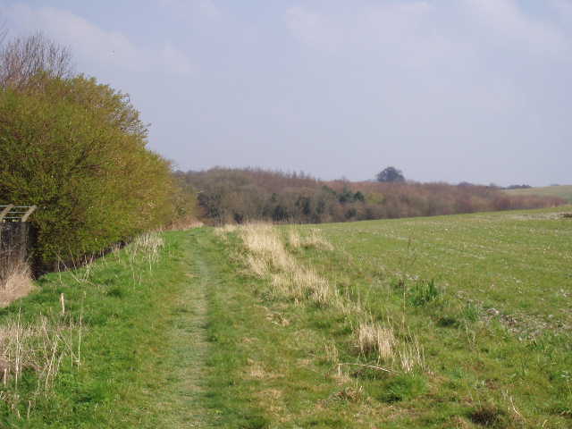
[16] Waymarks and Chalgrave Parish Sign, between Grove Farm and Chalton
[17] Looking back along the green lane to Chalton

[18] Chalton
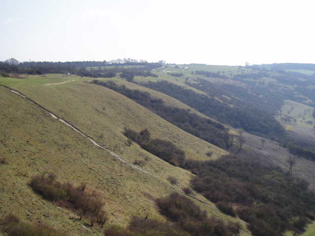
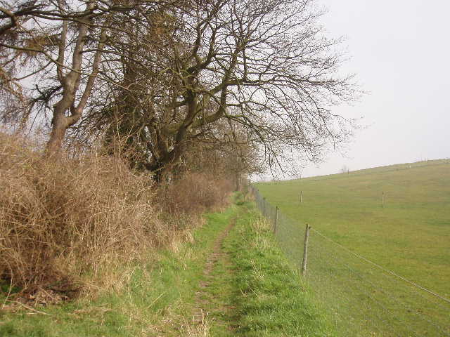
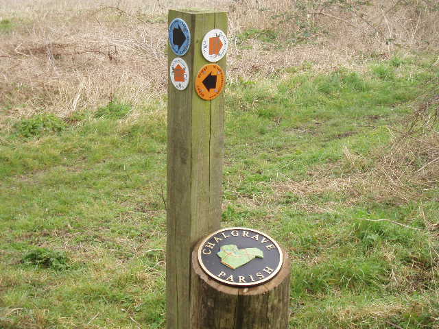
Beyond the stables, the bridleway turned right to follow a hedgerow up the hillside [15]. Near the top of the hill, it ended at a junction with a wide green lane. As well as several waymarks at the junction, there was a Chalgrave Parish sign, something I’d seen before on my Berks-Essex walk – a circular design with the shape of the parish marked out in green with reddish lines marking the roads through the parish [16]. I turned right and followed the green lane towards Chalton. I remembered that this was the bit of the walk I’d enjoyed when I did it two years ago. Although no longer foggy, it was still pretty misty [17]. This restricted the views – last time I remember being able to see Blows Downs on the other side of Luton and Dunstable, but there was no chance of that today. I followed the green lane for over half a mile, passing two or three path junctions (at least one of which had another Chalgrave Parish sign). Over the hedge to my left were fields of oil-seed rape, with some flowers showing already – the fields will be a mass of bright yellow before long. On the way back, the mist had thinned slightly and I noticed that there would have been a nice view towards Toddington in that direction if it hadn’t been spoiled by a row of giant pylons. There were two or three such rows here – there is a large electricity substation at Chalton.
Eventually I turned left and crossed a field of rough grass to reach the village of Chalton. I passed down an alleyway between houses, emerging at a T-junction where I followed the road straight ahead of me. After about a hundred yards I took a footpath on the left, initially between fences, then on a concrete track and then between fences or hedges again. This took me to a children’s play area, from which a short path took me to the main road through the village [18], opposite The Star pub. Here I turned round and headed back.
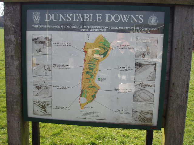
[19] Notice board at the foot of Dunstable Downs
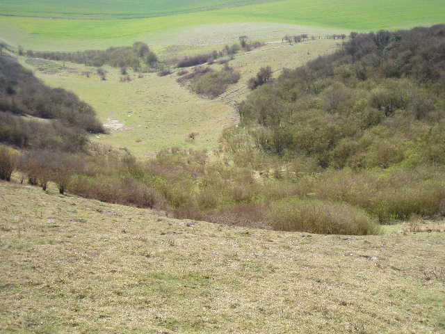
[20] Pascomb Pit, Dunstable Downs, apparently the site of a Roman amphitheatre (afternoon))
[21] Looking back at the path down from Dunstable Downs (afternoon)
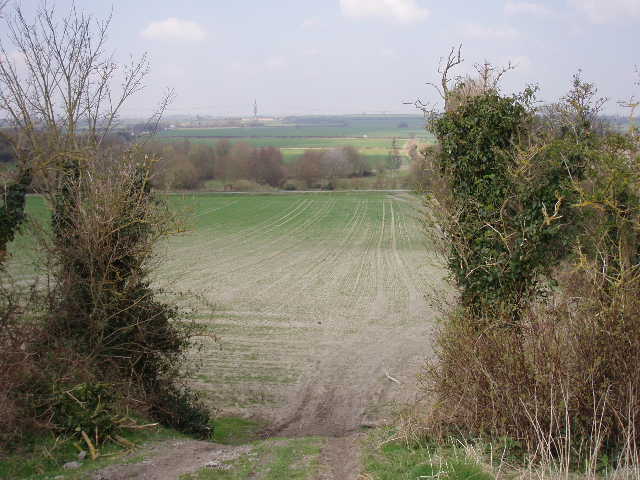
It was much brighter and warmer as I made my way back to Dunstable Downs, although it remained hazy. I saw more in the way of wildlife on the way back too. When I came down the far side of the embankment at Chalk Hill I saw a Brimstone butterfly, and then a bit further on I saw my first Peacock butterfly of the year. Not long after I heard and then saw a Buzzard, followed soon after by a Green Woodpecker that flew across in front of me and landed on a wooden telegraph pole. When I got back to Green Lane, heading into Dunstable, I saw my first Comma butterfly of the year. When I crossed West Street in Dunstable I stopped and read an information board [19] – this was what told me about the old golf course on the Downs and the Roman amphitheatre in Pascomb Pit [20]. I took several photos as I walked back over the Downs, although the views were nowhere near as extensive as usual because of the misty haze – I couldn’t even see Ivinghoe Beacon very clearly, which was only six or seven miles away.
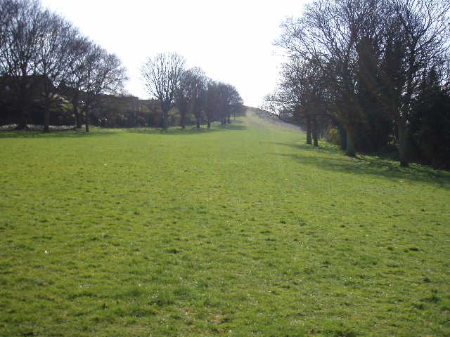
I really enjoyed this walk, despite the thick fog at the beginning of the day. The walk seemed to be better than I remembered it – possibly because it was a rather grey and gloomy day throughout when I did it two years ago. It certainly isn’t one of the better walks on the Chiltern Way – it’s generally flat apart from the steep descent from the Downs [21], and there’s not much woodland. But Dunstable Downs were a pleasure to walk over as always, even though the spectacular views were not at their best even in the afternoon, and I enjoyed the section of green lane near Chalton, despite the mist and the pylons spoiling the views. I’m really glad that I decided to walk the Chiltern Way again, and I’m very much looking forward to walking the rest of it.
Total Distance: 7.6 miles each way