Pete's Walks - The Chiltern Way (2)
If you are considering walking this route yourself, please see my disclaimer. You may also like to see these notes about the maps and GPX files.
Day 9 11/04/07 M1 to Fields End (7.2 miles each way, approximately)
Parked by church and village hall in Flamstead.
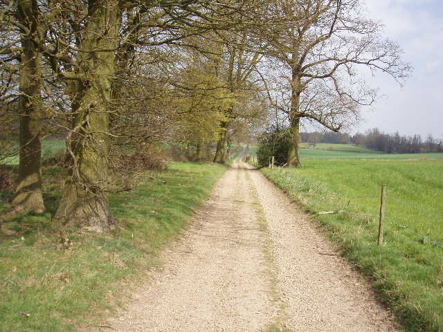
Another warm and sunny day, though with quite a few clouds in the sky. As Flamstead is only 4-5 miles from my home in Kensworth I was able to start walking about 9.30am. I first walked back to the M1 junction, where I again spoke to the friendly security guard that I saw yesterday.
From the roundabout by the junction of the M1 with the A5, I crossed a large field of green corn, going half right and slightly uphill towards a wood. It was just as well I’d just done this in the opposite direction, as otherwise the faint tyre tracks through the crop wouldn’t have been easy to pick up from the road end of the field. When I reached the wood, I turned right along its edge, soon leaving the field and following a right-hand garden boundary to reach a lane. Here I turned left, and immediately round a right-hand bend I turned left again at a lane junction. After about a hundred yards I turned right onto a footpath. This followed a right-hand hedge, with pleasant views over a typical Chiltern valley to my left. At the end of this field, the path continued as an alley between garden fences to a residential street in Flamstead. Here I went right, following the street as it turned left then right to reach the church, [1,2] where I had parked.
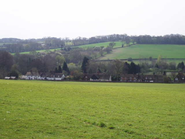
Flamstead is an attractive village of mainly brick-built cottages, with a prominent church and two pubs. It is pleasantly situated on its hilltop overlooking the valley of the River Ver, where the old Watling Street runs. The 12th century church, with its large tower topped by a ‘Hertfordshire Spike’, is visible from miles away (I can see it from parts of Kensworth). Apparently the church contains mediaeval murals (I haven’t seen them myself, unfortunately, as the church didn’t look as if it was open to visitors when I went by). Thomas Pickford, founder of the removals firm, is buried here.
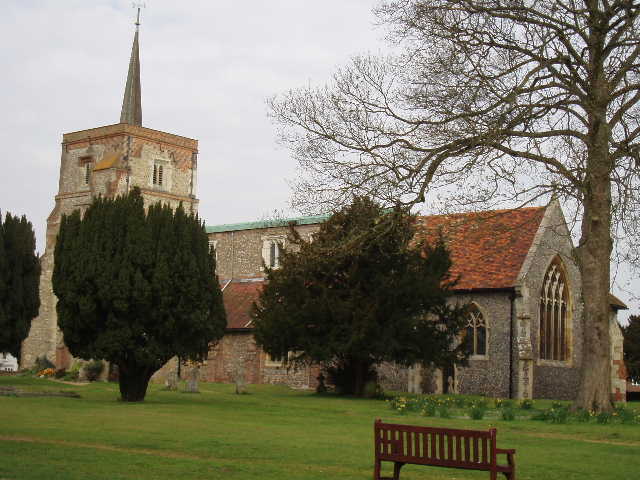
[1] Flamstead Church
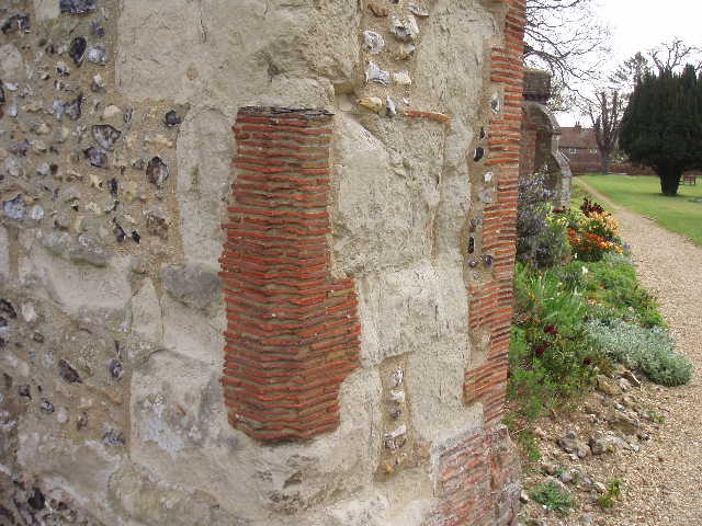
[2] Roman tiles in fabric of Flamstead Church
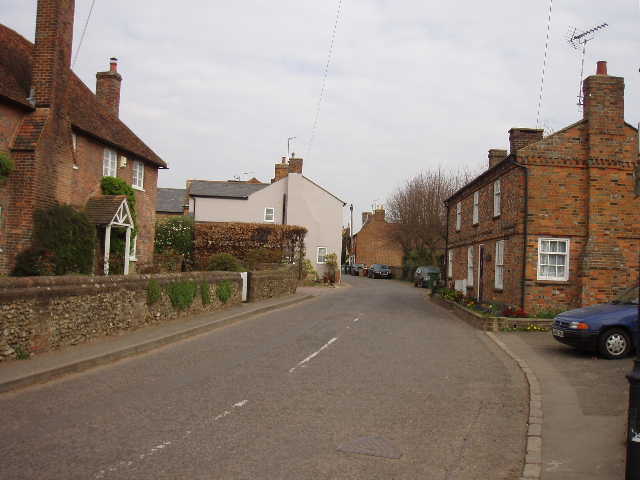
[3] Flamstead
I followed a path through the churchyard, passing to the left of the church. As I turned left down another street [3] I was sharing the route of the Hertfordshire Way again, but quickly left it as I took a path on my right. This ran between or beside houses to reach a field. Here I hit a problem – a sign said the footpath was closed, and there was a roped off section of recently dug earth running across the path and along the entire edge of the field, as if some sort of new pipeline was being put in. I could easily have climbed over the ropes and continued across the clear track through the green crop of the arable field, but chose to be a good boy and obeyed the sign. Using local knowledge and a quick glance at the map to check, I followed some streets and lanes and then a bridleway to rejoin the route of the Chiltern Way about half a mile further on (annoyingly I had to take a detour on my detour, as one stretch of lane was closed even to pedestrians!). I turned right on a path uphill through another green field to a lane, then went a few yards left. Here I was at the other end of the field were the footpath was closed, and again there was a sign saying it was closed. Having walked as much of the path that I was allowed to, I turned and retraced my way back to the bridleway.
I don’t really feel any need to go back and walk the section of closed path when it is re-opened. I have still done a continuous walk, sticking to the route as closely as possible, and have walked all the route that was open at the time I did the walk. For the purposes of this journal I can even describe the section of path I had to miss out – it was a clear path across a field of young corn, heading slightly downhill to meet a lane. However, as Flamstead is so close to my home, I may go back and re-walk that path sometime.
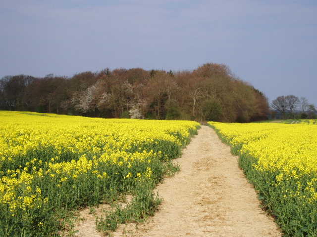
From where the bridleway crossed the Chiltern Way [4], I followed a footpath uphill, again on a clear path through a green cereal crop. This took me to another hedged lane, which I followed for a few hundred yards to the right, between more cereal crops and some yellow oil-seed-rape. On my detour I’d passed a sign at the start of this lane saying that it was also closed (but only to vehicles, it didn’t say anything about pedestrians) and I could now see why, as there was a team at work repairing potholes along the edge of the lane. I turned right on to another footpath, heading through a field of oil-seed rape to a corner of a wood [5], labelled Yewtree Spring on the map. The path continued with the edge of the wood on my left, then turned and entered the wood. There were a few Bluebells here, and the wood was a mixture of coniferous and beech trees.
[4] Footpath heading away from Flamstead, just past the 'diversion'
[5] Footpath heading towards Yewtree Spring
[6] Meadow near Little Gaddesden - the wood on the left here is called Abel's Grove
Something odd was going on in the wood. Two years ago, it seemed as if a lawn and garden were being planted around the pond in the centre of the wood (presumably Yewtree Spring). Now there were wide tracks running through the wood, entering and leaving the water via gentle slopes, and a few wooden barriers or obstacles along the tracks. There were also at least two loudspeakers mounted in the trees. The barriers looked too big and solid for horses or mountain bikers to go over – my best guess that it is some sort of steeplechase or cross-country course.
On the far side of the small wood, I was pleased to see the path was very clear through a field containing some sort of root crop. Two years ago on this walk, some strange and very tangly crop here left a mass of red marks on my legs for days afterwards, and pulled the laces of my boots undone. There were nice views northwards here, over largely wooded land towards Studham. On the far side of the field, I went a few yards to the left and crossed a stile into an empty paddock. I turned left alongside the hedge to the far corner to another stile, beyond which the path squeezed between a fence and a garage to join the drive to an isolated cottage. I followed the drive, mostly with a wood to my left and a grass field beyond the hedge on my right, for about a quarter of a mile to reach a minor road. I turned left here, now with woods on both sides. After about a hundred yards, I took a path on the right, where the wood on that side ended.
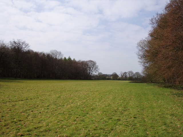
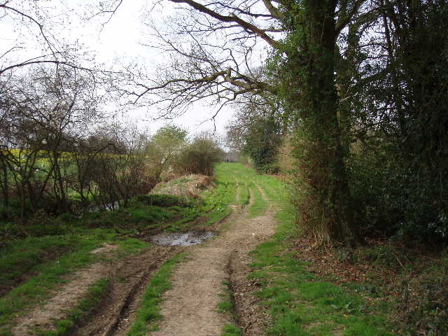
The path went diagonally across a large meadow (where I saw a Brimstone butterfly along the woodland edge) [6], passing a corner of a wood on the left called Abel’s Grove, to a gate in the opposite corner where the path joined a bridleway. I turned left, soon passing another path junction. The bridleway now ran on a broad strip of grass between hedges, with many deep ruts formed by tractors or 4x4 vehicles [7]. Shortly it passed Gaddesden Row School on the right and came to another minor road. I crossed this and continued ahead, down a private drive. Just before reaching a house, I turned left alongside a hedge. In the corner of the field, the path went through some bushes to a kissing gate. Here I could see Golden Parsonage in front of me, a grand and attractive building but in fact merely the surviving wing of a house built in 1705.
[7] Bridleway leading to Little Gaddesden School
[8] Impressive trees in the grounds of Golden Parsonage
[9] Looking back along the drive of Golden Parsonage
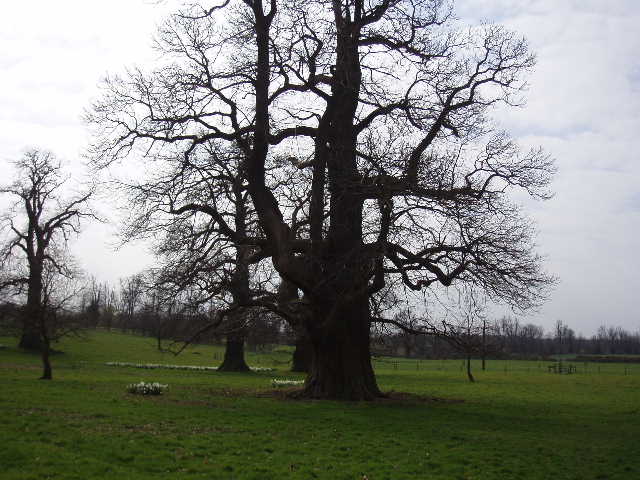
The path now went half left across a couple of meadows, the first one containing some ornamental trees with huge trunks and deeply ridged bark (possibly some type of walnut? Update 8/09/09 - Doh! A lady called Judith that I met in Markyate told me that they are in fact very old Sweet Chestnuts, and she is correct!) [8]. The path then joined the track leading away from the grand house. I followed this for about a third of a mile, with a sturdy hedge on my right and a belt of trees beyond a field of potatoes or some such on my left. The footpath then left the drive [9] and continued on a track through woods, with a farm through the trees on my left. I saw a comma butterfly, as well as some peacock butterflies which I have been seeing regularly the last few days. The track crossed another one that led to the farm, and just beyond this crossing point I saw some primroses.
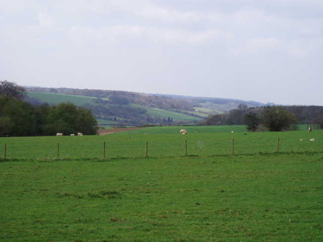
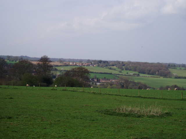
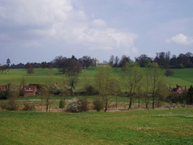
The woodland path ended at a gate, which took me into a large pasture (empty now, but there were many sheep and lambs here when I came back later). I followed tractor ruts through the grass, curving round to the left. In front of me now was the Gade valley, and there were great views along the valley to my right, or across the village of Great Gaddesden in the valley bottom [10,11]. The path next went over a stile into the corner of a large paddock, and followed a wire fence for about a hundred yards, with the huge house of Gaddesden Place now in front of me. This Palladian mansion was built for the Halsey family by James Wyatt between 1768 and 1773 (he also designed the nearby Ashridge House). The Halsey’s have lived in this area since 1512, and Great Gaddesden in the valley below was long an estate village of theirs - there is a Halsey Chapel in the church there.
[10] The Gade Valley from near Gaddesden Place
[11] Great Gaddesden in the Gade Valley from near Gaddesden Place/p>
[12] Great Gaddesden in the Gade Valley from near Gaddesden Place
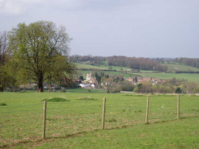
I went through a gate on my right, back into an extension of the large sheep pasture I’d been in before, and crossed to an open gateway [12]. The path then descended through another sheep pasture, going steeply downhill in front of the mansion. Again there were great views of Great Gaddesden, of the Gade valley, and of a side valley directly ahead of me [13]. I went over two stiles to cross the corner of another grassy field, then continued downhill across another grass field to emerge on the road through the valley next to a cottage in the attractive hamlet of Water End. Across the road, a path went down a short alley between buildings, to enter a water meadow at the valley bottom. I saw a Buzzard here – I’d seen one nearby when I did this walk almost two years ago. I walked across the grass to a footbridge over the river Gade [14,15], flowing south to my left, towards Hemel Hempstead where it is joined by the river Bulbourne. I turned slightly left here, crossed a shorter bridge over the outflow from a spring, and then followed a right-hand fence across the entrance to the side valley I’d seen from near Gaddesden Place. The meadow was empty now, but there was a mixed herd of cattle here when I came back and I took a slight detour around them to avoid coming between any cows and their young calves.
[13] View over Water End from the path from Gaddesden Place
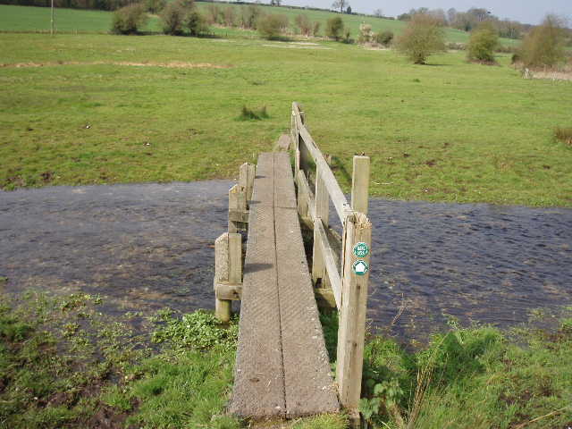
[14] Footbridge over the river Gade
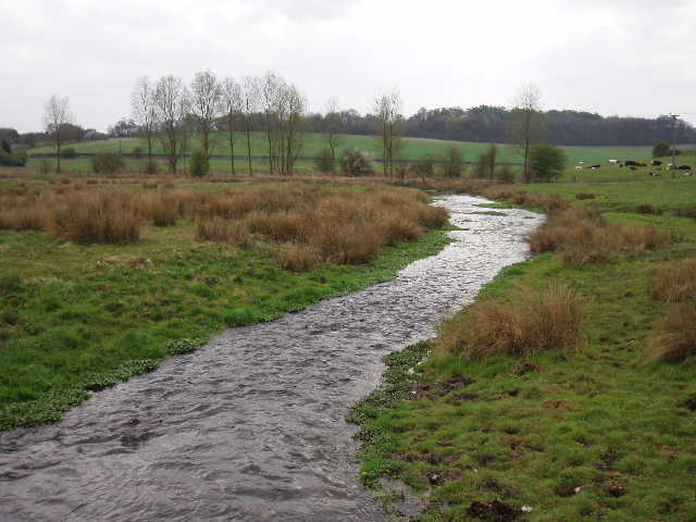
[15] The river Gade
The path [16] took me to the road running through the side valley, where I turned right for about a hundred yards before taking a path on the left. This ran uphill on another clear path through an arable field to reach a wood. Here the path turned half-right, to continue through the wood now going uphill at a gentler gradient. There seemed to be some sort of nature trail in the wood – there were several paths going through it and occasional notices. One board next to the path said “You’re a really ‘fungi’”.
At the end of the wood, I took a path going right across an arable field to a lone tree – a large cairn of flints had been built next to the tree [17], which reminded me of the ‘cairned path’ I came across near Chesham at the end of my Chiltern Heritage Trail walk. To my right there was now a tremendous view [18], overlooking where the side valley off the Gade valley now divided in two, forming a sort of Y shape. The village of Nettleden nestled at the bottom of the branch of the valley directly in front of me (I go through Nettleden on one of my local walks). The valleys, hills, woods and fields just cried out to be explored, and reminded me once again how fortunate I am to live in this Area of Outstanding Natural Beauty.
[16] Looking back towards Water End and Gaddesden Place
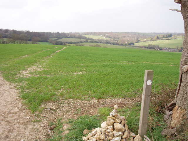
[17] View from the 'cairn' near Potten End

[18] View over Nettleden from near Potten End
The path turned half-left by the tree, and a couple of hundred yards later turned left alongside a hedge. It went through a kissing gate to a short track to a house, and then followed the drive of the house to a minor road (from Water End to Potten End, away to my right). I followed this right for a short distance, then took a footpath on the left. This ran between a wire fence and a right-hand hedge past a meadow. In the next meadow the path descended, still alongside the hedge and shortly with another row of bushes on my left. In the bottom of a small valley I turned left along a farm track, which very soon turned right and went up the other side of the valley towards a farm. The path continued beside the edge of Boxted farm, through a gate then over a sequence of stiles between small enclosures, eventually joining the farm drive and following it to another minor road.
I continued on a path on the opposite side of the road, following clear tracks across a grassy field to pass close to Boxted House on my right, then followed the path through a small are of scrub to a narrow hedge gap that opened onto a lane in Fields End, close to the edge of Hemel Hempstead. Here I turned round and started to make my way back to Flamstead.
I stopped for lunch at the same place as I did on my previous Chiltern Way walk, by the side of the path in the wood along the side valley leading to the river Gade. It was a very pleasant afternoon, warm but not too warm, sunny but with quite a few clouds in the sky. The walk went by very quickly. The detour back into Flamstead was a little annoying as it added about a third of a mile to the route, but it was still before 3pm when I got back to my car.
This was a very good walk, but I was a little disappointed. Last time I did the Chiltern Way I fairly raved about this walk, but it didn’t quite come up to my expectations this time. I think the reason for this is that when I did it last time, it was actually the first walk I’d done in this area for many years - I’d only recently returned to Kensworth, and hadn’t done much walking before starting the Chiltern Way because of a knee injury. It was the first walk in which the Chilterns had lived up to my childhood memories of them. Having done so many walks through the Chilterns subsequently (both on long-distance paths and on numerous local walks), this walk didn’t have the same impact on me this time round. But it was still a very good walk – it would be worth doing just for the great views near Gaddesden Place and from the path with the flint cairn.
Total Distance: 67.5 miles each way