Pete's Walks - The Hertfordshire Way
If you are considering walking this route yourself, please see my disclaimer. You may also like to see these notes about the maps and GPX files.
Day 20 13/01/06 Little Berkhamsted to Stapleford (8.0 miles each way)
Parked in side street in Little Berkhamsted.
I’ve obviously lost a lot of fitness during my enforced lay-off, as my legs were still slightly stiff from my walk two days ago when I started off this morning. Again, the weather forecasters got their predictions right – the sky was a very dark grey all day, but it never rained at all. I didn’t expect this to be too good a walk, as I knew that there was a lengthy section of town walking through Hertford in the middle, but it turned out to be a very enjoyable walk. The section through Hertford wasn’t too bad, and the sections either side were very pleasant indeed.

[1] Stratton's Observatory
From Little Berkhamsted, the Hertfordshire Way took a footpath to the side of the churchyard, which followed a hedge row through two grassy fields to a road – the path was obviously well-used, and this turned out to be the case for all the paths I would follow today. From here I could see Stratton's Observatory [1], a folly built in 1789 in the form of a five-storey tower. Across the road, another path led between hedges and then fences, across three stiles and then across two more grassy fields to a wood (I noticed that a couple of wooden signposts hereabouts misspelled Little Berkhamsted by adding an ‘a’ before the ‘d’). A broad path led uphill through the wood (mainly silver birch and some young beech trees), crossed a track and then reached a stile that gave access to another grassy field. The path followed the left hand hedge to a corner, where a track led to the right to reach a road on the edge of the village of Bayford. I followed the road to the left for about half a mile to reach the village centre, where there was a green and a pond [2] opposite a pub.
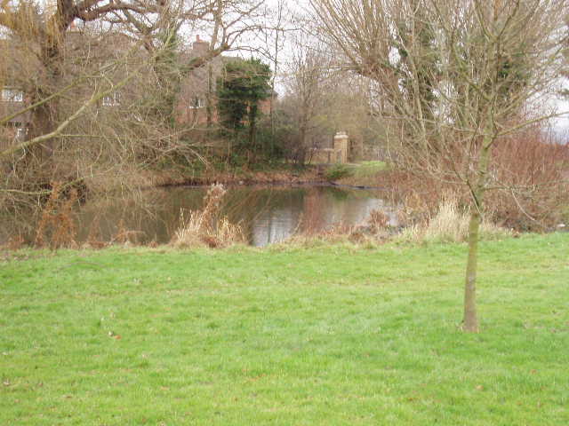
[2] Pond in Bayford
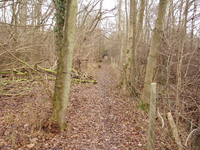
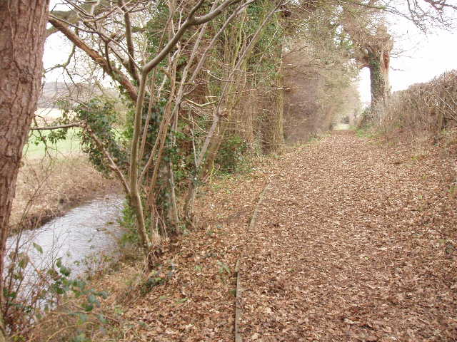
[3] Path through woodland beside the railway line
From here, the Hertfordshire Way took a lane which became a track when it reached the end of the houses after about quarter of a mile. After about 100 yards of the track, a footpath on the right led along the hedge of another grassy field, across a stile to a paddock with a single horse in it, then turned left in a small group of trees and bushes. The path then followed the right hand hedge of a huge field, planted with some cereal crop, for about three quarters of a mile, with a railway embankment to the right. The path then went through some trees and continued in the same direction through a wood for about a mile [3], with the railway (now in a shallow cutting) still to the right. Eventually, I crossed a footbridge over the railway and then a plank bridge over a stream. The path then followed a left hand hedge through two more grassy fields to reach a road on the edge of Hertford.

[4] Brewery in Hertford
[5] Grand house on edge of Hertford being converted into apartments
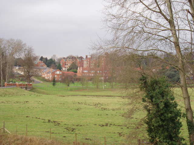
The section through Hertford wasn’t as bad as I’d feared. It went through a residential area, along a hedged alley between a school and some playing fields, through a further residential area, and then through a churchyard to a subway (under a dual carriageway) that led to the town centre. I was again quite impressed with the centre of Hertford, and intend to come back here to visit the museum and generally have a look round. At Parliament Square I reached the point where the alternative route of the Hertfordshire Way (legs 10A and 10B in the guide book) rejoined the original route. From here, the route went northwards along a series of roads [4] that gradually grew narrower, until I was on a narrow lane that led to Molewood Mill. A path beside Goldings canal (the former millstream converted in 1870 to a pumping station for the town’s water supply) then led to the main road between Hertford and Stevenage. I followed the footpath beside this busy road north [5] for about quarter of a mile, and then turned left on to a footpath.
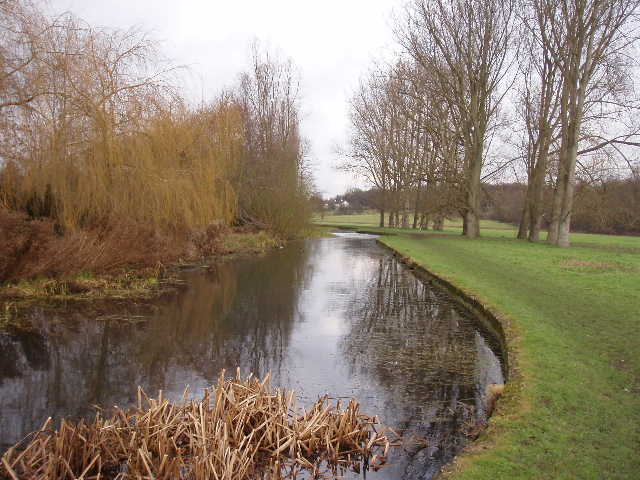
[6] River Beane, Waterford marsh
This next section was very pleasant indeed, as it followed the bank of the river Beane [6] through Waterford marsh, a flat area of grass where traditionally all parishioners were entitled to graze their livestock. I soon disturbed a heron that had been fishing in the river [7], and shortly afterwards saw the brilliant blue of a kingfisher! Two or three times as I approached along the river bank it flew 50 or so yards to another perch, before it finally disappeared from view. Then I saw a wagtail, but without my binoculars I couldn’t see if it was a grey wagtail or, more likely, a yellow wagtail.

[7] View across river Beane to Waterford
The Hertfordshire Way then crossed a road in Waterford, and at the end of a cul-de-sac a kissing gate led to another path across a grassy field. Over a stile, a path led through trees, passing under a railway bridge to reach a road. Almost opposite, a track led past a small group of houses and a large farm building, before a path went left to rejoin the bank of the river Beane [8]. This was a well-made gravel path, which followed the river for another three quarters of a mile to the churchyard at Stapleford [9]. At the road on the other side of the church, I paused for a quick look round and then turned round and started to retrace my steps back to Little Berkhamsted.
[8] Path alongside the river Beane
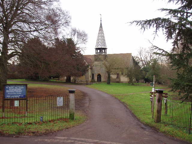
[9] Stapleford church
I stopped for lunch on one of the three river-side benches in Waterford marsh, which left me a walk of just under two hours in the afternoon. I enjoyed the walk back, although I could tell that I wasn’t as fit as I’d been – I felt far more tired than usual when I got back to my car. Despite the grey overcast skies, and the dull middle section through Hertford, I really enjoyed today’s walk. The highlight was definitely the bird-life along the river Beane, and I look forward to following the river a short while further on my next walk.
Over 300 miles walked on the Hertfordshire Way now!
Total Distance: 151.7 miles each way