Pete's Walks - The Hertfordshire Way
If you are considering walking this route yourself, please see my disclaimer. You may also like to see these notes about the maps and GPX files.
Day 22 19/01/06 Wareside to Perry Green (7.9 miles each way)
Parked in layby near Widford church.
This was another grey day, with the skies remaining overcast all day. There was a very slight drizzle just after I set off, but otherwise it remained dry. The footpaths were very muddy, of course - one near Perry Green was one of the worst so far, the mud managing to be very slippery and yet clinging to my boots at the same time
This walk took a rather convoluted route, not my normal ‘there and back’ routine. For a start, as there was no suitable place to park at Wareside, I parked in Widford and began by walking the 2.6 miles back along the Hertfordshire Way to Wareside. This reminded me of the fact that the Hertfordshire Way is only waymarked in the anti-clockwise direction that the guide book follows (unlike the Chiltern Way where there are usually waymarks pointing in both directions). As the Hertfordshire Way is not marked on all the OS maps (and where it is marked, it is sometimes out-of-date as the route has been altered over the years!) it is not really feasible to do the walk in the clockwise direction around the county.
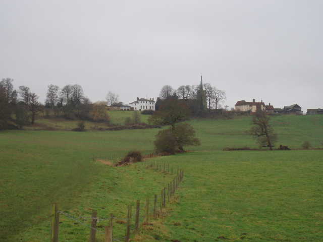
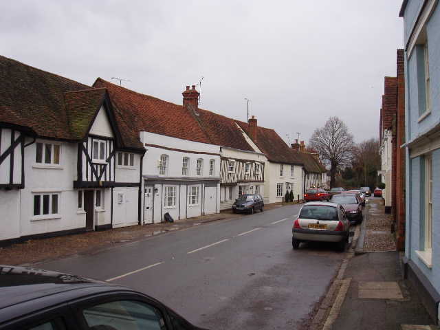
[1] Looking towards Widford church
From Wareside, the Hertfordshire Way took a path through rough ground alongside a stream and then followed hedgerows through fields to the course of a dismantled railway. Across this, another hedgerow was followed to the left (the old railway could have been followed if conditions had been too muddy), first through a grassy meadow and then beside an arable field. The path then went through the hedge to reach a bend in a road. The road was followed straight on for a couple of hundred yards or so, then a RUPP (Road used as Public Path) led off slightly to the left along the valley of the river Ash. Across a small bridge and through grassy fields for about half a mile, a footbridge was then crossed and the left hand hedge of another grassy field was followed to a stile at a crossroad of paths (I would be returning here shortly!). The Hertfordshire Way took the path to the right along a fenced path for about 50 yards to a gate. Beyond this there was a very large grass field – the path followed the right hand fence for some way [1], and then led steeply uphill to a flight of steps that led to Widford church (there is a view of the church on the cover of the Hertfordshire Way guide book).
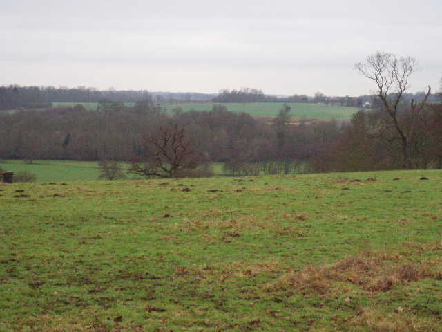
[2] View from near Widford church
On the other side of the churchyard I followed the road to the left [2], and continued for about half a mile through the village, before turning left down an alley. Across another road, the alley led back into the countryside, and a path led downhill through another grassy field back to the crossroads of paths that I’d been at 20 minutes before! The Hertfordshire Way had just followed a triangular path to end up at the same point – this may seem odd, but Widford is the end of one of the ‘legs’ in the guide book (presumably because there is parking and liquid refreshments available) and the next leg happens to come back to this point. Anyway, I now turned right along a hedged or fenced path that ran along the valley of the river Ash (which I’d be following for the next mile or two). I soon came to a lane, and on the other side of it I followed the driveway to a water works. A path led round the side of this, and then along the left hand hedge of another large grass field. This was a bridleway, and a small sign said it was “Toto’s Way” – the width of the bridleway had been doubled in honour of a late resident associated with the nearby school.
The bridleway led to a road, and the Hertfordshire Way took a lane opposite for a few hundred yards before bearing left down another bridleway. This initially crossed a strange concreted area, presumably a former depot for road maintenance, and then went down a very pleasant track through woodland (still along the Ash valley). After half a mile I came to a crossroads of path, where there was a Hertfordshire Way waymark pointing to the right, although I was sure I should be going straight on. I quickly twigged what was going on though – at this point the Hertfordshire Way does something a bit odd. I had to go straight on for about half a mile, then go in a loop around the village of Much Hadham before returning along the same path to where I was now, and then taking the path that was now on my right to Perry Green. Of course, I would have to do the same in the reverse direction on my way back, so the next half mile stretch I would actually have to walk up and down twice. Just as well that it was a very pleasant part of the walk, mainly just inside a wood with meadows in the river valley on one side and a steep wooded slope on the other. When the path reached a road, I followed it for 50 yards to the left to a sharp bend, and then took a footpath diagonally across a green field (evidently inhabited by a hyperactive mole!) to rejoin the road by a ford.
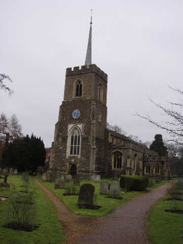
[3] Much Hadham church
This was the start of the loop around Much Hadham. Instead of crossing the ford (only an inch or so deep today, and their was a footbridge beside it), I turned right up the road, and after 50 yards entered a paddock on the right (occupied by a solitary horse). Across this, the obviously well-used path continued through another grassy field before crossing a footbridge and emerging on another road. I followed this to the right for a quarter of a mile until it reached Much Hadham church [3]. This had some faces carved by Henry Moore [4] (more about him later!) by the West door, and north of the church there was a large house that had formerly been a residence of the Bishops of London. Unusually, the church is shared by Anglicans and Catholics (the graveyard at Widford church had a section enclosed by brick walls that was for burying Catholics).
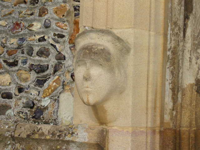
[4] Carved face by Henry Moore beside door to Much Hadham church
I continued along the road a short distance to its end, where I turned left along the main street of Much Hadham [5]. The village is reputed to be one of the most beautiful in Hertfordshire, and I could see why. The street was full of old houses from various periods - some half-timbered, some Georgian, some with Georgian facades obviously hiding something older, some Victorian. ‘The Hall’ was a very impressive red brick mansion built in the 1720’s. It was very interesting to walk down the street, and well worth the strange detour made by the Hertfordshire Way. After half a mile or so, just past the village school, a path down an alley led me back to the ford and I retraced my steps back to the crossroads of paths half a mile or so back down the valley.
[5] Much Hadham
Here I took the path (now on my left) that led towards Perry Green. This went initially quite steeply up hill, then curved round a small wood to the left, before a right turn led across a headland between two ploughed fields (this was the muddy path I mentioned earlier) continued slightly uphill. At the crown of the hill, I took a path to the right which then turned left after about a hundred yards, passing some farm buildings containing some sheep to reach a stile. The next section, across a field and then left along a track to a road in Perry Green, was interesting as it passed through where the sculptor Henry Moore had lived. There were several of his large sculptures visible from the path [6].
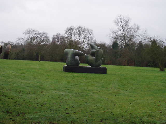
[6] Henry Moore sculpture, Perry Green
At Perry Green, I turned round and retraced my steps - at least I only had to go as far back as Widford, as I’d walked the bit to Wareside both ways at the start of the day. I did the loop around Much Hadham again, of course, in the opposite direction to before. I had a very late lunch, about 1.55pm, on a seat by the war memorial there (I couldn’t find anywhere else convenient to sit before then). Just as I reached the point where I could see Widford church again, the bells started to ring – I wasn’t sure if this was to welcome me back, or to warn the inhabitants to bolt their doors and lock up their daughters! The campanologists kept up their practice all the time until I rather wearily reached my car.
A noticeable thing about today’s walk was the number of dog-walkers I came across. From about 1pm onwards, I must have met seven or eight of them – I usually only see two or three of them a day.
Total Distance: 167.3 miles each way