Pete's Walks - Swan's Way
If you are considering walking this route yourself, please see my disclaimer. You may also like to see these notes about the maps and GPX files.
Day 2 3/09/07 Great Linford to Shenley Church End (7.1 miles each way, approximately)
Parked in car park in Great Linford.
I hadn’t walked for almost a week, as I’d been feeling a bit ‘under the weather’ for a few days and hadn’t been sleeping well either. In fact I had another bad night last night – I have got off to sleep fine, but keep waking in the early hours and don’t get much sleep thereafter. Consequently I was half an hour late getting up this morning, but I skipped my usual second cup of coffee and managed to leave home only seven or eight minutes later than normal. I managed to take a wrong turning in Newport Pagnall, and eventually started walking about 10.10am.
It was a nice morning for a walk as I went the short distance from the car park to the bridge over the Grand Union Canal where I finished the last walk. It was quite bright, though there was a lot of high cloud in the sky, and a pleasantly warm temperature, not too hot. It would remain pretty much the same throughout the walk.
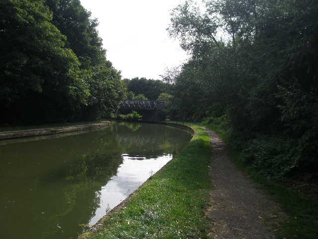
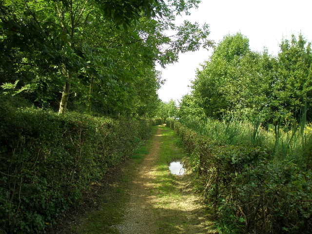
[1] The Grand Union Canal
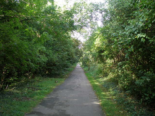
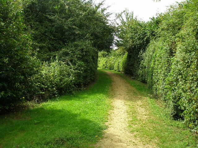
[2] The cycle path along the disused railway line
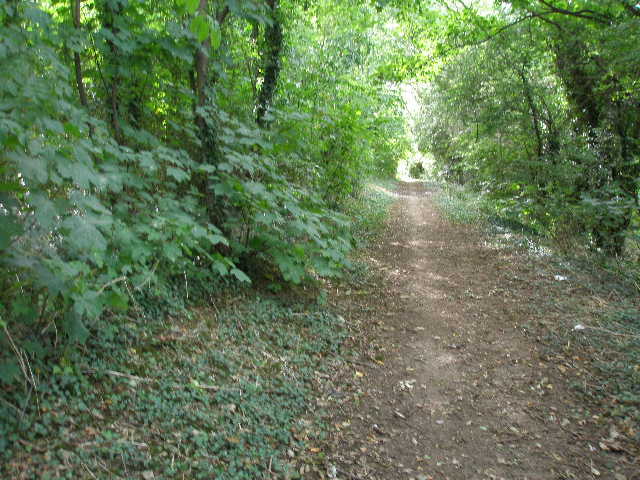
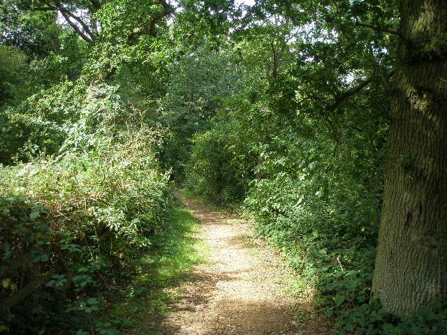
[3] The bridleway beside the disused railway line (afternoon
From the bridge, I followed the right-hand towpath southwards, immediately passing a pub on the other side of the canal. I only had to follow the towpath for about 300 yards [1] before turning right at an old railway bridge. Here I made a slight mistake – I didn’t recognise a different type of Swan’s Way waymark (the large swan’s head should have been a clue!) that pointed down a path immediately before the bridge. The guide leaflet said the route followed the old railway line, so I took the tarmac path beyond the bridge that led up to what was obviously the old track, and continued along the tarmac path heading west [2]. I did notice the parallel path through the trees below and to my right. Eventually that joined the tarmac path before a road bridge. Immediately beyond the road bridge, a parallel path started again now on the left beyond a hedge – there were no waymarks so I stayed on the tarmac path.
The path was generally on a slight embankment, with trees forming a tall hedge either side. Beyond a second road bridge, where the proper bridleway continued behind a fence on the left, I soon saw the Grand Union Canal again on my right. The path soon emerged onto an open grass area – there was a waymark on the end of the left-hand fence, which is why I managed to recognise and follow the correct path on the way back [3] (a much pleasanter walk than the hard-surfaced cycle/pedestrian track I’d followed).
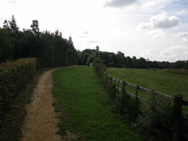
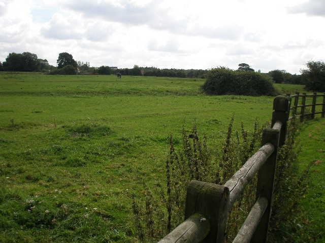
[4] The path running between main road (left) and empty pasture
[5] First sighting of Loughton Brook
[6] The 'Petanque piste'
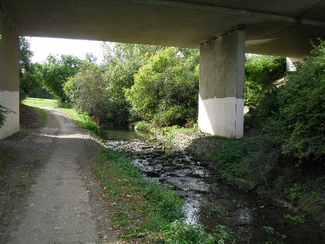
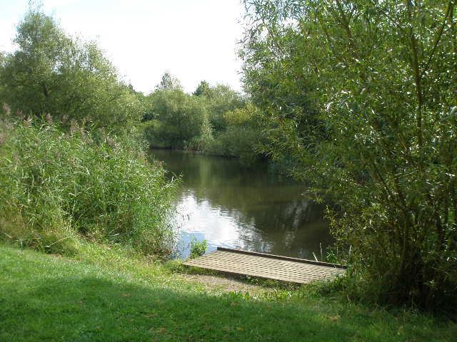
The route now crossed over a wide bridge over a main road. Immediately across the bridge I turned right on a sandy path of large steps that turned as it descended, and passed under the bridge. I now followed a path with a tall conifer hedge on the left separating me from a busy road, while on my left was a wooden fence and then a large green pasture [4]. Beyond the pasture I had hedges either side for a short distance, then the one on the left ended and I walked on grass close to the road for a few yards. On the way back, I noticed the top of New Bradwell Windmill across the treetops on the far side of the road. The path then turned right, beside a left-hand embankment carrying another road. After a short distance, the path turned left under a bridge. A stream (about 10 feet wide) also passed under the bridge [5] – this was my first view of Loughton Brook, whose course I would more or less follow for the next two or three miles.
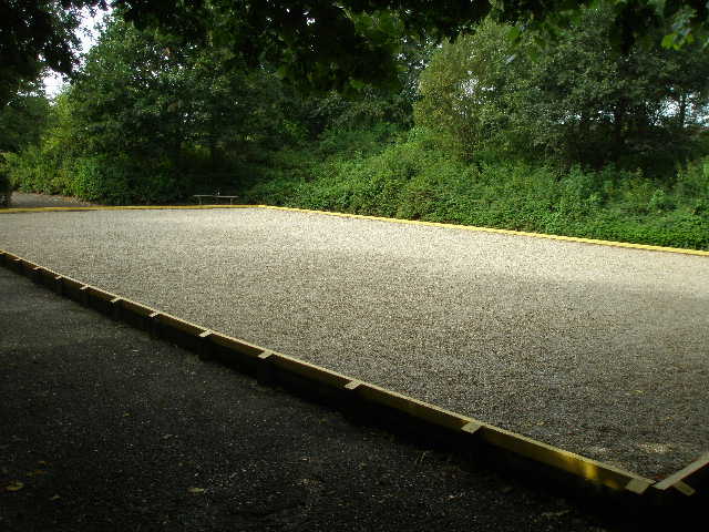
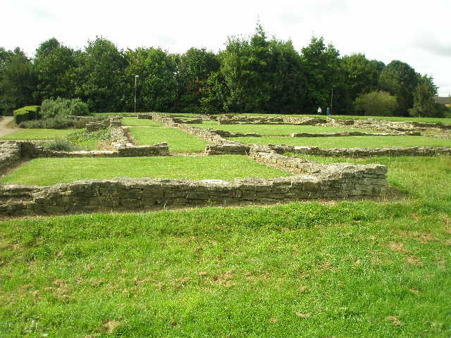
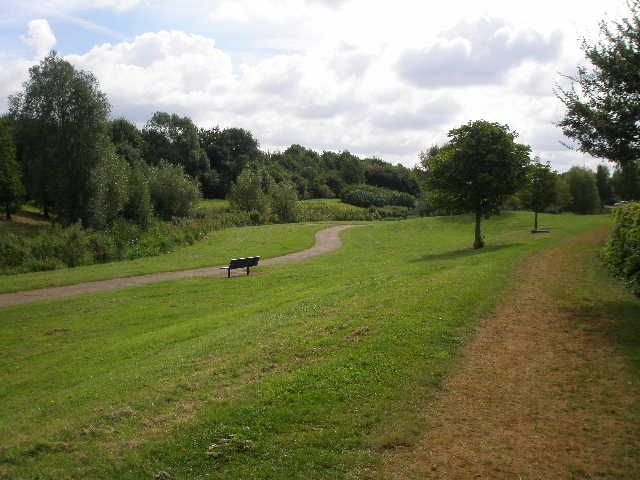
The path and stream turned to the right, in an area that was obviously a large grassy park. The path then crossed a bridge over the stream, and continued through more of the park on the other side. Here I passed a ‘Petanque Piste’ on my right, an area for playing Petanque or Boules [6]. After passing through an area of bushes, the path turned to the left. Soon there was a large and fairly level area of grass to the left, while the path followed a hedgerow on the right. I took a detour across the grass to look at the remains of a Roman villa that had been excavated here [7]. All that remained were the lower courses of a number of walls, showing the outlines of quite a number of rooms. Unfortunately, there did not seem to be any information boards to explain the outline of the villa, or to indicate what the individual rooms were used for.
[7] The Roman villa
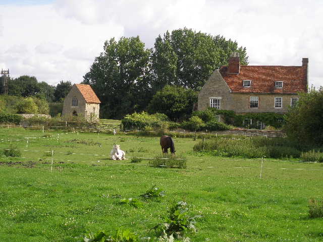
[8] Horse paddock beside the bridleway
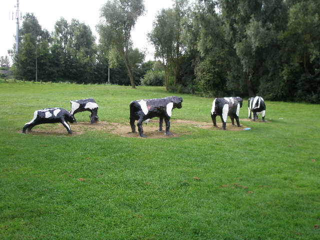
[9] The Concrete Cows
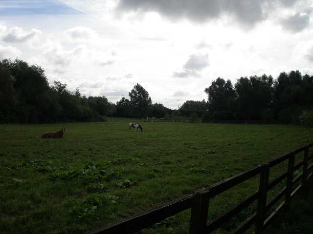
I rejoined the path, which soon passed close to the stream on the left. I then continued past a large paddock on my left, where three horses grazed or lazed on the ground [8]. After a few hundred yards, the path turned left round the far corner of the paddock. Here I saw the concrete cows (a famous, or perhaps infamous, feature of Milton Keynes) on my right [9]. The route then took me under another road bridge, again with the stream on my left. I then turned right and soon went under a brick railway bridge. Just beyond the bridge I again went slightly wrong. I again remained on the tarmac path rather than follow the bridleway that went left and then followed a parallel route the other side of a tall hedge. There was no waymark and the map wasn’t very clear, so I don’t blame myself too much for the error. The paths were parallel and part of the same overall bridleway/cycle rout/footpath, so I don’t think it matters.
I then turned left, rejoining the actual bridleway. On my left was another paddock, with the remains of Bradwell Abbey beyond [10]. All that remains now are a small 14th century chapel and some other structures incorporated into a former farmhouse, which is now used as a ‘City of Discovery Centre’, offering ‘environmental interpretation facilities’ (I think this possibly means Nature Studies!) for people in the area. Beyond the paddock, the path crossed a parking area (I resisted the temptation of the van selling hot and cold food) and then followed a line of trees before turning left. It now passed between a right-hand hedge and the wooden fence of a flower filled paddock, with a new building (presumably pat of the Discovery Centre) beyond. There were some blue flowers growing in the paddock, which I later identified as chicory.
[10] Bradwell Abbey
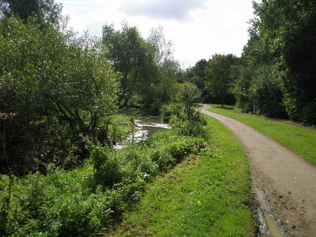
[11] Path beside Loughton Brook
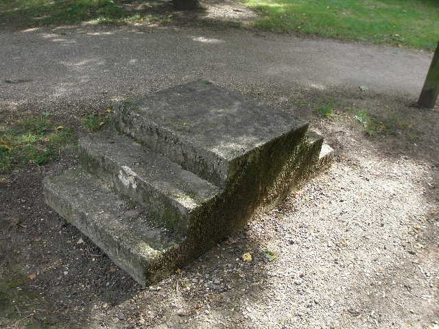
[12] Mounting block, so horse riders can dismount/mount either side of a low bridge
The path now continued close to the stream on the left again [11]. Some men with a JCB and a dumper truck were dredging the stream and dumping the mud nearby as I passed. The bridleway then crossed another small grass area of park. I was now quite impressed with the route so far – despite being entirely within the confines of the city of Milton Keynes I had hardly seen any houses or other buildings, the bridleway sticking to the green corridors with which the city is blessed. A bit further on I came to a mounting block for horse riders [12] – the reason soon became apparent, as the bridleway now passed under a low bridge below the A5 dual carriageway. It was too low for horse riders to pass under, and there was another mounting block on the far side.
There was now another park on my right, where I saw a Green Woodpecker fly off as I passed. The bridleway then crossed a bridge over the stream, and immediately turned right under another road bridge, again in company with Loughton Brook. The bridleway continued through another section of Loughton Valley Park. The brook has a history of flooding, and I now passed a couple of balancing lakes built to control the flow. The lakes were cleverly engineered to fit into the landscape of the park. There were a few wooden platforms beside the lakes for anglers and their tackle [13].
[13] Angler's platform beside one of the balancing lakes
[14] The bridleway through part of Loughton Valley Park
[15] The giant stepping stones
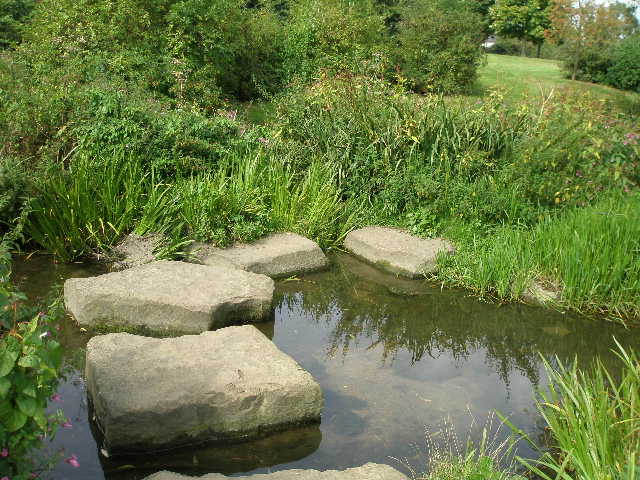
The path continued onwards beside the stream, again passing under a bridge. I noticed some Himalayan Balsam growing here – this is very attractive flower, but it is a non-native species that flourishes rapidly along waterways to the detriment of native plants. The path then crossed another section of the park [14] and went over a minor road. Next I had to cross the stream – the bridleway actually went through a ford, too deep for me to cross, but there were a few huge stepping stones just a few feet away [15], where I crossed without getting my feet wet. There was a lot more Himalayan Balsam here.
Having not passed many buildings so far, I now finally entered a residential area. A short side street led me to a road in Loughton. This was clearly an old village that had been incorporated into the new city. On the opposite side of the road, I could see across treetops to the tower of the village church, and a Georgian house next to it that I supposed was the rectory. There were more old houses as I followed the road to my right, including a long thatched house built of the same yellow limestone I’d seen in so many nearby villages recently [16]. The road crossed Loughton Brook, and then I turned left along a residential street. Soon I was following the left hand verge, with large new houses to my right and some large paddocks belonging to an equestrian centre on my left. There were several lumps and mounds in the paddocks, including what looked like a moat, evidence of where part of the village once stood [17].
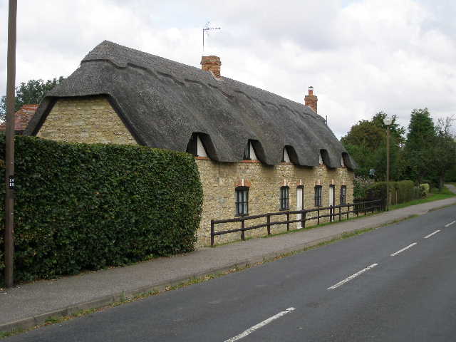
[16] Thatched cottage, Loughton
[17] Horse Paddocks, Loughton - lumps and hollows in the field indicate old house platforms
[18] Bridleway through Shenley Church End
After walking for several hundred yards beside the paddocks I crossed a minor road. There was a tree surrounded by a hexagonal bench here, where I’d later eat my lunch, admiring the view over the paddocks to Loughton church. I continued along the bridleway, a sandy path beside a hard-surfaced cycle path. Soon I was accompanying a road on my left, and then went under a road bridge with a sign informing me that I was in Shenley Church End. There was now a bit of road noise, but not too bad as there was a tall hedge between the bridleway and the road. A hedge on my left also screened the bridleway from the nearby houses [18].
This continued for some way, the bridleway running between tall hedges with the sound of the road to my left. Near a roundabout, the bridleway turned right, and continued with another road close by on the left. After a while, the bridleway turned left and went under the road (here it diverted from the route shown on the map, but the guide leaflet showed this new route correctly). The bridleway turned to the right, and after crossing a minor road it continued on with a large grass area on my left, and the busy road in a cutting to my right. The bridleway then carried on westwards between the road and Shenley Wood [19, 20]. The ancient wood was used in the past for coppicing and timber, but is now managed for wildlife by Milton Keynes Parks Trust.
I now made probably the silliest blunder of any of my walks. At the end of the wood, I turned left to follow the edge of the wood southwards, despite a waymark clearly indicating that the route went straight on! The path on the other side of a minor road was partially obscured by a parked car and a fence, and somehow I had got it into my head that I needed to turn left. Anyway, I followed the wrong path alongside the wood for about half a mile before finally realising my mistake and turning back.
[19] Bridleway along north edge of Shenley Wood
[20] Bridleway along north edge of Shenley Wood
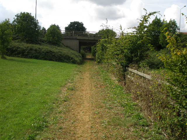
[21] Bridleway and road bridge near end of the walk
Once back on the right path, I continued on a sandy bridleway between the road and some new houses on the left. After two or three hundred yards, the path did indeed turn to the left, and continued between hedges with new housing estates either side. I went under yet another road bridge [21], and halted my walk at the second minor road crossing I came to. This would be the last place I could park at the start of my next walk, before Swan’s Way left Milton Keynes and re-entered the countryside.
It was now about 12.40, so I’d made reasonable time allowing for the 20 minutes or so I’d just wasted. I stopped for lunch about 1.30pm and got back to my car about 3.15pm. I took a totally different route to drive home, heading west and following signs to the A5 –this proved much better than the route through Woburn and Newport Pagnall I’d taken in the morning.
This was a much better walk than I’d anticipated. I’d expected a very boring trudge through the avenues and streets of Milton Keynes, and was pleasantly pleased by the amount of greenery I passed through. Much of the walk was through the Loughton Valley Park, and most of the rest had at least hedges between the bridleway and any residential areas. The Roman Villa and the Abbey buildings added a bit of historic interest, Loughton Brook was very pleasant in places, and I suppose the concrete cows at least had novelty value! I’m not sure I’d want to do it again, but I can honestly say that I enjoyed the walk and it was never the tiresome drag that I’d expected it to be. I have to say that I am very impressed with the way Milton Keynes provides for pedestrians, cyclists and even horse riders.
Total Distance: 14.9 miles each way, approximately