Pete's Walks - The Chiltern Chain Walk, Walk 8
If you are considering walking this route yourself, please see my disclaimer. You may also like to see these notes about the maps and GPX files.
Google map of the walkDownload GPX file of the walk
Walk 8 12/05/08 – Chenies and Chalfont St Giles (11.9 miles approximately)
Parked at Chenies.
If you are interested in walking this route yourself, click here to see the route description (but only if you have already read my disclaimer and notes regarding route descriptions).
WARNING: I would strongly recommend only doing this walk in the summer months, as the paths in the Chess and Misbourne valleys can be affected by flooding. Even in summer, the Chess Valley can be very wet. The Chess Valley can easily be omitted by simply following the bridleway from Lane Wood all the way back to Chenies, but there is no suitable alternative in the Misbourne valley (there is no continuous pavement beside the A413, and the straight path across Harewood Downs golf club is dangerous as it crosses a fairway where you are in a dip out of sight from the golfers and then goes across the driving range).
I started walking about 9.55am, having parked near the old water pump [1] on the village green in Chenies. It was another gorgeous spring morning, with hardly a cloud in the sky and the temperature already around 17C. I took the lane going south, immediately passing the school on my right. The route was familiar to me – I would be following parts of the Chiltern Way and/or Chiltern Heritage Trail for several miles, to beyond Chalfont St Giles. After a quarter of a mile or so the lane ended at a junction with the A404 – I spotted some Star-of-Bethlehem just before the junction, only the second time I’ve seen this attractive white flower.
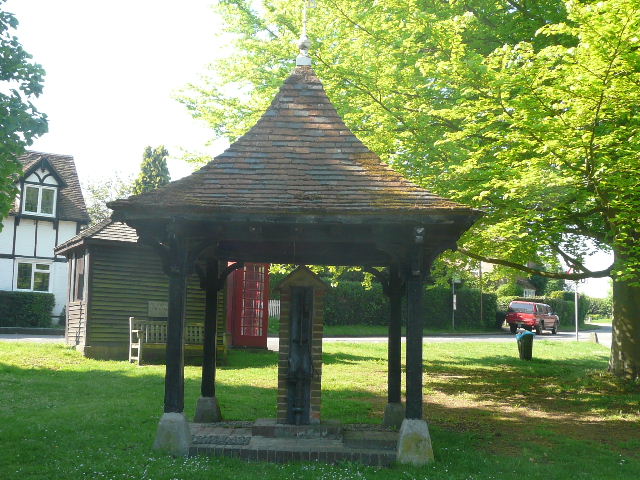
[1] Old pump on the green at Chenies
Chenies(originally Isenhampstead Chenies) derives its name from Thomas Cheyne, shield-bearer to Edward III, who was given the manor in 1326. There was once a royal palace here, that both Edward I and Edward III used. There were once several paper-mills in the village, powered by the river Chess.
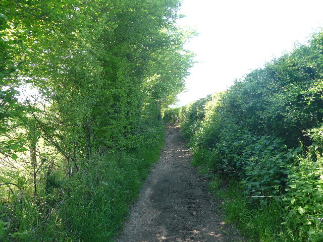
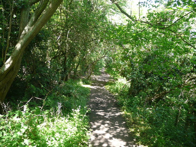
[2]The bridleway between Chenies and Chorleywood West
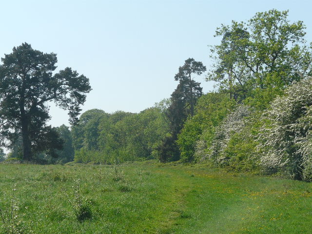
On the other side of the main road I continued along a lengthy bridleway running between hedges [2]. I looked out for and soon spotted some Herb Robert growing here – I’d remembered that the earliest sighting I’d had of it last year was here when I walked the Chiltern Way. I heard a Lapwing a couple of times somewhere beyond the hedge on my left, but didn’t see it. The bridleway passed a small wood on the left, and a little further on passed under a brick railway bridge [3]. It continued through a wood [4], initially mainly of beech. There was a surprisingly muddy section where it went down into a slight depression, before it rose again through an area of younger trees. The path then joined a good track [5], with a paddock on the left and part of the wood on the right. There was some Red Campion growing here. When the wood ended it carried on between the wooden fences of paddocks either side [6] (a lengthy section of the right-hand fence was completely broken down, making one of the paddocks unusable). Across the paddocks on my left, I could see the houses of Chorleywood West – this is Betjeman’s ‘Metro-land’, a curious mix of suburbia and countryside.
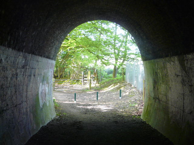
[3] Looking through the railway bridge, on the bridleway between Chenies and Chorleywood West
[4] The bridleway, continuing beyond the railway bridge
In 2004 a government survey of 32,482 neighbourhoods concluded that Chorleywood West had the highest quality of life in England, based on thirty seven criteria (the other top nine locations were also in the London Commuter belt, so as far as I’m concerned it’s yet more proof that there are ‘Lies, damn lies, and statistics!’). There was a Roman village at Chorleywood, with a villa thought to lie under the M25 here. In Saxon times it grew into a major town, with the border of Wessex and Mercia running through it. The town is famous for its Quaker connections – non-conformists flocked to the town, promised sanctuary by the towns inhabitants. William Penn settled the Pennsylvania colony with people from Chorleywood, Rickmansworth and the surrounding part of Buckinghamshire, though this had disastrous financial results for the town. It boomed again in the 19th Century through the paper and printing industries. The coming of the Metropolitan Line in the 1890’s led to an incredible population rise, which continued until the 1960’s. Sir John Betjeman described Chorleywood as “essential Metro-land”.
[5] Paddocks on the way to Chorleywood West
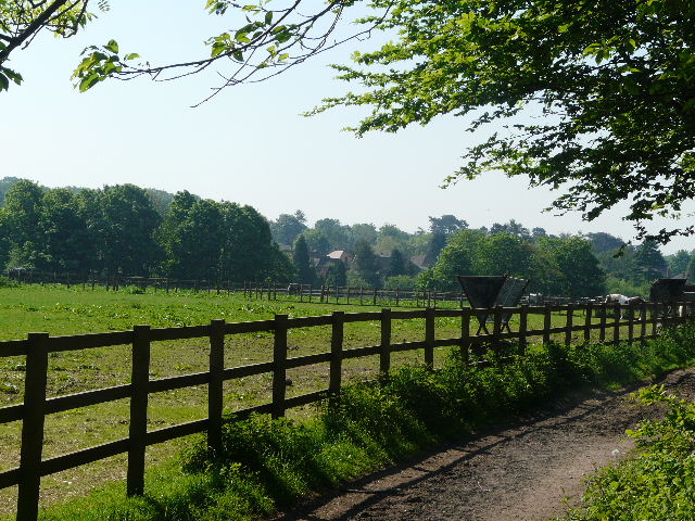
[6] The track between paddocks, approaching Chorleywood West
At the end of the track I turned left on a private road, with houses to my left and large paddocks to my right – I should mention that all the paddocks were bright yellow with buttercups and dandelions. At a crossroads I continued along Chalfont Lane ahead of me, with more plush residences either side. At the end, I turned right into Shire Lane – this soon turned sharply right, but I continued ahead along Old Shire Lane, as the name implies, once the county boundary between Buckinghamshire and Hertfordshire. There were more houses on the left, and the paddocks to my right, with woods and fields beyond [7]. A woman coming the other way saw my camera and guessed I was out to photograph Bluebells, but I explained I was interested in all wildflowers.
[7] View looking right from Old Shire Lane
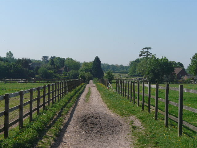
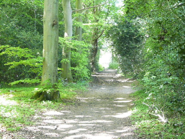
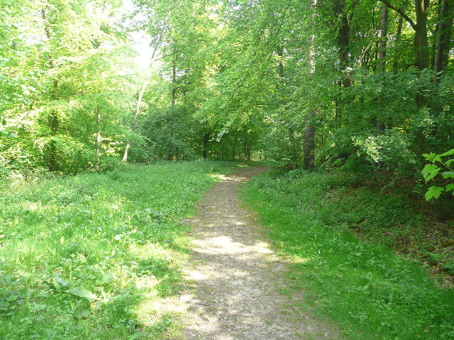
Further on, the lane became a track as it left the houses behind – it was now a good track, running for quite a distance beside Philipshill Wood [8], managed by the excellent Woodland Trust (this external link opens in a new window). After a while it started to descend gently. At the bottom of the hill, the track turned left, but I took a path going right, following a fence of wooden palings through part of the wood. I saw Yellow Archangel, Bluebells, Yellow Pimpernel and some more Red Campion amongst the flowers here. The fence and path curved slowly to the left through the wood, rising very gently to eventually reach a stile. The path continued alongside the right edge of a huge meadow [9], with part of the Chiltern Open Air Museum visible to my left (the museum is a collection of relocated old buildings representing the history of life in the Chilterns). I spotted some Cuckooflower growing beside the path here. I eventually went over another stile to reach a drive leading to both the museum and the Chalfont Campus of Buckinghamshire Chilterns University College. The latter is partly housed in Newland Park, originally built in the 1770’s and later owned by Abraham Newland, Chief Cashier of the Bank of England, whose signature was on five pound notes. I turned right for a few yards along the drive to reach a minor road.
[8] Old Shire Lane, running beside Philipshill Wood
[9] The path through the large meadow near the Chiltern Open Air Museum
Across the road the familiar path led along a thin belt of trees [10], once a continuation of the drive from Newland Park. Across a lane, the path passed between a garden hedge on the left and the fence of another small paddock. At a junction beyond the hedge the Chiltern Way went left, but I continued ahead, following the route of the Chiltern Heritage Trail, on a path that was initially between hedges on either side. Further on there was a large meadow to the right behind a large fence, with warning signs about guard dogs wandering loose. I passed some impressive conifers, and then the path ran between garden fences to reach a residential street on the edge of Chalfont St Giles. The path continued as an alleyway on the other side, running steeply downhill between wooden garden fences. It came to another street, where I continued along a narrow residential road opposite. Where this ended, I continued down another alleyway to emerge near a major road junction with mini-roundabouts. I went over a pedestrian crossing and took the road opposite, leading down into the busy but attractive centre of the village [11].
[10] Path through the tree belt, leading away from Newland Park
Chalfont St Giles is mentioned in the Domesday Book, the name Chalfont meaning ‘chalk spring’ . The parish church dates to the 12th century, and has some fine 13th century wall paintings, a rare example of painted battlements (dating from the 15th century), and also 17th century inscriptions of the Ten Commandments, the Creed and the Lord’s Prayer. The poet John Milton fled to Chalfont St Giles in 1665 to escape the Great Plague of London, and it was here that he completed ‘Paradise Lost’. It was also here that a local friend persuaded him to write its sequel, ‘Paradise Regained’. Milton’s Cottage still exists and is open to the public. ‘Chalfonts’ is the cockney rhyming slang for piles.
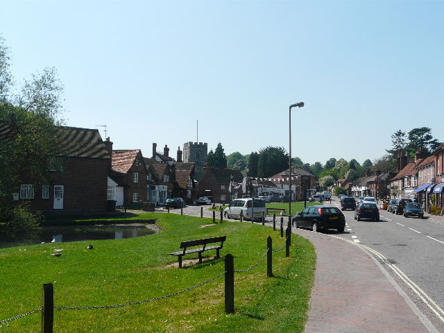
[11] Chalfont St Giles
I passed the pond on my left, and noticed signs announcing that today was the first day of a six-day literary festival here. Beyond the village green I took the familiar path on the right (part of the South Bucks Way as well as the Chiltern Way), initially along a private drive with some large residences either side. The drive turned left after about quarter of a mile, but I continued ahead on the path along the Misbourne Valley [12]. This ran through a thin belt of trees, then along the drive of a row of houses (I spotted a black rabbit here!). It continued on a short section of lane, then between the fence of a meadow on my left and a large hedge on the right. I saw a Speckled Wood butterfly here, but could only get a photo of it with its wings closed together. The path along the valley then ran through another belt of trees [13], where I spotted some Wood Avens. The Chiltern Way soon turned left, but I carried on almost to the end of the tree belt before turning right.
[12] The path along the Misbourne valley
[13] The path along the Misbourne valley
The path here was slightly overgrown with nettles, running alongside the wire fence of a flat cattle pasture on my right. I crossed the river Misbourne on a narrow and rather precarious wooden footbridge [14], with a hand-rail on only one side. The river was flowing quite nicely, though more a stream than a river – when I’d been here before there’d be none or very little water in evidence at all. The path then followed the left edge of another meadow, again spattered with bright yellow flowers. I re-crossed the A413, the main road through the Misbourne valley, and took the path opposite through a golf course. I crossed a couple of fairways, with a green and a tee on my right, then followed the edge of a small wood on my right, before crossing another couple of fairways.
[14] The river Misbourne, from the rickety footbridge
I passed the second of two small white posts marked ‘public footpath’ but then the path virtually petered out in the long grass beside another fairway on my left. I knew from past experience there was a decent path just inside the edge of the wood on my right, but there was no way of getting to it through the scrubby bushes between the long grass and the wood. I followed the rough grass ahead, going uphill beside the bushes – there were footprints through the long grass, but whether those of another walker or of a golfer hunting for his ball, I don’t know. I reached the green at the end of the fairway, and here managed to get through the trees and join the clear path running inside the edge of the wood. I followed this ahead for some distance. Twice it emerged back onto the golf course [15], only to immediately go back into the trees. Just after the second time it did this, I turned left at a path junction and crossed part of the golf course between some greens to reach the start of an alley between garden fences that led to a minor road.
[15] View out across the golf course
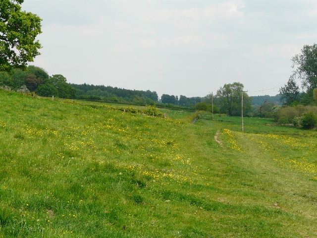
I turned right, passing a few houses, and then went half-left on a narrow lane or private drive between more houses. At its end I continued on a path, following a hedge on my right beside a huge corn field [16]. The path curved slightly left, with views over the field to a valley. At the end of the path a man and a woman were sitting by the edge of the field, the latter sketching – I said ‘Good Morning’ politely as I went by, but the man just stared at me blankly. Very odd. The path now crossed over the end of a line, and then ran between a wooden garden fence and a thick hedge. It then went through three meadows [17] or paddocks, following a hedge on the right through the first two, then one on the left in the third. There were horses in the first and third of these fields, and as with most other meadows or paddocks today, they were bright yellow with Dandelions and Buttercups. I then came to another larger field – I crossed it diagonally to a far corner, close to where seven horses grazed, then turned sharp right [18] to follow the hedge back to another corner of the same field. The path continued through yet another yellow paddock or meadow, then went through some allotments and followed a short drive to reach a main road between Amersham (immediately to my left) and Little Chalfont.
[16] The long field path, south of Little Chalfont
[17] Path through the first of three successive meadows, south of Little Chalfont
[18] Another meadow, just south of Little Chalfont
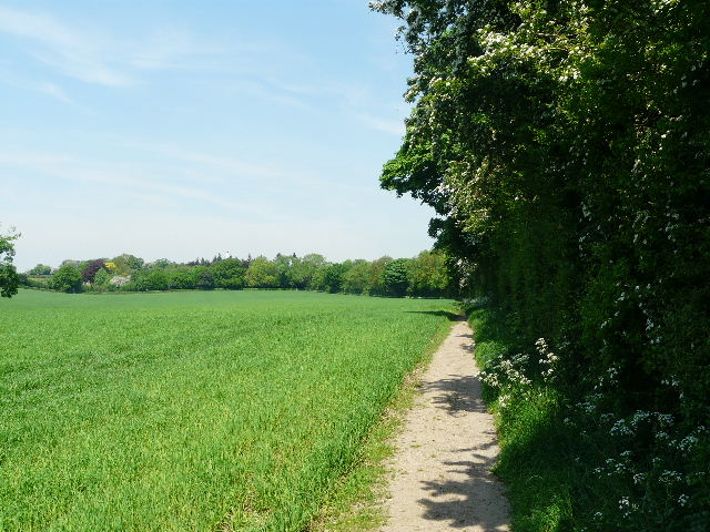
I turned right along the road for a couple of hundred yards or so, then took a path on the left. This ran along the edge of a small field, with the buildings of Little Chalfont to my right and then went over a footbridge across a railway line (there was metal caging across the top of the bridge, presumably to prevent people throwing objects onto the track). The path then followed a hedgerow beside two large arable fields [19], with an attractive barn conversion over to my left. Beyond the second field, the path ran between hedges on either side and ended at a track carrying a bridleway, where I went right and soon entered Lane Wood.
[19] Field path north of Little Chalfont
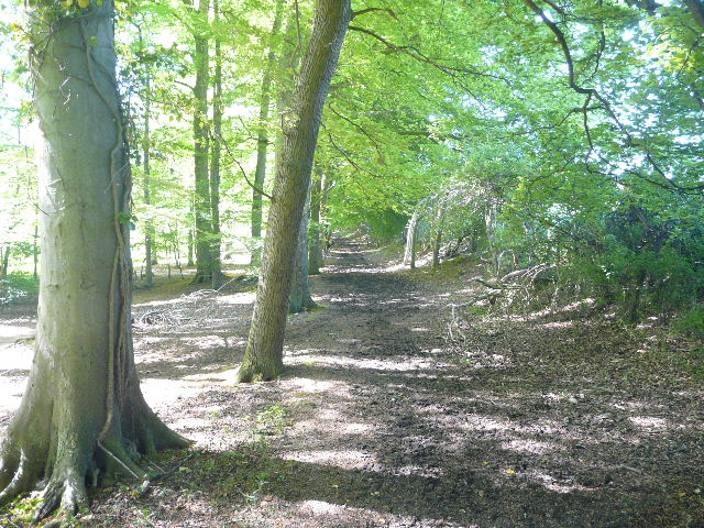
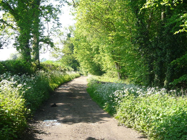
The bridleway immediately forked right at a junction, and ran along just inside the right edge of the wood, which sloped down on my left into the Chess Valley. The path was dry and well-surfaced, and this was a very attractive stretch of the walk [20]. I saw Herb Robert, Yellow Archangel, Wood Speedwell and Garlic Mustard beside the woodland path, and further on came across the largest clump of Woodruff I’ve yet seen. After quite some distance the bridleway went down a slight dip and up the other side, then emerged from the wood to follow a drive a few yards to a lane.
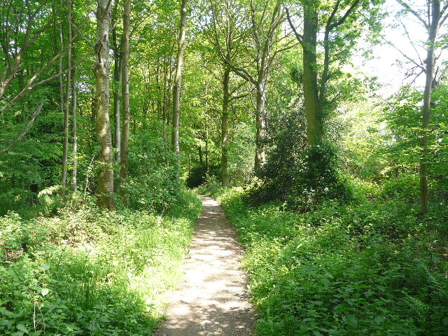
[20] The path through Lane Wood
[21] The path through the wood on the other side of the lane
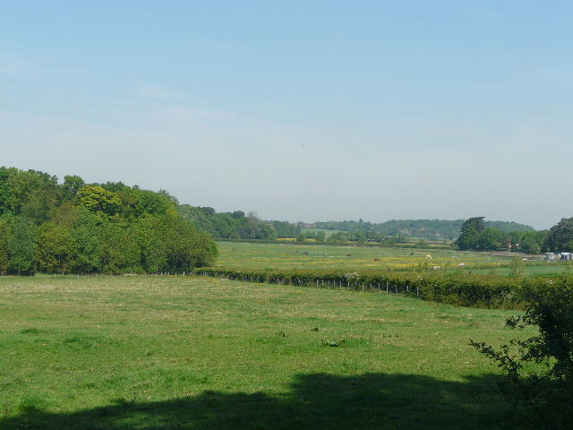
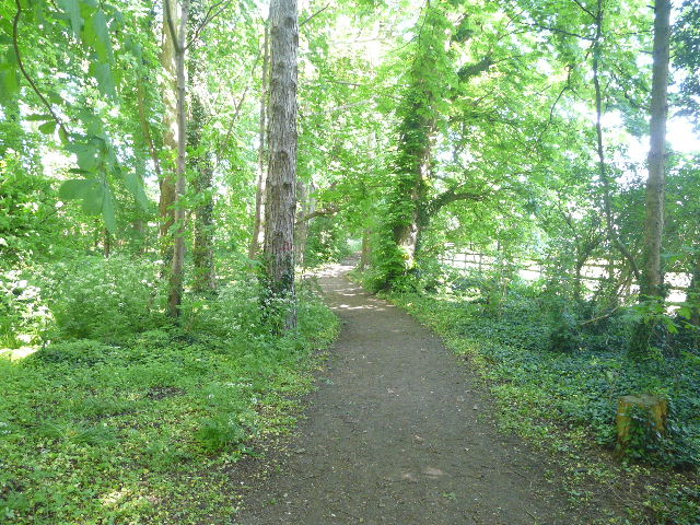
Immediately across the lane, I left the bridleway by forking left on a path descending through the trees of another wood [21]. There was more Wood Speedwell, some Bugle and a large amount of Yellow Pimpernel here. I forked left onto a narrower path, that ran close to the bottom edge of the wood. I kept left at a couple of path junctions to reach a metal kissing-gate, which gave access to a meadow that had some impressive horse chestnuts trees [22]. I crossed the meadow, admiring the view to my right along the Chess valley [23], to reach the minor road that runs through the valley. On the other side I crossed a small paddock, and then followed a drive across the river Chess – there was an impressive weir on my left [24], surmounted by a small statue. On top of the hill in front of me was the grand Latimer House [25].
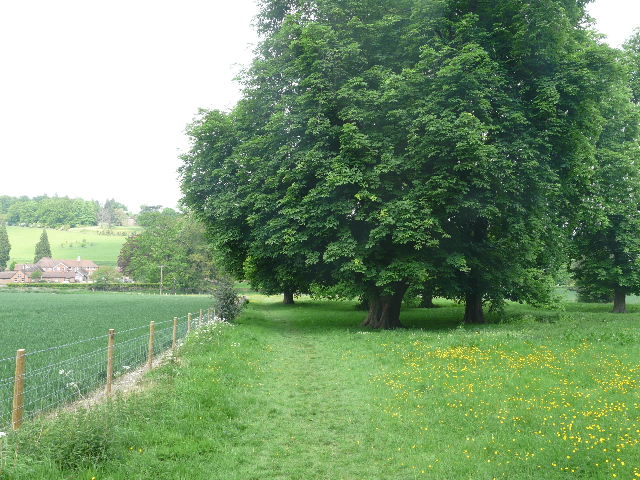
[22]The path through the meadow in the Chess Valley, just before crossing the road near Latimer
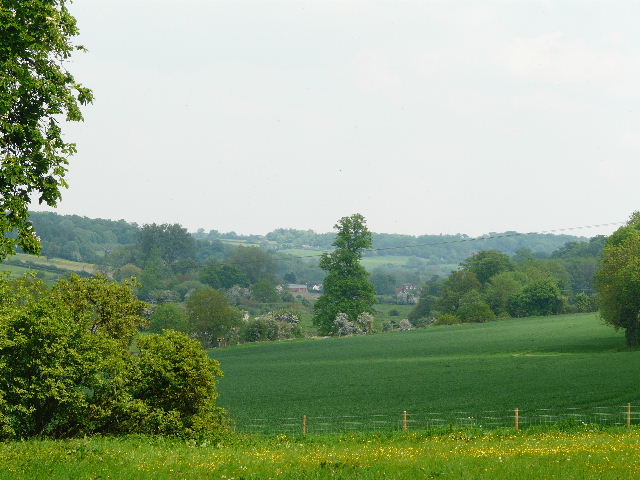
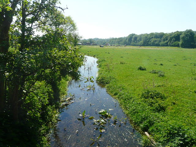
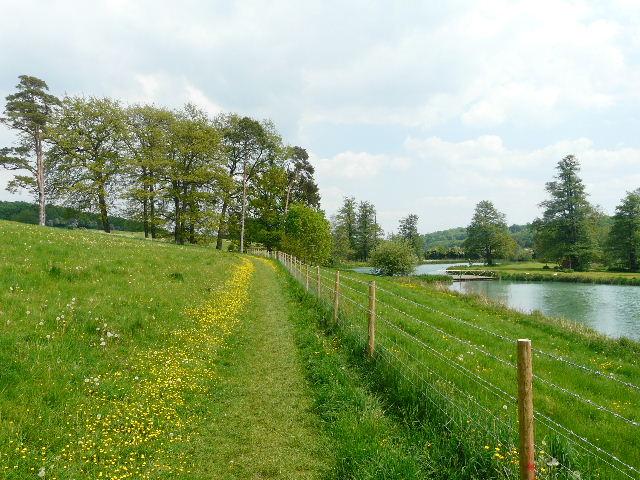
[23]View east along the Chess Valley from the meadow
The current building called Latimer House dates only from 1838 after a disastrous fire gutted the previous building. That had been acquired by Sir William Cavendish in 1615, and had remained in his family for almost 350 years. In the late 18th century, houses were removed from the valley and a lake created in order to improve the view from the house. From 1847-1971 the house was home to the military Joint Service Defence College, and it is now a conference centre.
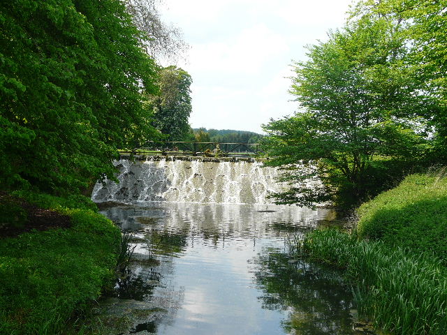
[24] The weir on the river Chess, near Latimer
[25] Latimer House
I turned right through a kissing-gate, and followed a path that initially ran parallel to the river on my right [26]. It then curved slightly left, as the river turned the other way, crossing another pleasant yellow-bespattered meadow to reach a lane on the edge of Latimer. On the other side, I started to retrace part of my previous walk, the path going through a large cattle pasture [27] (empty, today the black cattle were on the other side of the river). It then followed a left-hand fence through a small field of rough grass, beyond which it came to a junction with another path and a bridleway. Here I sat on a stile to eat a very late lunch. It was 2.05pm, and I’d already resorted to eating a second Alpine bar to keep the hunger pangs at bay, there just hadn’t been anywhere else to stop. This was the same stile where I’d had lunch on my previous walk!
[26] The path along the river Chess, near Latimer House
[27] The path along the Chess Valley, just east of Latimer
I joined the bridleway which continued along the valley between hedges – the river came very close at one point (I’d seen a Little Egret here on my previous visit). I saw some more Wood Avens growing here, and some Wintercress, something I’d not seen before and which I had to get identified on the ‘Wild About Britain’ site. The bridleway then went through Mill Farm to a lane, where I turned left, almost immediately stopping to take some photographs as I went over a bridge over the river – I always take shots here of the attractive views along the valley [28]. The lane soon ended at the minor road through the valley. On the other side I followed a steep path uphill through a wood, then continued with tall brick walls either side to reach Chenies Manor [29]. I turned left down the drive, with the impressive church on my left [30], to return to the green and my parked car.
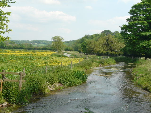
[28] The river Chess from the bridge near Mill Farm
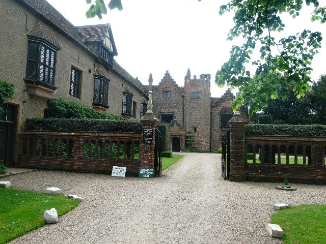
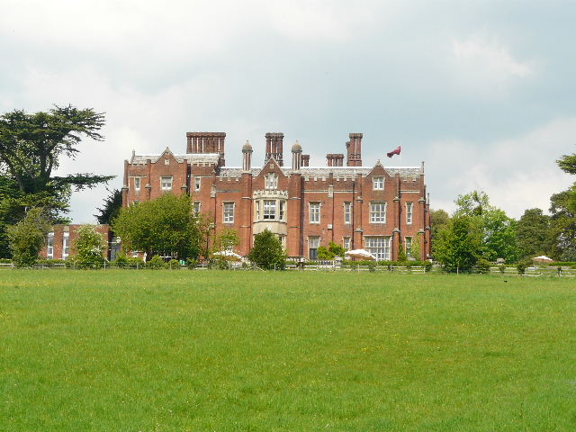
[29] Chenies Manor
Chenies Manorwas built around 1460 by Sir John Cheyne, and in 1494 was inherited by the Earl of Bedford. It was restyled in 1560 by Francis Russell, 2nd Earl of Bedford. Both Henry VIII and Elizabeth I stayed here. It remained in the Russell family until 1954, and there is a Bedford chapel in the adjacent church of St Michael. The house is open to the public at certain times, and has a mediaeval well, a priest hole and a dungeon. It is noted for its gardens, which include two mazes.
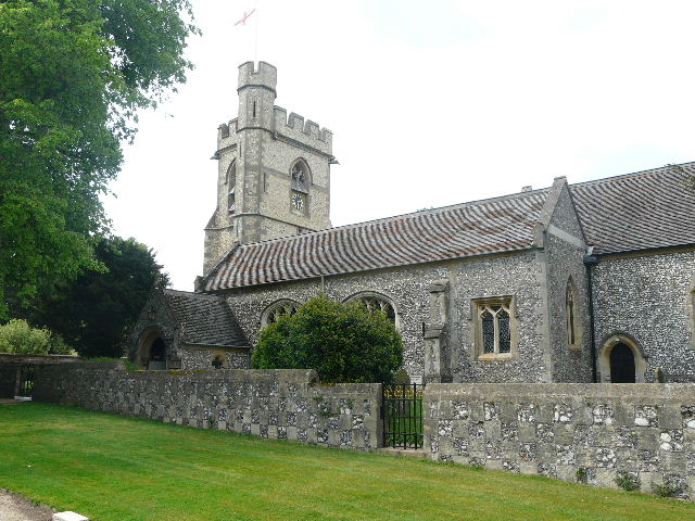
[30] The church at Chenies
This was another enjoyable walk, on a generally bright and sunny day although the skies had clouded over a bit by about 1.30pm. I was very familiar with the first half of the walk, but was quite happy to do it again. There was a good mixture today of woodland and field walking, and the Chess valley is always very pleasant to walk through. Chenies Manor and Latimer House added some historic interest, and there was the usual wide variety of wildflowers. The meadows and paddocks throughout the route were especially attractive today because of the profusion of yellow Dandelions and Buttercups.
Total distance: 97.7 miles
(To see this walk repeated IN THE OPPOSITE DIRECTION on 13/11/12, CLICK HERE)