Pete's Walks - The Chiltern Way (2)
If you are considering walking this route yourself, please see my disclaimer. You may also like to see these notes about the maps and GPX files.
Day 15 26/04/07 Colstrope to Maidensgrove (7.7 miles each way, approximately)
Parked in road in Skirmett.
I parked on the road in Skirmett as I didn’t think there would be anywhere to park in Colstrope, and so started the walk by going about a mile south down the Hambleden valley to Colstrope. I had a quicker journey this morning, taking only an hour as I’d expected, and left Skirmett by 10.05am, reaching the end of yesterday’s walk 20 minutes later. It was a gorgeous morning as I turned round at Colstrope and headed back towards Skirmett – blue skies and beautiful green countryside. I tried to walk quite quickly, as I realised I’d be spending a lot of time taking photographs today.
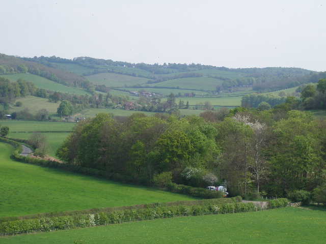
From Colstrope, the Chiltern Way continues northwards along the Hambleden valley, following the flat valley bottom with steep hillsides surmounted by woods on either side [1]. The path first followed a left-hand hedge through a green field [2]. Already I could see Cobstone Mill about two miles ahead, on top of a hillside between Turville and Fingest. It overlooks a point where four smaller valleys meet and the Hambleden Valley starts southwards to the Thames. The white-painted, eighteenth-century smock mill is thus visible for some distance in several directions. Like the village of Turville below it, it is a popular setting for films and TV, and is probably best known as the windmill in the film Chitty Chitty Bang Bang.
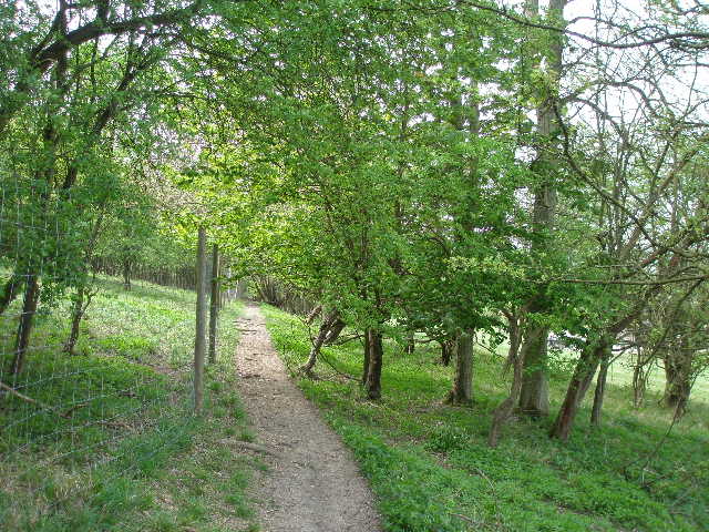
After the first field the path became a green lane between hedges – I remembered this short section of path well, as the numerous protruding tree roots across the path always reminds me of walking along the wooden sleepers of a railway line. I crossed a quiet lane and followed a permissive path across a small green meadow, then crossed two large empty pastures towards Arizona Farm [3]. When I did a circular walk round here in late January, I saw some Fallow Deer entering a field on the hillside about half a mile to my left. For some reason I decided to stop and count them as they ran into the field, expecting there to be maybe 20 or 30, the sort of number I regularly see around Ashridge. 10 … 20… 30 … 40 … they just kept coming … 70 … 80 … eventually I counted 180! Not only that, but as I walked on I saw two further groups of about 20-25 a short distance to my right. I looked but didn’t see any at all this morning (I saw about 20 Fallow Deer right at the end of the walk, on the opposite side of the valley as I was walking downhill back to Skirmett). Needless to say, I had of course already seen several Red Kites this morning.
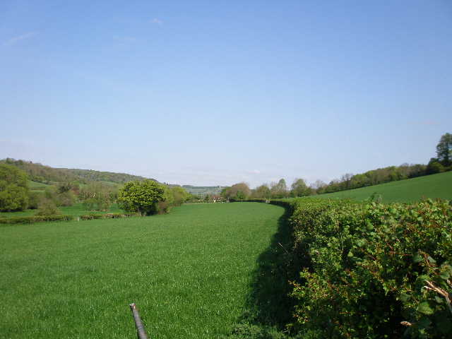
[1] The Hambleden valley, immediately north of Colstrope
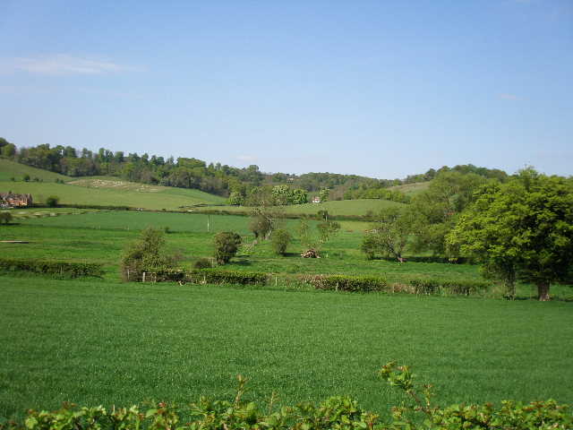
[2] Looking west across the Hambleden valley, just north of Colstrope
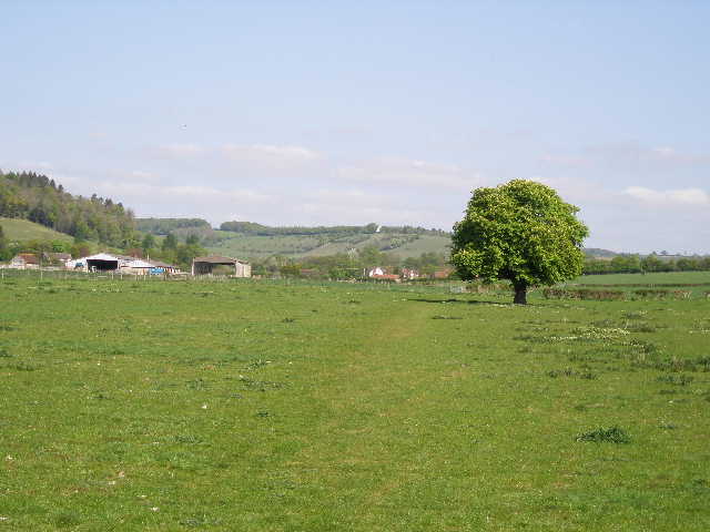
[3] The path approaching Arizona Farm, south of Skirmett
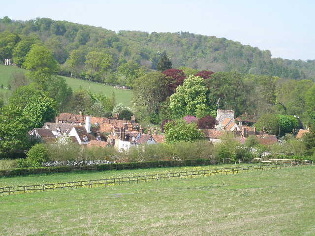
From near Arizona Farm the path continued alongside a left-hand hedge, with an attractive view ahead over the roofs of Skirmett towards Cobstone Mill atop its steep hillside. The path then entered a large pasture where four or five horses were grazing, and on the far side reached a lane on the edge of Skirmett. Like nearby Fingest, Skirmett has always been a hamlet within the parish of Hambleden. Unusually for this part of the country, its name is of Norse origin, meaning ‘Shire meeting place’. The popular village pub is called The Frog. It was originally the King’s Head but after it went through a spell when it had a bad reputation (for some reason) it was decided to rechristen it, to mark a break with the past. Apparently the new name was chosen because Skirmett rhymes with Kermit!
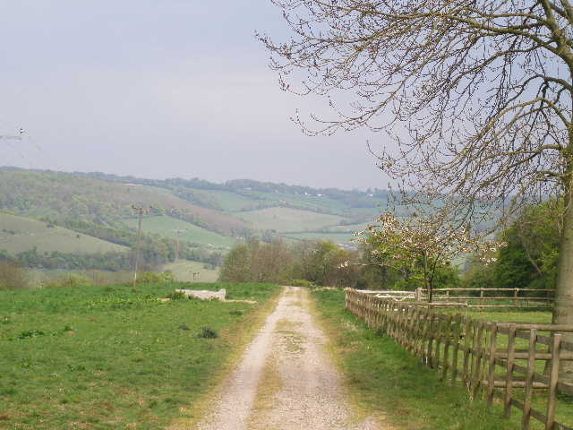
I turned right along the lane, soon leaving behind the pleasant brick-and-flint cottages of Skirmett. After a couple of hundred yards I turned left onto a footpath, which ran alongside the left-hand hedge of a large sheep pasture, roughly parallel to the main road through Skirmett so that there were houses a short distance to my left. When I walked through here almost two years ago, I saw six Red Kites and a Buzzard – today I saw just two or three Kites. At the far corner of the field, I turned right alongside the fence to walk a second side of the large sheep pasture. Several lambs and their mothers fled out of my way as I followed the fence, very gradually rising uphill. To my left I could see Fingest a short distance further along the valley – that was the next settlement I’d come to, but the Chiltern Way takes a rather roundabout route to get there, for reasons which would soon become clear. I next crossed a corner of a large empty grass field, and then continued uphill, steeper now, along a stony track between hedges. This soon reached Adam’s Wood, where the track soon narrowed to a path as it continued the steep climb – I was grateful for the shade of the trees, as it was already quite warm [4].
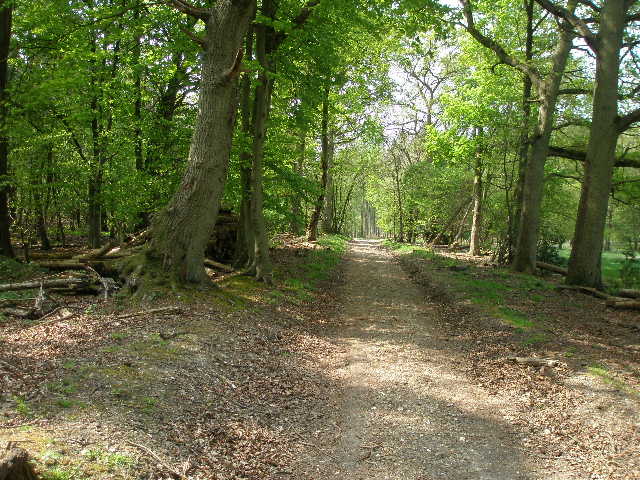
The path continued steeply for a short distance, then the gradient eased considerably as the path wound its way through the trees, mainly young beech but with other types as well. Some parts of the wood had a good carpet of Bluebells. After almost half a mile of pleasant walking through the wood, the path ended at a junction with a track. I turned left, and after a few yards left the wood. The Chiltern Way now crossed a large meadow, surrounded by trees on three sides. To my left, the meadow disappeared from view as it curved gently downhill towards the Hambleden valley, hidden out of view below. For no apparent reason, this meadow reminded me of the opening sequence of The Sound of Music, and I had visions of Julie Andrews coming over the horizon singing ‘The Hills are alive …’.
[4] Looking back along the path through Adam's Wood
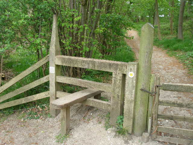
[5] Fieldfare's Stile
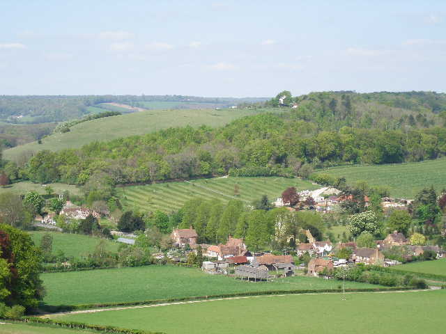
[6] View over Fingest towards Cobstone Mill, from Fieldfare's Stile
On the far side of the meadow, I followed a short path through Fingest Wood, now heading downhill. On the far side I went over a stile [5] into another sheep pasture. The stile here is a memorial to Henry Fearon, who as ‘Fieldfare’ wrote much about walks and the countryside. Apparently he loved the view from this point, and it was easy to see why [6, 7]. I am sure this is the reason for the Chiltern Way taking such a roundabout route between Skirmett and Fingest, and the climb up through Adam’s Wood was certainly worth the effort – the view here is magnificent. Steep valleys extended to my left and right, and another valley led directly away in front of me – all were a lovely mixture of green fields and woods. Below me and slightly to my left, was the hamlet of Fingest, with typical Chiltern houses of brick-and-flint, surmounted by red-tiled roofs. The church there with its massive and imposing tower was partially obscured by trees. Behind the village I could see Cobstone Mill on top of its hill.
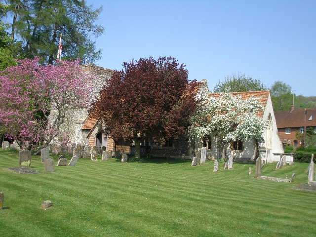
I followed the path steadily downhill to the left, alongside the wood at first. I crossed a stile to leave the sheep pasture, and followed a hedge on my left to reach a lane, where I turned left to reach Fingest (another Norse name, meaning ‘meeting place in a spinney’). I passed the seventeenth-century pub (‘The Chequers’) on my left, and the church on my right [8]. The church dates mainly from the late twelfth-century, with the chancel dating from the following century. The massive tower is very impressive, and is surmounted by a very unusual double saddleback roof.
Just past the church, I left the road as it started turning left, and continued ahead on a footpath, initially with a wooden garden fence on my left. The path climbed slightly into a small beech wood, where I turned left at a junction and soon reached a lane (going steeply uphill towards Cobstone Mill). On the other side, the path continued through a belt of scrubland, with a wire fence and a steep grassy slope on the right. I saw some Forgetmenots and Herb Robert growing along here. Across another stile, I came to another nice view point, looking along the descending path ahead of me towards the attractive village of Turville [9], with Cobstone Mill on top of the very steep slope on my right. I followed the path across a meadow to the edge of the village, and turned left to reach the centre of the village in a few yards. When I walked here in January, I took a diversion by turning right and taking the steep path up towards the windmill [10] – if anything the path is even steeper than it looks, but there are some nice views from the top of the hill.
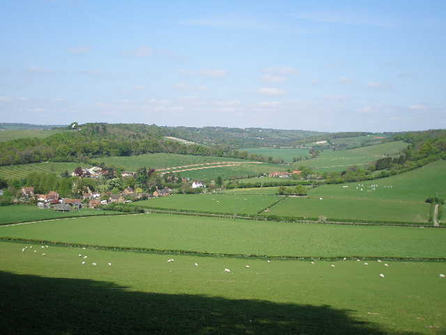
[7] View from Fieldfare's Stile
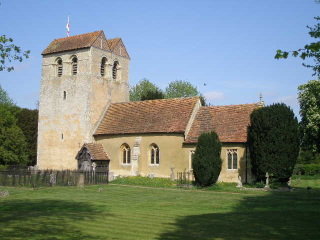
[8] Fingest Church
[9] Turville, from the path from Fingest
<Like Hambleden and Cobstone Mill, Turville is often used as a setting for films and TV. In recent years it has acquired a certain fame as the setting for ‘The Vicar of Dibley’ (a pleasant enough comedy that has its moments, and written by Richard Curtis whom I greatly admire, but how on earth was it recently voted third best British sitcom ever?). I saw the village pub, ‘The Bull and Butcher’, on Midsomer Murders recently (I think that’s the third or fourth time I’ve mentioned that programme in these journals, not because I especially like it but it seems to have been largely filmed around the Chilterns).
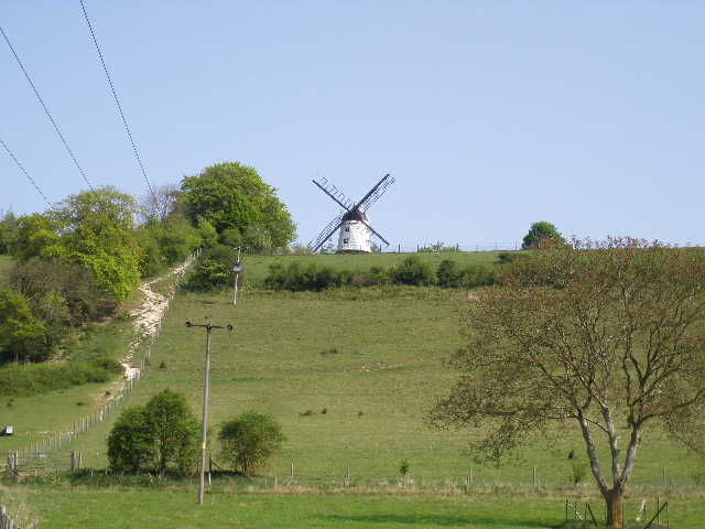
[10] Cobstone Mill from just outside Turville
[11] Turville church
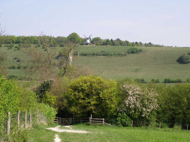
[12] Looking back to Cobstone Mill from the path from Turville to Southend
When I walked through here two years ago, the signpost for the Chiltern Way was pointing completely the wrong way – I heard later that it had been put back incorrectly by a film crew. There is an interesting story relating to the church in Turville [11]. In 1900, an ancient stone coffin was discovered buried under the floor – when opened up, it was found to contain not only the body of a thirteenth-century priest, but also that of a seventeenth-century woman with a bullet hole in her skull! (Perhaps an earlier attempt to install a female vicar in ‘Dibley’ hadn’t been quite so successful!).
I crossed the village green, with the pub to my left and the church to my right, and continued along a short village street until it ended, just past the school on my right. A well-used footpath continued ahead, running between high hedges for 200-300 yards to a stile. I then followed a right-hand hedge through a very large and empty meadow [12], the path rising and falling gently before rising again – there were nice views across the fields to more woodland ahead and to my left, with several Red Kites to be seen. Across a lane, the path continued more steeply uphill to reach a wood – there were two or three Kites very close here, and very good views back towards Cobstone Mill and towards Fingest [13]. A concrete drive continued up the slope through the wood and continued at an easier gradient through an empty pasture to Southend Farm. This was a much longer and steeper climb than I remembered from two years ago – perhaps because my mind was then distracted by the bull in this field!
[13] Looking towards Fingest, from the path to Southend
[14] Looking back along the Drive to Southend farm
[15] Southend
I continued along the farm drive, now on level ground [14], to the hamlet of Southend (so named because it is at the south end of Turville parish). As I reached the green there [15], I saw a small blue butterfly flying along the holly hedge on my right – it had distinct dark patches on the edges of its wings. I managed to get a rather distant photo of it before it flew of, and later managed to identify it as a Holly Blue. I turned left along the road through the hamlet for about 100 yards (I finally managed to get some photos of Orange Tip butterflies here on my way back), before turning right on a good track descending through the largely coniferous Kildridge Wood [16]. There were several Speckled Wood butterflies here, as the path descended gently towards a valley, before contouring round to the left. I had to climb over several fallen pine trees here, obviously the victims of a recent storm.
I soon reached a tall gate in a wire fence, where I entered the Deer Park surrounding Stonor House. Once through the gate, I continued alongside the wire fence on my left [17], at first through bushes but then with the views to my right opening up as I entered typical parkland scenery of scattered trees. The path continued to generally descend, though there were one or two slight undulations. Soon there was a good view ahead over the parkland to another typical Chiltern valley [19]. I stopped to photograph Stonor House and its adjoining Roman Catholic chapel [18], over to my right. Both date from around 1280, and have always been owned by the Stonor family (granted the title Baron Camoys in 1838). The house and chapel have undergone many changes over the centuries, and the house now looks largely Georgian, although the chapel still looked much older to me. The house is open to the public from April to September, and also stages various events, such as a VW owners rally and a Jools Holland concert (see http://www.stonor.com/home.htm for more details about the house and the events held there).
[16] Start of the woodland path from Southend to Stonor
[17] Path through the grounds of Stonor House
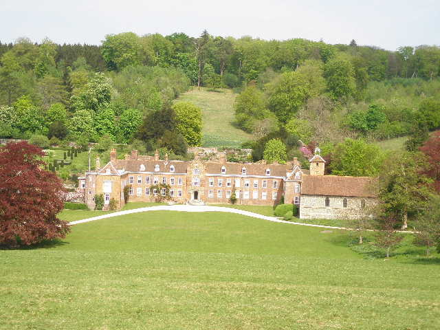
[18] Stonor House and its chapel
The path finally went down a fairly steep grass slope to a gate in the rail fencing bordering a road, where I turned left into the village of Stonor – the footpath sign here said it was 1½ miles to Southend, which had been almost all downhill. I walked about a quarter mile or so through the village, noticing one or two Red Kites flying above the village, then turned right. The footpath took me uphill across a large pasture, where there were a few cattle including some young calves, and then more steeply through a large open meadow, passing a small copse on my right. There were good views to both sides along the Stonor valley, and also back over the village to Stonor House. Over the wood ahead of me, I again saw a Buzzard happily sharing the skies with a couple of Red Kites.
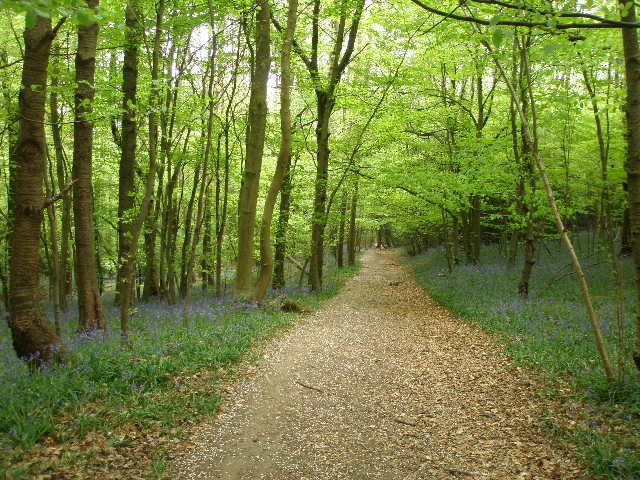
The path entered Park Wood [20], and continued uphill through the beech trees. It then crossed a field that seemed to be more clover than grass. On the far side, a short track going left led to the end of a lane in Maidensgrove, a very remote hamlet situated on a ridge giving extensive views over the surrounding hills and valleys. I followed the lane for about a quarter of a mile, then took a track going half-left where the lane turned right. This took me out onto Russell’s Water Common [21], a vast flat area of grass partly circled by woods. I followed a track that went along the left edge of the common as far as a bend in a lane, which was as far as I was going today.
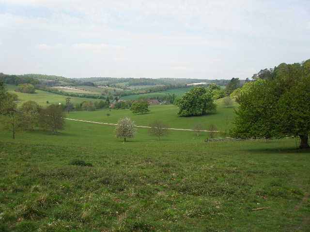
[19] Looking north along the Stonor valley from near Stonor House
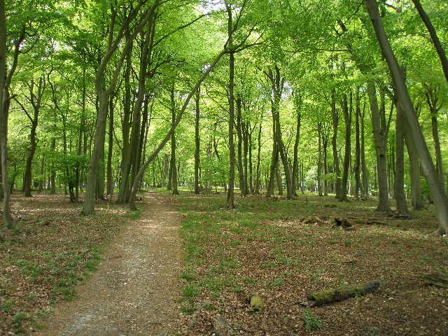
[20] Path through Park Wood
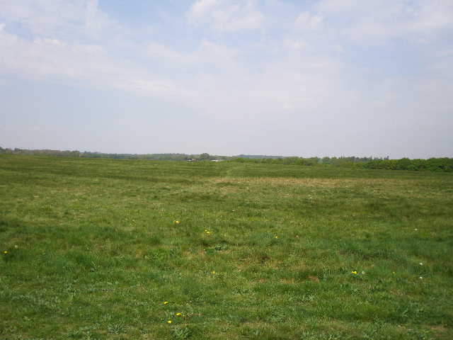
[21] Russell's Water Common, near Maidensgrove
On the way back to Skirmett, I stopped for lunch on a stile on the edge of Park Wood. The walk back was just as pleasant, with many fine views over the wooded hills and green valleys. The weather changed however – I noticed the skies ahead of me were now grey rather than blue, and I had a few spots of rain during the last mile or two from Fingest to Skirmett. But that didn’t detract from what had been a marvellous walk.
This was the most enjoyable walk I did when I walked the Chiltern Way almost two years ago, and it didn’t disappoint me today. I have already been back to walk in this area once before, and I’m sure I’ll be back here again. This walk had everything I’d want from a walk in the Chilterns – some quite steep ups and downs, beech woods and other woods, some great views, Red Kites and Buzzards, quaint villages with interesting histories. I saw several butterflies, including one that was new to me, and several wildflowers (I haven’t mentioned many of the more common ones that I saw today). I could hardly have had a better day’s walk.
Total Distance: 110.8 miles each way