Pete's Walks - The Chiltern Way (2)
If you are considering walking this route yourself, please see my disclaimer. You may also like to see these notes about the maps and GPX files.
Day 16 30/04/07 Maidensgrove to Crocker End (6.8 miles each way, approximately)
Parked on Russell’s Water Common.
The drive this morning took me an hour and ten minutes again – unless my memory is playing tricks (a perfectly plausible scenario!), there are several new speed restrictions on the roads since I did this walk two years ago, and several existing speed limits have been reduced by 10mph. It’s quite a pleasant route to drive, apart from a nasty infestation of speed humps in Chinnor, but the almost continuous speed limits are a bit frustrating. I’ve nothing at all against speed limits in general, far from it, but some of them on completely rural roads seem a bit unnecessary.
As today’s walk was not my usual ‘walk 7.5 miles, turn round and come back’ routine, I’d better spend some time explaining the route I followed today. Firstly, let me explain about the ‘Ewelme loop’ (it took me several readings of different sections of the guide book before I got my head round this!). The Ewelme loop is a section in the far south-western corner of the original route of the Chiltern Way, where about 10 miles of the way turns back on itself to finish within ½ a mile of its starting point. The guide book mentions a ‘short-cut’ that crosses this gap, thus giving the possibility to shorten the whole Chiltern Way by about 10 miles, or else of creating a 10 mile circular walk. To complicate matters, the southern extension branches off the original route about ½ mile before the ‘short-cut’ begins, and rejoins the original route about halfway round the Ewelme loop. I want to do all of the original route, plus the extensions, and also the ‘short-cut’ (just for completeness - not sure how ‘official’ it is). So, from today’s starting point, I walked ½ mile to where the southern extension splits off (left) from the original route, stayed on the original route for another ½ mile to where the short-cut splits off (right) from the original route, walked the ½ mile short cut each way, continued on the original way about 5 miles to where the southern extension rejoins it (from the left), turned round and retraced my steps all the way to where the southern extension began, walked about 1 mile on the southern extension and the same back again (this was just to bring today’s mileage up to my normal 14 or 15, and to finish at a convenient place for me to park next time), and then the last ½ mile back to my car. The point of this convoluted walk was that it means I now only have to complete the southern extension and the rest of the original route, with no more ‘side-trips’ required. Hopefully the map might make this all a bit clearer!
This was another gorgeous day for walking – blue skies, but with quite a stiff breeze that kept the temperature down nicely. I set off from Russell’s Water Common near Maidensgrove at about 10.15am, following a farm track running between tall hedges that started by a corner of the road through the common [1]. After about 200 yards, the right-hand hedge ended, and I turned half-right on a clear path running through a field of beans. The path went steadily downhill, towards a corner of a wood. The path entered the wood a few feet from its right edge, and kept roughly parallel to the edge as it progressed through the young beech trees.
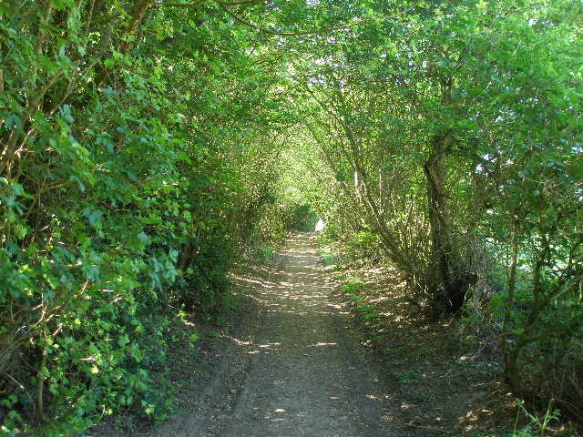
[1] Track leading away from Russell's Water Common
[2] The bridleway along Upper Bix Bottom, part of the Original Route of the Chiltern Way
[3] The bridleway along Upper Bix Bottom, part of the 'Ewelme Loop'
At the end of the wood, I went over a stile and went half-left, the path going steeply downhill across an empty sheep pasture (if it was empty, how do I know it was a sheep pasture? The ground was littered with evidence, and there was an open gate into a pasture that did contain sheep). I saw both a Buzzard and a Red Kite here. The path then descended a steep flight of steps through a wide belt of trees, a nature reserve owned by the local Wildlife Trust. I then continued downhill across another empty pasture, to reach the floor of the valley of Upper Bix Bottom.
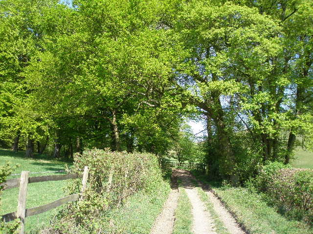
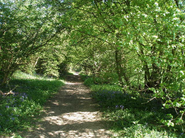
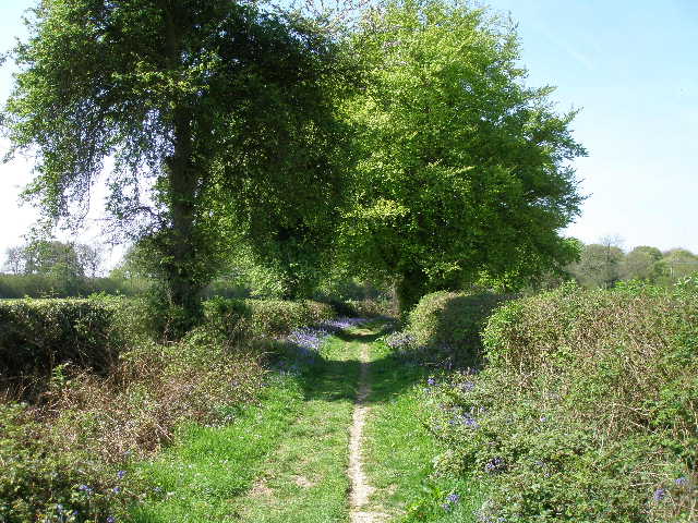
Here there was a T-junction of bridleways, with two footpaths also arriving at the same point (the path I had just followed, and the one carrying the southern extension of the Chiltern Way which I’d follow later). I turned right along a bridleway on a good track along the valley bottom [2], staying on the original route of the Chiltern Way. There was a green field over the hedge on my left, while over the hedge on my right was a few feet of flat grass before a very steep downland slope of grass and occasional scrub. I then passed a small bit of woodland on my left. At its end, the Chiltern Way went left, but I continued ahead on the track to do the half-mile ‘short-cut’ that closes the ‘Ewelme Loop’. This was a straightforward walk along the broad track [3], with hedges either side. There were many Bluebells along here, but few other wildflowers. I went straight on where a bridleway (no signpost) went left, then turned round at the next path junction (where a bridleway went right), where I met the return route of the Chiltern Way, and walked back the half-mile to the junction at the end of the wood.
The path, now on my right, immediately forked and I took the right fork, going through the small area of trees and over a double-stile into a huge pasture. It followed a line of trees on the right edge for a short distance, then started quite steeply uphill, aiming to the left of some trees that marked the site of an old chalk pit. There were cows and calves along the top of the hill, and they rather panicked at my approach, running together to form a single group in front of me. I went slightly left from the path to go round them – at first they started moving away in front of me, and even started to cross in front of me, before they realised I was simply going round them.
[4] Looking back in the first meadow on the path to Park Corner from Upper Bix Bottom
[5] The third and final meadow on the path to Park Corner
[6] Track leading away from Park Corner
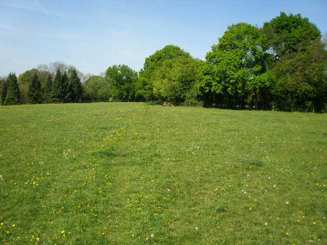
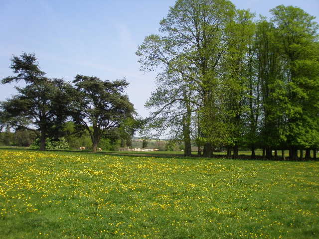
I crossed over another double stile into the corner of a field, and continued alongside a right-hand hedge. I was now on the flat top of the hill, with a slope going down over to my left and mainly woods on the opposite slope of a small valley. The field I was now in was a hay meadow [4], the green grass speckled with the bright yellows of buttercups and dandelions. This was a very charming stretch of the walk, as I continued through two more such meadows, the first I think I’ve encountered on this walk. As well as the woods to my left, glimpses through the hedge to my right showed there were more woods across the meadows in that direction.
On the far side of the third meadow [5], I crossed a stile in the hedge to join a farm track on the other side. As I did so, I heard a bird that I recognised immediately – a Raven! I knew the call as I have heard it so often in the Lake District – I knew there were a few Ravens now in the Chilterns, but hadn’t come across one before. I heard it ‘caw, caw’ as it flew across the hedge behind me, and from the stile I saw it fly across the meadow I’d just left towards a wood.
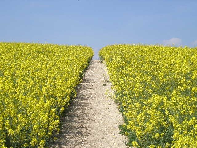
I followed the track between hedges and then garden boundaries to a sharp bend in a lane in the small hamlet of Park Corner (so called because it was once in a corner of Ewelme Park). I followed the lane ahead for almost quarter of a mile to a T-junction, where I crossed the road and went over a stile opposite. The path went left, along the opposite side of the hedge to the road. Even with my sunglasses on, I was almost dazzled by the bright yellow of the oil-seed rape in this field. At the corner of the field I reached the edge of a wood, and turned right along a wide track along its edge. When the track reached the end of the wood after a couple of hundred yards, it continued between hedges [6], with a green arable field to the left and the rape field still on the right. There were a lot of Bluebells mixed with white Greater Stitchwort along the hedgerows, making this a very attractive track to walk along.
[7] Path through the long belt of trees
[8] Path through the long belt of trees
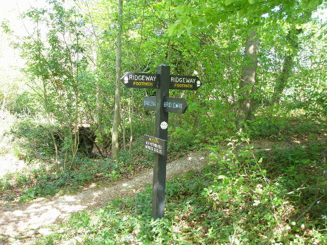
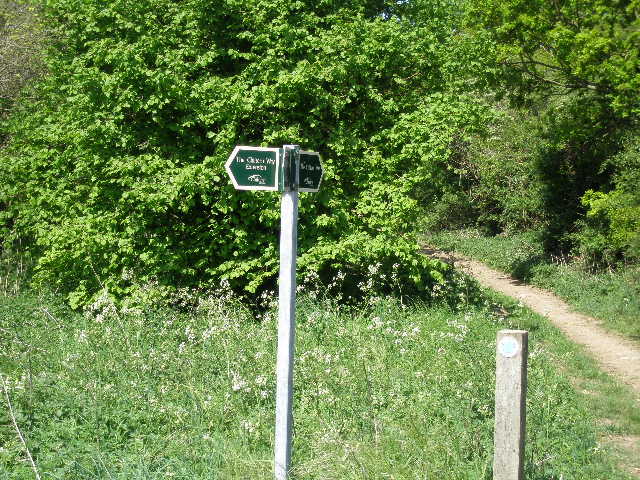
[9] Finger post where the Chiltern Way crosses the Ridgeway
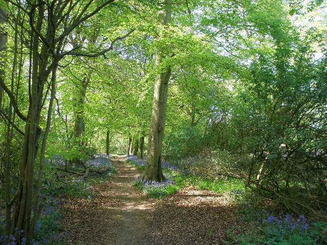
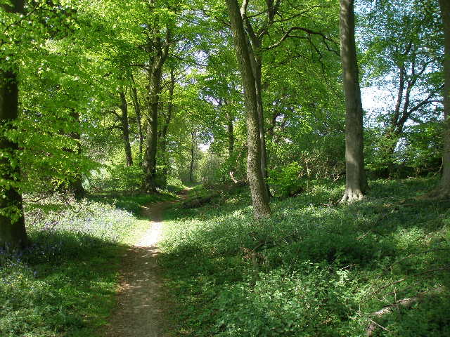
The track soon reached another wood, where I continued ahead on a path through the trees (predominantly beech). This was again a very pleasant part of today’s walk, as the path descended very gradually for well over a mile, through a thin belt of trees at the bottom of a slowly developing valley [7,8]. I soon saw a Buzzard fly out of the trees, and almost immediately heard and then saw a Red Kite. Occasionally I had glimpses of the green fields either side of the belt of trees, with more woods further away. At one point I saw a clear path through the green crop ahead and to my left, which I recognised as part of the Ridgeway. I soon came to the signpost where the Ridgeway crossed my route [9] – I remembered it well from both my previous Chiltern Way walk and my Berkshire –Essex walk. I continued on through the trees – there were still plenty of Bluebells but few other wildflowers.
Eventually the long thin belt of trees ended – as I emerged from them I saw a Brimstone butterfly, which was here again on my return. I followed a farm track a few yards left, then turned right to continue in the same westerly direction as before. I was now on a very good track called Old London Road, the route of an old road from London to Oxford via Henley. I passed a couple of houses, and then a small wood on my left. Beyond the wood were a couple of small enclosures containing Alpacas [10], which I remembered well from my walk here two years ago.
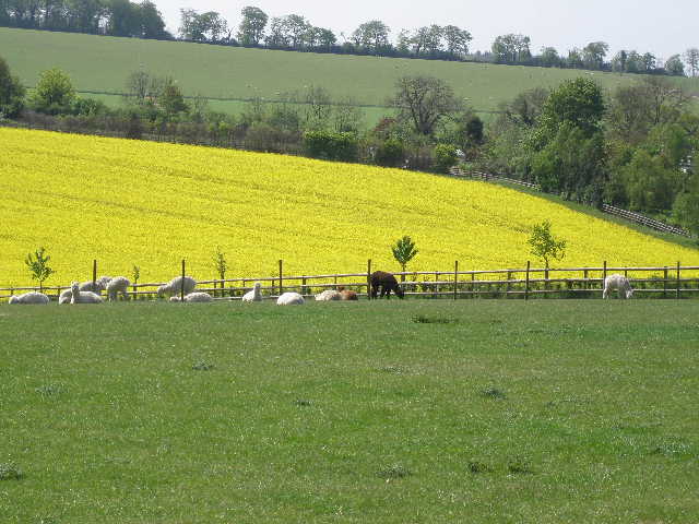
[10] Alpacas by Old London Road
[11] View towards Didcot Power Station from Old London Road
[12] Looking back along Old London Road
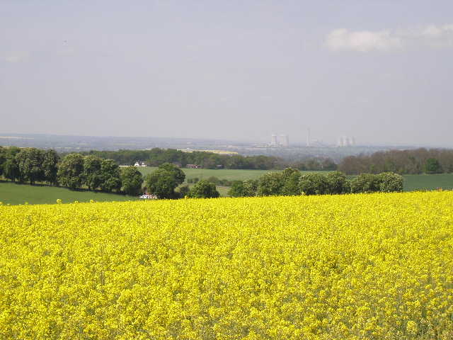
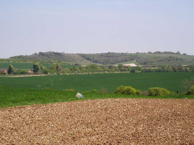
The chalky track continued onwards, fairly level, with a hedge on my right, and enormous yellow fields of oil-seed rape on either side [11]. I was clearly heading towards the edge of the Chilterns, as ahead of me the view opened up to show the lower and flatter lands of Oxfordshire, dominated by the enormous eyesore of Didcot Power Station. I saw some Red Campion in the hedgerow, and a lot of Herb Robert.
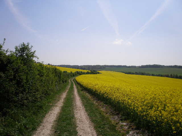
After about a third of a mile [12], I turned right through a gap in the hedge, and followed a left hand-hedge with a rape field to my right. Ahead of me I could see Swyncombe Down, which I will be crossing later on the Chiltern Way. I soon reached a clump of trees on my right, marking the site of a former farm. Here I turned left, on a clear chalky path going uphill through yet another field of rape [13]. I saw a Red Admiral butterfly here, one of the first I’ve seen this spring. The path levelled out, and on the far side of the field I turned right along a farm track, which soon brought me to a junction by a farm building (at Potter’s Farm, Ewelme). Here was the signpost marking where the southern extension rejoined the original route of the Chiltern Way [14,15].
At each of the two junctions of the northern extension with the original route, I did one walk that went past the junction and one walk that started or finished at the junction. This walk today is the only one where I will visit the first junction of the original route with the southern extension. However, I shall visit this other junction with the southern extension at Potter’s Farm three times, as apart from today another walk will end here and the subsequent walk start here. It is thus the only point on the entire route that I will visit on three days. It strikes me that it is therefore somewhat unlucky that it also the only point on the entire route that usually stinks of pigs! Fortunately, today the wind was blowing in the right direction, and I could only detect the presence of pigs by their squealing.
[13] Path through oil-seed rape field, near Potter's Farm, Ewelme
[14] Swyncombe Down, from Potter's Farm, Ewelme
[15] Signpost where the Southern Extension rejoins the original rout, Potter's Farm, Ewelme
I turned round and made my way back, along Old London Road, through the long thin belt of trees (I stopped and ate my lunch on a log near the far end), through Park Corner, through the beautiful hay meadows and past the cows, all the way back to the junction in Upper Bix Bottom. Here I took the other path, now starting the Southern Extension of the Chiltern Way, and crossed an empty pasture diagonally and uphill [16]. I crossed a stile, and followed the left edge of another pasture, this one containing bullocks. Rather unusually, there were trees along this edge of the pasture, an extension of the wood on my left, presumably to provide shade for the cattle. Near the top of the hill, I went over a stile and turned left alongside the wood, now in a vast open meadow. I had to duck under some protruding boughs of oak trees as they extended over the meadow.
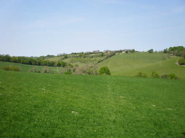
After a few hundred yards I reached a field corner, and continued ahead on a stony track, now with a beech wood to my left and a hedge on my right. I passed a house on my right, and at a junction left the track and turned right down a lane for a short distance. To my left was Soundess House, reputedly the home of Nell Gwynne, most famous of Charles II’s mistresses. I then turned half left on a path across a large area of parkland, where a few cattle grazed amongst the scattered trees to my left [17]. I passed a row of three cedar trees, and followed the path to the hedge on the far side, where a short track led me between gardens to a lane in the attractive hamlet of Crocker End, centred round its green [18].
[16] Looking back to Upper Bix Bottom from the path to Crocker End
[17] Parkland scenery, on the edge of Crocker E
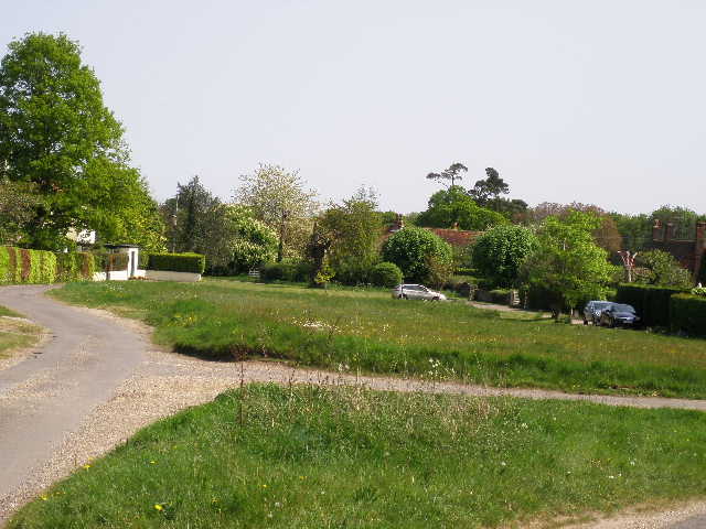
[18] Crocker End
I now completed this rather convoluted walk by turning round and heading back the mile or so to Upper Bix Bottom, then retracing my initial footsteps back to my car. I got back there at about 2.50am, much earlier than I’d expected. I was so surprised at how quickly I’d done the walk, I thought I’d better check the mileage – sure enough, I’d made a mistake when adding up the distances in the guide book when I did this walk before, and it was only 6.8 miles rather than 7.2 miles each way. If I’d realised before I could have extended this walk as far as Bix Bottom, and thus reduce the next walk which will be 8.2 miles each way.
For some reason I’d not been looking forward to this walk, thinking it was one of the three or four least enjoyable walks on the Chiltern Way. In fact it was a very pleasant walk, on an almost perfect day, where the profusion of bluebells and occasional other wildflowers greatly added to the delights of the walk. The flower-filled hay meadows surrounded by woodland on the way to Park Corner were particularly charming. Seeing a Raven in the Chilterns for the first time was a definite bonus! It is probably the walk on which I will see the least ‘civilisation’ – I only walked about quarter of a mile on lanes all day, mainly in Park Corner then very briefly near Soundess House, and only touched on two more where I started and where I turned round in Crocker End. Apart from the hamlets of Park Corner and Crocker End, I only passed a couple more houses near Soundess House, and a couple near the Alpacas on Old London Road.
Total Distance: 117.6 miles each way