Pete's Walks - The Chiltern Way (2)
If you are considering walking this route yourself, please see my disclaimer. You may also like to see these notes about the maps and GPX files.
Day 2 27/03/07 Chalton to Barton-le-Clay (7.1 miles each way, approximately)
Parked in side street in Chalton.
It was a nice bright morning when I set off from home, but as I turned up the road to Dunstable Downs I noticed all the cars coming the other way had their lights on, and one or two had their fog lights on. Sure enough, as I drove over the Downs I entered some fog and by the time I got into Dunstable it was really thick. Visibility was down to 50-70 yards all the way to Chalton. I had to take a diversion from my planned route and go via Toddington, as the main road through Houghton Regis was closed (this probably explains the queued up traffic on the A5 yesterday). The diversion didn’t bother me, as it just meant I more or less went the way I intended driving back anyway, but it was a heck of a long way round for anyone wanting to get from Dunstable to the far side of Houghton Regis.
I set off walking at about 9.25am – one of the advantages of doing a walk a second time is that I already know where there are convenient places to park. The Chiltern Way crossed the car park of The Star pub in Chalton, then crossed a small area of grass before taking a path between bushes to reach an arable field. Here I followed the hedge to the left and turned right at the corner, soon joining a gravel farm track that came through a gap in the hedge and then followed the hedge to the next corner (last time I did this walk, the field was just grass and the path cut the corner straight to the start of the farm track – the official route round the edge of the field was overgrown and impassable). At the field corner the track turned left and changed to a concrete surface. The track went up slightly and turned right to cross a bridge over the M1 – I’d heard the traffic noise through the fog right from when I started walking. The concrete track then turned left and went downwards from the bridge, sandwiched between the motorway and a main railway line on the right (the main line to London St Pancras). Within a few yards I reached a tall footbridge which took me over the railway line [1].
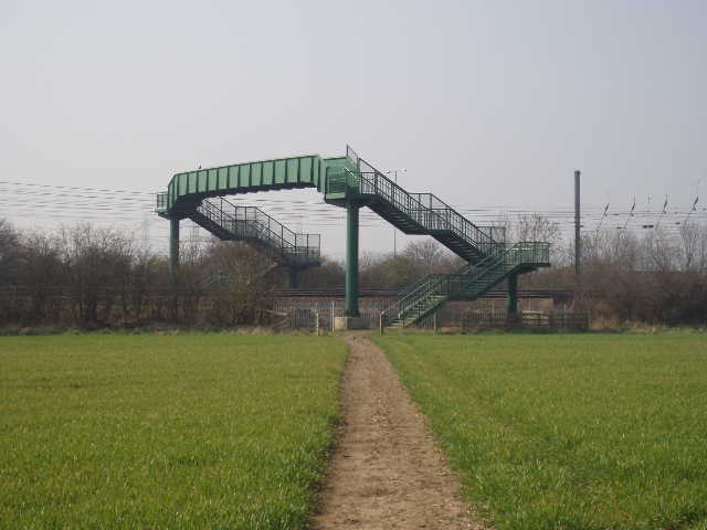
[1] Looking back at the footbridge over the railway line at Chalton (photo taken in the afternoon)
[2] Path through old quarry workings between Chalton and Upper Sundon (afternoon)
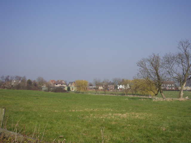
[3] Upper Sundon (afternoon)
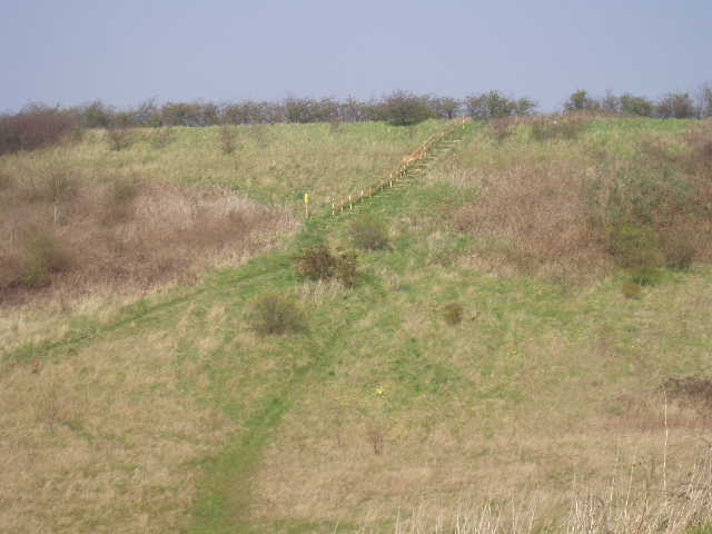
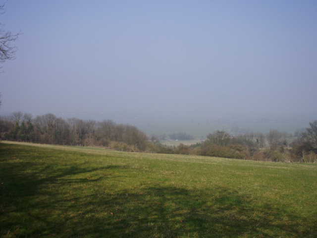
On the far side of the railway bridge, I took a nicely cleared path half-right across a small arable field to reach a concrete drive running between an avenue of trees. On the other side of this drive, I took another clear path through a much larger arable field, now going half-left and slightly uphill. The fog was still really thick and I could only see about 50 yards either side of the path. It took some minutes to cross this large field, and on the far side I entered a region of scrubland surrounding an old chalk quarry site. The path rose uphill between bushes and trees. At a fork I went through a gate and continued ahead beside a left-hand hedge, with a very overgrown field to my right. The path soon turned left through the hedge and descended some steps into another part of the old quarry, which I crossed to a longer flight of steps rising up the other side [2] – here I saw both some Violets and some Lesser Celandine. The Chiltern Way then crossed another concrete drive and then a small arable field (on a less well-defined path) to reach the village of Upper Sundon [3].
Upper Sundon lies on a plateau about half a mile north of Lower Sundon, which was the original village here as that is where the church and manor both stand. Lower Sundon lies close to the source of the river Lea (or Lee), which flows south to join the Thames at London. The thirteenth century church is noted both for mediaeval murals and for stone seats around its sides for use by the elderly and infirm in the days before pews (as the guide books says, this is the origin of the saying ‘the weak go to the wall’). I’ve driven past the church many times, I must make a point of going inside it some time.
[4] Field path heading towards Sundon Hills Country Park (afternoon)
[5] Very hazy view out from the Sundon Hills Country Park (in the afternoon)
[6] View ahead along the ridge in Sundon Hills Country Park (afternoon)
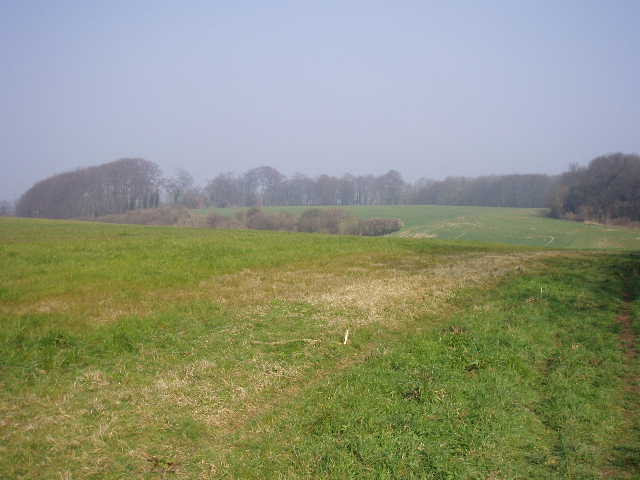
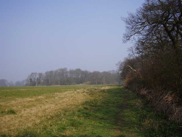
I walked down a short alley between houses and then to the end of a cul-de-sac, where I entered a playing field. I followed the fence on my right, and turned left at the far corner. Having walked round two sides of the playing ground, I emerged by a duck pond opposite the Red Lion pub. I then took a track to the right of the pub, which ran between hedges for a couple hundred yards or so, then descended gently with ploughed fields either side. Near the bottom of the slope it reached the locked gates of a sewage works, where I went through a gap on my right and followed the left-hand hedge of a grass field to its far corner (this was one of only two or three places on the whole Chiltern Way where I felt the guide book could have been slightly clearer). Just before I reached the field corner, a bridleway came in from my left, the northern alternative of the Icknield Way now rejoining the Chiltern Way having passed through Toddington. I went through a gap ahead of me in the corner, and turned right to follow the hedge uphill. Towards the top of the slope I came to another field corner, where I turned left and followed the hedge for several hundred yards [4] – there should now have been some good views to my left, but I was still in thick fog. At the far end of this large grass field I reached a road, where I turned right for a few yards before going through a gate on my left. I turned right to very quickly reach the car park at Sundon Hills Country Park.
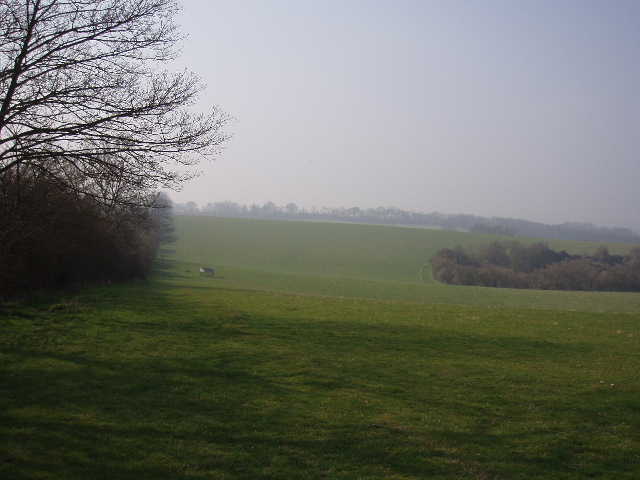
The next section of the walk, from Sundon Hills Country Park to Sharpenhoe Clappers, was very familiar to me (and will be to you, if you’ve read all my journals!). Apart from my previous Chiltern Way walk, I’d also been this way on my Berks-Essex walk and twice on the John Bunyan Trail. There are normally great views to the left, over Harlington and on to the greensand ridge around Ampthill. Today I couldn’t see more than 50-70 yards down the slope on my left. The Sundon Hills Country Park [5,6,7] is basically a large sheep pasture on a steep chalk escarpment, with an old chalk quarry at the foot of the slope. The path runs along the top of the slope, beside a right-hand hedge. It goes up and down once or twice, passing a post festooned with waymarks for the various walks that go this way. At the far end of the sheep pasture I joined a track, which curved round a deep shrub-covered combe [8]. I then turned right alongside the left-hand hedge of an arable field, where I would see two hares on my return trip in the afternoon. The path next turned left beside a wood [9], then left again beside a second wood. Very shortly it turned right, still alongside a wood to the right. The path turned left then right again, as it followed the edge of the wood several hundred yards to a field corner. Here it turned left for a few yards, before entering the trees on the right.
[7] Looking back along the path through Sundon Hills Country Park (afternoon)
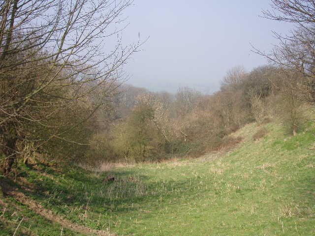
[8] The shrub-covered combe just beyond the Sundon Hills Country Park (in the afternoon)
[9] Woodside path between Sundon Hills Country Park and Sharpenhoe Clappers (afternoon)
The next part of the route is always very pleasant, as the path runs between mainly beech trees at the top of a steep slope on the left. After a few hundred yards there was a path junction, where the John Bunyan Trail comes in from the right, rejoining its outward route from Sundon Hills Country Park. The path ahead now narrowed [10,11] – I always take extra care here, because the ground drops away so steeply on the left, the path itself is often at an angle and there are many protruding tree roots that can be tripped over. Normally there are glimpses through the trees to the lower land to the left or ahead towards Sharpenhoe Clappers, but not in today’s fog. Strangely I didn’t feel disappointed at not seeing the usual views – having done the walk several times before it was actually quite nice to do it in totally different conditions (I enjoyed the contrast when I started the John Bunyan Trail along here, it was bright and sunny in the morning, very grey and gloomy on the way back in the afternoon). The beech trees petered out after a while, but the path still continued along the top of the steep slope, now amongst bushes with a fence on the right. Eventually I came to a stile in the fence, which I crossed and then walked across a grass field to reach a road and the car park for Sharpenhoe Clappers.
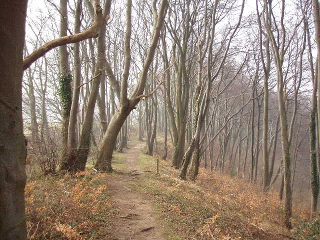
[10] Looking back along the path to Sharpenhoe Clappers (afternoon)
[11] The path to Sharpenhoe Clappers (in the afternoon)
[12] Start of the path round Clappers Wood on Sharpenhoe Clappers (afternoon)
Sharpenhoe Clappers is a promontory jutting north from the northernmost escarpment of the Chilterns, a landmark visible from miles around. The village name Sharpenhoe actually comes from the Saxon for ‘sharp spur of land’, while the second part of the name comes from the Norman French for ‘rabbit warren’ (as usual, thanks to the guide book for this information!). The board I read yesterday at the foot of Dunstable Downs said there was another rabbit warren there, somewhere near Pascomb Pit. Sharpenhoe Clappers is surmounted by the remains of an Iron Age hill fort (it is an obvious defensive position, with steep drops on three sides) and both Iron Age and Roman pottery has been found there. The hill is also surmounted by Clappers Wood, a beech wood that looks as if it has been there for many centuries, but in fact was planted as recently as between 1834 and 1844.
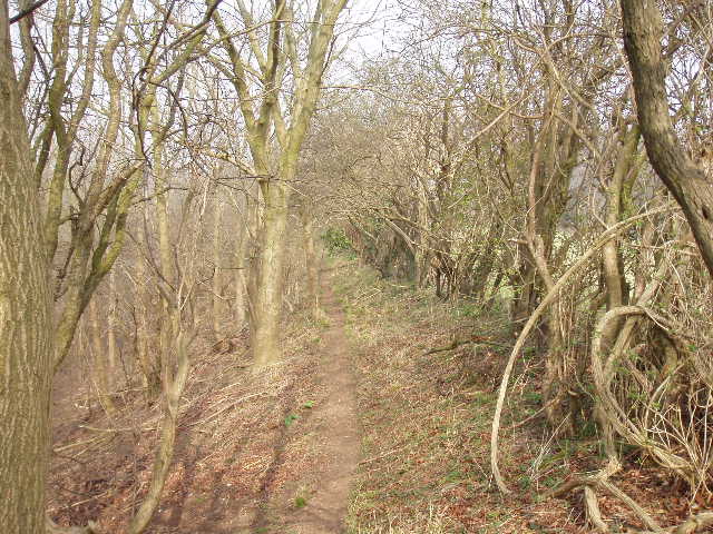
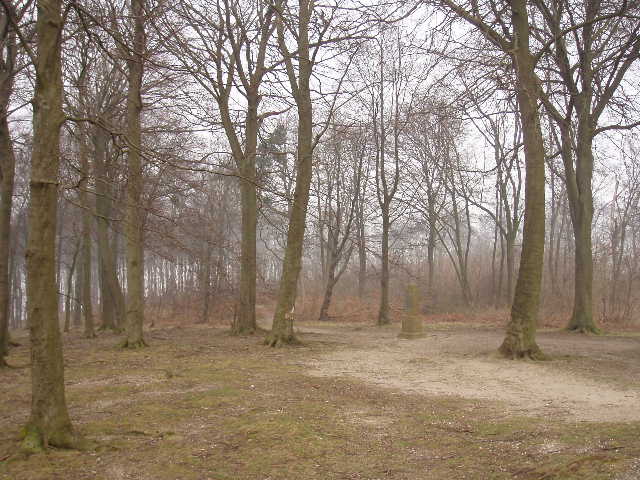
I followed the path from the car park, passing a gate. Shortly before a second gate I took a path off on the left – here the northern alternative of the Icknield Way continued ahead (curiously it misses out on visiting the summit of the hill by turning right well before Clappers Wood). My path ran through trees and then bushes before descending then ascending small flights of steps – here I came across the best display of Violets I’ve seen so far. Oddly enough, the Chiltern Way doesn’t visit the top of the hill either, following a left-hand fence round the left edge of Clappers Wood [12,13].
On the far side of the wood, the Chiltern Way divides. The northern extension of the Chiltern Way, created in 2003, branches off here and follows a longer and slightly more northerly route through Barton-le-Clay, Pegsdon, Great Offley, Preston and Whitwell to Peter’s Green. The original route, created in 2000, continues contouring round Clappers Wood and goes on to Streatley, then through Lilley and on to Peter’s Green, where the two routes come together gain. I left that section of the original route for another day, and took the start of the northern extension, which descended a very steep set of wooden steps down the northern edge of the hill. The steps finished at an arable field, where I continued downhill less steeply alongside a hedge on the left, soon reaching a road on the edge of the village of Sharpenhoe.
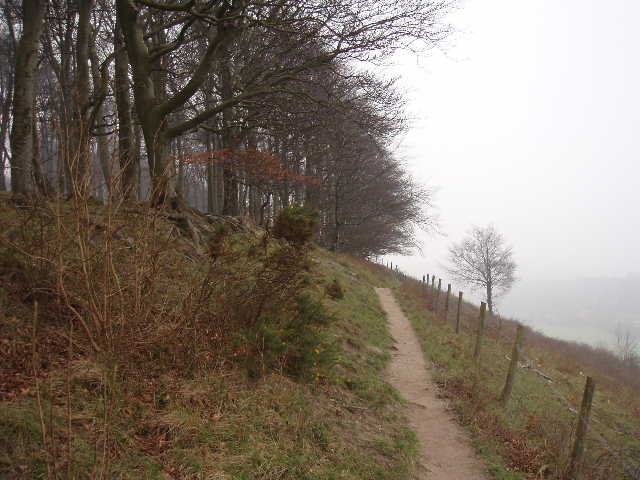
[13] Looking back along the path past Clappers Wood (afternoon)
[14] Robertson Memorial in Clappers Wood (afternoon)
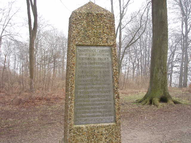
[15]Robertson Memorial in Clappers Wood (afternoon)
I turned left along the road. Just before reaching a pub (rather curiously named The Lynmore) on the corner of a road on the left [NOTE: the pub has since been converted to a house - I have to thank Richard Brown for some updates and corrections on this page]. At this point I turned right onto a bridleway running along the drive to Sharpenhoe Bury. A former moated manor here was the home to both Edmund Wingate, a noted seventeenth century mathematician, and Thomas Norton, a poet and playwright as well as being Elizabeth first’s Solicitor General, nicknamed ‘Rackmaster General’ for his use of torture on Roman Catholics. I passed through the large concrete yard of Bury farm, where a tanker was delivering oil, and continued on the John Bunyan Trail, which had shared this route all the way from Sundon Hills Country Park, alongside a left-hand hedge towards the prominent water tower at Pulloxhill. After two hundred yards, I turned right. My path initially followed a right hand hedge, and when this turned right the path continued ahead on tractor tracks through the crop of cabbages (or something similar). I went through the hedge on the far side of the field, turned right for a few yards along the hedge then turned left. Here the path ran between two hedges, and there was firstly an overgrown World War II ammunition store and a few yards further a similarly overgrown World War II pillbox for which it stored ammunition [16,17]]. [Although the track runs between these hedges you can go either side too. If you want to see the ammunition store and pillbox, you need to either go between the hedges or for a better view go to the left of them.] It was slightly less foggy now, but the visibility was still not good.
After a few hundred yards, the good track between hedges turned half-left and almost immediately the Chiltern Way went right through a kissing gate to run alongside a right-hand hedge in an empty pasture. Through another kissing gate, the path ran alongside a hedge on the left, in a paddock where three thoroughbred horses looked at me nonchalantly then went back to their leisurely business of eating grass. Through another kissing gate, across a stream and through a small woody area, the next field was obviously ‘set aside’ as it was very overgrown. On the far side, I had to pass through the garden and car park of Barton Mill [18], a weather-boarded water-mill. There has been a mill on this site since the Domesday Book, though the current buildings date to 1790 and the mill ceased working in 1928. It is now ‘The Olde Watermill Shopping Village’ – no comment!
After entering the car park of the watermill, avoiding the entrance for vehicles which is to the left and ahead, diagonally on the right is a footpath which takes you across the A6 Dual carriageway using a staggered gap in the crash barriers in the central reservation. On the other side I entered a residential estate in the large village of Barton-le-Clay (which I last visited on my John Bunyan Trail walk, not too long ago). I followed an alley between houses, crossed a minor road (there was a delightful half-timbered thatched cottage on my left, seeming quite out of place in the middle of this modern housing estate) and continued ahead down a side street to reach the main road through the ? village. This road was the old route of the A6 before the bypass was built – Barton was a stopping off point on the old main road that goes to Bedford and then all the way to Carlisle, so like Dunstable it has several old coaching inns. Its history goes much further back than that though, as in the ninth century it was the scene of a battle between the Saxons and the Danes and it was mentioned in the Domesday Book.
I turned right along Barton-le-Clay’s high street, crossing the road at a pelican crossing where the local shops are, and continued in the same direction. Just after a mini-roundabout I took a left fork that led onto Hexton Road. After a further 100 yards I used the zebra crossing to cross to the right hand side of the road and continued to where Hexton Road turns left, where I turned right onto Old Road (so named because it was the old main road before a re-routing in 1832 to lessen the gradient down Barton Hill – this was just a few years before the chalk cutting and embankment at Chalk Hill were created for similar reasons). After a couple of hundred yards or so I reached the entrance to a playing field on the left, where I stopped and turned around. It was now noon. Last time I did this walk, I continued a bit further, crossing the playing field to reach the church. But I then parked this side of the playing field for my next walk, so needlessly crossed the playing field twice. Having done the walk before is a definite advantage!
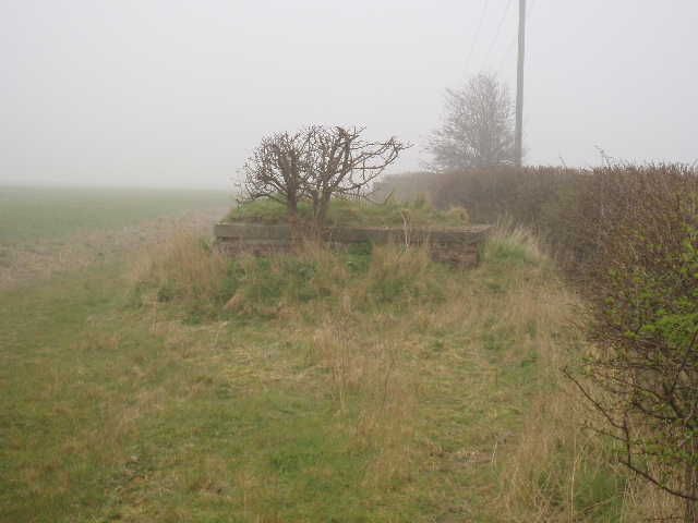
[16] Somewhat overgrown WWII ammunition dump between Sharpenhoe and Barton-le-Clay
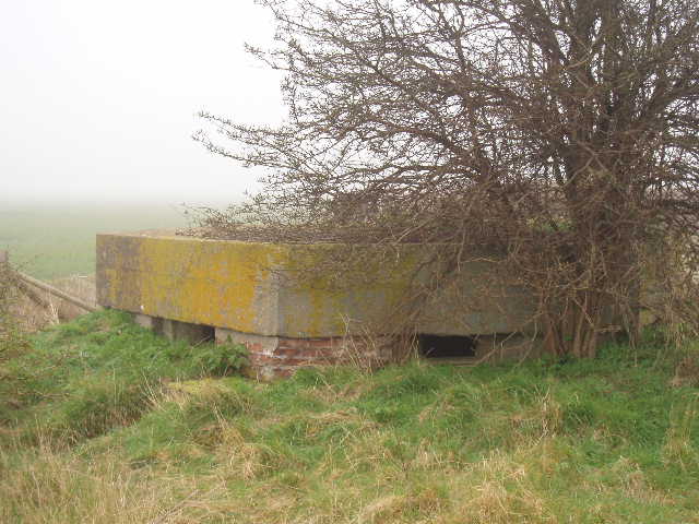
[17] The other WWII pill box between Sharpenhoe and Barton-le-Clay
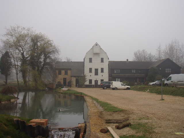
[18] Barton Mill
It was still foggy as I walked back. I took it very slowly up the steep flight of steps to Sharpenhoe Clappers, and stopped for lunch on a bench at the far end of Clappers Wood, just as I did last time (another advantage of having done the walk before is that I know where there are good places to sit and eat my sandwiches!). As I munched on my sarnies and quietly reflected, the fog thinned out a bit more and I could just about see down to the valley bottom. After lunch I took a quick detour into Clappers Wood on the top of the hill, and visited the Robertson memorial in the middle of the beech trees [14,15]. W.A.Robertson left a large legacy to the National Trust, on condition that they matched his bequest and used the combined sum to purchase properties and land, mounting a plaque wherever they did so to commemorate his two brothers killed on the Western Front in World War I. There is a similar column and plaque close to the new visitor centre on Dunstable Downs, as part of that area was bought with the same money.
The fog gradually evaporated as I made my way back, but it remained very hazy. The views were still quite restricted all along the ridge past the Sundon Hills Country Park, but at least I could see down to the valley floor. Only white painted buildings loomed out of the mist at Harlington, less than a couple of miles away. But at least the visibility was good enough to make it worth my while taking a few photos for this journal. As I got back towards Chalton, I saw a train heading towards London just as I reached the footbridge, as had happened in the morning. This was the first time for a few months that I’d walked on successive days, so I felt a little tired when I got back to my car, but not too bad at all.
Again I enjoyed this walk, even though much of it is now very familiar to me – I have walked the section from Sundon Hills Country Park to Sharpenhoe Clappers more often than any other path in these journals. But it was interesting doing it in different conditions, first in the fog and then back in a misty haze – to walk the route without seeing the usual splendid views at all was quite odd, and actually an interesting experience (it would be very frustrating if this was the first time you did this walk, though!).
Total Distance: 14.7 miles each way