Pete's Walks - The Chiltern Way (2)
If you are considering walking this route yourself, please see my disclaimer. You may also like to see these notes about the maps and GPX files.
Day 3 31/03/07 Barton-le-Clay to New Wellbury (8 miles each way, approximately)
Parked in side street in Barton.
I parked by the entrance to the recreation ground at Barton (there were two or three cars there already) and started walking at about 9.45am. This was a fairly bright and sunny morning, though visibility was limited by a strong haze. It was also quite chilly at about 6C as I set off. I crossed the recreation ground and went down a short alley that ended in Church Road, opposite Barton church. Here I turned right, now back on the route of the John Bunyan Trail as it headed towards Lilley and back to its start at the Sundon Hills Country Park. I soon reached the end of the road where I turned left on a footpath. As usual there were one or two horses in the paddock on my right. Curiously I don’t remember ever noticing the moat behind the hedge on my left before – this went round three sides of the rectory, which according to the guide book dates from around 1550 and is said to be the second oldest such building still serving its original purpose. It is also said to be haunted by a former vicar’s wife, who died in childbirth around 1700.
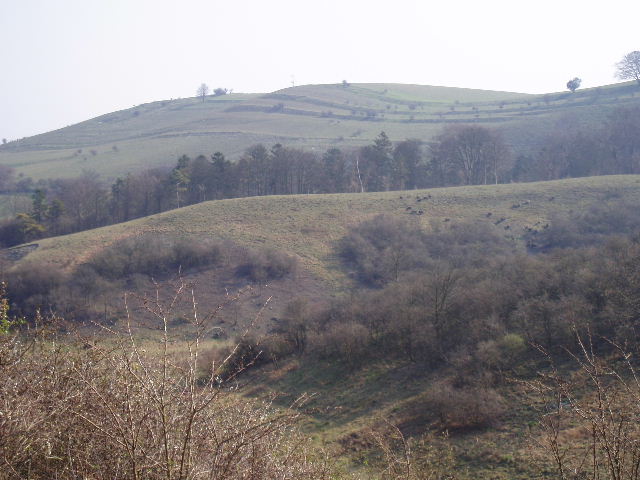
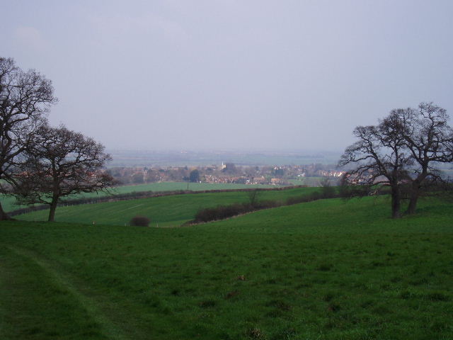
The path continued alongside the edge of an arable field, and near the field corner I went through a kissing gate into the Barton Hills Nature Reserve. The path now went steeply uphill through an area of scrubland, bearing slightly right to climb a sequence of three flights of steps as it made its way to the top of the chalky hillside. Beyond a kissing gate at the top of the third set of steps, the ground started to level out a bit, and I paused to catch my breath and take a few photos, of the hills themselves and looking back over Barton [1,2]. The views were good, but limited by the haze. I’ve been here three times now, but have yet to see the views at their best as the other two times it has been rather grey and gloomy.
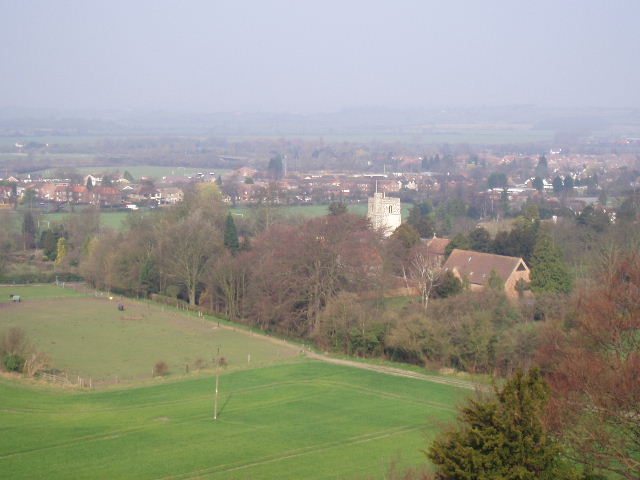
[1] Barton-le-Clay and its church from Barton Hills
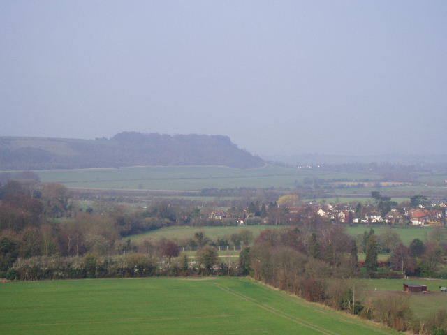
[2] Sharpenhoe Clappers from Barton Hills
[3] Looking back along the path across Barton Hills
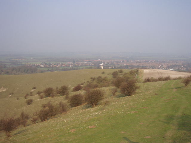
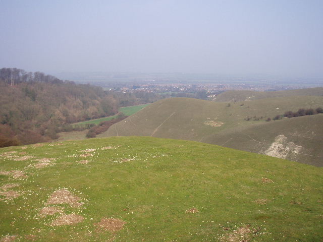
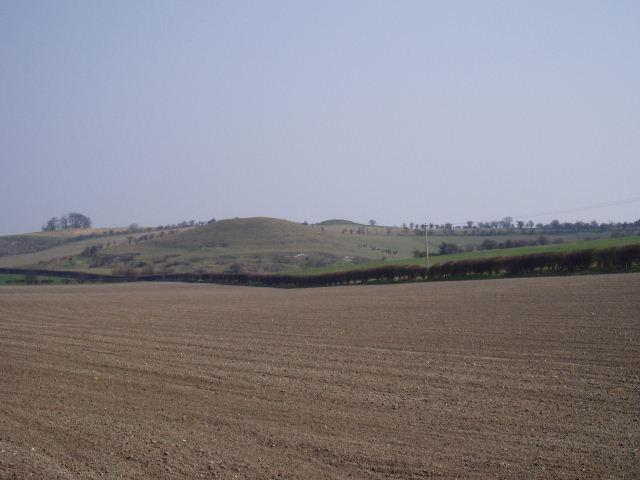
Barton Hills are a fairly small area surrounding a steep-sided dry valley that cuts into the northernmost escarpment of the Chiltern Hills for about two thirds of a mile. The western side of the valley is fairly straight and covered by woodland. The eastern side is typical chalk downland, mainly grass with occasional clumps of scrubby bushes. This side of the dry valley is cut by two side valleys, the northernmost of which further subdivides into two or three small valleys. The path followed by the Chiltern Way runs alongside the fence on the eastern edge of the Barton Hills, so I had a ploughed field on my left (very chalky, on my return I noticed part of it looked almost dazzlingly white from a distance) while on my right I peered down the side valleys towards the main valley below. There were several rabbits on the steep grassy slopes, and I heard a Yellowhammer’s distinctive call (several short notes followed by a longer one). The path rose and fell once or twice, gradually climbing a bit further [3], finally curving round the end of the second side valley. Here, looking across the field on my left, I could just glimpse the earthworks of Ravensburgh Castle in some trees [4] – this is a 22-acre Iron Age hill fort, the largest in South-East England. It is possibly the site where Julius Caesar defeated Cassivellaunus in 54BC.
[4] The earthworks of Ravensburgh Castle are just about visible in the woods if you expand this photo
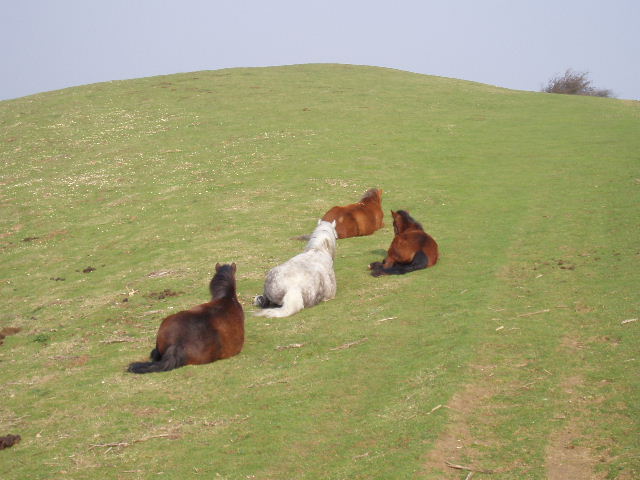
[5] Dartmoor ponies on Barton Hills
[6] Barton Hills
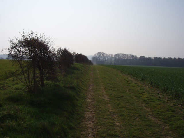
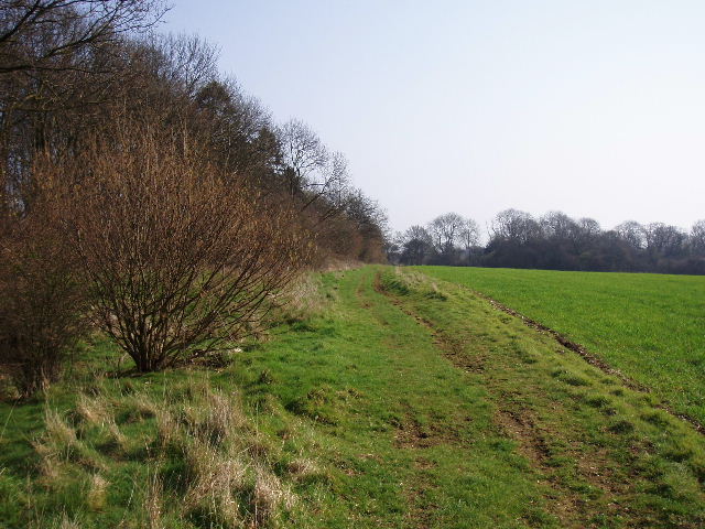
Dartmoor ponies are used to graze the Nature Reserve for part of the year. I’ve seen them here before but never so close up [5]. Four of them were laying down close to the fence here, with a fifth standing a few yards further down the steep slope on my right. The fence reached a corner, where I turned right on a wide track across the turf (the John Bunyan Trail continued ahead on a farm track). As I followed this undulating path, I still had nice views over the Nature Reserve [6] and soon could see along the main valley back towards Barton. The path next went through some bushes to a gate where I turned left, to head southwards along a well-surfaced farm track. I soon passed a notice board on my left, explaining what farmers were doing to help birds and other wildlife in this area. The track ran for about half a mile, with an arable field on the left and a field of oil-seed rape on the right, eventually reaching a minor road. I turned left for about a hundred yards, before turning right on another path heading south (I was now back on the route of the John Bunyan Trail again). This path followed a left-hand hedge through some large arable fields [7], with the scrub-covered Galley Hill on the edge of Luton ahead of me. Today’s walk is part of the northern extension of the Chiltern Way – as I drew nearer to Galley Hill, I was very close to the original route of the Chiltern Way, which runs along the far side of the hedge across the field to my right (I shall be walking that path in a few days time). It was now feeling quite warm and I took my coat off.
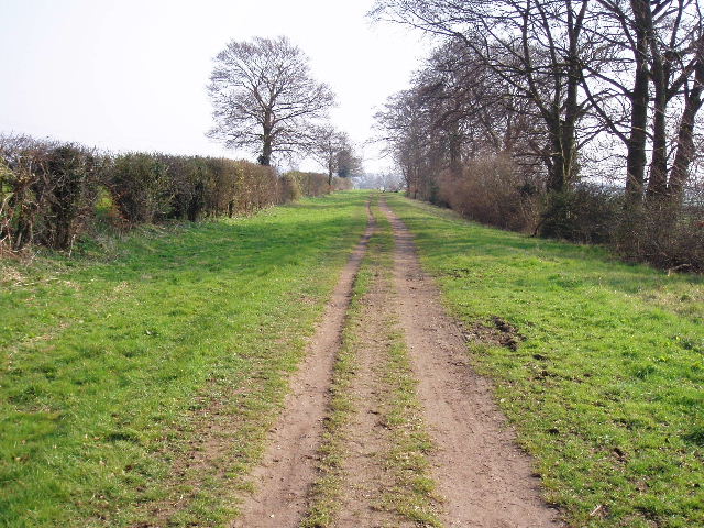
The path came to a track crossroads by a belt of trees (I ate my lunch here a few weeks ago on Day 10 of my John Bunyan Trail walk). I turned left along a broad track between hedges – this was part of the Icknield Way [8], so I’d also walked it before on my Berks-Essex Walk. There had been several types of wildflower here that day last summer, but this early in spring I saw only some Lesser Celandine and, a bit further, on some Coltsfoot, the first I’d seen. As this was a Saturday there were a few other people about here, a dog walker, a jogger and a horse rider. I was now walking into quite a stiff and cold wind, so I soon put my coat back on. The good track ended on a sharp corner of the Lilley-Hexton road, where I continued ahead along the road for a few hundred yards until it turned sharply left. Here I continued in the same easterly direction as before, passing through the Treasure Groves car park (actually this small car park has been closed off, but there is still room by the road corner for two or three cars to park) to join another track between hedges. The John Bunyan Trail soon turns right here towards Lilley, but I continued onwards towards Telegraph Hill. After a while the hedgerows gave way to shady trees. At the foot of the hill is a particularly good example of a beech tree [9], and then the Chiltern Way veered slightly right from the track to climb a grassy slope between trees to the top of the hill.
[7] Track heading towards the Icknield Way near Galley Hill, Luton
[8] The Icknield Way, near Galley Hill
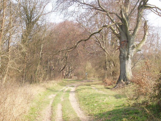
[9] Beech trees at the foot of Telegraph Hill
At 602 feet Telegraph Hill is the highest point in North Hertfordshire. It is so-called because it was used as a semaphore station during the Napoleonic wars. It was formerly known as Pegsdon Beacon, and is thought to have been the site of one of the beacons used to warn of the Spanish Armada in 1588. It is now a nature reserve. From the top of the hill I followed a fairly level path alongside trees with a large arable field on my right [10] – this field was formerly part of Lilly Hoo, the site of a race course where the Prince Regent trained his horses. Near the field corner the path rejoined the track I’d been on earlier, but only for a few yards as the Chiltern Way soon turned left into the Pegsdon Hills Nature Reserve (the Icknield Way continued ahead to pass Deacon Hill and make its way towards Pirton – I would rejoin its route briefly later).
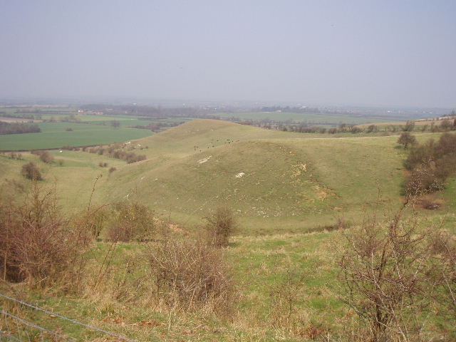
I was now heading back north, and there were lovely views ahead of me over the lower lands at the foot of the chalk escarpment. The path crossed a grass area and followed a right-hand hedge for a while – on the other side of the hedge was Barn Hole [11], another steep-sided dry valley cutting into the escarpment, similar to the one at Barton Hills. I went through a gate at the end of the hedge, so I now had a clearer view of Barn Hole as it ran towards the village of Pegsdon [12]. Across the steep valley on my right I could see Deacon Hill (I took a short detour to its top on my Berks-Essex Walk last summer). The mediaeval ‘strip lynchets’ on its side were very clear from here – these are terraces cut into the hillside to allow ploughing where it would otherwise be too steep [13]. I could also see a flock of black sheep used to graze the Nature Reserve. The path descended quite steeply for a short while, then for a much longer time at a gentler gradient – this was probably one of the longest sections of continuous descent that I have done in the Chilterns. This was quite delightful walking on a good path through open grassland, with Pegsdon and the lower lying land ahead (I recognised Shillington church from my John Bunyan Trail walk a few weeks ago). It was still a sunny morning, but the haze was still slightly restricting the views. As well as Barn Hole and Deacon Hill to my right, I could also see a lower ridge extending north from it – this was Knocking Hoe which I would soon be crossing. The Neolithic burial mound of Knocking Knoll at its top was clearly visible.
[10] Path beside Lilley Hoo, on top of Telegraph Hill
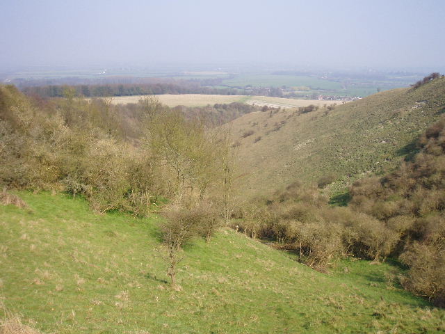
[11] Barn Hole
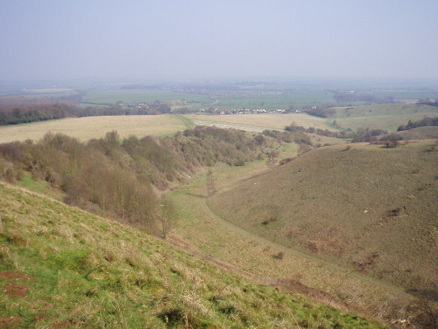
[12] Looking along Barn Hole to Pegsdon and beyond
Eventually I reached and crossed the Barton-Hitchin road, then followed a short section of old road to a junction where I turned left. After just a few yards I turned right at another junction, and followed the dead-end lane through the small village of Pegsdon, passing the Live and Let Live pub on my right. Near the end of the village I turned left along a private drive. This soon turned right and then left again – after this second turn the footpath left the drive on a grassy strip across a large ploughed field, where I again had views of Knocking Knoll [14]. Again the soil here was quite pale because of the chalk. On the far side I went up a flight of wooden steps and crossed a track between hedges. Another flight of steps continued uphill, now with a wood on my left (mainly coniferous but with young beech trees around its edge. On my right was a small steep-sided gulley cutting through a narrow neck of chalk hillside, and beyond it was Deacon Hill – I saw another walker arrive at its summit. Where the wood on my left ended, I continued alongside the gulley with a field now on my left. I then turned left alongside an intermittent hedge, with good views of Knocking Hoe and Knocking Knoll ahead of me. At the end of the field I turned right, again heading slightly uphill, with another dry valley to my left, a ploughed field on my right and a belt of beech trees ahead of me at the top of the slope.
The path took me to a track at the left end of the beech trees. There was a bench here where I would have my lunch here on my way back – it must be fairly new, as when I walked here two years ago I sat and ate lunch by the side of the path next to the wood I had just gone past. Close by was an entrance to the Knocking Hoe Nature Reserve [15], and I could see another flock of black sheep grazing there. I turned left along the track, and very soon another path came in from my right, carrying the Icknield Way from Deacon Hill. I carried on along another very pleasant chalky track between hedges. I exchanged greetings with a pair of walkers coming the other way – curiously we’d meet again in almost the same spot on my return trip, so I think they probably went to the top of Deacon Hill and turned round. Shortly after, I could see Knocking Knoll again across the field on my left – according to legend, knocking sounds can be heard from this Neolithic Long Barrow, made by an Ancient British chieftain guarding a hoard of treasure in the mound.
[13] Looking across Barn Hole to the 'strip lynchets' on Deacon Hill
[14] Knocking Knoll on Knocking Hoe, from near Pegsdon (Knocking Knoll is the small mound on the skyline, not the small hillock to the front and left of it)
[15] Knocking Hoe Nature Reserve
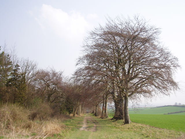
The track soon ran between an attractive avenue of beech trees [16] - I just love the combination of beech trees and chalky soil. It just somehow feels ‘right’ to me, presumably because it was what I saw so regularly as I was growing up in a Chiltern village. I came to another bench, where a cyclist was taking a break and enjoying the scenery (I had had my lunch here one day on my Berks-Essex Walk last summer). Here I left the Icknield Way (it continued ahead to shortly reach the village of Pirton), taking a hedgeside footpath on the right that went slightly downhill and then up again to the corner of a wood. I continued with the wood on my right, and across the grassy fields to my left I glimpsed High Down House partly hidden amongst trees [17]. This is a Jacobean house with mullioned windows and twisted chimneys, reputed to be the site of the murder of a Cavalier during the Civil War. I kept close to the edge of the wood as I crossed a grassy field, following tractor tracks, then taking a narrow path across a corner of the field to a stile. I then followed the right-hand hedge of an arable field downhill towards the Barton-Hitchin road. There was a lot of common field speedwell along the field edge, and the hedge here was quite wide and seemed to consist of beech saplings. In the field corner, the path turned right to run between trees for a short distance, parallel to the road. There were a lot of Violets and Lesser Celandine here.
I crossed the road, and followed a wide and clear path going uphill through a grassy field. When I did this walk almost two years ago, I had met a women walker a little further on along this path, and we had both agreed that this area was a ‘hidden jewel’. A couple of days ago I’d thought about that, and wondered what I’d meant - I couldn’t remember anything too special about the walk I’d done then at all. I smiled now, as this had been a great walk so far and I really understood again about this area being a ‘hidden jewel’. Just as I did so, I looked up and saw a large bird just above the skyline over this small hill – a Red Kite! It flew a bit closer towards me, then drifted to the right. I was delighted and very surprised to see it – I had no idea that they had spread so far east along the Chilterns (this is pretty much the end of the Chilterns in this direction). Last time I walked the Chiltern Way I didn’t see a Kite until I reached Penn Bottom, near High Wycombe, on Day 12 of my walk.
[16] The Icknield Way heading towards Pirton
[17] Pirton from near High Down House
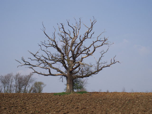
[18] Old oak tree near the path to New Wellbury
The path continued on a clearly cut path through the grass, with one of two posts indicating the way as well, passing to the right of an old pond surrounded by bushes. A bit further on, I saw to my right an impressive Oak tree standing alone in the middle of a ploughed field [18]. The path next ran between hedges and then fences, between paddocks containing horses. The path turned left, then right, running slightly downhill to a stables. I walked across the concrete stable yard and through a small belt of trees to reach a track, which was my turnaround point for the day. At the start of my next walk, I will park at a small car park near where the track leaves the Barton-Hitchin Road, and follow the track to this point before continuing with the Chiltern Way.
Last time I did this walk, I said that I finished at Old Wellbury – that was slightly inaccurate, as I’d actually passed that house and reached the farm or stable complex at New Wellbury.
The return trip to Barton was very enjoyable – this was one of those nice days where my legs were still feeling strong at the end of the walk, and so the afternoon passed very easily. I stopped for lunch at the bench I mentioned earlier – as I was approaching it, I became aware that the skies had greyed over, and there was a brief shower as I ate my sandwiches. The skies brightened again very quickly though – they darkened again at one point in the afternoon, but it was generally sunny and remained dry. As I descended the steep path between the wood and the gulley on the way to Pegsdon, I heard a bird but could not tell if it was a Red Kite or a Buzzard. Then a few yards later a Red Kite flew out of the wood and soared over the gulley to the grass on the far side. I assumed that that was the bird I’d heard, but a few steps later a Buzzard flew out of the wood! As I continued down the path I heard more bird noises to my left, and saw several smaller birds ‘mobbing’ the Buzzard. As I started the long path up Pegsdon Hill, I had another very good view of a Red Kite, presumably the same bird I’d seen about 10 minutes before. I was really chuffed to see the Kites today – this was the first time I’d seen them east of my home in Kensworth, so I feel confident that I’ll see them around my home village soon – I know they’ve been seen at Dunstable Downs, just a mile and a half away, as they were recorded on the bird list outside the new visitor centre.
This was a great walk, the best walk I’ve had for a long time – I took 70 photographs, many more than I’ve taken on any other walk so far. There were plenty of ups and downs, some far-reaching views, very nice grassy downland at Barton Hills and Pegsdon Hill, good paths and tracks throughout, and bits of historic interest – Ravensburgh Castle, Knocking Hoe, the strip lynchets on Deacon Hill. The long walk down from Pegsdon Hill, with the great views ahead and over to the right to Deacon Hill, was a particularly enjoyable part of the walk – well worth the effort of the long walk back uphill in the afternoon! There was little in the way of woodland, but there were many small belts of trees along the route, especially beech trees. Apart from the shower when I stopped for lunch, it was generally bright and sunny, though with quite a thick haze meaning that the views weren’t quite as extensive as they could be. The sightings of Red Kites were just the icing on the cake!
Total Distance: 22.7 miles each way