Pete's Walks - The Chiltern Way (2)
If you are considering walking this route yourself, please see my disclaimer. You may also like to see these notes about the maps and GPX files.
Day 4 2/04/07 New Wellbury to Preston (8 miles each way, approximately)
Parked in side street in Great Offley.
Last time I did this walk, I only went as far as the tiny hamlet of Austage End, but today I needed to go on another 1.4 miles to the village of Preston. The reason for this is that last time, when I tried to start my next walk by going back from Preston to Austage End (there is nowhere to park in Austage End), I found part of the route along Dead Woman’s Lane had been closed for repairs after over-use. So I turned round, and instead of walking as far as Whitwell as planned, carried on for another 1.5 miles the other side, so that the walk conformed to my usual distance of about 7.5 miles each way. I then came back several months after I completed the rest of the Chiltern Way to walk the 1.4 miles between Preston and Austage End once the path was re-opened. This time round, I am trying to repeat the walks I did last time as far as possible – there seems no point in splitting the walk into 7.5 mile segments again, having done it successfully already! But it means I have to add this extra 1.4 miles on to either today’s walk or the walk from Preston, and as this is slightly the shorter of the two I chose to add it on to today’s walk.
Consequently, I changed my mind about how I’d do this walk. Last time I did it, I parked in a small car park on the Barton-Hitchin Road, and followed a bridleway along a track to where I ended my previous walk, and carried on from there as far as Austage End. This meant I did about half a mile’s unnecessary extra walking at the start and end of the day, on top of the 7.1 miles each way I did on the Chiltern Way. That wasn’t much of a problem, as I was still very close to my usual distance of 15 miles. However, I didn’t want to add the unnecessary walking on to a walk that was already 8 miles each way, so today I parked in Great Offley and started the day by walking back along the Chiltern Way to where I finished my last walk near New Wellbury.
[1] The start of the walk at New Wellbury
[2] Start of the path from New Wellbury to Little Offley
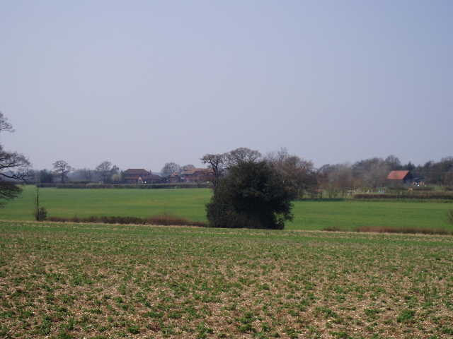
[3] Looking back towards New Wellbury from the path to Little Offley
This was a gorgeous Spring day, warm with blue skies and no clouds. It was quite hazy again, as on my last walk, and there was quite a stiff breeze at times, but the breeze was warm, not chilling, and so I didn’t need my coat at all today. After a long, wet and cold Winter, a day like today was just what the doctor ordered! Spring has sprung, and I’ve got a spring in my feet again (actually, that is almost literally true as I’m using some new footbeds in my boots which I’m finding to be very helpful).
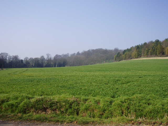
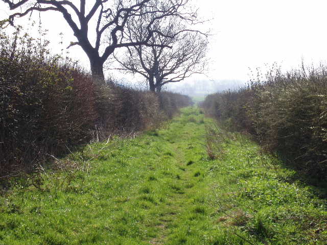
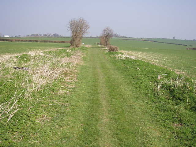
Starting at the junction where the footpath I’d followed on my last walk met a bridleway on a track [1], I turned left along the track, but immediately forked right as the track went left to the farm or stable complex at New Wellbury. The bridleway continued on a gravel track beside a left-hand hedge, with a wooded hillside across the ploughed field on my right. I saw a Buzzard over the trees there – a few minutes earlier, as I’d walked here from Great Offley, I’d seen five large birds over the woods there, including at least one Red Kite. The track passed the entrance to Wellbury House on the left and then a house on the right. It turned to the left, and after another 50 yards I turned off it, taking a bridleway going right.
The bridleway followed tractor tracks through an arable field with a young crop in it [2]. The field lay in an attractive small valley with wooded slopes on either side, then rose steadily up the hillside at the end of the valley. The bridleway joined a farm track near the top of the hill [3], and I continued along the track for about 100 yards before turning left just before the yard of a farm at Little Offley. The bridleway here was very uneven, as it followed a right-hand hedge beside the farm and then a paddock. On my way out from Great Offley earlier, I’d seen a Red Kite over the field to my left. The bridleway then joined the drive from Little Offley House, a late Tudor brick house that I could see a short distance away. Where the tree-lined drive ended, I turned right along another bridleway, running along the bottom of a typical Chiltern valley. There was a hedge and then a small belt of trees on my right [4], and I saw a Peacock butterfly here, one of several I’d see today. When the trees ended, the bridleway continued along the bottom of the valley with arable fields on either side. At the next field boundary, the Chiltern Way turned left alongside a hedge to climb up Clouds Hill – I could see a large bird over to my left here, but couldn’t make out if it was a Red Kite or a Buzzard. At the top of the hill, I turned right along Honeysuckle Lane [5], a green track between hedges. I remembered that when I was here almost two years ago, the track was covered in long wet grass and the bottoms of my trousers were soaked by the time I reached the end of the track. The grass was much shorter this time, and I had no such problem now. I saw some Lesser Celandine here, and some Greater Stitchwort.
[4] Path just beyond Little Offley
[5] Honeysuckle Lane
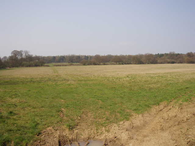
[6] Hazy view over Lilley Bottom from near Great Offley
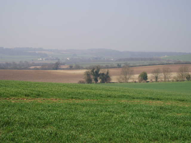
Honeysuckle Lane ended at the A505 dual carriageway between Luton and Hitchin. I soon managed to cross to the far side, where another track went right, initially almost parallel to the main road but then curving further and further away from it. After a few hundred yards it reached the old road between Luton and Hitchin, by the end of a row of cottages. Here I crossed over and followed a left-hand hedge through the next field to a lane. On the other side, I continued on a good farm track, still with a hedge on my left. There were good views here to my right, downhill and over the wide valley of Lilley Bottom and the village of Lilley, with another line of chalk hills beyond [6]. It was still somewhat hazy, so the view wasn’t quite at its best. Ahead of me I caught a glimpse of a Hare on the track, which soon fled into the arable field on my right. It was so sunny that I stopped to put my sunglasses on. After a while I turned left off the track, taking a path which followed the left edge of a meadow with a wood over to my right – there wouldn’t be much woodland walking today, but I’d certainly see plenty of woods around me. In the next field corner the path went through some bushes to a kissing gate. This led to a long narrow meadow, where I followed the wire fence and hedge on the left. Through another kissing gate near the next corner, I entered a large grass meadow on the edge of Great Offley. I followed the right hand edge, passing a water works and then a farm entrance, to emerge in the village opposite the Red Lion pub.
Great Offley is said to get its name from Offa, the King of Mercia who built Offa’s Dyke along the English-Welsh border. He is thought to have had a palace here and to have died here in 796. According to legend Offley Place, originally built in 1600 but much altered in the eighteenth century, was built on the site of Offa’s palace. The village was once an important stopping point on the road from Luton to Hitchin and several coaching inns survive.
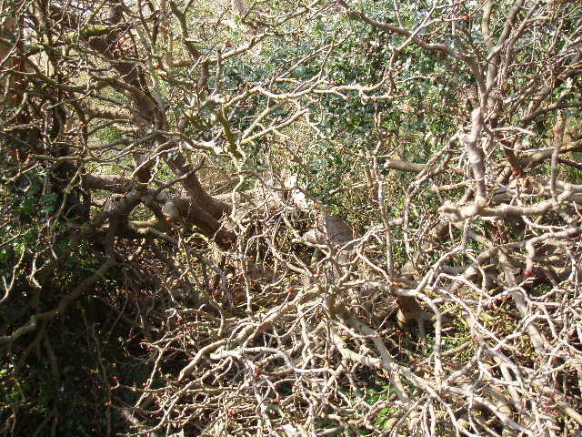
[7] Looking back at the fallen tree blocking the path near Great Offley
[8] Path heading downhill beside a wood just after Great Offley
[9] Track between fields near the A505
I followed the road left for a few yards, then took a footpath on the right, between a garden hedge and the churchyard on my left. After a while, the hedge was replaced by a wire fence separating me from a field. A little further along the path, I came across a large fallen tree, completely blocking my way [7]. There was no obvious way round it, so I struggled across its fallen trunk and picked my way carefully through the numerous branches. I did the same on the way back, even though I noticed there was an easy diversion round it by following a path through the trees on one side – a dog walker there probably thought I was mad (but I’m used to that!). The path then ran alongside the left-hand hedge of an arable field, with pleasant views over the countryside to my right. I saw another Peacock and a Brimstone butterfly along here – I’m looking forward to seeing more and more butterflies and wildflowers as Spring progresses.
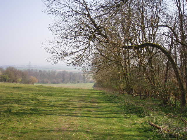
The next section of the walk was very enjoyable, a long steady descent besides a wood – I think the trees here were possibly limes, they certainly weren’t the usual beech or oak [8]. I could see more woods ahead and to the left as well. At the bottom of the slope I crossed a small area of rough grass, and then the path continued alongside a wood on the left, with arable fields to my right stretching across to a steep chalky slope about a mile distant. Where the wood ended, I went through a gap and then followed a hedge on my right. I continued to follow it as it turned sharply to the right, and soon reached a crossing track, where I turned left. The countryside here was very pleasant, arable or ploughed fields between hedges, often separated by green tracks [9], and with the line of chalk hills to my right. Sadly it was spoilt by a row of giant electricity pylons, and also slightly marred by noise from the nearby A505 dual carriageway. I saw another Hare in one of the fields, and there were several more butterflies.
[10] Looking back along Hoars Lane
[11] Large sheep pasture, leading to West Wood
[12] Path through corner of West Wood
The track passed under the pylons and came to a junction with another track. Here I turned right, and followed the track beside a right-hand hedge through two large arable fields – here, as in several other places, I saw lots of Common Field Speedwell. At the end of this track, I turned right into Hoar’s Lane, another green track between hedges [10]. This soon crossed Chalk Hill, an unmade road, and continued on the other side, sometimes as a green lane between hedges, and sometimes as a track beside a right hand fence. I was now getting nearer the hills I’d seen to my right earlier. In fact the track passed the end of a long low hill, named Pinnacle Hill on the map, which had a small clump of trees on its lowly summit. The track ended at a corner of a lane, where another path went off right alongside a wire hedge, running through a sheep pasture. The sheep here were an unusual breed for this area, having two small curving horns – most sheep I come across around here don’t have horns.
The path next went through a plantation of beech trees. I remembered from last time that some of the gates here had a peculiar ‘patented’ locking system – I don’t think anyone will make money from this invention, they are far too complicated. It always surprises me just how many different ways there are to achieve the simple act of keeping a gate closed.
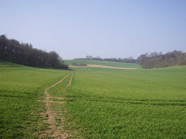
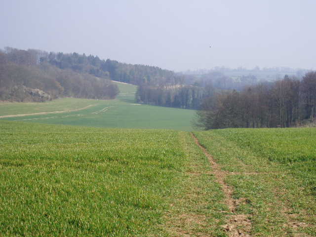
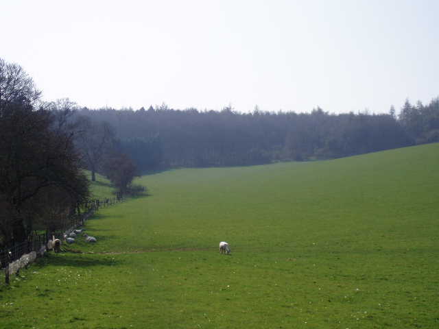
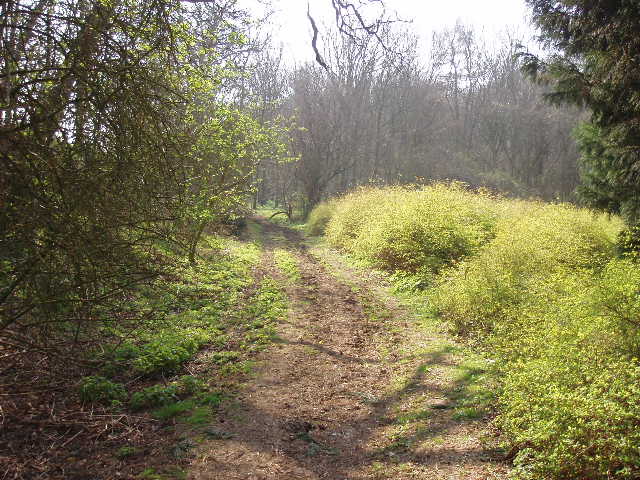
Anyway, beyond the plantation I entered another sheep pasture (same unusual sheep) [11], and followed a wire fence on my left gently uphill towards a wood. This again was a very pretty scene, with the green pasture rising ahead of me to a wood and uphill to my right to the clump of trees on Pinnacle Hill. To my left was another green pasture, and then an attractive old farm with wooded hillsides beyond. It was a long but gentle climb beside the wire fence, then I continued uphill through a corner of West Wood [12]. The path soon emerged from the wood to reach a ploughed field, where it continued gently uphill along the edge of the wood. I saw a Buzzard here, and again on my return. The ground started to level out as I followed the edge of the wood. After a while, by a marker post, I left the edge of the wood, turning half-left across the ploughed field – there was no real sign of the path, but it was easy walking across the dry, hard earth. On the other side I went through a hedge gap, and followed a left-hand hedge through a field of rough grass. At the end of the field I went through a gateway to reach the tiny hamlet of Austage End [13], just three or four large houses at the end of a track.
[13] Field on edge of Austage End
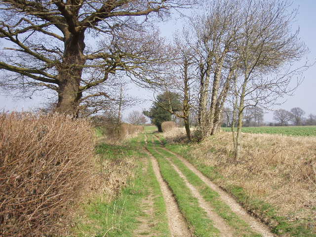
[14] Track between Austage End and Preston
[15] Looking back to Austage End
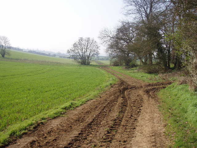
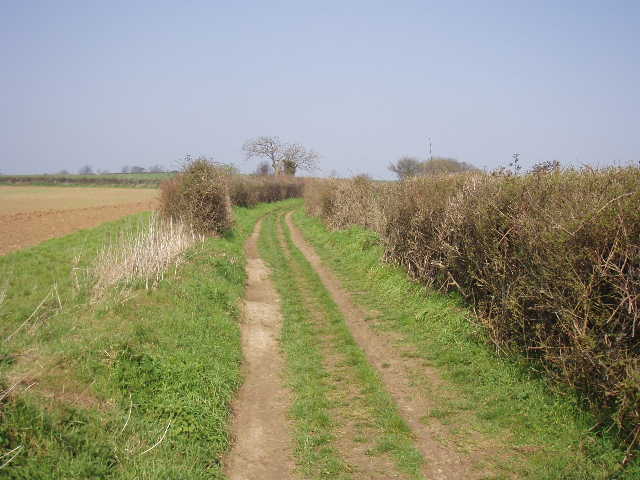
I turned left down a footpath immediately past the only house on that side, the path running beside the fence of a very long garden and then crossing an arable field. The Chiltern Way then turned left for a short distance along an old track [14], before turning right up a few steps and crossing another much larger arable field [15]. On the far side of this field the path joined another track, called Dead Woman’s Lane [16], where I turned right – this was the section of the route that had been closed last time because of erosion due to over-use. The repair work carried out seemed to have worked as the track here was fine now – there was quite a deep drainage ditch cut along the right of the track, and the track was at a slight angle, tilting from left to right so that water would run into the ditch. I followed the track for about a quarter of a mile, then turned left at a footpath sign. The path went up the left-hand side of an empty pasture, then through an open gate into another pasture where a herd of black-and-white cows and bullocks were grazing. The path continued in the same direction then turned right just before reaching a farm – the same pasture continued in that direction, being roughly L-shaped. As I crossed this second part of the pasture, I saw a man come through the hedge gap by the footpath sign on the far side with two dogs. The dogs both saw me and ran towards me – they were obviously friendly though, and just ran round me and then back to their master. When I got close to where he was standing, he apologised for his dogs behaviour, which was nice of him. I’ve had several unpleasant incidents where dogs have run at me barking aggressively, and their owners haven’t offered a word of apology. Anyway, I warned him about the cows in the other part of the field, but he said he wasn’t going to take the dogs round there.
I had now arrived at a lane on the edge of the village of Preston, where I turned left for a few yards then went right down another footpath. This had an arable field on its left and garden fences on the right. It then ran past a play area on the right, which a sign proclaimed to be the ‘Church Meadow Millennium Commemoration Project’ [17]. The path then went down a short alley between houses to reach another lane, where I turned right. I soon reached a junction where I turned right again, and within a few yards reached the triangular green at the heart of the village [18]. I carried on a few yards further, to reach the village hall, before turning round. It was now almost 1.30pm. I went back to Church Meadow, where I sat on a bench by the play area to eat my lunch (corned beef and Branston pickle sandwiches, my favourites!).
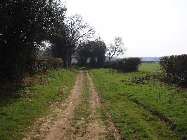
[16] Dead Woman's Lane
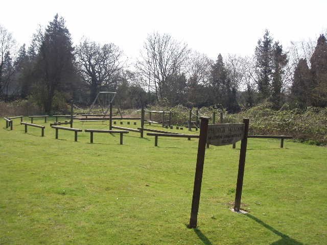
[17] Church Meadow, Preston
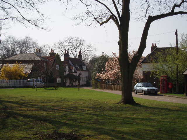
[18] Preston
The walk back to Great Offley went by very quickly and pleasantly. It was a lovely sunny afternoon, though still a little hazy. There was a bit of wind, but it was a warm wind that hardly affected the temperature. It was about 3.15 by the time I got back to my car.
This was another very enjoyable walk, on an almost perfect day, weather-wise. It didn’t have the chalk downland that the last walk had, but otherwise was almost as good a walk as that had been. There were many nice views over the countryside, noticeably over the wide valley of Lilley Bottom. The paths throughout were clear and easy to follow (apart from that fallen tree!).
Total Distance: 30.7 miles each way