Pete's Walks - The Chiltern Way (2)
If you are considering walking this route yourself, please see my disclaimer. You may also like to see these notes about the maps and GPX files.
Day 5 3/04/07 Sharpenhoe Clappers to Lilley (7.5 miles each way, approximately)
Parked at car park for Sharpenhoe Clappers.
Having spent the last 2½ walks on the northern extension of the Chiltern Way, today I returned to walk part of the original route that the northern extension misses out. I haven’t finished the northern extension yet, so there’s no real logic behind this decision – it’s just that this is what I did on my previous Chiltern Way walk almost two years ago, for some reason, and I am trying to repeat the walks in the same order as last time as this keeps things simple for me in terms of planning ahead and of keeping track of distances walked.
What a difference a day makes! Yesterday was a gorgeous, warm and sunny spring day, today seemed like the return of winter. It was grey and overcast all day, until the sun put in a fleeting appearance just before I got back to my car, there was a strong and cold north wind and I had two or three spells of drizzle. In fact, I might have changed my mind about walking today, except that I’m hoping to fit in four walks this week. I have always tried to do three walks a week, but over recent months I have been failing lamentably for various reasons, and my average can’t be much over two walks a week. So it would be nice to do four walks in a week now and again, especially as I need to get fit for another holiday in the Lake District in about a month’s time.
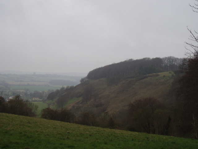
[1] Sharpenhoe Clappers, from the car park
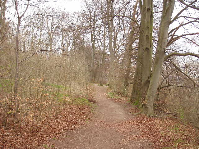
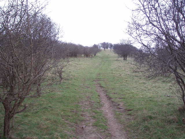
[2] Looking back along the path round Sharpenhoe Clappers
[3] Path beside Watergutter Hole
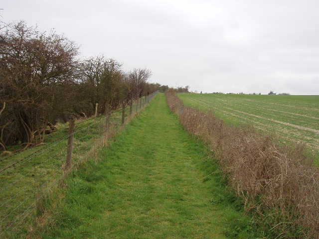
The car park [1] is actually 0.6 miles from the point where the northern extension splits away from the Chiltern Way, so I actually walked 8.1 miles each way today, making it two 16-mile walks on successive days. I took a different route to the Chiltern Way to get to that point, so I could walk through Clappers Wood on the top of the hill, rather than round its edge. When I reached the signpost where the northern extension diverges from the original route at the top of the steep steps down the northern end of the hill, I ignored the steps and instead followed the path that contoured round the edge of the beech trees that surmount the hill [2]. After a few hundred yards, the Chiltern Way went down a short but steep chalky bank to leave the trees, and then followed a path between fences. There was a large grass meadow on my right at the top of the hill, where I saw several dog walkers, while to my left was a scrub covered slope heading down towards the A6 and Barton-le-Clay beyond. After a short distance, I went through a kissing gate on my left to enter the area of scrubland, following a well-worn path through the rough grass and small bushes. There were good views to my left over a valley to the A6, Barton and the Barton Hills. After a few hundred yards, the northern alternative route of the Icknield Way path came in from the right, and both routes continued through the scrub to another kissing gate, where I rejoined the fenced path.
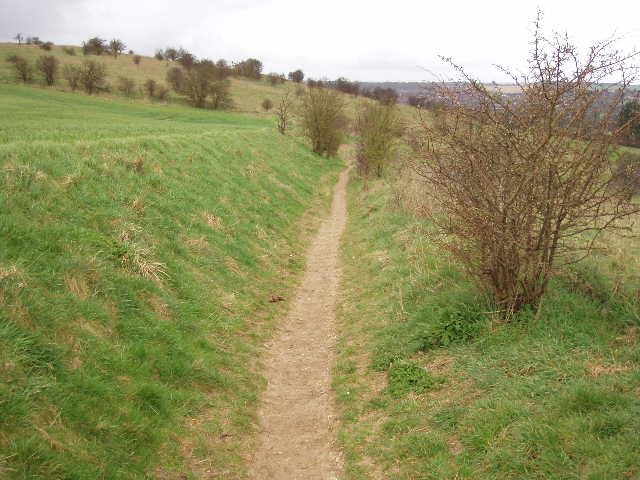
The Icknield Way soon left the fenced path, going through a kissing gate on the left to go downhill and take a route into Streatley that included a stretch alongside the A6 dual carriageway. From experience, I prefer the Chiltern Way route, which continued along the fenced path, now with arable fields on the right but still with a steep scrub-covered slope on the left. I heard a skylark singing here – I heard them in several places today, and have done on my previous walks too. The path was heading generally southeast towards Streatley but soon had to take a quarter-mile detour to the west, contouring round a narrow and steep-sided dry valley called Watergutter Hole [3]. The sides of this valley were covered in small trees and shrubs that reached the top of the valley beside the path, so that I could only get occasional glimpses of the valley floor below, and couldn’t take a photograph of it. I did catch a sight of some sheep in the pasture in the valley bottom, curiously walking one behind another in a long line. The path went round the narrow head of the valley before heading eastwards, only to take another detour round the head of a smaller dry valley, Cow Hole. On the far side of this small valley there were a group of beech trees, and I managed to take a photo looking down to where Watergutter Hole and Cow Hole came out into a sheep pasture beside the embankment of the A6 [4].
The path now turned south, close by and parallel to the dual carriageway, and soon passed through some allotments to reach the edge of Streatley. If you’ve read my previous journals, you’ll already know that this village’s name is pronounced ‘Strett-ly’ as opposed to the better known village of the same name in Berkshire which is pronounced ‘Street-ly’ (I remember which is which by recalling that the one in Berkshire is on the other bank of the Thames to Goring, and that the adjacent villages were often referred to as ‘Boring’ and ‘Discretely’ by commuters). The village was once just a small community of a few houses, and only grew into its current size during the last century. At the start of that century it’s largely fourteenth-century church was in ruins, and was only restored by Sir Albert Richardson in 1938 (thanks as usual to the guide book for this info). I was interested to read on the church’s web site that it belonged to Markyate Priory, from the priory’s foundation in 1145 to the dissolution of the monasteries in 1536 – Markyate is one of the neighbouring villages to Kensworth where I live. I was further interested to see that the last prioress of this house of Benedictine nuns was called Joan Zouche – there is a Zouche’s Farm just a few miles away in Caddington (sorry for this irrelevance, it’s funny how you get distracted from one thing to another when you search the internet).
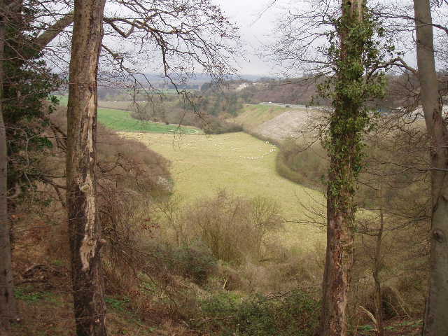
[4] Looking down on sheep pasture beside A6 embankment, at end of Watergutter Hole and Cow Hole
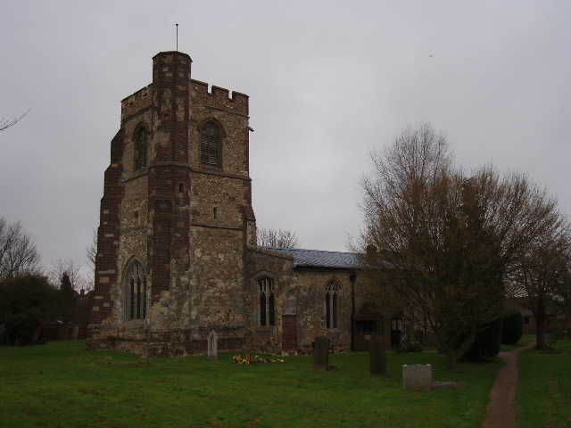
[5] Streatley church
[6] Path leading uphill, away from Swedish Cottages
I turned right along the road, rejoining the route of the Icknield Way briefly – with hindsight I could probably have parked here by the allotments, and saved myself the extra 0.6 miles each way off route between the Clappers and the car park. There was a slight drizzle now, but it only lasted a few minutes. At the end of the road, I turned left for a few yards then crossed the road to take a footpath beside the pub that entered the church yard. I followed the path to the left of the church [5] to a gate, then followed an alley between garden fences. I then followed a left-hand hedge between fields of rough grass, slightly downhill, then turned left along a track past a few cottages to rejoin the main road through the village by a pond. I’d been following the same route as the John Bunyan Trail through the village, but that now took a path beside the pond, while I turned right along the road, rejoining the Icknield Way that had kept to the road all through the village.
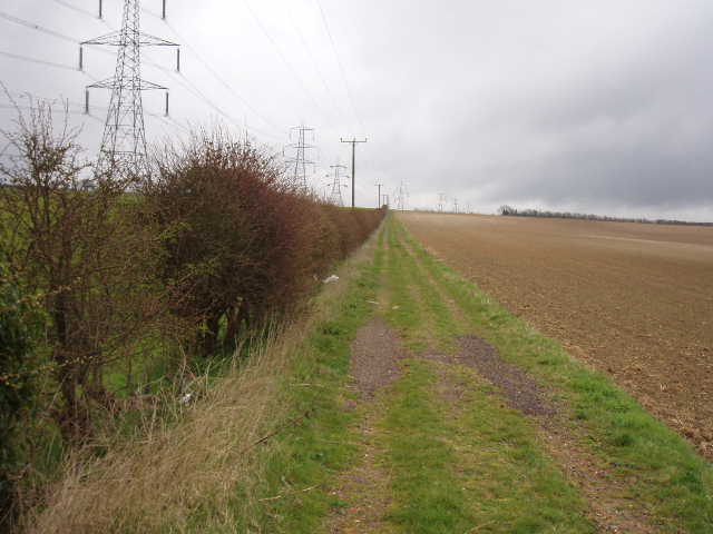
I followed the road past more houses and a farm, then left the buildings behind and shortly reached the end of the road when it reached the A6 (here just a single carriageway). I crossed over and continued along a track opposite, which passed the curiously named Swedish Cottages, a row of largely wooden houses. The track followed a left-hand hedge (and a row of giant pylons) as it climbed gently uphill between large ploughed fields [6]. I remembered seeing Small Tortoiseshell butterflies when I walked this path last summer on my Berks-Essex Walk, but I didn’t see any butterflies at all on this cold and gloomy day. To my right I could see the steep, scrub-covered sides of Galley Hill and Warden Hill. After about a third of a mile, at the second crossing hedgerow, I turned right on another good farm track, with the hedge on my left [7]. Across the field on my left, the northern extension ran alongside the next hedgerow – I’d been walking along there three days ago.
[7] Path heading towards Galley Hill and Warden Hill
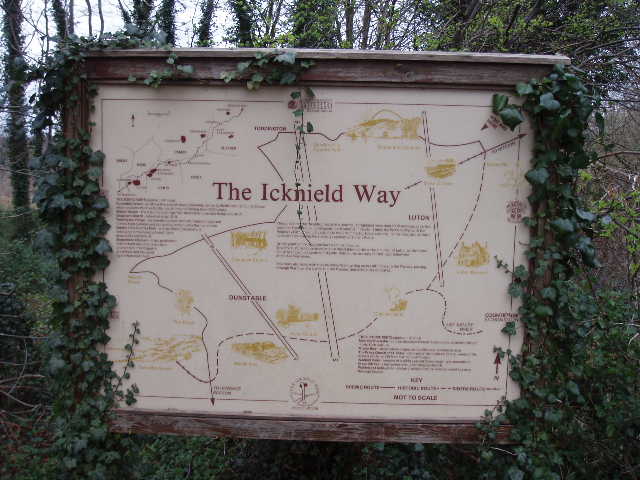
[8] Information board at the Icknield Way junction, by Galley Hill
[9] Path going up Galley Hill
The track I was now on continued to the end of the large ploughed field on my right, then passed through a small area of trees to a major path junction. This was where the northern alternative of the Icknield Way rejoined the main route (there was a notice board about the Icknield Way here [8]). The combined Icknield Way now went left here, shortly to meet both the northern extension of the Chiltern Way and the John Bunyan Trail, all those routes continuing further to my left towards Telegraph Hill. I went straight on instead, entering a golf course where I soon turned half-right and crossed a fairway to a kissing gate. Leaving the golf course behind, the path now climbed the scrub covered end of Galley Hill [9], reaching the summit surprisingly quickly and easily. Galley Hill is a corruption of ‘Gallows Hill’ (I’ve come across similarly named hills elsewhere) – a barrow mound on the hill was found to contain not only Neolithic and fourth-century burials, but also those of fifteenth-century gallows victims.
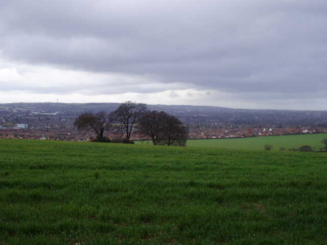
It was very windy here, and again there was a brief bit of drizzle. South-westwards, I could see out over the Luton and Dunstable conurbation [10] to the steep chalk slopes of Blows Downs beyond, while to the northwest I looked back over the valley carrying the A6 to Streatley. To the east, there were gently sloping arable fields – a sharp contrast to the steep slopes of grass and scrubby bushes on the western side of both this hill and the neighbouring Warden Hill. I had walked the area east of these hills on the John Bunyan Trail a few weeks ago and found it a very enjoyable area for walking, despite its proximity to Luton.
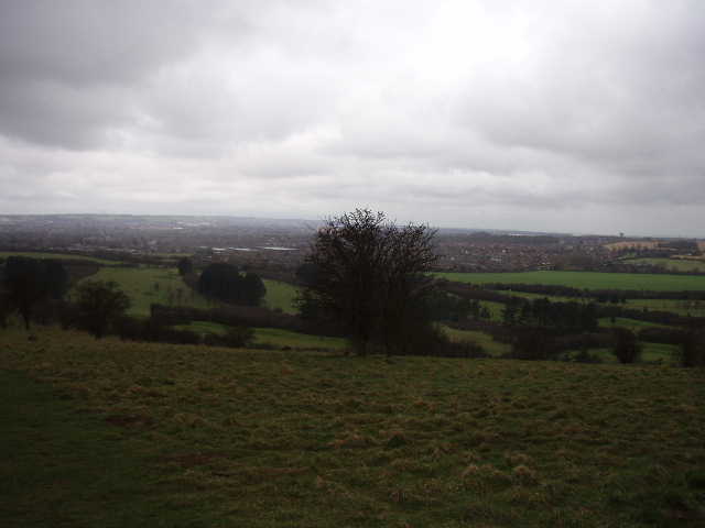
[10] View over Luton from Galley Hill
[11] Path between Galley Hill and Warden Hill
[12] View back towards Streatley from Warden Hill
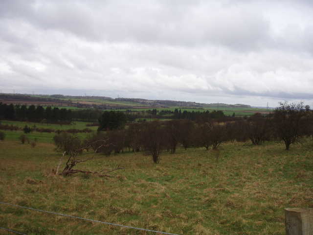
I followed the path along the top of Galley Hill, soon going through a kissing gate and following a fence that separated the area of grass and bushes on my right from a large ploughed field to my left. I followed this fence for some distance, as it went downhill slightly to a small gap between Galley Hill and Warden Hill. Here I turned right on another path, briefly following the route of the John Bunyan Trail again [11], before turning left on another path that led up across more downland to the top of Warden Hill – a slightly stiffer climb than that up Galley Hill. The path then followed a fence on my left, separating the scrubland from an arable field. The actual summit of the hill was marked by an Ordnance Survey triangulation column a few yards into the field. There were more extensive (if not attractive) views over Luton here [12] – the only thing worth looking for, of course, was Kenilworth Road, the home of Luton Town FC (who, despite being the greatest football team the world has ever seen, are currently at the bottom of The Championship).
The path next crossed an area of grass by some earthworks, and then headed steeply downhill. Just before reaching the bottom of the hill, with the houses of Luton just a field away, I turned left along a path contouring round through the bushes close to the bottom of the slope. After a few hundred yards it reached a row of impressive beech trees, and then went through a gate. Leaving the scrubland behind, I now followed an old hedge on my right, gradually rising back uphill again, with huge arable fields on either side. At the top of the hill I joined a track going right. I stopped for a few photos here, looking across Luton in one direction, and across the pleasant farmland around Lilley towards Telegraph Hill in the other direction [13]. A little further on I came to a track crossroads, where two mountain bikers were struggling up the slope on my right. Two large concrete blocks were positioned to stop four-wheel vehicles entering the track I was about to take ahead of me – I sat on one to eat my lunch on the way back. This track ran along the hill top, passing a small wood [14] and a cottage on the left, to reach the end of a lane near Whitehill Farm.
[13] View towards Telegraph Hill from path to Whitehill Farm
[14] View over Luton from near Whitehill farm
[15] Looking back across sheep pasture near Whitehill Farm
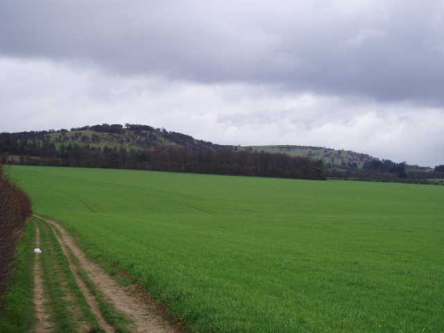
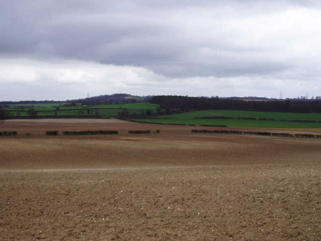
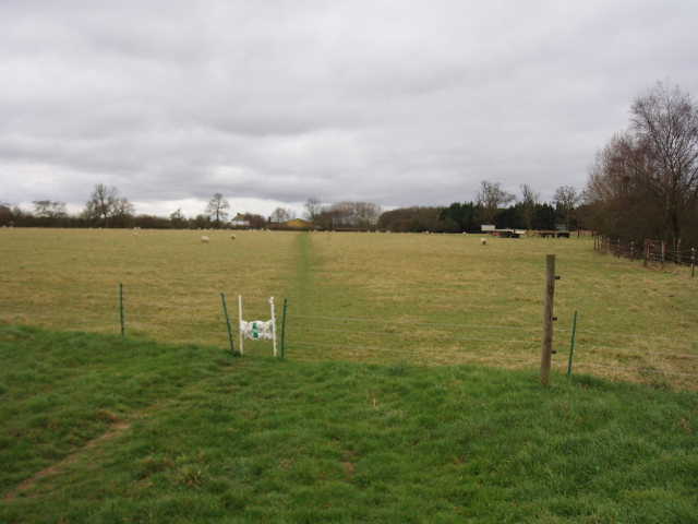
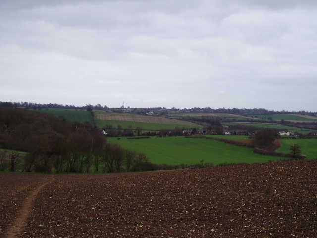
A few yards down the lane, I turned left through a hedge into a sheep pasture. I crossed an electric fence and followed the clear path through the rough grass, to the consternation of one or two nearby sheep and lambs (these were more like the normal sheep I see, not the horned beasts I saw yesterday). I re-crossed the electric fence on the far side of the pasture [15], and then set off across a very large ploughed field. The path here had been marked out by a tractor, but everyone using the path had obviously walked along the right-hand tyre track, as this was a clear and hard path through the ploughed soil whilst the left-hand tyre track was almost indiscernible. This was a very large field that soon started to slope down towards the wide valley of Lilley Bottom. The slope was such that the bottom of the field could not be seen from the top, and vice versa. I passed a solitary tree in the middle of the field – there were nice views here [16], across Lilley and Lilley Bottom towards Great Offley on the other side, and I could see where I’d been walking yesterday morning.
At the bottom of the field (and bottom of the hill) I followed a left-hand hedge and then a wood past an arable field, with the A505 dual carriageway between Luton and Hitchin a short distance to my right. A Buzzard flew out of the wood as I passed by. At the end of this long field [17], I entered a track which soon brought me to the grounds around Lilley Village Hall and so to the main road through the village [18]. I walked a few yards to the left, to where a signpost indicated the footpath by which I’ll leave the village on my next walk. It was now about 12.25pm as I turned and started to make my way back to Sharpenhoe Clappers.
[16] Looking over Lilley and Lilley Bottom towards Great Offley

[17] Looking back along the path, from near Lilley
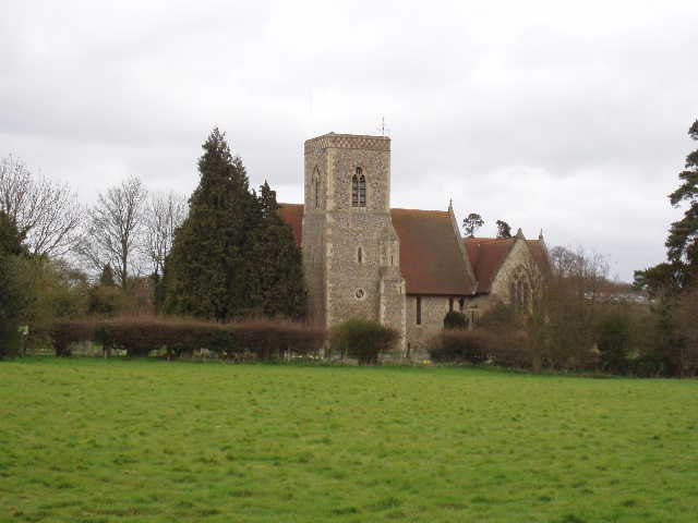
[18] Lilley Church
I had my lunch, as mentioned, sat on a concrete block on the track from Whitehill Farm. There was a reasonable view from there over the fields to Warden Hill. I had another brief spell of drizzle on the way back, and the day remained dark and gloomy all the way back to the Clappers. The sun then just appeared briefly through the clouds during my short walk back to the car park. Curiously, although this was only the second time in ages that I’d walked on successive days, I felt very good today and the walk back in the afternoon went by really easily. I could easily have carried on for a few more miles (of course, whenever I say this, I really struggle on my next walk!). I think the new footbeds I’ve put in my boots are really helping – my feet no longer start to get sore towards the end of a walk and my knees feel less painful on steep downhills.
Despite the grey and gloomy weather, this wasn’t too bad a walk at all. The stretch from Sharpenhoe Clappers to Streatley was fine, apart from a bit of road noise from the A6. From Streatley to Galley Hill was straightforward on good farm tracks. The walk over Galley and Warden Hills was pleasant, even though the views were dominated by the large built-up area of Luton, Dunstable and Houghton Regis. The last mile or so from Whitehill Farm to Lilley was probably the best, with good views over the wide valley of Lilley Bottom to hills on the other side near Great Offley.
Total Distance: 38.2 miles each way