Pete's Walks - The Chiltern Way (2)
If you are considering walking this route yourself, please see my disclaimer. You may also like to see these notes about the maps and GPX files.
Day 22 2/06/07 College Wood to Bledlow Ridge (7.2 miles each way, approximately)
Parked in Ibstone.
This was another Saturday walk, exactly a week after the last walk. I’d not been able to walk in the meantime because of the wet weather – Global Warming is playing havoc with the British weather, as the warmest April on record has now been followed by one of the wettest ever Mays.
The walk got off to a really bad start. I parked in Ibstone, in a parking bay just 100 yards from where the Chiltern Way crosses the main road, and started by walking back to College Wood (there was nowhere to park where I finished the last walk). After walking a few hundred yards through a wood, I started a very long and quite steep descent along a path near the edge of the wood. As I was going down, it struck me that this was one of the longest stretches of downhill on the whole of the Chiltern Way. Then, when I neared the bottom, I realised I’d gone wrong – I could see the path continuing along a valley, instead of across one. Far too late, I got the guide book out and saw that I should have forked left about halfway down the hill. So I had to turn round and go a long way back up the hill.
What made it worse, was that I’d just had to take a detour round a fallen tree which had involved going up a very steep bank beside the path, and in doing so I seemed to have hurt my right calf muscle. When I got back to the junction where I should have turned left, I then had to go downhill quite steeply for about 50 yards – both my calf muscles were really aching, and when I came out of the wood into a large meadow and turned right to continue downhill beside the wood, I was in such pain that I was in two minds as to whether I should carry on. I decided to go on, and see if I could walk it off, hoping the pain would ease when I reached more level ground. The pain was in the lower part of the calf muscle, towards the Achilles tendon – perhaps the muscles hadn’t been properly warmed up before I started the steep descent. I limped slowly and painfully down to the bottom of the valley. I was particularly concerned, as I knew that today would be the hilliest walk of the entire Chiltern Way. Fortunately the pain did ease as I crossed the fields in the broad bottom of the valley and so I managed to carry on the walk, although I was conscious of a tightness in the muscles every time I went steeply up or down.
[1] Path through meadow, leading away from Hollandridge Lane
[2] Path through corn fields, heading towards Northend
[3] Path through woodland on the Wormsley Estate
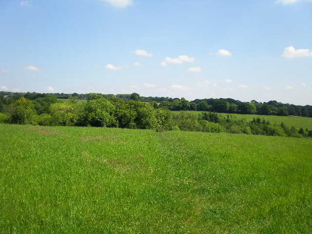
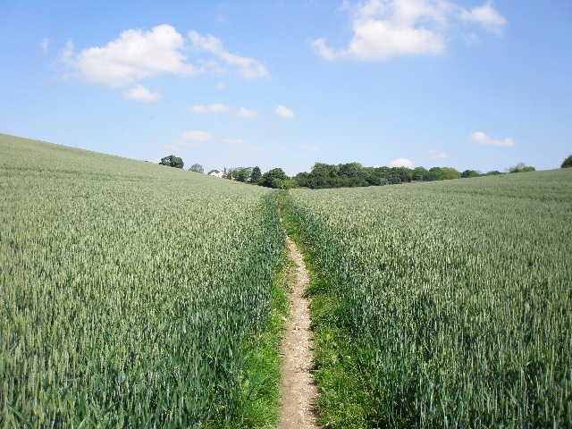
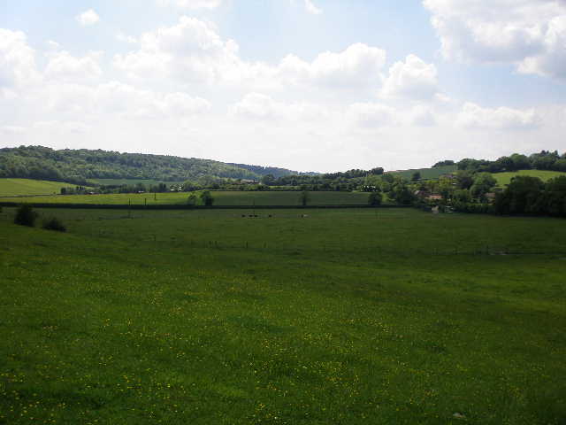
I got back to College Wood (or, to be strictly accurate, Hollandridge Lane) at 11am, having left Ibstone at 9.50am. I turned round and headed back to Ibstone. The Chiltern Way followed a hedge on the right of a large meadow for about 100 yards, then went slightly left across the meadow [1], soon descending towards a wood. On entering the wood, I went steeply down a bank to a path junction, where I continued ahead on a wide track through the wood that followed the bottom of a small valley. I met two horse riders just before the path left the wood, and then carried on as the path rose very gradually along the valley bottom through a very large corn field [2]. I could see a Red Kite flying over the valley ahead of me. After about a quarter of a mile, I turned right to go uphill beside a fence on my left. After a hundred yards or so, I crossed a stile in the fence and followed a path across a corner of a meadow, then went along a short alley between garden hedges and fences to reach the hamlet of Northend.
The small settlement of Northend takes its name from the fact that it is at the north end of the parish of Turville (the ‘Dibley’ village) – I went through Southend at the other end of the parish on Day 15 of this walk. I followed a path across some grass and then along a gravel drive for a few yards to reach a road. I crossed over and continued on a path through bushes to reach a wood – a sign here indicated that I was entering the Wormsley estate. This was owned by the late Sir Paul Getty, who did much to renovate both Wormsley Park and the tenanted properties on the estate – he also staged many cricket matches on his private cricket ground here. Previously the estate had been in the hands of the Scrope and Fane families for 400 years, and they were largely responsible for seeing that no public road ever went through the Wormsley valley, thus ensuring that it retained its tranquil and isolated beauty.
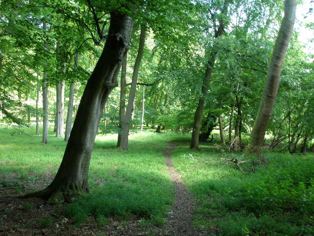
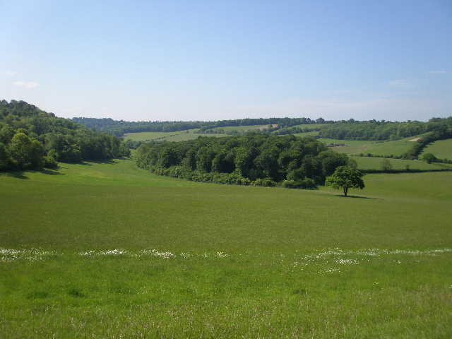
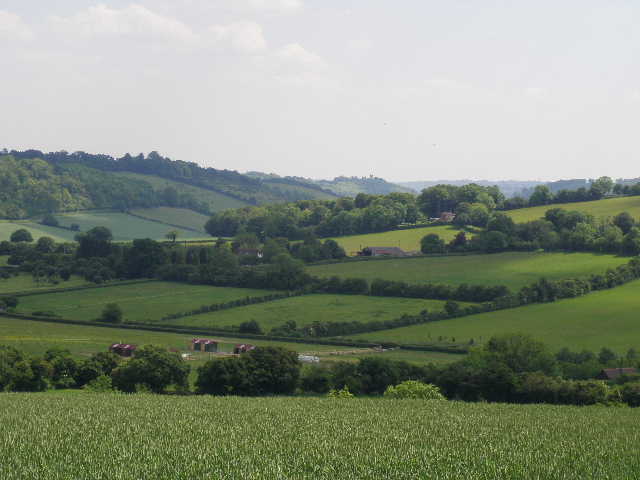
The path now descended quite steeply through the pleasant deciduous wood, where I saw beech and oak trees – I noticed a lot of what look liked Ash leaves on the path, but curiously couldn’t see the trees from which they might have come. This happened elsewhere on this walk too. At the bottom of the slope [3], I reached a junction close to a clearing with a statue. I turned right, soon following a flint wall on my left. The path led to a tarmac estate road, where I turned right for a few yards before going over a stile on my left. The Chiltern Way now crossed a corner of a sheep pasture, where I saw another Red Kite, and then crossed another estate drive. I next followed the path across a large cattle pasture – there were some long-horn cattle here, all but two of them lined up in the shade of the hedge a long way to my right. I was now crossing the bottom of the broad Wormsley valley [4] – very pretty, with a patchwork of green fields across its bottom sloping up to the woods along the hilltops.
[4] Footpath across the Wormsley valley
[5] The Wormsley Valley, from where the path to Ibstone enters the woods
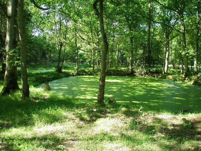
[6] Pond in woods near Ibstone
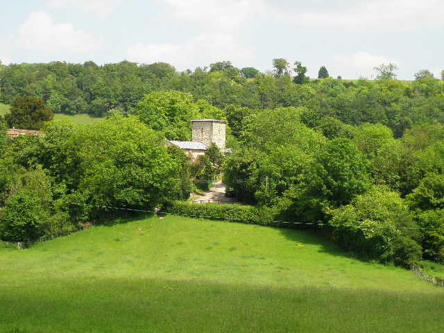
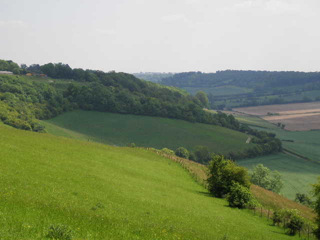
On the far side of the cattle pasture I crossed over a stile, then went through a gate on the other side of a track carrying a bridleway. The path then followed a left hand fence between large meadows, gradually getting steeper as it started to rise up the other side of the valley (this was where my legs had really hurt earlier). There were many wildflowers amongst the grass (including Salad Burnet), and some little blue butterflies that I couldn’t get a good enough look at to identify. The path rose more steeply, now with Great Wood on my left and nice views over the Wormsley valley to my right [5]. I followed the path into the wood, where it rose steeply for about 50-100 yards to reach a junction, where I turned right (this was the junction I had missed earlier). The path now continued uphill through the trees, but less steeply. The path remained close to the edge of the wood, and I could see another meadow to my right. Where I could see a hedge came in on the right, I reached a junction at the top of the hill where I turned left, still in Great Wood. I soon came to another junction, where I took the left fork, with a couple of ponds on my left (both covered in green algae) [6]. As I walked along the path I saw a female Muntjac deer run across in front of me – I’d been thinking just a few minutes earlier that I was a bit disappointed at how few deer I’d seen recently on this walk.
The path led to the road in Ibstone, close to where I parked. I turned left along it for 300-400 yards, then turned right on a footpath that went through the garden of the last house in the village to a gate into a wood. Again the wood was mainly beech and oak, with quite a lot of holly too. The path soon started to descend, quite steeply for a fairly short section, then less steeply as it reached another valley bottom. I went over a stile at the wood edge, then turned left to follow the edge of the wood uphill, with a large corn field on my right. Again this was an attractive valley of green fields and woods, but much narrower and smaller than the Wormsley valley [7]. Near the top of the field the path went slightly left, back into the wood for a hundred yards or so. I next followed a left-hand hedge and fence through two interconnected fields where four horses and a handful of sheep grazed. The ground here rose much less steeply, before levelling off as I reached Studdridge farm [8].
[7] View back over valley, between Ibstone and Studdridge Farm
[8] The view from Studdridge Farm
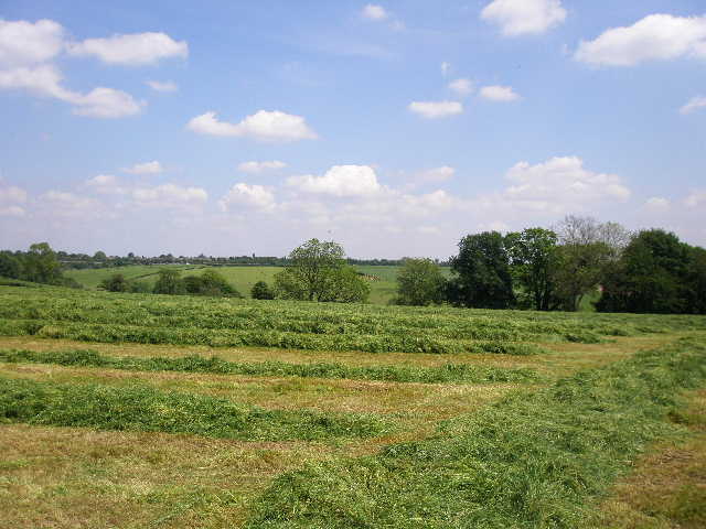
[9] Hay meadow near Studdridge Farm
I went through a kissing gate on my left, and followed the drive through the farmyard and past the farmhouse on my right. Immediately beyond a gate across the drive, I went over a stile and took a path going half-right. I was now in a large meadow that had just been mown, the grass lying in large green strips ready to be collected up [9]. I headed for the right edge of a small copse in the middle of the meadow. As I walked across I saw several Red Kites flying above the meadow, and two or three more flew up from the lines of grass as I neared the copse. I followed the edge of the copse, and saw two or three more Kites fly out of it, then continued across the meadow to a gateway. There were now many Red Kites flying about over the freshly cut meadow, and I could see more further away towards the M40 and Stokenchurch. I managed to count twenty of them, easily the most I have ever seen at one time.
The path continued alongside a left-hand hedge in another freshly mown meadow (on my way back, the farmers were here with tractors and a harvester, gathering the hay into trailers on the back of the tractors). Again there were more Red Kites here, and more flew up from the grass as I walked along – presumably they were finding a rich picking of dead mice and voles amongst the mown hay. The path went downhill alongside the hedge, and in the field corner I went over a stile by a gate and followed a farm track through a small wood. On the other side of the wood, the track went uphill between a hedge and a left-hand fence, with more newly mown hay meadows either side. There were yet more Kites here, some flying low over the trees in the hedge on my left. Just after a gate across the track, I went over a stile on the right near a farmyard, and walked half-right across a small pasture containing a few brown and white calves. On the other side I joined a track, which almost immediately went left, under the M40, and reached a road junction on the edge of Stokenchurch.
The history of Stokenchurch centres around its position on the main road from London to Oxford, at the top of the steep hill from Aston Rowant that climbs the Chiltern Escarpment. Many pubs and inns were established here as the result of the need to change horses, and by 1864 there were 13 pubs and ale houses. King Charles II was reputed to have stayed at the King’s Arms hotel. Although mainly a farming community, the village was at one time a centre for chair-making (a popular craft in the Chilterns), using wood felled locally, and there were seven or eight firms making chairs here in the 1930’s. The village school was founded in 1769 by Hannah Wray, a friend of John Wesley. Today Stokenchurch is a residential village with a few small high-tech businesses, popular because of its proximity to the M40, giving easy access to both Birmingham and London.
[10] View from path through cornfields just beyond Stokenchurch/p>
[11] View over Collier's Lane, towards Radnage and Bledlow Ridge
[12] Collier's Lane
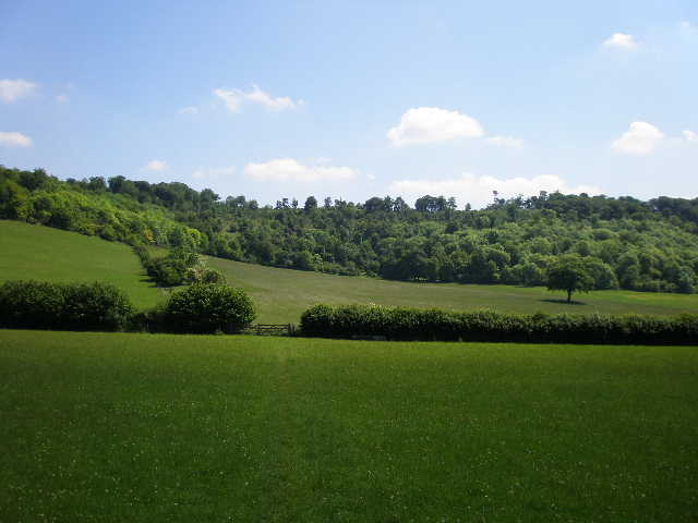
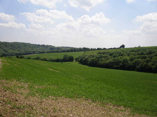
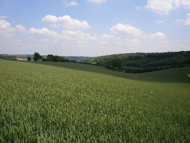
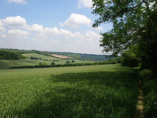
I followed the road opposite me, soon coming to a large green in the village centre. I crossed the main road, the A40 from Oxford to London, and walked down Church Street, which soon turned right. I then went left down Park Lane, soon leaving the village behind. I went through a kissing gate on the right, and followed a left-hand fence and then a line of mature trees through a meadow. The path next went half left across a corn field, with nice views to my right along another valley of corn fields and woods [10]. I then turned right along a track by a bungalow, and after two or three hundred yards went through the hedge on my left, turning right to follow the hedge through two large green fields of corn. There was a valley on my left with a wood along the top on the far side, and ahead of me I could see over part of Radnage to a line of houses running along a hilltop, which was my destination of Bledlow Ridge [11].
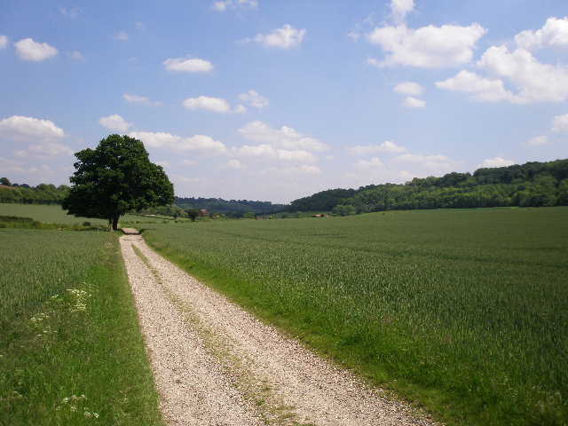
After the two corn fields I crossed over a farm track, and the path continued through a third corn field, now going half-left to descend into the valley where it joined a track. This was Collier’s Lane [12], an old route from Oxford to London that was once used by Welsh colliers taking coal to London. I turned right along the track for about 100 yards, then went half left across a small enclosure that seemed to be set aside as a wildflower meadow. I then crossed another track by a farmyard, and continued on another path through another corn field, now rising steadily uphill. In the far corner of the field, near the top of the hill, I went through an open gateway and over a stile on my right. I then walked through a small grass enclosure, and crossed two stiles either side of a track to reach a driveway by Andridge farm. I turned right, and followed the drive as it turned left, passing by two bungalows where some small dogs barked as I went by (on my way back I had a nice chat with a lady and her son here, about my walk and about the abundant Red Kites in the area).
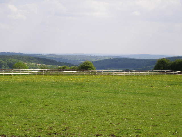
[13] View over the valley around Radnage, from near Andridge Farm
[14] Looking towards Radnage church and Bledlow Ridge
[15] Radnage church
The concrete drive ended at a field corner [13] where there was a junction of paths. The Chiltern Way followed the left hand hedge of yet another green corn field, heading slightly downhill. At the next field corner I went over a stile into a pasture and a few yards further on another stile took me onto a lane. I followed this downhill for a short distance into Town End, part of the village of Radnage. Radnage is another of those villages that consist of a number of hamlets or ‘Ends’, without having a real centre. The various hamlets – The City, Town End, Green End, Bennett End – all lie in a broad Chiltern valley, and are linked together by a network of narrow country lanes.
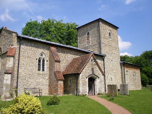
I turned left at a lane junction, and then soon turned right onto a footpath [14], which crossed a driveway and then crossed an empty meadow to reach a lane by Radnage church [15,16]. The church is unusual in that the tower is central, rather than at one end. It is thought that the church was built by the Knights Templar in the late twelfth or early thirteenth century, originally with a shorter tower and just what is now the chancel. The nave was added later in the thirteenth century, hence the unusual design. The porch was added in the fifteenth century. There are fragments of wall paintings inside that span six centuries, some of which were only rediscovered in the 1960’s.
As I approached the church gate, a young woman was taking a photo. She asked if I was a local, to which I obviously said No. As she was smartly dressed, I asked if there was a wedding there this afternoon and she said Yes. I then asked her what time and she said Four O’clock. I was relieved, as I knew I’d be coming back this way shortly, and didn’t want to be in the way when the bride was arriving or when they were taking photographs. As the church was open, I went in and had a quick look round. The church was very beautiful in its simplicity, just the nave, tower and chancel. (Update 28/02/02: Radnage Church was used as the setting for Cranford church in the BBC's excellent recent costume-drama 'Cranford').
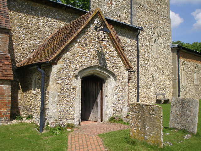
[16]The porch of Radnage church
[17] Looking back from near Radnage church
[18]View from the footpath leading into Bledlow Ridge
The Chiltern Way passed through the churchyard and continued on a footpath the other side, crossing three small meadows, the third one leading steadily uphill [17]. The path then continued through a narrow belt of grass and wildflowers between two areas of wood, continuing steadily uphill. The path turned left and then entered a wood. It soon crossed a stile, and then came to a junction where I went left, now between a hedge and a fence on my right [18]. I didn’t quite reach my intended destination, the road at Bledlow Ridge – about 50 yards short, I came across a lamb that had obviously got out from the field on the right. The path was very narrow between the hedge and fence, so I couldn’t get past the lamb, and I was worried that if I carried on I might drive it out onto the road. So I turned round there – I’ll do that 50-100 yards at the start of my next walk instead.
It was now about 1.50pm, and I stopped for a rather late lunch at the stile I’d just passed in the wood. I soon had to stand up to let a group of about 12 walkers in running shorts and vests go by – their shirts said they belonged to the Marlow Striders (according to their web site they are a running club, but have a walking section primarily for runners recovering from injuries). The walk back to Ibstone was pleasant, although it was a bit too warm – I’d only brought 2 litres of water, which I now rationed out so that I had the last of it when I got back to the car. The thermometer in my car said it was 22C, but it had been parked in the shade and I’m sure the temperature had been nearer 25-26C. I was rather worried that I might get one of the very mild migraines I occasionally suffer from when I walk on hot days, but I was OK. Nor did I suffer too much from the pain I’d had in my calf muscles, although they felt tight on some of the steep sections. I remembered that this was the hilliest section of the Chiltern Way, and when I counted the contours on the map I worked out that I had ascended and descended about 2350 feet over the course of the day.
This was another very good walk, a lot of up and down through green fields and woods, with many good views over the rolling Chiltern countryside. It was a pleasure visiting Radnage church, and the number of Red Kites around the hay meadows near Stokenchurch was quite amazing!
Total Distance: 163.6 miles each way