Pete's Walks - The Chiltern Way (2)
If you are considering walking this route yourself, please see my disclaimer. You may also like to see these notes about the maps and GPX files.
Day 21 26/05/07 Ewelme to College Wood (8.3 miles each way, approximately)
Parked in car park by Sports field in Ewelme.
At 8.3 miles each way, this is the longest walk I will do on the Chiltern Way (it is only so long because last time I did it I forgot to stop at Pishill Bottom and carried on for a further unplanned 1.3 miles!). Even though my journey to Ewelme would only be an hour, rather than the hour and 20 minutes of the previous two walks, I still got up half an hour earlier than usual at 7am in order to make an early start. I then decided to forego my usual second cup of coffee, and actually set off by about 8.10am, which meant I was able to start walking by 9.15am. There were a couple of short showers during the drive to Ewelme, and more were forecast, but I was lucky with the weather. Although it remained grey and overcast almost all day, it stayed dry – another time I might not have walked on such a grey day when showers were expected, but the forecast for the next few days is for rain.
I parked in Ewelme and started the day by walking about a mile of the route back to the track junction near Potter’s Farm that I had reached on my last walk (the junction where the Southern Extension rejoins the Original Route). Again I was lucky in that I couldn’t smell the pigs in the large sheds by the junction – in fact I didn’t even hear them squealing this time.
From the junction of tracks I headed back to Ewelme, going Northwest along a track called Potter’s Lane [1]. This is a bridleway running between hedges (last time I did this walk I met some horse riders, today I saw only a jogger and two mountain bikers). The last part of the previous walk and the start of this one go across a shelf of land that is below the main escarpment of the Chilterns, but still above the lower-lying Oxfordshire plain to the North and West. When there were gaps in the hedges along the track, I could see Swyncombe Down [2] and the long line of the Chiltern escarpment to my right, while to my left I could see towards Didcot Power Station and Wittenham Clumps. There was a lot of White Campion growing in the hedgerows, and this would be the predominant wildflower all the way to Swyncombe Down. After about half a mile, the track joined a short section of concrete before it reached a lane.
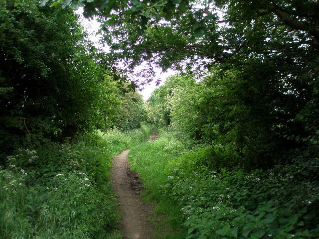
[1] Potter's Lane
[2] Swyncombe Down from Potter's Lane
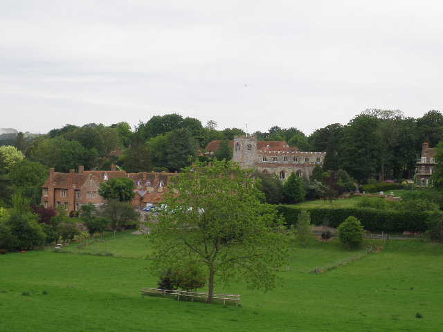
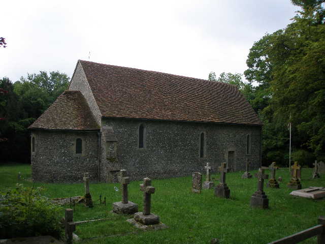
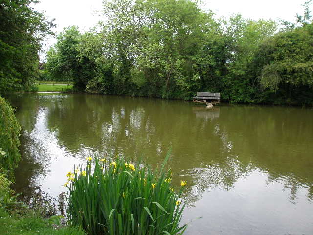
[3] Ewelme
I turned right for just a few yards, before continuing on a path on the other side. This ran between wire fences, with a meadow of long grass on my right. On my left was a low bank, bedecked with a variety of colourful wildflowers, that marked the edge of a quarry. The path ended at a sharp bend in another lane, where I went ahead along the lane for a few yards before taking another footpath on the right – there was a nice view towards the attractive village of Ewelme at this point [3]. I went a short distance through some bushes and long grass to a stile in a hedge (I saw two Buzzards here, and had seen one of them nearby as I had walked by in the opposite direction a little earlier). The Chiltern Way then followed a left-hand hedge downhill through a small corner of a large pasture (there were a few cattle a long distance away to my right) to another stile, and then crossed a playing field to reach a lane in Ewelme.
This very pleasant village has an interesting history. In the early fifteenth century, Geoffry Chaucer’s son (who achieved the position of Speaker of the House of Commons) became the Lord of the Manor, and his daughter Alice married the Duke of Suffolk in 1430. The Suffolks largely rebuilt the village church, and built a series of thirteen almshouses around a courtyard in 1437. They also built a Grammar School which is now the village primary school (and thought to be the oldest primary school building in the country). The church contains an alabaster effigy of Alice Chaucer, and Jerome K. Jerome (author of Three men in a boat) was buried in the churchyard in 1927. After the downfall of the Suffolks, the manor reverted to the crown and Henry VII built a palace here. His son Henry VIII used the palace, and it was a childhood home of Elizabeth I. The palace was later sold, and only fragments of it remain in the fabric of the present, largely Georgian, manor house. (As usual, most of this information is taken from the Chiltern Way guide book).
I turned right along the lane for a few yards, almost to where my car was parked, then went sharp left along another lane. After a couple of hundred yards, shortly before I would have reached the church on my left, I turned sharply right on a footpath that at first followed a gravel drive, then passed a small area of bushes. I was now heading East, the direction I’d be following for most of the remainder of this walk. My route now followed a broad track beside a very large arable field on my left, with a wire fence on my right separating me from an equally large pasture containing a small number of young bullocks. The track went almost imperceptibly uphill for several hundred yards, heading straight towards the wooded slopes of Swyncombe Down. As well as more White Campion along here, I also saw some Wild Mignonette just coming into flower. The track then dropped quite steeply [4] to a lane, where I turned left. I met a party of five walkers coming the other way, the first of about twenty or so walkers I would see today (this was the Saturday of a Bank Holiday weekend, so it was not surprising that I saw far more walkers than usual – especially as heavy rain was forecast for the remaining two days of the long weekend).
[4] Path from Ewelme heading towards Swyncombe Down
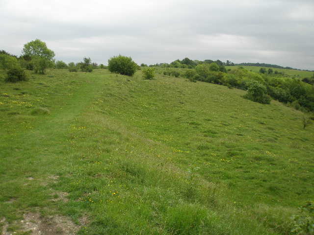
[5] The top of Swyncombe Down
[6] Looking back along the top of Swyncombe Down
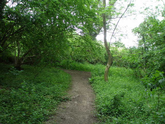
After about four hundred yards I turned left, following a bridleway with a small plantation of young trees on my left and a wheat field on my right. I then turned right along a dusty and chalky farm drive to reach a car park at the foot of the wooded slopes of Swyncombe Down, close to a bend in the lane I’d just been walking on (the Chiltern Way had just walked two sides of a triangle instead of just continuing along the lane). From the car park I followed a path through the trees, climbing steeply up the hillside. The trees were mainly beech at first, but later I’d pass through a small section of Yew trees. There was some Herb Robert here, which I’d continue to see throughout the walk. The climb was quite steep in places, but didn’t go on for too long. Eventually I went through a metal kissing gate on the edge of the trees to reach the top of the hill, where I saw two Green Woodpeckers fly off.
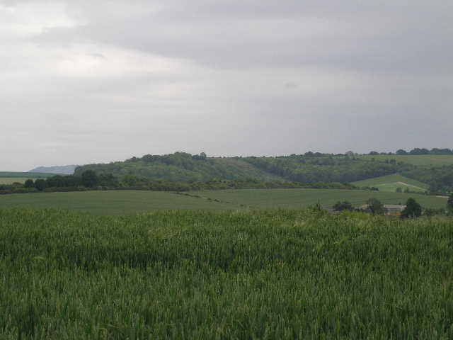
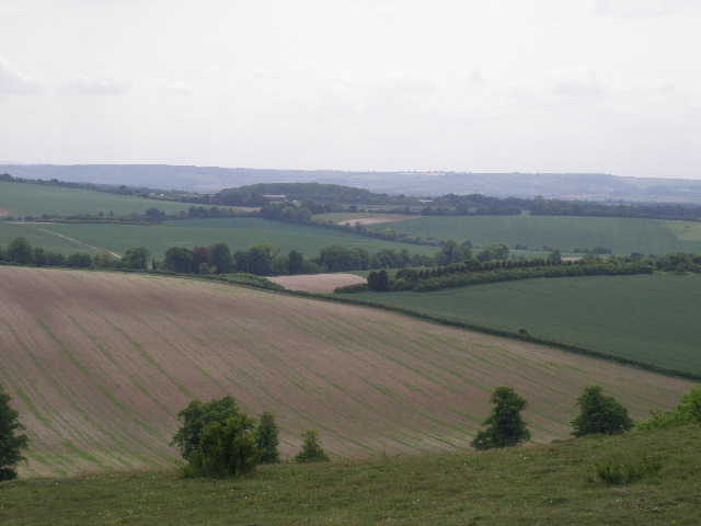
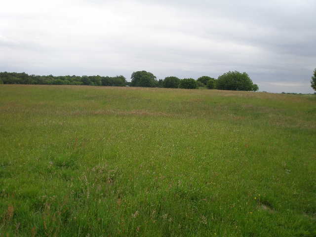
Swyncombe Down [5,6,7] is one of the few remaining areas of open downland in the Chilterns (nearby Ewelme Down, for instance, appeared to be entirely woodland or under agriculture). There were a lot of wildflowers growing amongst the grass and scrubby bushes here, including Common Rock-Rose, Birdsfoot Trefoil and a few fading Cowslips. An ancient earthwork called the Danish Intrenchment runs along the top of the hill – it is thought to possibly date to the 870’s when the Danes reached this area before being repulsed by King Alfred. The hill is like a promontory jutting out from the Chiltern Escarpment, so there were good views in most directions. To the north I could see the line of the escarpment heading towards Watlington and beyond, while to the south I could see the Wessex Downs beyond the Thames. Looking back, I had the now rather passé view of Didcot Power Station and Wittenham Clumps.
[7] Looking towards the Wessex Downs from Swyncombe Down

[8] Path along Swyncombe Down (spot the Hare!)
[9] The path from Swyncombe Down to Swyncombet
I followed the path across the grass for a few hundred yards to another kissing gate. The path now continued along the northern side of the promontory, with the Danish Intrenchment in the trees and bushes along the crest of the hill on my right. Over the fence and occasional hedge on my left was a large green arable field – I could see where the Ridgeway went along the opposite side of the field, and remembered thinking how insignificant Swyncombe Down had looked from there. I saw more wildflowers along here, including some Wild Strawberries (I noticed some Yellow Rattle here on the way back). I also saw a Hare [8], which emerged from the bushes onto the path about 30 yards ahead of me. It seemed quite unaware of my presence and I managed to creep even closer to it before it scampered back into the undergrowth.
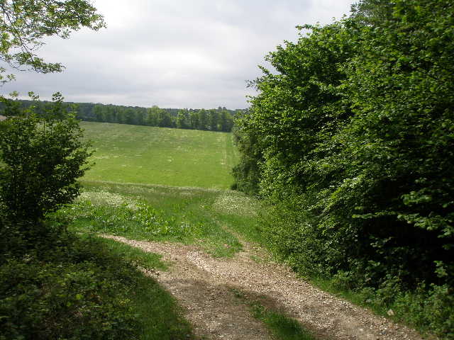
After several hundred yards, the path turned right and soon joined the track carrying the Ridgeway, climbing over the wooded end of the promontory that becomes Swyncombe Down. The track started to descend the other side, soon leaving the trees [9] and following the right hedge of a large meadow of long grass. I continued descending, quite steeply, and then started rising a little less steeply up the other side of a small valley – I saw two Red Kites here, and saw two more nearby on my return in the afternoon. At the top of the slope I reached a lane opposite a junction. I followed the lane ahead, which soon turned right with the ancient St Botolph’s church [10] on my left.
[10] Swyncombe Church
[11] The park at Swyncombe House
[12] Cookley Green
I have passed the eleventh-century Swyncombe church twice before, but didn’t think it was open. As I turned left and passed the west end of the church, I could see the south porch door was open, and a sign asked walkers to remove their muddy boots before entering, so I stopped and took a few minutes to look around. The church is thought to have been built by Saxon builders directed by Normans, to a traditional design of a long nave with an apse at the eastern end (similar to the church at Bengeo I saw on Day 18 of my Hertfordshire Way walk). The porch was only added in the nineteenth century. Inside the church, the font is Saxon and there is an aumbry (a cupboard or recess near the altar where the sacred vessels are kept) lined with very old oak in the chancel arch. There is also a reliquary (for storing holy relics) behind the altar, and some mediaeval floor tiles.
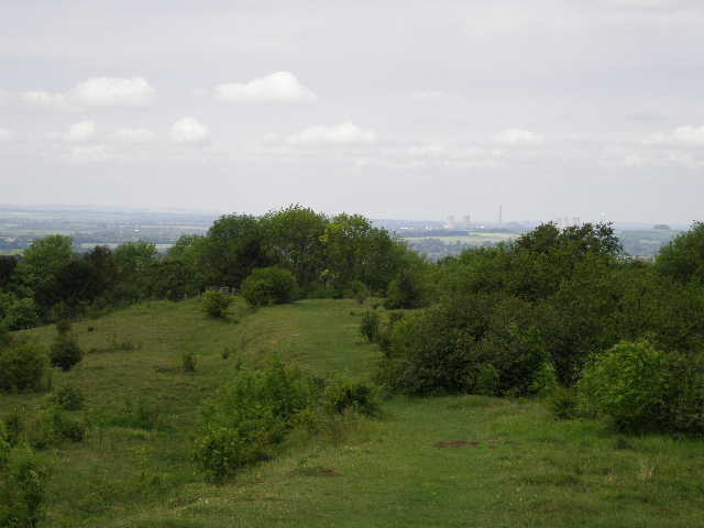
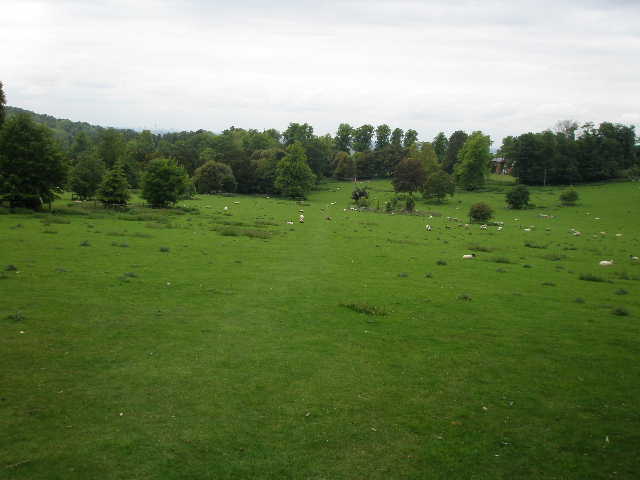
From the other side of the church I turned left across some grass and crossed the drive of Swyncombe House (an Elizabethan manor house extensively rebuilt in the 1800’s). The path then continued uphill across an area of parkland surrounding the house [11] – a large number of sheep (and even more lambs) were grazing here, with several mature trees dotted about the large expanse of grass. Looking back over my right shoulder I could see Swyncombe House, almost surrounded by trees. I heard a Raven here on my way back, but failed to see it. Near the top of the hill I entered woodland again, and the path now rose more gently through the trees before levelling off. The wood here was mainly deciduous at first, before I passed a block of conifers on my right. On my way back in the afternoon, I heard a Peacock calling somewhere over to the left. I saw some Bugle growing in the wood. On the far side of the wood I reached a lane, where I turned right and soon reached the village of Cookley Green, a collection of attractive houses and cottages around a large triangular green [12]. I followed the northern edge of the green to a road (I’d driven along through here to get to some earlier walks), seeing another Red Kite quite low overhead as I did so. I followed the road a few yards to the left before turning down a track on the right.
The track went past the entrance of a few residences, alongside the wall of a larger house and then passed a further cottage. The track then ran for about half a mile between hedges, descending very, very gradually, until I came to a junction [13]. This was a point I reached on Day 16 of this walk, the end of the ‘Ewelme Loop’ – if I’d turned right, I would have met the original route of the Chiltern Way just after the southern extension branched off, and could have followed it back to Ewelme, thus making a 10-mile circular walk. Instead I followed the Chiltern Way left, the path now climbing uphill, soon going quite steeply up an old ‘sunken lane’ with the roots of some large beech trees exposed on my right. The path flattened out and soon went along a short gravel drive between houses to the minor road through Russell’s Water (like Cookley Green, still part of the parish of Swyncombe).
[13] Bridleway between Cookley Green and Russell's Water - this junction is where the 'Ewelme Loop' goes right while the Chiltern Way goes left
[14] The duck pond at Russell's Water
[15] Russell's Water Common
I turned left, and followed the road round a couple of sharp turns. I turned right by the large duck pond [14] that gives the village its name (it was once owned by a local brickmaker called Russell) and followed a signposted track that led me to the edge of Russell’s Water Common [15]. This is a large expanse of grassland, almost surrounded by trees, a rare surviving example of a hilltop common in the Chilterns. I’d started my walk on Day 16 on the far side of the common at Maidensgrove. I turned left and followed the edge of the common a few hundred yards to a corner, where I took a path that entered another wood and went downhill, in part following a ‘sunken way’. This brought me to another short gravel driveway and a road in Pishill Bottom (I’d driven along here to reach Stonor, a mile or so to the right, and then Maidensgrove, on Day 16). I turned left, passing two or three cottages as I walked about 350 yards to the entrance of Grove Farm. I struggled to open the large metal gates here – it was only when I’d done so and started to go through them that I could see there was a stile just beyond the gates. I crossed the farmyard and turned right, then immediately took a path going left, uphill into yet another wood.
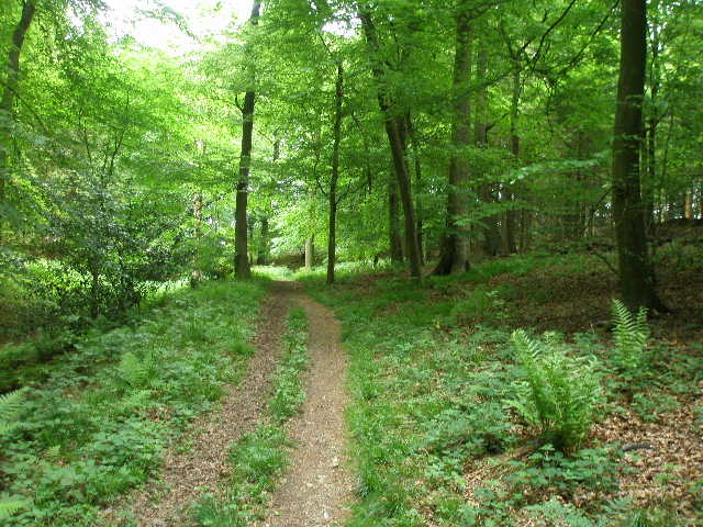
The next half hour or so was one of the best sections of the whole Chiltern Way so far as I now followed a delightful path through the adjoining Shambridge, Greenfield and College woods [16]. There were several sections of mainly beech wood, one of the things for which the Chilterns are renowned, but other parts of these woods consisted of other deciduous trees and there were occasional areas of conifers. I saw some Yew trees again, for the second time today. There were various wildflowers beside the path, including Wood Avens and Herb Robert. I saw some Yellow Pimpernel, which was the first time I’d come across it. I also saw some Foxgloves, something that I’ve seen surprisingly seldom on my walks.
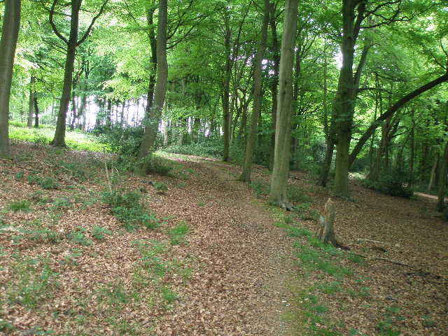
[16] Near the start of the walk through the woods beyond Pishill Bottom (Shambridge Wood)
[17] Where the woodland walk meets one of three crossing paths in a small valley
[18] Close to the end of the woodland section, near the stile at the end of College Wood
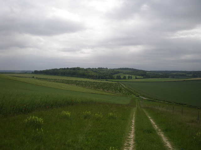
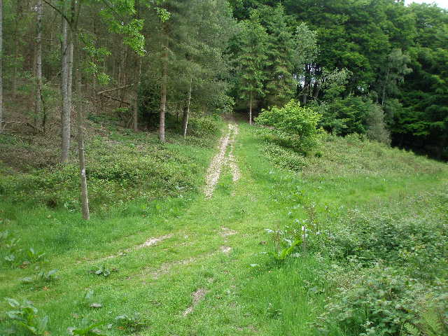
This walk through the woods was a very up and down section. Three times the path rose uphill through the trees, then descended to a valley with a crossing path [17], before finally rising uphill for a fourth time. The route was clearly waymarked, with occasional white arrows painted on trees – at the many path junctions ‘cw’ was also painted to show which was the correct route to take. At the end of the fourth section of uphill walking [18], the path emerged from College Wood at a stile. I then crossed a large meadow to a hedge-lined track (Hollandridge Lane, which dates back to the Saxons), where I turned round.
I stopped for lunch straightaway on the stile into College Wood. It was now 12:40pm, and allowing for the 20 minutes it had taken me to walk back from Ewelme to Potter’s Farm, and the five minutes I spent at Swyncombe Church, it had take me three hours to walk 8.3 miles. This was appreciably slower than I’d have expected, but I put it down to the excessive number of photographs I’d taken (it would be about 80 by the end of the walk), especially of wildflowers. It took me about 10 minutes less to walk back to Ewelme than it had taken to walk from there to College Wood, so I got back to my car about 3.30pm. I was lucky with the weather, as the predicted showers did not occur, and in fact the grey clouds cleared slightly as I got back to Swyncombe Down and the last mile or so were in relatively bright conditions.
This was a brilliant walk. I thought it pretty much had everything you could reasonably expect from a walk in the Chiltern Hills. It went through a wide variety of landscapes - apart from the usual paths through fields, there were many sections through woodland, including a section of about 1½ miles near the end, and there was also the open downland of Swyncombe Down, the hilltop common of Russell’s Water Common, and a short section of parkland by Swyncombe House. There were Red Kites and Buzzards to be seen, and a wide variety of wildflowers. The Danish Intrenchment and Swyncombe church added some historic interest to the route. It was a surprisingly up and down route – I have just worked out from the map that I ascended and descended about 2000 feet (600 metres) over the course of the day (obviously that is spread over numerous small climbs and descents, it is not like doing 2000 feet in one go as you would somewhere like the Lake District). So I think this was not only the longest, but also one of the best walks I have had on the Chiltern Way.
Total Distance: 156.4 miles each way