Pete's Walks - The Chiltern Way (2)
If you are considering walking this route yourself, please see my disclaimer. You may also like to see these notes about the maps and GPX files.
Day 20 24/05/07 Woodcote to Ewelme (7.6 miles each way, approximately)
Parked at Woodcote village hall.
I wore a T-shirt for the first time this year, as the forecast said it would be very warm with temperatures up to 24-25C. The journey to Woodcote took just over an hour and a quarter. I had to leave the car radio on as I put on my walking boots, so that I could hear the end of the first movement of Dvorak’s Cello Concerto on Classic FM – one of my favourite pieces of music, which I haven’t heard for ages. As I slung my rucksack over my shoulders and put on my sun hat, a Red Kite circled very low above me! A very nice way to start the walk.
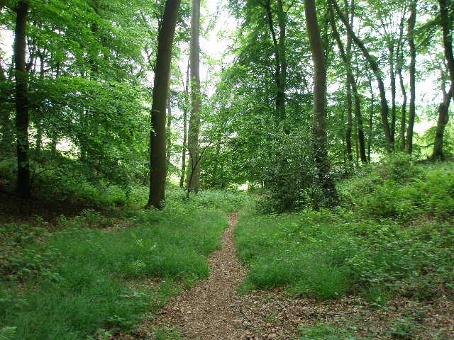
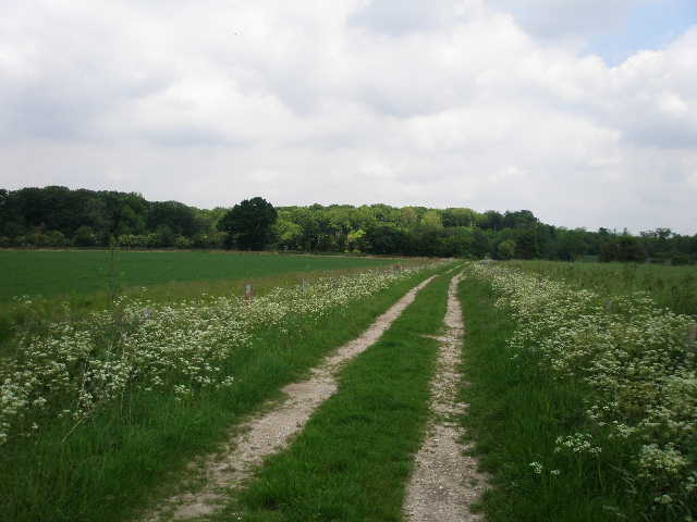
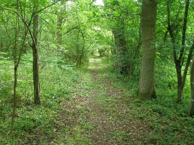
I set off from the car park at the village hall in Woodcote [1] at 10am, first going the quarter of a mile or so through the village to the lane junction where I’d finished the previous walk. I followed the hedged Tidmore Lane for another quarter of a mile, before turning left along a tarmac drive. The Chiltern Way here follows a drive through a garden by a thatched cottage, then goes over a stile and continues beside a left-hand hedge, with a wire fence separating the path from a large paddock on the right. I then crossed the A4074 main road, and followed a right-hand hedge through a small meadow to a lane, where I turned left. I saw two Buzzards here, circling low over the field on my right (somebody cutting wood by a 4x4 on the far side of the field stopped to see what it was I was peering at in the sky). After a hundred yards or so I went right, down a short tree-lined track [2] that took me to Hammond’s Wood.
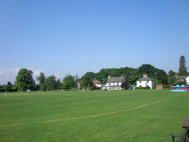
[1] Woodcote
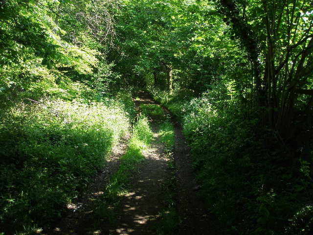
[2] Track leading to Hammond's Wood
[3] View from the other side of Hammond's Wood
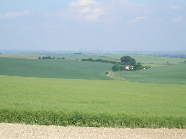
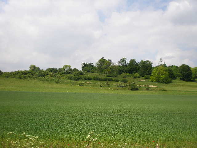
I turned left along a path that initially kept to the edge of the wood, before heading further right into the trees. There were several types of wildflowers along this woodland path, and I stopped to photograph two or three of them – there was a lot of Germander Speedwell and Ground Ivy, and some Wood Avens (or Herb Bennet), which I saw a few times on my last walk and would see a few more times today. After the ubiquitous Herb Robert, the Germander Speedwell is probably the wild flower that I see the most now. The path led gently downhill to a stile, which took me into a large pasture overgrown with nettles. There were extensive views here out to my left, towards the far off Didcot Power Station. I followed a very narrow path downhill through the nettles, which were thigh high in places, inevitable getting stung several times. I then continued downhill on a good track between arable fields [3,4] to reach Bottom Lane.
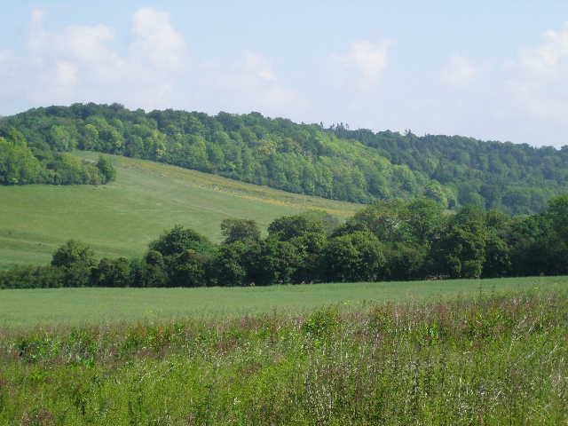
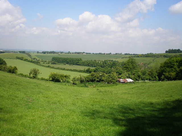
I turned right to follow the lane along the valley floor – on my way back, I noticed visible terraces on the steep scrub-covered slopes that were now on my left. When I checked the map later, this confirmed my suspicion that they were strip lynchets [5], similar to those I saw on Deacon Hill near Pegsdon on Day 3 of this walk. I also saw four more Buzzards here on my way back. I followed the lane for about a quarter of a mile, then took a path going half-left, crossing a large grass area of the garden of Bottom Farm, then following a fenced path along the edge of the garden. Over a stile, I continued along the edge of a large grass meadow, following a faint path through the long grass to stile in a wire fence. The path now started going uphill, at an angle to the slope, towards the woods running along the hilltop. The field here had obviously not been planted with any crop this year, and was a profusion of blue and yellow flowers, with a few Scarlet Pimpernel as well. From the edge of the wood there was a charming view back, over Bottom Farm in the valley to the wood-topped slopes on the other side [6]. This was just the sort of scenery that attracts me so much to walking in the Chilterns.
[4] View across Bottom Lane towards Heycroft Wood
[5] Strip Lynchets, seen from Bottom Lane
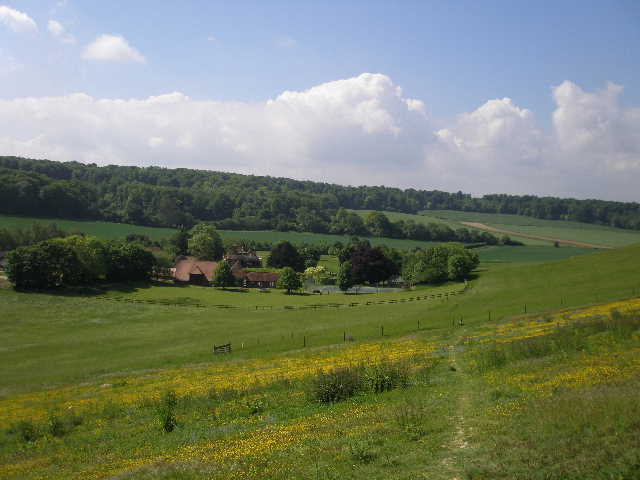
[6] Looking back over Bottom Farm from the edge of Heycrofts Wood
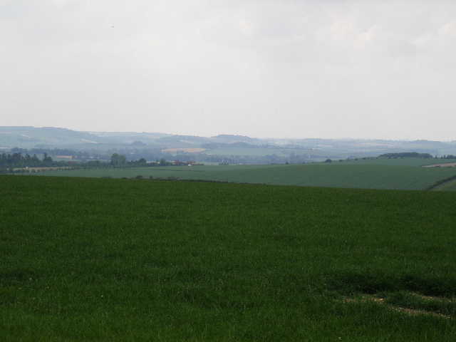
The path now climbed some steps up through the edge of the wood, to reach a crossing path where I went left. The path rose fairly gently through Heycroft Wood, soon reaching a junction where I turned sharply right on to a track called Braziers Lane (there was some evidence in places that this had been a surfaced lane at some point) [7]. I followed the track, now fairly level, through the mixed woodland for about quarter of a mile to reach Garsons Lane at Garson Hill. Here there was again a view out across the flatter lands at the foot of the Chilterns [8]. I turned right, and followed the lane for about a hundred yards , before turning left along a drive to a cottage. By the garden gate, the path went slightly left between a hedge of mature trees and a wire fence – two spaniels barked ferociously as I went by, putting their heads over the top of the fence. I soon reached a wood, Wee Grove, where I followed a path to the right. I remembered I needed to turn sharp left here, but the junction was not very clearly marked and so I went past it and needed to backtrack.
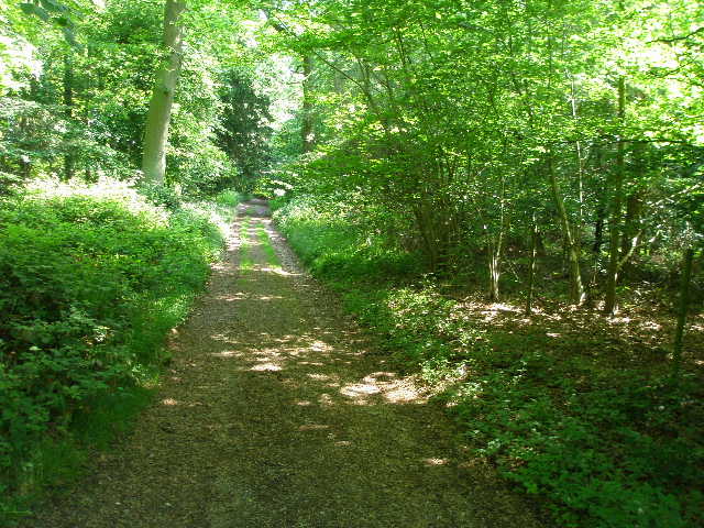
[7] Braziers Lane (track) through Heycroft Wood
[8] View over the Oxfordshire Plain from edge of Heycroft Wood
[9] Path leading to exit from Wee Grove
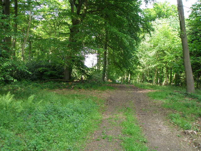
The path now led downhill through the trees, mainly beech [9]. I then continued downhill through a sheep pasture [10], then continued alongside a right-hand hedge through another meadow. In the field corner, the path turned left alongside the hedge. After a few yards, it went through the hedge to a lane. Here I turned left, but almost immediately took another path back through the hedge. The path followed the left-hand hedge of a large meadow, where there were many buttercups and a lot of Germander Speedwell again. In the far corner of the meadow, the path went over a stile and continued between hedges, with an arable field on the left and another meadow on the right. The path then turned left and followed a fence down to another lane near Well Place (so called because a Roman well was found here). When I walked here two years ago there was a small zoo here, but there was no sign of it now – when I checked later on the internet, I found it had closed last September. It had been here since 1968.
I followed the lane a hundred yards to the right through an avenue of trees, then followed a track on the left, which gradually went uphill [11]. The former zoo was on my right at first, then a sheep pasture, while to my left was a very large arable field. Ahead of me I could see a few houses and a pub in the small hamlet of Hailey, part of the parish of Ipsden. It was quite a long stretch of uphill walking, but never very steep. At the top I turned left down a lane towards Hailey. I stepped aside to let a 4x4 pass me - the gentleman driver stopped, wound his window down and said ‘Don’t worry – it’s only about 100 yards to the pub!’. I must have been looking in worse condition than I felt! I passed up on the opportunity to visit the pub, and passed one or more houses in the hamlet before turning right down a good gravel track called Poors Lane [12].
[10] View from edge of Wee Grove, looking towards Hailey
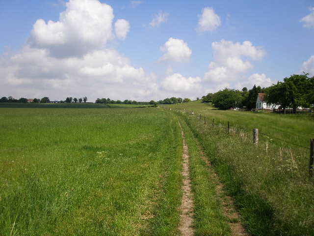
[11] Path beside the former Wellplace Zoo, heading towards Hailey
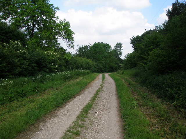
[12] Poors Lane, heading away from Hailey
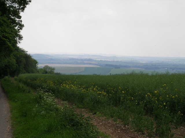
This soon ran through a small area of woodland, and then between fields. Near a house on the left I had another sighting of a Buzzard – on the way back I saw one take off from a fence post a short distance ahead of me. The track soon passed Poors Farm, so called because it was once used for the relief of the parish poor, and continued past a small wood on my left. Beyond that, the track carried on between arable fields, with views out towards Didcot Power Station to my left [13,14]. There was some Hedgerow Cranesbill growing along this section of the track. The track then went through Wicks Wood [15], descending slightly to reach Woodhouse Farm. Here I turned left through the farmyard and followed the farm drive – a Red Kite flew over the field to my left here. The drive soon reached a lane (Icknield Way) by a cottage, where I turned right. I now saw another, or the same, Red Kite, now being harassed by a crow.
[13] Poors Lane, heading towards Wicks Wood
[14] Looking back towards the Wessex Downs from Poors Lane
[15] Path through Wicks Wood
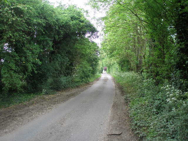
The next field boundary the lane passed was an ancient earthwork called Grim’s Ditch, here carrying the route of the Ridgway national path – I had walked this section on Day 2 of my Berkshire-Essex Walk last year. I continued down the lane [16], being passed by three or four cyclists as I went – I suspect the lane must be part of some long-distance cycle path. This was the longest section of lane walking I’ve done for some time. I passed a farm and pottery on my right, then a little further on passed a boarding kennels and cattery, and after about a mile I reached a crossroads (close to a main road) where I turned right. There was a lot of Wild Rose growing in the hedgerows here. I passed a few houses on my right, then took a path on my left just past a wood.
The path ran between wire fences, with the wood to my left and arable fields to my right. The path was almost overgrown with nettles, with just a very thin path through them, so it was again inevitable that I had a few stings. At one point I passed some Red Campion next to some White Campion – it seemed curious that they were right next to each other when I didn’t see either of them anywhere else along the path, so I wondered if they’d been deliberately planted together. There were some noisy rooks flying around over the fields on my right. Eventually I managed to get through the nettles and reached the main road I’d seen earlier. I crossed it, and entered Oakley wood, following a well-sign-posted path [17]. On the other side of the wood, I crossed a field that was obviously ‘set aside’ land this year – some corn left over from last year was growing, but it was threaded with numerous weeds and several different flowers, including the first Field Pansies I have seen this year.
[16] The lane (Icknield Way)
[17] Looking back along the path through Oakley Wood
The Chiltern Way then followed a fenced path between trees, soon with the numerous rusting cars of a scrap merchant over the fence on the right. The path ended at a road, where I crossed and took a wide gravel track between hedges that went half-right. After three or four hundred yards this brought me to Potter’s Farm, Ewelme, where I turned left. I passed the farm buildings and then the farm house on my right, and continued for a few hundred yards between fields and paddocks to a track junction, by two large modern sheds on my left. This junction was where the Southern Extension of the Chiltern Way rejoined the original route, and was the point I reached on Day 16 of this walk. As I turned and headed back the way I came, I was again lucky that I could hear pigs squealing in the nearby sheds but couldn’t smell them.
This walk was about the same length as the previous one, but it had taken me almost 20 minutes longer to reach my turn-around point. I think that this was probably because I took a lot of photos, especially of wild flowers, and also because I needed to stop to apply sun cream to my bare arms several times. It had been a fairly warm morning but not too bad. As I walked back to Woodcote it clouded over, but became very bright and warm again for the last half-hour or so of the walk. I carried 2½ litres of water with me today, and drank two of them, the first time I’d drunk so much this year. It was a warm and rather muggy day, which caused me to feel more tired than usual at the end of the day.
This was quite a remote walk, in that it hardly passed through any settlements at all. As with the previous walk there was a good mix of field paths and woodland sections. The latter part of the walk was fairly flat, but the early part was quite hilly. There were some extensive views out over the flatter parts of Oxfordshire, and also some nice views of typical Chiltern scenery of valleys and wood-topped hills. It was a good walk for seeing wildflowers, and I saw a few different butterflies today, including Speckled Wood and Orange-Tip. I saw a few Red Kites, and probably more Buzzards than on any other walk I have done. There was little of historic interest on the route, however, and the long section of lane walking wasn’t too interesting. But overall, this was another very enjoyable walk on the Chiltern Way.
As with yesterday’s walk, I feel that I have passed another significant milestone. I have now completed the Southern Extension of the Chiltern Way, and so just have the final stretch of the original route to do.
Total Distance: 148.1 miles each way