Pete's Walks - The Chiltern Way (2)
If you are considering walking this route yourself, please see my disclaimer. You may also like to see these notes about the maps and GPX files.
Day 19 22/05/07 Whitchurch Hill to Woodcote (7.7 miles each way, approximately)
Parked next to green at Whitchurch Hill
It took me an hour and 20 minutes to drive to Whitchurch Hill this morning – the longest drive of this walk, and almost certainly the longest for any of the walks I’ve recorded in these journals. The next drive will only be a few minutes shorter – I had to go through Woodcote to reach Whitchurch Hill. Today’s was one of those slightly annoying walks where I walk seven and a half miles to end up just two or three miles from where I started. The drive this morning got off to a great start though – I saw a Red Kite above the road at Bison Hill (next to Whipsnade Zoo), the nearest yet to Kensworth that I’ve seen one.
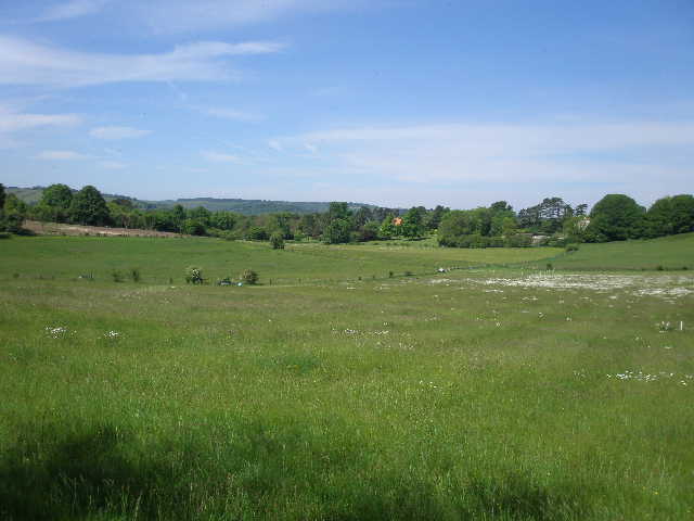
It was a lovely warm and bright morning as I started walking about 9.55am. I crossed the green at Whitchurch Hill and turned right along the main road, passing the church on my right [1]. A few yards further on I turned left on a footpath that followed a concrete farm drive for 300 or 400 yards, then went right through a small paddock or meadow, following a hedge on the right. In the corner I went through a kissing gate, and followed the path through a small but dense piece of woodland. On the far side, I crossed a much larger meadow, with the narrow path visible in the long grass, and went over a stile into a small pasture where about 10 young black bullocks were grazing. I went slightly right to a stile near a corner (with the yard of Coombe End farm on my left). The stile took me into a much larger pasture, where just two cows were grazing a good distance away to my right. The path just crossed a small corner of this field to a stile, beyond which I turned right along the farm drive, soon reaching a crossroads of rights of way.
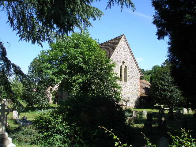
[1] Whitchurch Hill church
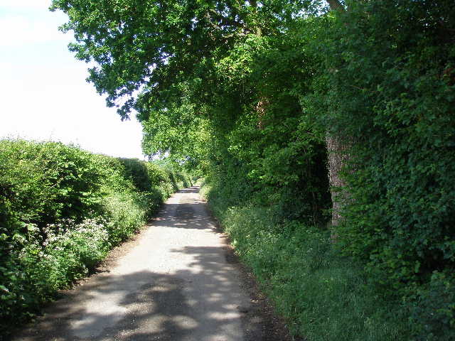
[2] Coombe End Lane
[3] Brunel's railway bridge, from Coombe End Lane
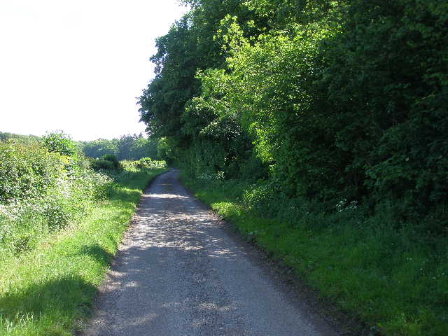
I turned left along a surfaced lane, with trees and hedges either side restricting the view. I soon passed a cottage on the right, and continued along the hedge-lined lane [2]. After maybe half-a mile, the Chiltern Way followed a bridleway that branched left but just went parallel to the lane, before I rejoined it after a few hundred yards. I could now see ahead towards the flatter lands of Oxfordshire around the almighty eyesore of Didcot Power Station. After a few yards I could look over the hedge on my left, and see the view over the Thames Valley to the Wessex Downs on the far side (they looked remarkably similar to the Chilterns!). There was a Red Kite here, but some way away and I didn’t get a good view of it. I could also see where the railway crossed the Thames at Gatehampton on Brunel’s 1840 viaduct [3]. Looking back slightly I saw Basildon Park, a large eighteenth century mansion set in typical parkland scenery [4].
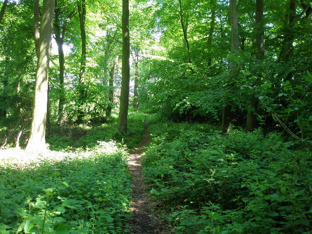
A few hundred yards further on I turned right onto a footpath, by a deserted farm. There was a lot of Herb Robert growing here - I would see it almost everywhere I went today, it is now the most common wild flower that I see. I no longer see any Lesser Celandine, and only a few fading Bluebells. The path led me to Great Chalk Wood, a large mixed wood. The path initially led through mainly beech trees, staying close to the edge of the wood on my right, then continued through a section of mainly coniferous trees. At a junction, I turned left [5]. The path now continued through the wood for almost a mile, gradually descending along a small valley. I passed through more dark conifers, then there was a section where I walked on a wide grass path open to the skies, with deciduous trees either side. The path then narrowed again between more conifers [6], finally crossing a couple of stiles in quick succession to leave the wood.
[4] Basildon Park from Coombe End Lane
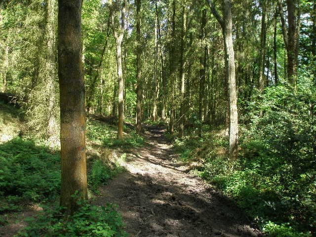
[5] Path through Great Chalk Wood
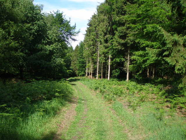
[6] Path through Great Chalk Wood
The path now followed a right-hand hedge of a very large field [7] – this was mainly green corn, but just here on my left there was a strip of last year’s maize crop. I saw my first poppies of the year here, and I also saw some blue butterflies but couldn’t tell which species they were. The path dipped then went uphill, before turning left [8]. It was now very warm, and I rolled up my sleeves and applied some sun cream to my arms for the first time this year. Soon there was a cemetery on the other side of the hedge. I had a nice view ahead over the Thames to the Wessex Downs. The path stayed level for a while, then started descending downhill towards the river. Where the hedge reached a fence, I went through a gap and crossed a large recreation ground on the edge of Goring – there was more Herb Robert here amongst the dandelions, buttercups and daisies. On the far side I went through a gateway and along a short alley between hedges to reach the end of a residential street. I followed this as it soon turned left, and continued downhill along another couple of streets to reach a main road by a pub. Here I turned right, with the railway line on my left and Goring and Streatley station just behind me.
After about 200 yards I came to a junction, where a road went left over a railway bridge to the village centre and on across the Thames to Streatley. Last time I did this walk, I took a detour here to go through Goring and to cross the bridge (actually two bridges separated by an island) to reach the next county of Berkshire, but having also done that on my subsequent Berkshire-Essex Walk I didn’t want to do it again today (see Day 1 of my Berkshire-Essex walk if you’d like to view a photo of the Thames between Streatley and Goring). Instead I turned right along a private residential road. After about quarter of a mile I turned left along a short alley, then continued ahead along another residential road. At the end, I went ahead along a paved footpath, but almost immediately turned right off it, crossing a private drive and then following the path along an alley between hedges and fences. I went over a couple of stiles, then followed the path beside a field with houses to my left. The path then went slightly left, with garden fences on my left and a belt of ivy-clad trees on my right. This path continued for several hundred yards, eventually reaching a minor road called Battle Lane.
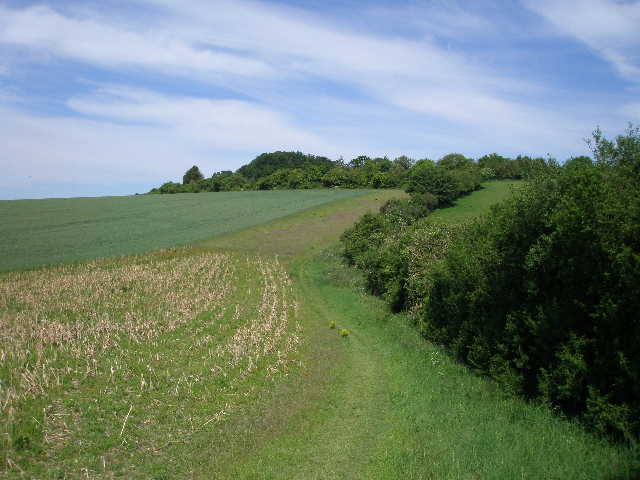
[7]The path to Goring, from the edge of Great Chalk Wood
[8] Looking back at Great Chalk Wood
[9]View from the path between Battle Lane and Wroxhills Wood
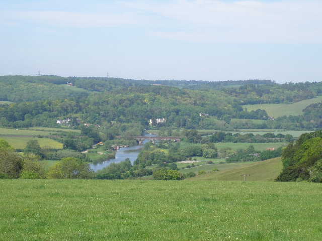
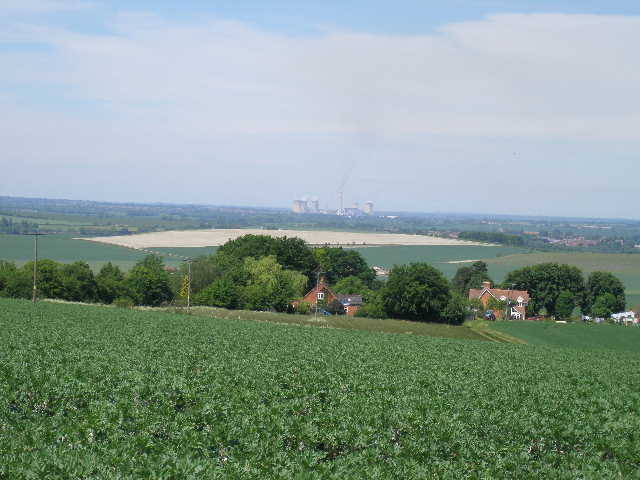
I crossed over and continued on a path between hedges, with a driveway on the other side of the hedge on my right. To my left there were some chickens and a couple of ducks in a small meadow next to some farm buildings. The path continued, rising very gently, now with a fence on my left and some paddocks beyond where some rooks and jackdaws were making quite a racket [9]. I was pleasantly surprised, as I thought the path here was going to be much steeper – obviously my memory was playing up again. When, after a few hundred yards, the path entered Wroxhills Wood it did steepen however. After a fairly short climb through the trees I came to a path crossroads (there was a stile here where I’d sit and have my sandwiches on my way back). I turned left, and after a couple of hundred yards I emerged at a corner of the wood – here there extensive views over the lower land at the foot of the Chilterns [10, 11]. I could see Didcot Power Station again, and also Wittenham Clumps, two prominent hills close together both topped by small woods (Time Team once did a dig there). The field in front of me was inhabited by pigs, but fortunately the wind was blowing in the right direction (so my comment on an earlier walk might still be true, about Potter’s Farm at Ewelme being both the only place on this walk that I’d visit three times and the only place to smell of pigs).
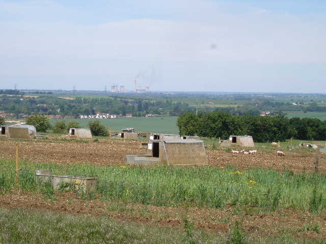
[10] Pig sties and Didcot Power Station - what more could you want in a photograph!
[11] Looking westwards to the Wessex Downs, from edge of Wroxhills Wood
[12] Beech lane, just beyond Beech Farm
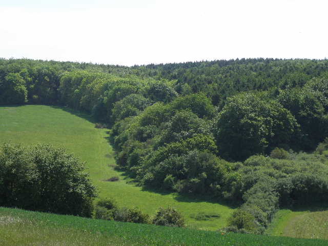
I now followed Beech Lane, a good track going right (eastwards), alongside the wood at first. I was startled here by a female jogger coming up behind me suddenly as I was looking at the guide book. I followed the hedge-lined track for about half a mile. When it passed the entrance to Beech Farm on the left it became a surfaced lane [12], and a few hundred yards further on I left it, taking a path on the left that followed a wire fence between grass fields down to a wood. The path immediately forked left through the trees, and soon ran close to an edge of the wood on my right. The wood, High Wood [13], was mainly young beech trees, with a lot more Herb Robert amongst the unusually thick vegetation covering the ground. I left the wood at a stile in a corner and entered a small meadow that had quite a variety of wild flowers including Ox-eye Daisies.
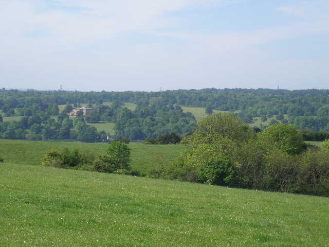
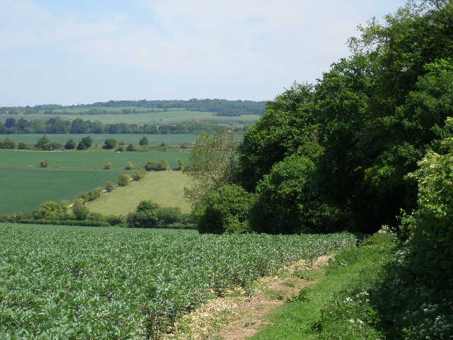
Another stile took me out onto a lane, South Stoke Road (I went through South Stoke on Day 1 of my Berks-Essex Walk), where I turned right. I soon passed Broad Street Farm on my right, and very shortly afterwards took a path on my left (there was some White Campion growing on the corner here, I saw it in another couple of places today as well). The path descended gently, following the right-hand hedge of a large field of beans, with extensive views over the lower-lying land at the foot of the Chilterns [14], with Didcot Power Station and Wittenham Clumps being prominent features again. The hedge on my right was soon replaced by a wood [15], which I followed as it turned to the right. I had a very good close up view of a Buzzard as I turned this corner on my way back. I soon reached the garden fence of Dean Farm, which I followed to the left. I then took a path going right, alongside the outbuildings of the farm (actually now a very smart private residence). This soon joined the tarmac farm drive, which gradually rose uphill for about a quarter of a mile to reach a road on the edge of Woodcote. Here I went right for about a hundred yards to a junction with a lane on the left, which was where I turned round (the centre of Woodcote, where I’ll park next time, was a short distance further down the road). It was now about 12.25pm, and I’d been walking for 2½ hours.
[13] Path through High Wood
[14] View towards Didcot Power Station from near Broad Street Farm
[15] Woodside path leading to Dean Farm and Woodcote
It was a very pleasant walk back and I had a fairly leisurely lunch on the stile in Wroxhills Wood. It was quite warm in the early afternoon, and I was glad of the shade during the long walk back through Great Chalk Wood. I managed not to get lost here this time – the only time I have been truly lost on any of these walks was when I walked back through here two years ago. I’ve been ‘temporarily misplaced’ countless times when I’ve missed a turning, but I’ve always been able to quickly work out what I’ve done wrong and where I am. That time, I somehow went straight past a left fork that I should have taken and became quite confused, even though I knew I’d been on the correct path just minutes earlier. I really couldn’t get my bearings and work out where I was in the wood. Instead of going back to a point I recognised, I foolishly ploughed on assuming I was on the right path, and ended up back at the point where I’d entered the wood! The Chiltern Way follows two sides of a triangle through the wood, by missing a turn I walked the third side back to where I started. Anyway, there were no such mishaps this time, and I got back to Whitchurch Hill about 3.15pm.
This was a very pleasant walk on a very nice day. There was a good mixture of field paths and woodland walks, and the section through Goring was shorter and easier than I’d remembered. There were some good views over the Thames to the Wessex Downs, and also over the lower parts of Oxfordshire below the Chilterns. I saw a few different butterflies, and several types of wildflower, plus a few Red Kites and a Buzzard.
Goring is the most westerly point reached on the Chiltern Way, so having passed it seems a significant milestone. Although described as a circular walk, the Chiltern Way is more like a very long and very thin rectangle, on a Southwest to Northeast axis. I have now been round all four ‘corners’ of the rectangle, and just have about three quarters of the long northern side of the rectangle to do. I definitely feel that I am now starting the ‘home’ straight – I have seven more days of walking left, but I remember from my earlier walk how quickly this last stretch from Goring back to Dunstable Downs seemed to go by.
Total Distance: 140.5 miles each way