Pete's Walks - The Chiltern Way (2)
If you are considering walking this route yourself, please see my disclaimer. You may also like to see these notes about the maps and GPX files.
Day 26 11/06/07 Berkhamsted Common to Dunstable Downs (7.0 miles each way, approximately)
Parked at new visitor centre on Dunstable Downs.
Instead of parking near Berkhamsted Common and then walking to Dunstable Downs and turning round, I did this walk the other way round. I parked at the new Visitor Centre on Dunstable Downs, walked back to the place in Berkhamsted Common I reached on my last walk, then walked back to the Downs. I often do this on the last day of a circular route, so that I complete the entire journey where I started it – otherwise, the return leg of the walk can feel a bit of an anti-climax, as mentally I feel I have already completed the journey. As usual though, I will describe the route in the clockwise direction so that it is consistent with the rest of the journal.
I had been hoping for a fine day on which to complete the Chiltern Way, so that I could get some bright photographs, especially of the fine views from Dunstable Downs. Instead, today was dull and overcast, though dry and nowhere near as humid as my previous walk. I had no option but to walk today though, as the forecast indicated that the rest of the week would be very wet.
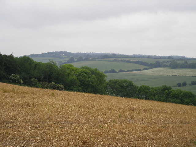
I had one or two things to sort out at home this morning, so I didn’t get quite as early a start as I could have done (Dunstable Downs are only five minutes drive from my home), but it was still only 9.35am when I set off from the car park at the new visitor centre. The highlight of the walk to Berkhamsted Common was seeing a Red Kite, flying over a freshly mown hay meadow just behind the church in Whipsnade. This is the closest I’ve seen one to my home in Kensworth (just under a mile away), and I would guess that it was probably the same bird that I’ve twice seen over nearby Bison Hill. Yet again this shows how much they have spread out since I walked the Chiltern Way two years ago.
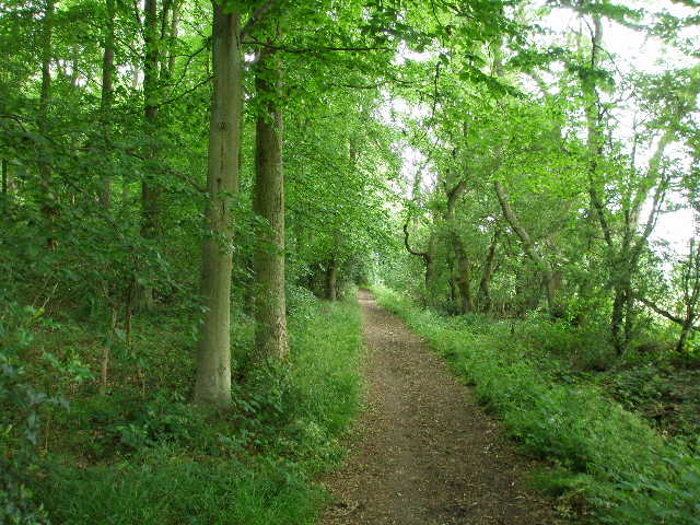
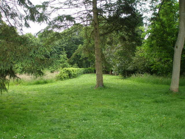
It was around 11:40am when I reached the corner of the large meadow in Berkhamsted Common that I reached on my previous walk. I turned round and followed a path through the trees, back the way I had come. As well as the beech trees for which this area, and the Chilterns generally, are well-known, I saw a lot of oak and silver birch trees. The path soon joined a tarmac drive at a bend, where I followed the drive ahead [1]. I soon came to a gap in the trees, where the drive crossed Prince’s Riding, a wide grassy strip about a mile and a half long, leading from Ashridge House to the tall column of the Bridgewater Monument (about two thirds of a mile to my left) [2].
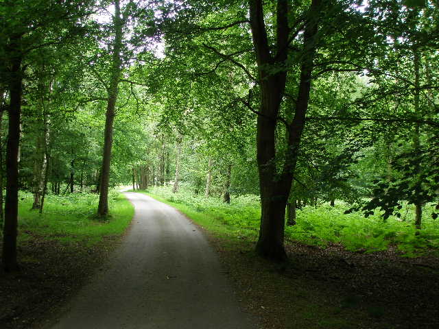
[1] The drive leading to Old Park Lodge
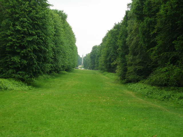
[2] Looking long Prince's Riding towards the Bridgewater Monument
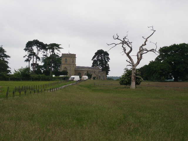
[3] Little Gaddesden church
Ashridge House, now home to a Business School, is on the site of an Augustinian Priory, founded in 1276 by the Earl of Cornwall. In 1290, Edward I held a parliament here, and after the dissolution of the monasteries it was a private residence of Elizabeth I when she was a princess – she was arrested here under suspicion of treason against her sister Mary in 1552. The estate was in the hands of the Egerton family, the Dukes and Earls of Bridgewater, from 1604 to 1848. They built the current neo-gothic fantasy in the early 1800’s – at the time, the county boundary between Buckinghamshire and Hertfordshire ran through the dining room! The 3rd Duke of Bridgewater, who commissioned the building before his death in 1803, was the main mover behind the creation of much of the canal network in this country. The 108-foot tall at the other end of Prince’s Riding was erected in 1832 in honour of ‘the Father of British Inland Navigation’. (There are photographs of both the house and the monument in the journal entry for Day 9 of my Hertfordshire Way walk).
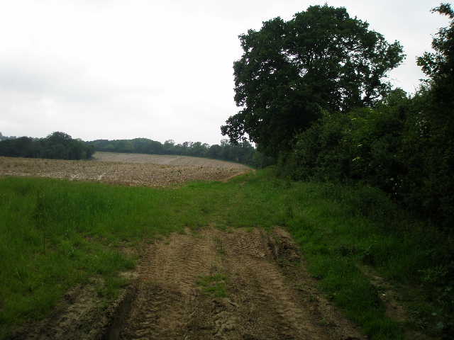
The tarmac drive soon reached a farmyard at Old Park Lodge – the Chiltern Way seems to have been diverted slightly here since I did this route two years ago, as instead of going through the farmyard, the waymarks indicated a path through the trees to the right of the buildings. This soon rejoined the route described in the guide book, and crossed a fairway of Ashridge Golf Course, with the green just on my left (Henry Cotton, the famous golfer, was the club professional here in the 1930’s). I then passed the club house on my right, and went through a small area of mainly silver birch trees to reach a tarmac drive just left of the golfer’s car park. I followed this for a few hundred yards to a staggered crossroads of drives, where I went half-right on a footpath that ran between tall garden hedges. I crossed another fairway of the golf course, by the tee, and then continued through trees again down into a slight valley called Witchcraft Bottom (allegedly where the last witch in Buckinghamshire was tried and hanged). Here I crossed a path that is part of the Ashridge Estate Boundary Trail (see my separate journal), and went uphill between garden hedges again. I crossed a tarmac drive (this carries a public footpath, which I use as part of a circular walk I do from Kensworth to Ivinghoe Beacon and back) and then a short path took me to the car park of the Bridgewater Arms in Little Gaddesden.
Little Gaddesden is a long straggling village, stretched out along the road from Ringshall to Nettlebed. There are many attractive houses and cottages, many beside the long narrow village green, with Ashridge Park on the other side of the road. One of the houses, timber-framed with an overhanging upper floor, is reputed to be the home of John of Gaddesden, a famous doctor to Edward II and Edward III in the fourteenth century (although the building seems to only date from the following century).
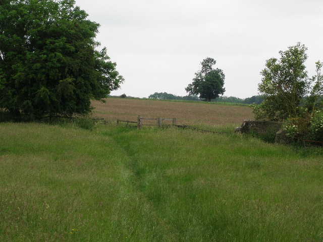
[4] Path through meadow, near Little Gaddesen church
[5] View across the Gade valley from near Hudnall, looking towards Whipsnade
[6] Looking back across the Gade valley, from the path to Studham (the Chiltern Way follows the hedge line across the valley)
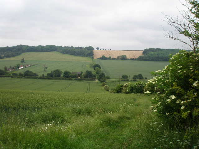
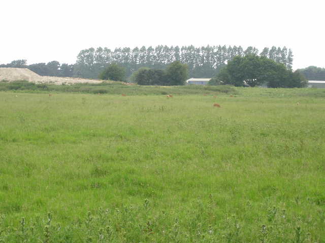
I crossed the road, and took a path starting a few yards to the right. This passed between the wooden fences of some paddocks, and then squeezed between a hedge and the rear fences of some houses. It next crossed a small meadow to a stile and the lane leading to the rather isolated village church, to my left [3]. The path continued through another couple of small meadows [4], and then crossed a very large field of peas diagonally. In the far corner, where four paths met close to the hamlet of Hudnall, I went half-left, initially alongside a wire garden fence – two Doberman Pinschers barked fiercely as I went by. The path then carried on beside a right-hand hedge, the field on my left still containing last year’s stubble. Ahead of me was the Gade valley (strictly speaking, the river only rises a mile or so further right down the valley) [5], and the path soon started to descend quite steeply. The gradient eased as the stubble field was succeeded by a corn field, but it was still downhill all the way to the Leighton Buzzard to Hemel Hempstead road in the valley bottom.
The path continued on the other side of the road, but now with the hedge line on my left. The path rose up the other side of the valley, gently at first but then more steeply. I got my breath back as I stopped at the end of a corn field to take some photos of the Gade valley [6]. To my left I could see Galley Hill extending from Ivinghoe Beacon at the end of the valley where it meets the Vale of Aylesbury, but the view was not as clear as usual because of the overcast conditions. I was somewhat disappointed with the weather conditions, as on a sunny day the views from this point are really good (this stretch of the walk is also part of my circular route from Kensworth to Ivinghoe Beacon).
[7] Long straight path through fields heading towards Studham
[8] Path through corn field, heading away from Common Road, Studham
[9] Path through Church Grove Studham
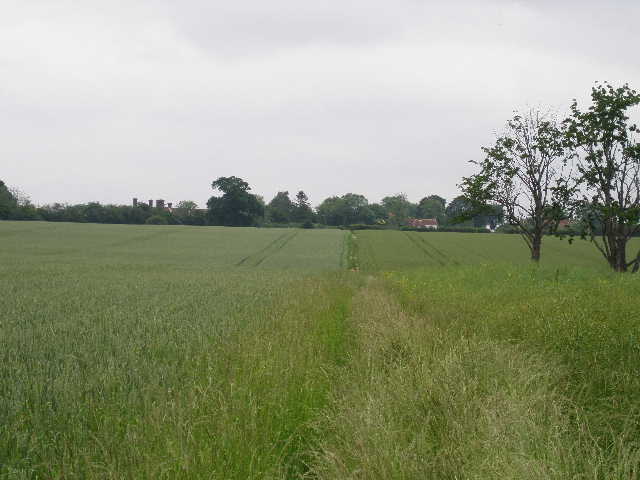
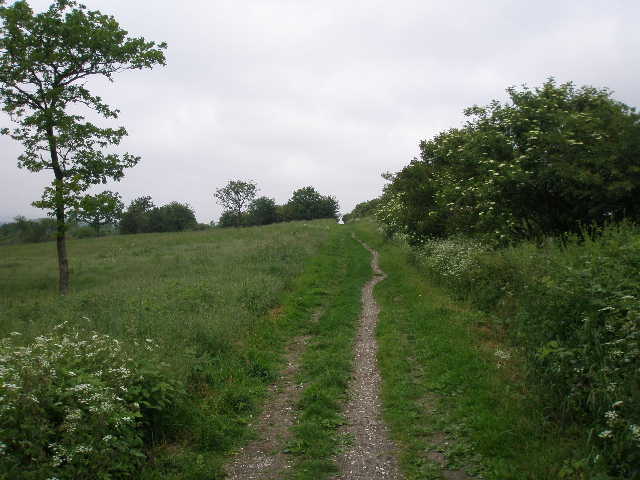
The path went through a gap in the hedge to join a track, continuing uphill beside the hedge, but at an easier gradient. There was a plantation of young trees on my left here. As the ground levelled out, the path ran through a wood for a couple of hundred yards – this section is always very muddy, but wasn’t too bad today. Just past the end of the wood, I went through a kissing-gate in the hedge, following a path going half-right. At first this was partly overgrown by tall grass, with a corn field on my left and oil-seed rape on my left [7]. After a while, an intermittent line of trees came in from the right, and the rape field gave way to another corn field. The path was now a clear chalky mud gap between the corn – it was noticeable that the corn on the right was slightly taller and a more yellowy green than the grey-green field on my left. From the kissing-gate, the path between the fields went on in a dead straight line for about a third of a mile. I then carried on in the same direction across a hay meadow, where the very tall grass was obviously due to be cut soon. I then went over a stile, and followed a short driveway to Common Road, Studham.
There are a few residences along the southern side of this road, which is really a lane going to Dagnall a mile or two to the west, but the main part of the village lay at the bottom of the valley just ahead of me. Studham is the southernmost village in Bedfordshire, and until 1897 it straddled the border with Hertfordshire (the neighbouring village of Kensworth, where I live, was transferred from Hertfordshire to Bedfordshire at the same time – I’ve sometimes idly wondered how my life would have differed if this hadn’t occurred, and I’d been to school in St Albans rather than Dunstable). Studham was an early stronghold of Nonconformity and, like many local villages, was a centre for the straw-plaiting that was required by the hat-makers of Luton and Dunstable.
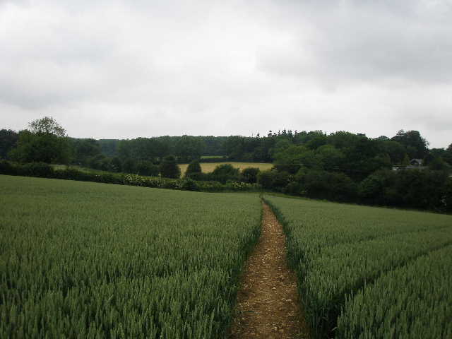
I crossed the road and took a path going half-left through another corn field [8], descending the valley to a corner of the field. Here I turned half-left again and crossed a road (the thirteenth-century village church was about quarter of a mile to my right), then followed a right-hand hedge along the valley bottom – the field on my left had been left fallow, and so there were many wild flowers of different colours growing here, including some Scarlet Pimpernel. I went through a kissing-gate, and continued for about a hundred yards to a stile in the hedge on my right. There were cows grazing some way up the hillside on my left – this morning, they had all gathered together and started moving towards me as I went through here, before stopping when they realised I was walking away from them, and a sign on the other side of the stile warned that they might chase dogs. I crossed another pasture, going uphill slightly to a corner of a wood. I followed the edge of the wood to a stile in the corner of the pasture, and turned left along a footpath.
[10] Start of path from Church Grove towards Whipsnade Zoo
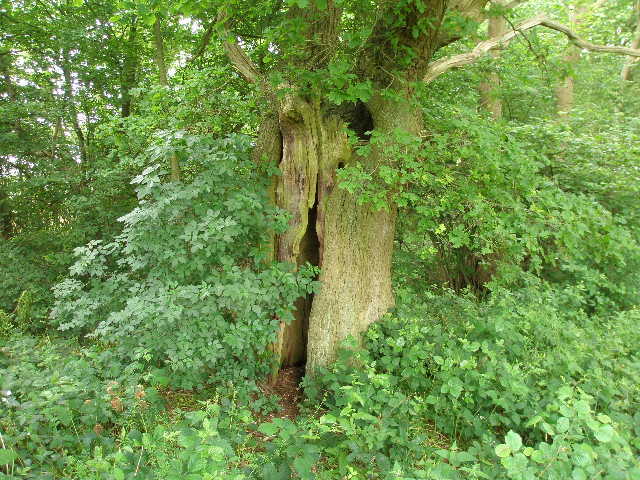
[11] Hollow oak tree near Whipsnade Zoo
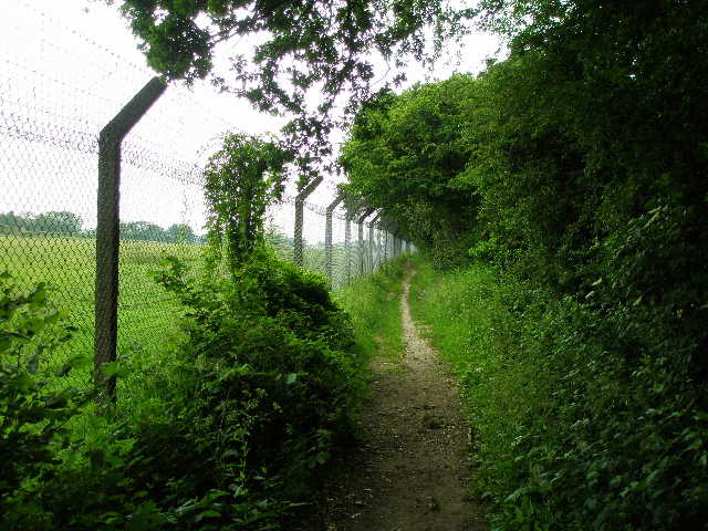
[12] Path alongside boundary fence of Whipsnade Zoo
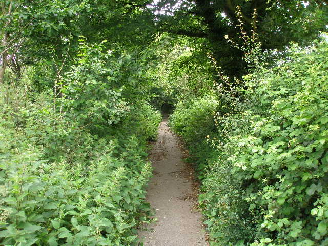
The path soon entered Church Grove, and carried on just inside the right edge of this wood for a few hundred yards (I remember this bridleway being almost impassably muddy twenty years ago, but it has been re-engineered and given good drainage since) [9]. Where the path emerged from the wood, I turned right alongside a hedgerow [10]. Across the stubble field on my left I could see part of Whipsnade Zoo. I followed the hedge on my right for almost half a mile, with two barren stubble fields on my left, until I came to a corner of a small wood. Here a path came in on the left, part of the route of the Icknield Way (part of Day 7 of my Berks-Essex Walk). I continued ahead, passing a hollow oak tree on my right that I remember hiding in when I was a child [11]. The wood soon ended, and the path now continued between a hedge and the tall wire boundary fence of the zoo on my left [12]. Unusually, there were no wallabies to be seen here today, only the small species of deer [13].
[13] Part of Whipsnade Zoo
[14] Studham Lane, path leading towards Whipsnade
[15] Whipsnade church
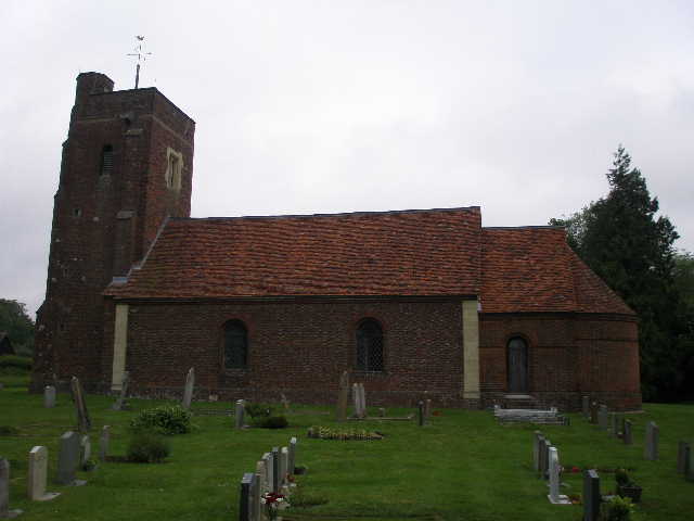
The path ended at Studham Lane – this has been closed to traffic for about twenty years, but a thin line of tarmac is still visible although the vegetation on both sides seems to have encroached further every time I walk here [14]. I turned left, and after quarter of a mile turned right (thus parting company with the Icknield Way). I now followed a left-hand hedge beside another stubble field, turning left at the field corner at the top of a small rise. I now followed a right-hand-hedge through a meadow where the hay had just been cut – this was where I’d seen the Red Kite earlier. I then walked through the graveyard of Whipsnade church – the church is rather unusual in that it is built of brick, with a sixteenth century tower and eighteenth century nave [15].
[16] Whipsnade
[17] Part of Whipsnade Tree Cathedral
[18] Path along Dunstable Downs
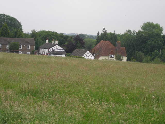
Most of the residences of Whipsnade are scattered round the edge of its huge and irregularly shaped green which extends over both sides of a typical Chiltern ridge. The only road (also the main road through Kensworth) winds its way through the green to reach Whipsnade Zoo and Bison Hill beyond (obviously, the hill is named after the Zoo animals in the large fenced paddock on its slope – I’ve often wondered what the hill was called before the Zoo opened in 1931). Incidentally, when I first walked the Chiltern Way two years ago, the Zoo was calling itself Whipsnade Wild Animal Park, but it’s recently changed its name to ZSL Whipsnade Zoo (ZSL being the Zoological Society of London).
I turned left and crossed part of the green to the road, then followed a drive on the other side past a few houses [16]. Here I came to the entrance to Whipsnade’s other claim to fame, its Tree Cathedral. This was created by Edmund Kell Blyth in the 1930’s as a tribute to his friends killed in World War I. It is an area of trees of many different varieties, planted out in the shape of a Cathedral, complete with Nave, Chancel, Transepts and side chapels. It is now managed by the National Trust, and religious services are still occasionally held here. Apparently Blyth got the idea after seeing the evening sun light up a coppice in the Cotswolds as he drove home from visiting Liverpool Cathedral (then under construction) in 1930. There are houses in the village named after Blyth (Blythswood) and after his two friend who died during the war, Arthur Bailey (Bailey Cottage) and John Bennett (Bennetts Cottage).
The Chiltern Way doesn’t go through the Tree Cathedral, but follows a path just to the right of it [17]. On reaching a private drive I turned left, but after a few yards the right of way goes slightly right alongside the right-hand hedge of the two small meadows that make up the Sallow Spring Nature Reserve. At the end of the second meadow, I turned left alongside a garden boundary (I saw some Lesser Stitchwort here, only the second I’ve seen) to rejoin the private drive, where I turned right. This continued past a few more houses, and after the last house a short path continued to a bridleway. Here I went left, with a wood on my left and cereal fields on my right. I soon crossed over a drive to a farm, and shortly after came to a gate into a very large pasture on the side of the downs. The views today were disappointing because of the grey conditions – I could barely see three or four miles, whereas on a clear day you can probably see for forty miles.
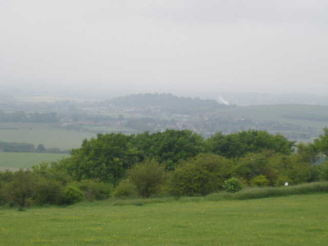
[19] Very limited view, towards Totternhoe, from Dunstable Downs
[20] The 'Wind Catcher' for the new visitor centre
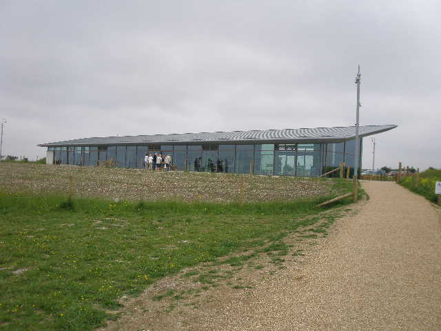
[21] The new visitor centre (Chiltern Gateway) on Dunstable Downs
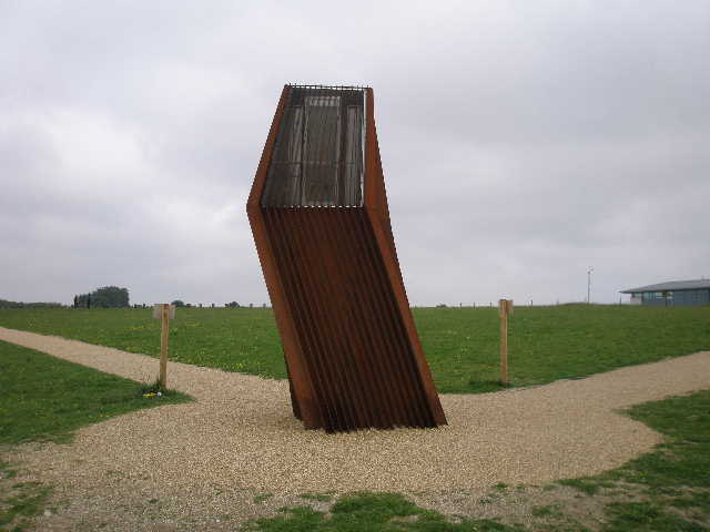
I turned right, following a line of trees near the top edge of the pasture (there were a few sheep a long way away behind me) to a metal kissing gate. The path continued along the hilltop through an area of rough grass and some bushes (I saw some Red Campion here) for two or three hundred yards [18], to emerge at the southern end of the vast open grass area that runs along the top of Dunstable Downs [19], a very popular place for kite flying and picnics. Almost at once I reached the peculiar rusty object called the ‘windcatcher’ [20] which ventilates the new visitor centre [21]. A few more steps along the gravel path going to the right, and my journey was over!
As I took off my walking boots, I could hear my friend the Skylark singing to welcome me back (well, alright, I had to listen very carefully as it was a long way off!). The time was now shortly before 2pm – I hadn’t stopped for lunch, and so I had my sandwiches when I got home, along with a celebratory glass of wine. Again, as with the previous time I did this walk, I had no great feeling of elation or achievement at having completed the Chiltern Way. Instead I had a sense of regret that it was over – I have thoroughly enjoyed it, and am rather disappointed that it is over. Of course, doing a walk like this as a series of day walks is different to walking it all in one go – then there is much more a sense of physical achievement (mixed with relief!) when it is finished. Now I’ve just got to look forward to the next long-distance path …
Total Distance: 192.6 miles each way