Pete's Walks - Hertfordshire Chain Walk
If you are considering walking this route yourself, please see my disclaimer. You may also like to see these notes about the maps and GPX files.
Walk 14 18/11/06 Therfield going south (5 miles each way)
Parked by green in centre of Therfield.
This was another Saturday walk, a short one of only five miles each way. The weather had changed again, back to the colder temperatures and bright blue skies that we had at the beginning of November. I parked beside the green in the centre of the village, close to the village pub, and started walking at about 10am.
Therfield is a small village, known locally for its church, chapel and pub. Its ancient name was Thurrewald, after the god Thur and the hill on which the village is situated. The church was rebuilt in 1879, on the site of a previous church that dated back to the 13th century – the church register dates from 1578. About 18 months ago, the vicar of Therfield and Kelshall was voted the most popular vicar in the country! About a mile north of the village, adjoining the town of Royston, is Therfield Heath – this is now a nature reserve, with a colony of chalkhill blue butterflies amongst its attractions, but it is a place with a fascinating history dating back to the Neolithic (see my Hertfordshire Way and Berks-Essex walks for more details on Therfield Heath).
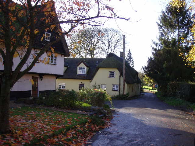
[1] Church Lane, Therfield
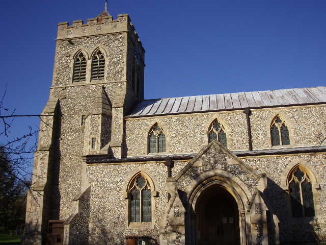
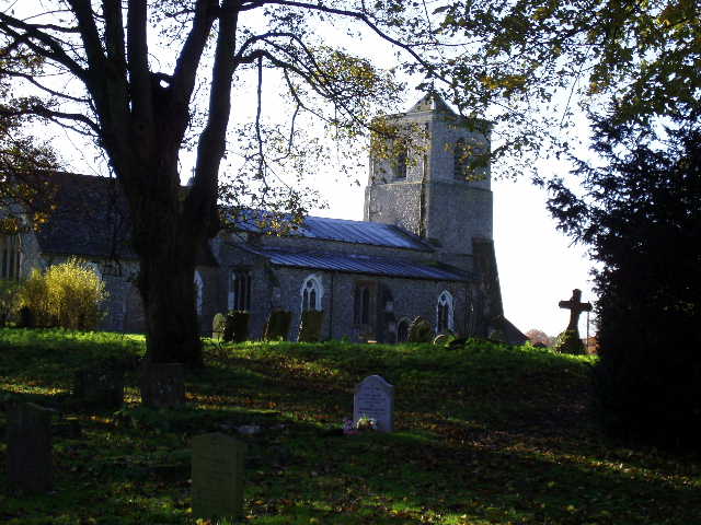
[2] Therfield churcht
From outside the pub, I crossed the green and the main road through the village, and went down Church Lane opposite [1]. Today’s walk would be the first one for a while that went in an anti-clockwise direction. I followed the lane past some attractive old cottages to reach the churchyard, leaving it by a gate to the left of the church [2]. The Hertfordshire Way also passes through the churchyard, but here it took a track going right, initially alongside the churchyard, while the Hertfordshire Chain Walk went ahead on another track. After a few yards it came to a corner of a field, which it crossed diagonally to the right on a footpath. The field had recently been ploughed and planted, and there was no sign of a path. In the far field corner, I went through the hedge and continued in the same direction across a ploughed field – this was hard going as my boots started to gather more and more mud. I crossed a boundary ditch on an earth bridge, then continued across the next field, also ploughed. I was glad to reach a lane on the far side and shake some of the mud off my boots. The fields were muddy due to the large amount of rain we’ve had in the last couple of days – yesterday, in particular, we had a really heavy and prolonged downpour in Kensworth. Later on this walk I’d see many puddles on the path and in the fields, and drainage ditches with a very strong flow of water.
I followed the lane to the left – after a while I thought I’d gone too far. The guide book said there was a footpath on the right after a new bungalow – there was, but I quickly realised that this was not the path the guide book meant. I checked on my map, and saw that I had gone too far down the lane. I turned and went back – I couldn’t really blame myself too much for the mistake, because the footpath sign I’d wanted was well hidden by branches and foliage (plus I was looking straight towards the sun, making it harder to see). More importantly, it was not after a bungalow but after a very large modern house, so I could blame the guide book for my misdirection. Anyway, the path followed a right-hand wooden fence across a field to reach another lane, near to Kelshall church.
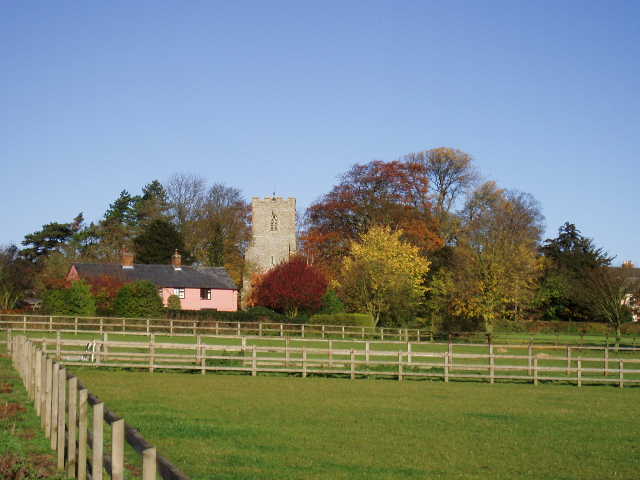
[3] Looking back towards Kelshall church
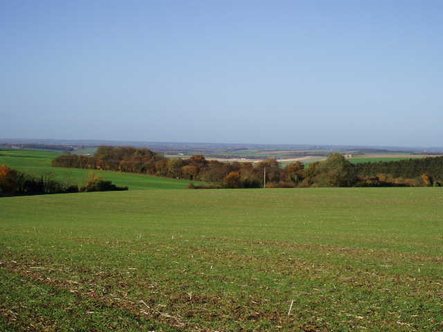
[4] View out towards Cambridgeshire, from near Kelshall church
Kelshall is one of a number of villages established by the Saxons along the line of the chalk ridge from Baldock to Royston. The remains of two mediaeval crosses can be found here, one on the village green and the other in the churchyard. If you’ve read my Hertfordshire Way journal, you may recall that a modern cross was erected next to the old one on the village green as a Millennium celebration, with some interesting notice boards about the history of the village and the local wildlife.
I followed the lane to the left, where it almost immediately turned right. After about a hundred yards I took a footpath going half-left, which went through a series of kissing gates over a lawned area and a sequence of paddocks – for a short while, as the path ran for a few yards between fences on either side, I was back on the route of the Hertfordshire Way again. Beyond the final paddock [3], I crossed another grassy field to a field corner and went through a gap in the hedge. Continuing on the same line, I then crossed another ploughed field, fortunately one where the path had been reinstated as a pair of tractor tracks so my boots didn’t pick up too much mud. This was a large field and, as the guide book pointed out, there were some good views to my right of the hillside sloping down and the flat lands of Cambridgeshire beyond [4]. In fact there were nice views all round, including a nice view back towards Kelshall church.
[5] Sandon church
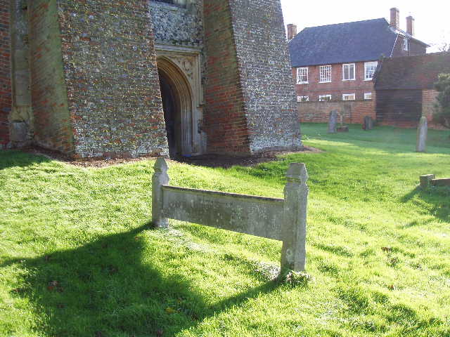
[6] 'Hertfordshire bedstead' grave marker, Sandon church
On the far side of the field I turned left on a minor road, immediately passing a farm on my left. I followed the road for about half a mile – it was quiet with very few cars, I remember a couple of cyclists coming the other way. There were nice views again to the right, down to the lower lying land of Cambridgeshire to the north. At a sharp bend to the right, a good track went on ahead which I recognised from the Hertfordshire Way and the Icknield Way, but I stayed on the road for another 200-300 yards, before bearing half-left on a path between hedges that took me to Sandon churchyard [5,6]. Beyond the lych gate I turned left on the lane where I’d parked on my previous walk. I repeated that route as I took the road towards Buntingford, but continued on the road when Walk 13 took a footpath on the right. After half a mile the road turned sharply right (the other end of the track I’d noticed before came in on the left at this point). A short distance further on I turned left at a junction, and soon after turned left again down a drive towards a cottage. About halfway down the drive I turned right on to another good track running between hedges – this was familiar territory, as I’d been here before on the Hertfordshire Way and the Icknield Way section of my Berks-Essex walk.
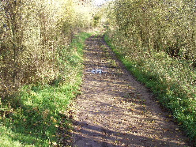
[7] Bridleway between Sandon and Therfield
[8] View from path between Sandon and Therfield
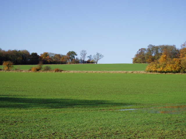
I followed the track for a few hundred yards, as it twisted and turned, heading slightly uphill then downhill. I continued on the track where it turned sharply right [7], the point at which the Hertfordshire Way took a footpath ahead. A few hundred yards later I turned left on a footpath (the Icknield Way stayed on the track). The path followed the right hand hedge of a field [8], with a wood ahead and another wood over to my left – the trees all looked gorgeous in their yellow and gold foliage. On reaching the wood ahead of me, I turned right on a clear track alongside the wood. At the corner of the wood, the track continued ahead across the stubble to reach a hedge corner, where it continued in more or less the same direction, now with a hedge on the left. At the far field corner, I rejoined the track carrying the Icknield Way and turned left. This track was being repaired when I was here in July, and it was generally well-surfaced although there were a few puddles. The ditch or stream on my left was half-full of fast-flowing water.
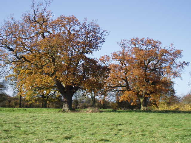
[9] Oak trees near Therfield
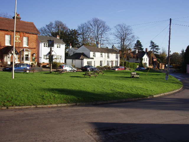
[10] Therfield
After about half a mile along the track, I took a footpath on the left [9] – I’d had to check the map a few times as there were several footpaths leaving the track, although I should have remembered there’d be an Icknield Way marker at the junction I wanted. The path went half-right across a small narrow field, then crossed another meadow with a cottage over on my right. It then crossed a large pasture, currently empty but obvously having been recently occupied by some cattle – there was the remnant of a hedge running through the pasture, so it had obviously formerly been a number of smaller fields. A kissing gate on the far side took me on to the main road through Therfield, with the green, village pub and my car just a short distance to the left [10].
It had taken me about an hour and fifty minutes to do the walk, but it took only an hour and a half to do the return journey – it’s usually quicker when I no longer need to keep studying the guide book or map. I got back to Therfield again at about 1.20pm, and sat in my car to eat my lunch.
This was a short and straightforward walk. It was a beautiful day and the countryside looked wonderful, but I didn’t particularly enjoy the walk. This was partly because I’d walked parts of it twice before, partly because of the muddy fields with no visible path and partly because there was more road or lane walking than usual. For someone who hadn’t walked here before, and who came at a different time of year when the fields hadn’t been freshly ploughed, I’m sure it would make a perfectly decent walk. There were some nice views in places, especially north towards Cambridgeshire.
Total Distance: 80.25 miles (each way)