Pete's Walks - The Hertfordshire Way
If you are considering walking this route yourself, please see my disclaimer. You may also like to see these notes about the maps and GPX files.
Day 13 9/11/05 Aldenham to Shenley (5.5 miles each way)
Parked by Aldenham church.
Today got off to a bad start, as I had the worst drive to the start of a walk that I have had since starting to write these journals. I got stuck in a traffic jam near W*tford (as a Luton Town supporter, that word is a swear word to me!) and then I got lost looking for the A411. I eventually stopped and looked at my maps again, set off and still couldn’t find the road I wanted. By good fortune, I suddenly came across the turning to Aldenham that I’d been looking for. When I parked I looked at the maps again, convinced that the road numbering had been changed or something - in fact, I’d somehow misread A41(T) on my OS map as A411T. No wonder I’d been frustrated in my search for the A411! (The worrying thing is I did have my eyes checked just a few months ago!
So I’m afraid I wasn’t in the best of moods when I set off from Aldenham church, about 40 minutes later than I’d planned – probably just as well that it was a much shorter walk than usual. From the churchyard, a path led to a lane by its junction with a minor road. I followed the road for a few hundred yards, before a bridleway on the right led across a field for almost half a mile to reach the edge of Letchmore Heath [1]. The Hertfordshire Way effectively went round two sides of a triangle to visit the centre of this attractive village – unfortunately it wasn’t looking its best on this occasion as the pond had a large wire fence around it, and people with blowers were clearing the leaves off the green into large sacks.
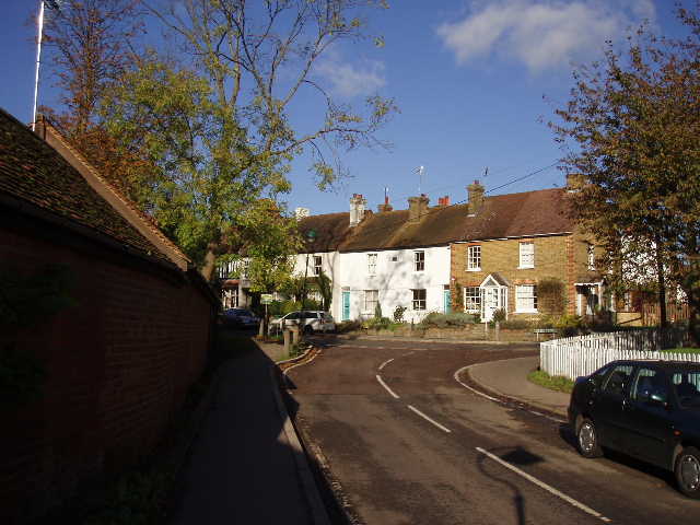
[1] Letchmore Heath
From Letchmore Heath, a path led through a garden and passed a stable to a paddock and then a field, where it joined a wider track. By the corner of a wood, the Hertfordshire Way turned right across a field. It followed the opposite hedge for a few yards, before entering and crossing a new orchard. It then went through the middle of a large grassy field, over a footbridge to reach the Watling Street (the old roman road, now the A5, which I’d already crossed three times between St Albans and Redbourn). Across this, a road led to the ‘Hertsmere JPS’ – intrigued by what this might be, as I passed it I saw a sign saying Jewish Primary School. I followed a farm track for a few yards, and then as I crossed a stile I saw that a security guard had come out of the school and was eying me suspiciously, talking on his radio. I carried on across another large grass field beside a farm, over a dangerously slippery stile, and then followed a track parallel to a railway embankment. After a couple of hundred yards or so, I turned right on a path that went through a tunnel under the railway line, and then followed a hedgerow to emerge by another main road. Across this, I walked through two large linked cattle pastures (no cows, but plenty of evidence of them being there recently!) and then followed a hedge-lined path for about quarter of a mile.
Here I came upon a sign saying that the path ahead was not a public footpath, but the owner permitted access when the gate was open. There was a gate that was chained shut, but the kissing gate next to it was latched but not locked. I wasn’t sure whether this meant I could go on or not (there was no mention of it being a permissive path in the guide book, which specifically mentioned the one near Kings Langley yesterday – however, I checked on the map later and it was indeed a permissive path). I didn’t really have a choice, so I went on (feeling rather sheepish), along a track and through the large stable area of an estate (there were several people here on my way back, and as I wasn’t challenged I guess it was OK).
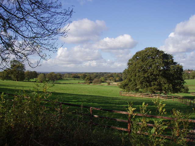
[2] View from the lane between the stables and Shenley, looking towards the Vale of St Albans
I then followed a lane for about half a mile [2], with a view towards the water tower of the old Shenley Hospital, a large mental hospital for much of the last century. I lived in Shenley for a year when I was a student at the nearby Hatfield Polytechnic, sharing a house with some friends, and recall occasionally meeting patients from the hospital. A good footpath then led through a belt of trees, and then between fences [3,4] through a couple of fields to reach the Radlett to Shenley road. I crossed this to enter Shenley Park, where I turned left to reach the car park, my destination for the day.
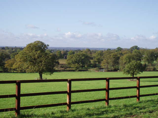
[3] View from near Shenley, looking towards the Vale of St Albans
I have to admit that this was the one time, so far, that I didn’t feel too keen about turning round and heading back the way I’d come. This was probably trepidation about whether I was trespassing on the permissive path, plus there were a couple of places where the route went uncomfortably close to properties such that I felt rather awkward passing through their gardens. Still, once I got going again the walk was fine and I had no problems. There was nowhere really suitable to stop for my lunch, so I ended up eating my sandwiches back in my car at Aldenham, which I reached just before 2pm.
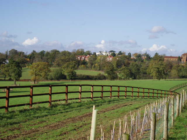
[4] Looking towards Shenley
I think that I’d have enjoyed this walk more if my map-reading blunder hadn’t delayed me so much and put me in a bad mood. It was a perfect day for walking, with clear blue skies and hardly any wind at all. Apart from my silly concerns about walking through private property, it was a perfectly pleasant route. Other than crossing a couple of main roads, it was entirely rural. The views from near Shenley were very attractive, looking out towards St Albans. It was certainly a much nicer walk than I’d expected.
I’m now halfway through the Hertfordshire Way. In terms of distance, I’m about a mile past halfway if you include the alternative route via Hemel Hempstead (which I walked), less than half a mile short of halfway if you exclude that bit. In terms of days, I still think that it will take me 26 days, so this is the halfway mark in terms of days walked. There is, though, a slight chance that I might change my schedule so that I have an extra day to walk. Currently my penultimate walk is scheduled to be about 8.7 miles each way – this may be a problem, because I will have to drive almost an hour to the start and as it will then be very close to the shortest day of the year, I might not have time to do it before it gets dark. So I’m going to have to look at my schedule again – I should be able to rejig things though, without having to insert another day into the plan.
Total Distance: 99.6 miles each way