If you are considering walking this route yourself, please see my disclaimer. You may also like to see these notes about the maps and GPX files.
Day 14 11/11/05 Shenley to Potters Bar (6.9 miles each way)
Parked in car park for Shenley Park.
A very grey day today, dark clouds obscuring the sky all morning although it brightened up a bit in the afternoon. A few spots of rain briefly as I drove to Shenley – when I arrived the skies were so dark that I wondered if I should have trusted the forecaster’s prediction that it would stay dry. As it turned out, they were proved to be correct.
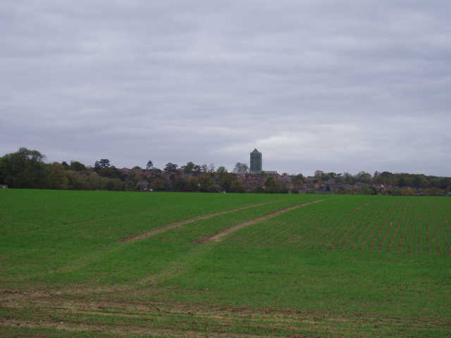
[1] Looking back towards Shenley
From the car park at Shenley Park, I followed a pleasant woodland path that followed the edge of the huge Porter Park housing estate that has recently been built on the site of the old mental hospital. The guide book seemed to omit one turn along this path, but luckily I spotted the Hertfordshire Way waymark and followed the path to the entrance to the estate. Having crossed a road (from Shenley to St Albans), I followed a parallel green track for a couple of hundred yards or so. Here again, the guide book wasn’t quite as clear as it might have been and I had to get my map out. Eventually I saw a footpath sign and a post on the other side of a field, and managed to make my way from one to the other, although there was no evidence of the path through the recently planted crop. Curiously, the other side of a small belt of trees, the path through the next (similarly planted) field was perfectly clear [1], as it was in the next, larger, field. A large grassy meadow followed, with a stile leading into another one. Beyond this a stile led onto a farm track which I followed for a few hundred yards [2], before a stile by a farm led to a small field which led on to a lane.
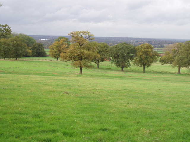
[2] Looking back towards the Vale of St Albans
I followed the lane to the left for a few hundred yards, before turning right onto another footpath. This led through two pastures, the second one badly churned up by cows that were no longer there. Across a farm track, I crossed through a larger pasture then followed the left-hand hedge through two more pastures – a single electric wire fence protecting me from the cattle, or vice versa. Across a lane, the Hertfordshire Way then passed through a large paddock beside a large house. A stile led into a corner of the grounds of the house, where there was an interesting column with a plaque [3,4] – the column was thought to have been raised originally in memory of Nelson by cousins of his who lived in the house. The plaque also said that it was probably only a myth that the Earl of Warwick (the famous ‘Warwick the Kingmaker’ who played such an important role in the Wars of the Roses) was killed at that spot after the battle of Barnet. A kissing gate (provided by Friends of the Hertfordshire Way) led into a pasture, where I turned right along the hedgerow and then left at the field corner. Here I continued following a bourne (stream) on my right through several fields, eventually passing under the M25 and, after another field, reaching a road just north of South Mimms. Across another field, now with the bourne on my left, I reached a foot bridge that led into the village.
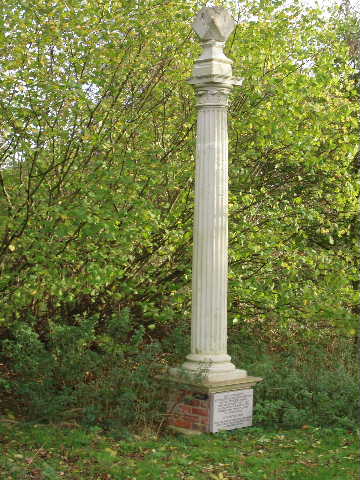
[3]The column and plaque
Crossing a lane in the village and passing between two houses, I came to another footpath leading through a grassy field. Beyond this, a bridleway between fences led on for quarter of a mile or more towards the noisy A1(M). The bridleway joined a farm track beside the embankment for the road, following it for a few hundred yards before another track went under the motorway to the old A1 road. Having crossed this, I followed another farm track (having to use a footbridge to avoid a ford in another bourne) through another large field to a farm. Here I crossed another bridge, and followed the left hand edge of a brook (no, I don’t know why one stream is called a bourne and another nearby is a brook!) through a smaller field and then through an industrial estate on the edge of Potters Bar. This probably sounds a bit grim, but in fact the path though the industrial estate was actually a quite pleasant green corridor with trees or bushes along each side, and the brook running alongside. The water in the brook was very clear, and I could see every pebble or stone at the bottom. On the way back I saw a couple of Bullfinches here, and much more surprisingly a Grey Wagtail! I’d already seen a pair of buzzards by the M25 (and saw another pair on the way back near Shenley) so today was a good day for bird watching.
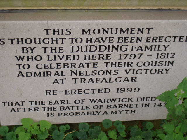
[4] The plaque
Beyond the industrial estate, the Hertfordshire Way went through a bridge under a railway (there were a team of men working on the embankment) to reach Potter’s Bar golf course. Here I followed a series of waymarks beside a drainage channel, counting the small footbridges that the golfers used – the guide book said I should cross the twelfth bridge, but the waymark was on the eighth or ninth (I lost count as I was constantly checking to see which way the fairways were going as I didn’t want to get hit by a stray golf ball – the course was pretty busy). A path then led up through trees and beside a garden fence to a road on the edge of Potters Bar.
As with the previous walk, I didn’t eat lunch until I got back to my car at about 2pm.
This was a far nicer walk than I’d been expecting – this was the area that the chap at Whitwell had said was the worst part of the Hertfordshire Way. While it probably was the least interesting walk I’ve done so far, it wasn’t too bad at all - only slightly spoiled by the noise of the M25 and the A1(M) in a couple of places. Not a great deal of interest on the route, but it was pleasantly rural considering how close it went to the outskirts of London.
Total Distance: 106.5 miles each way