Pete's Walks - John Bunyan Trail
If you are considering walking this route yourself, please see my disclaimer. You may also like to see these notes about the maps and GPX files.
Day 10 12/01/07 Hexton to Lilley (6.7 miles each way)
Parked in road in Hexton.
This was my first walk of 2007. It was just over two weeks since my walk to Hexton, since when there’d been the New Year, a quick visit to my friends in Ipswich and some very wet and windy weather. A bad cold had also deterred me from walking. Today was grey and overcast, but the forecast said it would remain dry and wouldn’t be as windy as previous days, so as I was now desperately keen to go walking again I went for it.
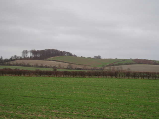
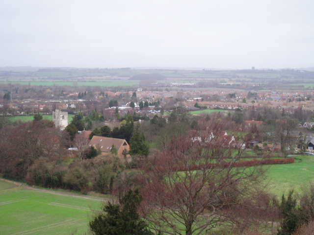
[1] View from path to Barton-le-Clay
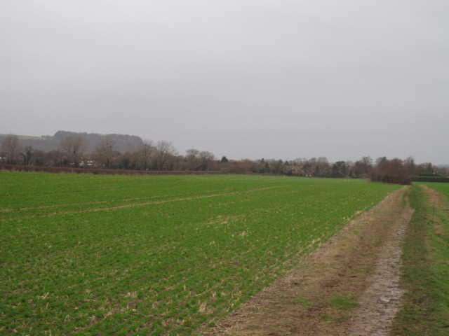
[2] Field path leading towards Barton-le-Clay
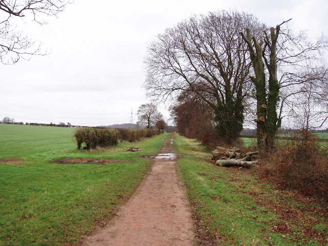
I parked near the pub in Hexton, and started walking at about 9.50am. I turned left down a lane, which almost immediately turned right with a cricket pitch on the left. Immediately beyond that, I took a footpath that went half-left across a grass field. On reaching the far corner of the field, I crossed a footbridge over a fast-flowing stream or ditch and continued on a wide path beside a left-hand hedge. This was quite muddy and slippery at first, but by the time I reached the next field it was fine and I didn’t really have any more problems with mud during the rest of the walk, despite the amount of rain there’d been in recent days. The path continued alongside the hedge through some more fields – this was a pleasant section of walking, as it was parallel to the steep slopes of the Barton Hills a few hundred yards to my left [1], with Sharpenhoe Clappers in view ahead. After a while there was a section of path with no hedges on either side [2], then the path had a hedge on the right. On reaching the edge of Barton-le-Clay (or Barton-in-the-Clay – no wonder it was muddy!) the path turned left for a few yards before crossing another footbridge and passing between garden fences to reach a road.
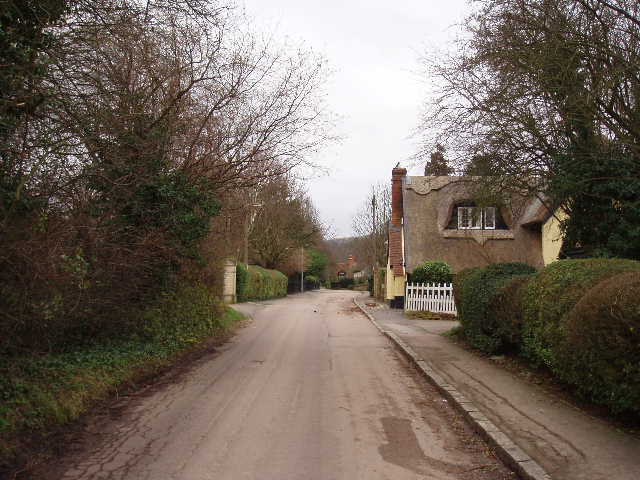
[3] Church Road, Barton
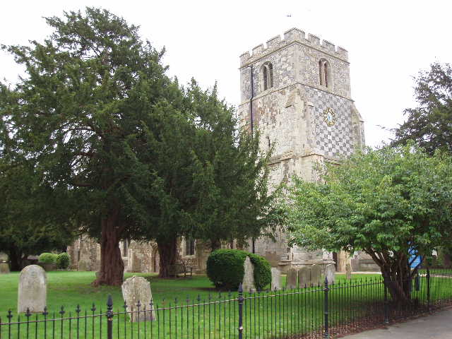
[4] Barton church
I turned left and followed the road for about a third of a mile through the village – I was now heading roughly south, as I would be for the rest of the walk. At the end of the road, I crossed Hexton Road and continued ahead along Church Road [3], passing Barton church [4] on my left. Partway along the road the northern extension of the Chiltern Way came in from the right – I would be repeating my steps on that walk for much of the next two or three miles. The road came to a dead end a little way past the church, and I took a footpath on the left. This went past a paddock on the right, then round the edge of an arable field to a kissing gate giving access to the Barton Hills Nature Reserve, managed by English Nature. Through the gate, the path went steeply up the chalky hillside – wooden steps had been put in place in the steeper and muddier sections to make it easier. It was steep, but only a short climb. From the top of the climb there were nice views back across Barton [5] and the lower-lying land to the north (I could see the water-tower at Pulloxhill, and the strange square white building on the industrial estate I’d passed just south of Ampthill), and westwards along the escarpment to Sharpenhoe Clappers [6].
[5] Barton from the Barton Hills
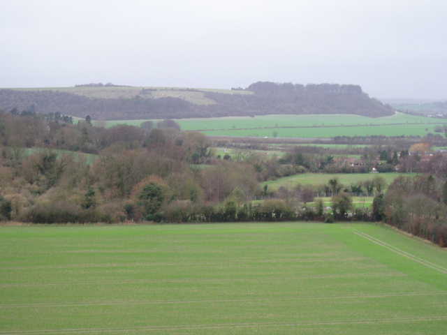
[6] From the Barton Hills looking west towards Sharpenhoe Clappers
It was now very windy as I walked southwards across the Barton Hills. I remembered getting caught in heavy rain when I walked here on the Chiltern Way, and how I struggled to get my waterproofs on in the strong wind then. The wind was coming from the west, my right, and as I walked south I passed three steep-sided valleys or combes on that side [7]. The wind was obviously funnelled into them, because as I passed the head of each of them the wind became particularly strong – this was especially noticeable in the afternoon on the way back, when I was almost blown off my feet several times. The three combes went down to a larger valley that was parallel to my route, with a steep wooded slope on its far side, and the top of Sharpenhoe Clappers visible beyond [8]. I was following a wire fence on my left, with a ploughed field the other side of it. Near the end of the Nature Reserve, as I was passing the head of the third combe, I could see the large embankment of Ravensburgh Castle, an iron-age hill-fort, over in the trees a few hundred yards to my left. I was tempted to take a diversion to see it, but looking on the map there are no public rights of way that go to it. To my right, I could see a group of about half a dozen horses that were being used to graze the Nature Reserve.
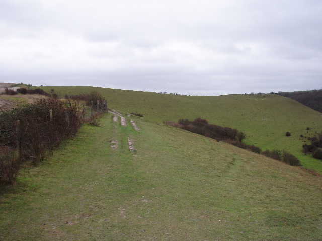
[7] The path along the top of Barton Hills
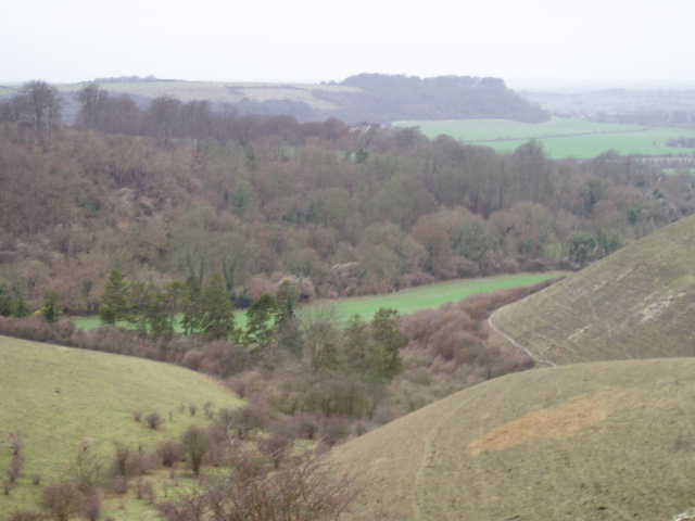
[8] View from Barton Hills towards Sharpenhoe Clappers
Where the fence I was following met a crossing hedgerow at the end of the Barton Hills Nature Reserve, I went through a kissing gate on my left and turned right, continuing southwards on a bridleway along a good farm track. This soon passed a small piece of woodland on the right, then followed a thick hedge on the right for a few hundred yards towards Barton Hills farm – there were occasional glimpses now towards the conurbation of Luton, Dunstable and Houghton Regis to the south, with Blows Downs beyond. Just before reaching the farm, the footpath left the farm track to follow a parallel path a few yards to the right, which ran through a small belt of trees to reach a minor road. Here the John Bunyan Trail turned right for a couple of hundred yards (there were good verges either side of the road), before turning left on a bridleway – I rejoined the northern extension of the Chiltern Way here, which had taken a different route from the Barton Hills Nature Reserve.
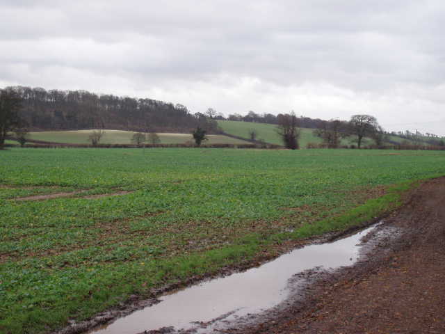
The bridleway followed a left-hand hedge, soon passing under electricity wires carried by a row of massive pylons. To my right a field sloped gently down – on the other side of the far hedge, a parallel path carried both the Icknield Way and the original route of the Chiltern way. At the bottom of the slope was the village of Streatley (pronounced Strett-ley) which I’d passed through on both those walks. Ahead of me and slightly to my right were Warden and Galley hills. After a few hundred yards I came to a crossroads of tracks, where I turned left on to the Icknield Way – I’d walked this section twice before, on the northern extension of the Chiltern Way and as part of my Berks-Essex Walk [9]. The path here was a good farm track, surfaced with bricks in a few places, running down the middle of a grass strip between hedges about 20 yards apart. After about half a mile, the track emerged at a sharp bend in the Hexton-Lilley road (which I’d driven along earlier). I followed the road ahead for a few hundred yards to a sharp bend to the left, where a footpath continued ahead through a small car park (I parked here on Day 10 of my Berks-Essex Walk). Immediately beyond the car park, I turned right on a footpath [10], leaving the route of the Icknield Way and Chiltern Way which continued eastwards to Telegraph Hill.
[9] Start of the section eastwards along the Icknield Way, near Galley Hill
[10] Footpath between the Icknield Way and Lilley
The John Bunyan Trail followed a right-hand fence heading south for a few hundred yards, with a farm ahead and over to the right. After a few hundred yards, the path passed a small belt of trees on the right, then turned sharply left and then sharply right. This was a pleasant part of the walk. The path was about halfway up the very gentle right-hand slope of a valley, with a much steeper slope on the left-hand side. Much of the top of that slope was wooded, and I heard then saw a couple of Buzzards over one of the woods. At the next crossing hedgerow, a John Bunyan Trail waymark indicated that I should go right, but the map clearly showed there was no right of way there and that I should go right at the next field boundary. I decided to follow the map, and having turned right at the next boundary soon came to the road through Lilley. I turned left, and followed the road for about half a mile to a road junction at the centre of the village. (I couldn’t find much about Lilley when I searched the internet, but one curiosity is that the name of its MP is Peter Lilley.)
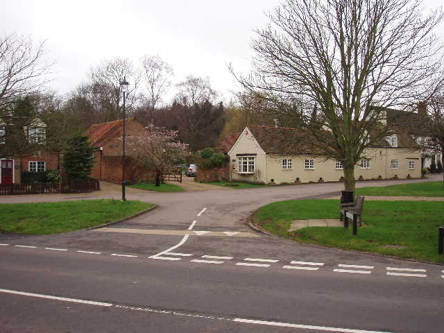
[11] Lilley
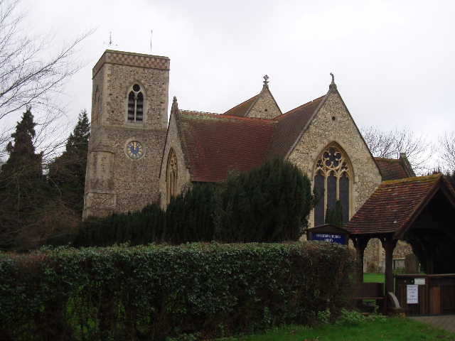
[12] Lilley church
This was my turn-around point for the day, the John Bunyan Trail continuing along the road on the right. I took a couple of photos [11] and wandered on a few yards further to take a couple more of the church [12]. Then I turned round and headed back the way I’d come. It had taken me 2hrs and 10 minutes to reach Lilley, and the return journey was slightly quicker, nearer to 2 hours – presumably because I didn’t spend any time taking photos on the way back. Walking back along the Icknield Way was the toughest part of the walk, as I was walking westwards into the wind. I stopped for lunch on a fallen tree trunk by the crossroads where I turned left off the Icknield Way. Going back across the Barton Hills was quite exciting, the wind almost blowing me off balance on several occasions. It rained for a few minutes here too, but nothing serious. A little earlier I’d seen a few patches of blue sky amidst the grey clouds for the first time today.
This walk was a bit shorter than usual. It was a pretty good walk, on clear paths throughout and with some nice scenery for most of the way. Today wasn’t a great day for walking, very grey and with a strong wind, especially in the afternoon. On a nice summer’s day, I’m sure this would be a very enjoyable walk. I’ll have to come back and walk over the Barton Hills on a nice day sometime – I’ve walked over them twice now, and each time it’s been grey and wet!
Total Distance: 72.6 miles (each way)