Pete's Walks - John Bunyan Trail
If you are considering walking this route yourself, please see my disclaimer. You may also like to see these notes about the maps and GPX files.
Day 11 15/01/07 Lilley to Sundon Hills Country Park (6.4 miles each way)
Parked in car park at Sundon Hills Country Park.
I chose to do this walk ‘backwards’, starting at Sundon Hills Country Park and walking to Lilley before turning round. As usual, though, I shall describe the walk from Lilley to Sundon Hills Country Park, so that it conforms to the direction of the rest of this journal. I chose to start at the country park partly because it was shorter to drive to than Lilley, partly because there is a spacious car park there, but mainly because I like to complete my walks where I start them – if I’d started at Lilley, the return walk from the country park would have felt a bit of an anti-climax after having completed the walk in the ‘normal’ direction.
It was a fairly grey morning when I set off from Sundon Hills Country Park about 9.45am, although there were just a few small patches of blue sky visible. By the time I reached Lilley, almost two hours later, it had brightened up considerably, with half the sky now blue, the other (westerly) half covered by high light grey clouds.
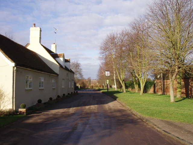
[1] Lilley
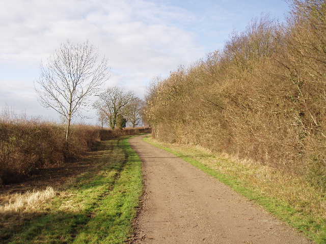
[2] Track beside Ward's Wood
From the centre of Lilley, I took the side lane that went past the pub [1] (on my left) and followed it a few hundred yards, passing a few older houses, until it ended by a farm. Here a bridleway continued ahead, heading north-west, running between two hedges. This first section of bridleway was very muddy and I had to work my way carefully along the remaining firm ground on the very edge of the track. It wasn’t too bad though and the surface soon improved, although there was another short section of very muddy ground a few hundred yards further on. Just after that though, the bridleway became a surfaced farm track as another farm track came in from the right. The bridleway soon turned sharply to the left alongside Ward’s Wood, then turned sharp right at the corner of the wood, to continue in a more westerly direction with the wood still on my right [2]. The countryside around here was very attractive – the bare brown hedges separating fields that were either brown where they’d been ploughed, or bright green where they’d been planted with a new arable crop. There were several other woods around, a mixture of deciduous and coniferous, and the ground was like a huge shallow bowl, rising gently in most directions with one or two hillocks rising from it and a more pronounced line of hills behind me. The map showed many other bridleways criss-crossing this area, and it seemed an attractive place to come back to for another walk. Surprisingly, as I would soon discover, it is right on the edge of Luton, not somewhere I’d have associated with good walking.
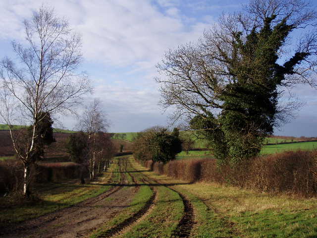
[3] Track from Ward's Wood to Warden Hill
[4] Looking back from near Warden Hill
Beyond the end of Ward’s Wood, the bridleway continued, now descending slightly between two hedges some 30 yards apart – this section was slightly muddy, due to the numerous tracks made by farm vehicles [3]. I went past one bridleway going off on my left, but then a hundred yards or so further on took a second bridleway on the left. This ran alongside a left-hand hedge for several hundred yards. Ahead of me I could see the green fields rising gently to the horizon – this was actually the back of Warden and Galley Hills, which were quite innocuous from this side, but are steep grass and scrub covered downs on the other (westerly side), as I would see when looking back this way later on. Where the hedge eventually turned left, at another bridleway junction, I continued ahead along a grass track between two green fields, the track rising gently towards a crossing fence line [4]. As I reached the fence on the top of the crest, the view opened up before me – I was standing in a slight depression between Warden Hill (to my left) and Galley Hill [5], with the north of Luton ahead and to my left, with a shallow valley ahead to my right carrying the A6 towards Streatley, the next village that I’d reach [6].
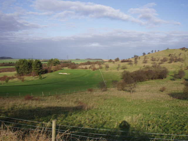
[5] Golf course and Galley Hill
[6] View towards Streatley, from between Galley Hill and Warden Hill
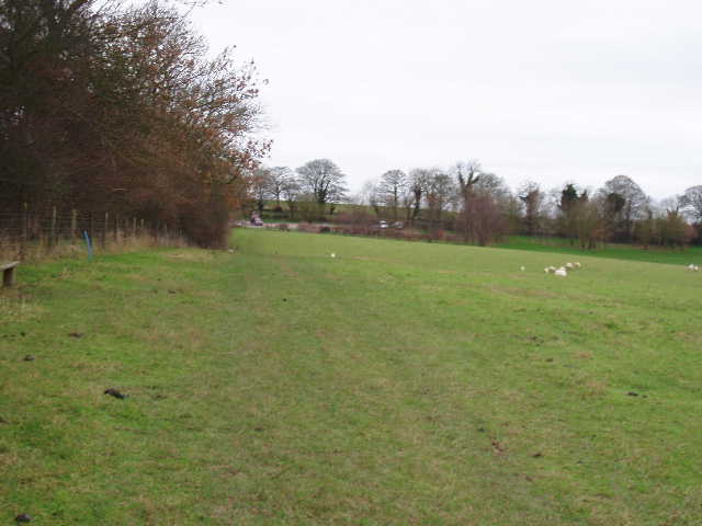
The bridleway continued on a good track, noticeably chalky now, descending between fences to reach a golf course. It went past one tee, then went downhill beside a fairway on the left. It passed a car park on the left and the club house on the right then, leaving the golf course behind, continued westwards between mature hedges. Beyond the hedge on my left were garden fences marking the very northern edge of Luton [7]. The bridleway soon ended at the A6, which I crossed without any difficulty. Beyond this, the print-out said to take a lane opposite – I had followed the narrow lane on my walk out to Lilley, but now I took a clear bridleway running parallel to the lane which was a safer and quicker option (I didn’t have to stop each time a car passed by). I crossed over to the lane just before it reached a large building that is an adult Hospice, turning right immediately before the Hospice onto a footpath heading north. This crossed a field that had obviously been left as ‘set aside’ this year to reach a hedge corner. The path continued for a hundred yards with the hedge on the right, before passing through the hedge and continuing with the hedge on the left, soon passing a wood on that side also. The path followed the hedge through a couple of fields of long grass [8], then through a large field of short grass containing about half a dozen horses. At the far side of this field, I went through a kissing gate and crossed a large sheep pasture, then crossed an empty paddock to reach the village of Streatley by its village pond.
[7] Footpath on edge of Luton, beyond the golf club
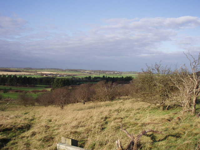
[8] Looking back towards Galley Hill and Warden Hill from near Streatley
There was a bench by the pond [9], and as it was now close to 1pm I stopped here to eat my sandwiches. When I set off again, I almost immediately turned left off the village street that I’d reached, following a path beside a couple of cottages and then turning right alongside a hedgerow. The path rose gently to reach a small modern housing estate, where it followed a short alleyway to reach the village church [10]. I went through the churchyard, passing to the left of the church, to rejoin the road by the village pub (The Chequers). I had walked this short section since the pond before on the Chiltern Way, but that route (and the Icknield Way, which had followed the road from the pond) now turned right at a junction, while the John Bunyan Trail continued ahead. When the road reached a T-junction, I turned right with houses on my left and fields to the right of the road. After a few hundred yards I reached a footpath going off to the left, but before going down it I stopped to take a few photos from the opposite side of the road – I was less than a mile south of Sharpenhoe Clappers, and I had a nice view towards the lower ground north of the chalk escarpment (around Shillington where I’d been a few walks earlier).
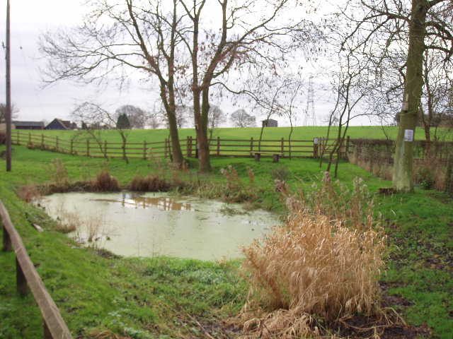
[9] Pond in Streatley
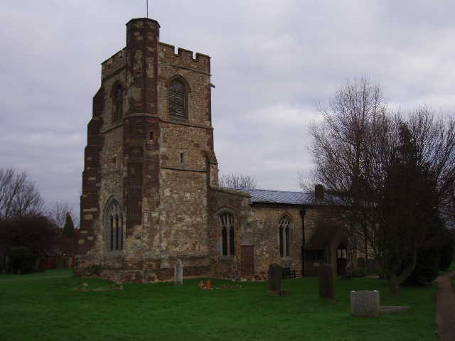
[10] Streatley church
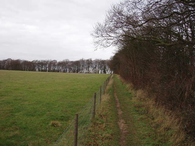
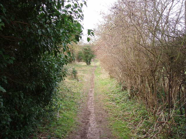
[11] Path heading away from Streatley
The footpath on the edge of Streatley followed the right-hand hedge of a grass field, then turned right (north) between another hedge and a left hand wire fence [11], the empty grass field beyond the fence being part of an area of land owned by the National Trust, according to a sign. This path ended at a path junction at the top of a steep wooded slope, a short distance west of Sharpenhoe Clappers, where I turned left. I was now back on the same route as the start of the John Bunyan Trail, following the top of the chalk escarpment back to Sundon Hills Country Park. I followed the path through the trees, then followed it along the edge of a large wood on my left. I followed the path to the left at the corner of the wood, then went right (with another wood on my left). I turned right again alongside a right-hand hedge, with good views ahead of me over Harlington and towards the greensand ridge. I then turned left along a track around the head of a steep combe cutting into the chalk escarpment – I was surprised to see my first lamb of the year here. The track led into the large sheep pasture along the escarpment that is the Sundon Hills Country Park [12,13,14], and I simply followed the left-hand hedge to reach the car park and the end of my walk along the John Bunyan Trail.
[12] Sundon Hills Country Park
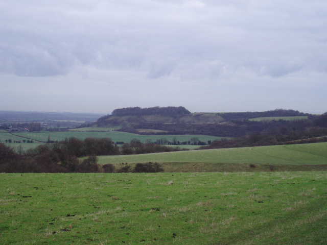
[13] Sharpenhoe Clappers from Sundon Hills Country Park

[14] View from Sundon Hills Country Park towards Harlington and beyond to the Greensand Ridge
It seemed strange that instead of being truly circular, the first and last mile or so of the John Bunyan Trail were the same. Still, I didn’t mind repeating that section of the walk (despite having already walked it on the Chiltern way and the Icknield Way!) as it was very pleasant walking along the top of the chalk escarpment with the good views northwards to the Flit Valley and the Greensand Ridge. I just wondered why the walk hadn’t started and finished at the car park by Sharpenhoe Clappers which would have avoided the need to repeat a section of the walk – as far as I am aware, there is no historic link to John Bunyan that makes the mile or so between the country park and the Clappers essential to the trail.
This was another enjoyable walk, a fair bit shorter than usual. The countryside near Lilley was very nice, and with the abundance of good paths there I’d like to go back and do another walk around there sometime. The walk along the top of the escarpment to Sundon Hills Country Park was still very pleasant, despite having walked it several times before. I think I actually preferred doing today’s walk in the opposite direction to that that I’ve described, as the steep sides of Warden and Galley Hill were in view for much of the way, although doing it that way you don’t get the sudden surprise of the view as you reach the crest of those hills. I was very pleasantly surprised by the quality of this entire walk, considering how close it was to the northern edge of Luton.
Total Distance: 79.0 miles (each way)