Pete's Walks - Milton Keynes Boundary Walk
If you are considering walking this route yourself, please see my disclaimer. You may also like to see these notes about the maps and GPX files.
Day 6 1/8/07 Salford to Nun Wood (7.3 miles each way)
Parked in Salford.
I parked on the main road through Salford, and started by walking back to the road junction I reached last time. I had a much shorter journey this morning, so started walking about 9.45am.
I turned left down Brittens Lane, and followed it as it turned sharply to the left. When it reached the main road, I turned right. There was a gap of about a quarter of a mile between houses in the village here, as the road crossed a stream between meadows [1]. There were a few more buildings as the road turned to the right, soon passing the Red Lion – a sign proclaimed that this had won a national award as ‘Wine Pub of the Year 2003/4/5’ [2]. The road turned sharply left by a minor junction, and left Salford behind. There was no footpath here and I had to take care as the verges weren’t too good. The road crossed over the M1 motorway and an adjacent road, then went round an ‘S’ bend by a farm that now housed some small industrial units. A short distance later [3] I came to a junction where I turned right (I noticed a red Hollyhock by this junction when I came back).
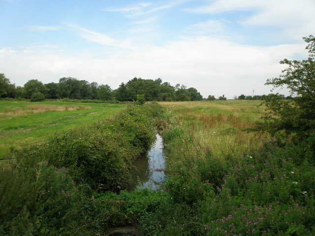
[1] Stream in Salford
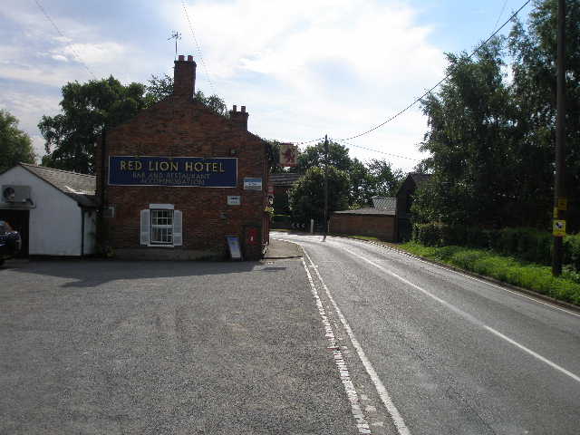
[2] Looking back at the Red Lion, Salford
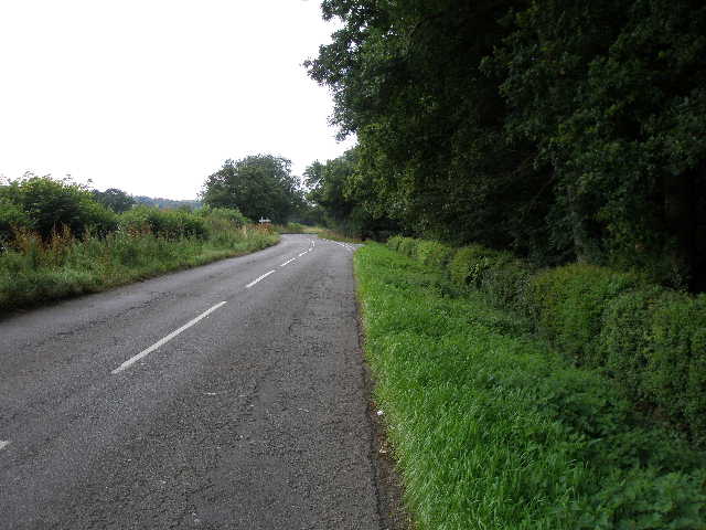
[3] Road between Salford and Wavendon
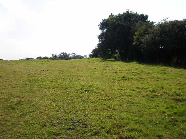
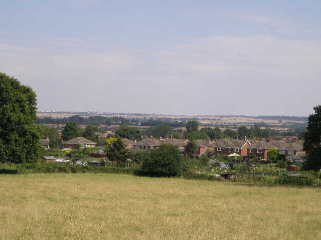
I was now in part of the village of Wavendon (there is a good music venue here, The Stables, run by Cleo Laine and Johnny Dankworth – I went to see the Be Good Tanyas there some months ago). I passed a few houses on the right, and soon had quite far-reaching views to my right, over corn fields towards Milton Keynes, the scene dominated by some very large modern warehouses [4]. After a few hundred yards I turned left down the drive of Wavendon House. This was an attractive drive between mature trees, with a long pond beyond the trees on my right [5]. There were some magnificent oaks on the left, and several plane trees on the right (I recognised them from their distinctive bark, and later checked their leaves in the Tree book I bought at the Chiltern Gateway Centre on Dunstable Downs). I passed between some cottages and the main building (the original house has been refurbished and divided into apartments). Where the drive turned right, behind the main house, I went half-right across the large lawn, with another pond on my left, to reach a stile in a fence.
Here I entered Wavendon Golf Course. I walked slightly right, behind a green, to a hedge and fence, where I turned left. After a hundred yards or so, I went over a stile in the fence and turned left, only to cross another stile back onto the golf course after about 50 yards. I crossed over a fairway and went past a tee, then followed a gravel track that turned to the left and crossed a stream. I had to wait for some golfers to play their shots before I could turn right across another fairway and back across the stream. I then turned immediately left and went over a stile to leave the golf course. I then followed a left-hand hedge through two large hay meadows [6], to reach the driveway to a farm (more industrial units) where I went a few yards to the left to reach a road.
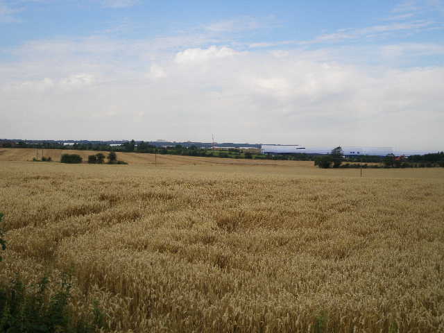
[4] View towards Milton Keynes from road in Wavendon
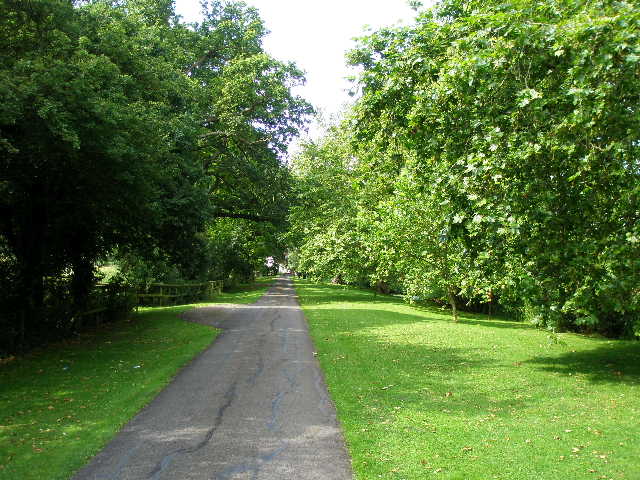
[5] Drive to Wavendon House
[6] Looking back along path from Wavendon Golf Course
I turned right, and followed the road round to the left. I was now on the north-eastern edge of Woburn Sands, and to my right there was a view over the town to the wooded slopes of the Greensand Ridge near the villages of the Brickhills [7]. I followed the road slightly downhill for about a quarter of a mile. When the road turned right, I went left along a short alley and continued ahead along a residential street of bungalows. Another even shorter alley then took me out of the residential area into a rather overgrown meadow, which the path crossed diagonally half-right [8]. I crossed a stream and followed the hedge on my right a few yards to a metal kissing-gate. Here I crossed a railway line, and through the kissing-gate on the other side I entered a large field grazed by four or five horses. I went slightly uphill [9], more or less following a right-hand hedge to another kissing gate by a telegraph pole (rather unusually, the swinging ‘gate’ part of the kissing gate was wooden, but the enclosing section was metal).
[7] Looking across Woburn Sands to the Greensand Ridge near the Brickhills
[8] Meadow on the edge of Woburn Sands
[9] Large pasture beyond the railway line outside Woburn Sands
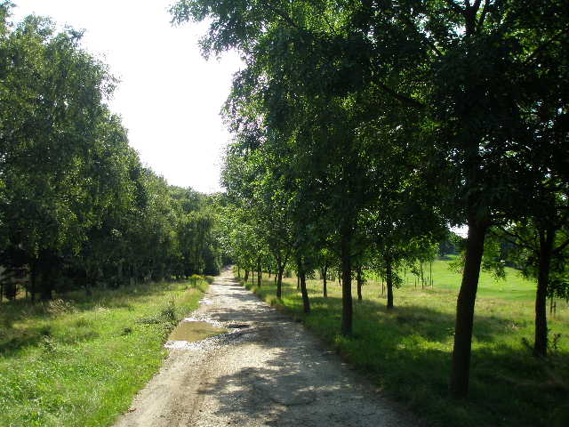
I had now entered a second golf course, that of Aspley Guise and Woburn Sands. I turned left along a track, with a few trees separating the track from a fairway on my right [10]. After a while the track went uphill between bushes, and passed between a couple of houses on the left and some metal sheds on the right. At the subsequent path junction, I got a bit confused and initially went the wrong way. The instructions for the Milton Keynes Boundary Walk said to take the right fork, but this was actually a four- or even five-way junction, and there was no sign of the waymark or gorse bushes it mentioned. So I followed the track straight on for a couple of hundred yards, until I reached a footpath junction where I could see from the map that I’d gone wrong. When I went back and took the correct path, I almost immediately spotted the ‘missing’ waymark and gorse bushes, hidden behind a small tree and completely out of sight from the junction. I carried on along a track that ran through trees between two fairways [11]. It crossed another track then climbed uphill at first through bracken then through trees, with the club house over to the left, to reach another road in Woburn Sands.
I turned left, passing the golf club entrance, then went right along an alley between wooden fencing. I crossed a smaller residential road and continued down a very short alley. The Milton Keynes Boundary Walk then turned right, on a tarmac path with wooden garden fences at first on the right, and a mainly coniferous wood rising uphill on the left. There were a few deciduous trees amongst the conifers, but there was no greenery at all on the ground in the wood, just fallen branches and dead leaves. I soon came upon a party of about a dozen people who were tidying up the path, removing a few weeds and sweeping away the mud and decaying leaves on top of the hard surface. After a few hundred yards, the path went down another short alley to emerge on a road close to the centre of Woburn Sands.
[10] Track through Aspley Guise and Woburn Sands Golf Course
[11] Track through Aspley Guise and Woburn Sands Golf Course
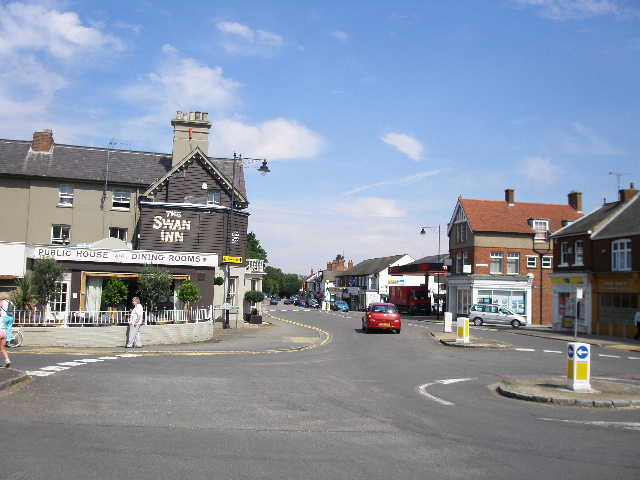
[12] Centre of Woburn Sands
Woburn Sands is now a small town on the border of Buckinghamshire with Bedfordshire. Until the 1860’s it was a hamlet called Hogsty End in the parish of Wavendon, and so is a largely Victorian creation. The Sands part of the name comes from the very fine type of sand known as “Fuller’s earth” that is extracted in this region – it was used historically to clean sheep’s wool before it was carded and spun.
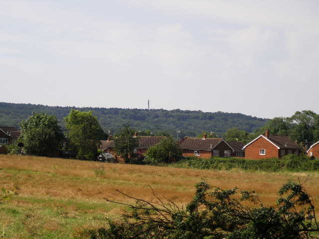
I turned left and crossed over the main street at a double mini-roundabout by the Swan Inn [12]. I continued along the road for a few hundred yards. Just after it turned right, I turned left on a gravel track, with some houses on my right and Edgewick Farm on my left. This small 20-acre farm was recently taken over by the town council and is used, I think, for introducing young people to nature and other such purposes. Some sheep were lying right up against the fence, sheltering from the sun under some trees. Beyond the houses I passed some allotments on the right, then went through a gate and continued on a path between meadows, heading uphill towards the woods crowning the Greensand Ridge. There were some nice views back over Woburn Sands [13], and I could see the buildings of Cranfield University on the skyline.
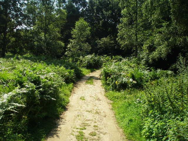
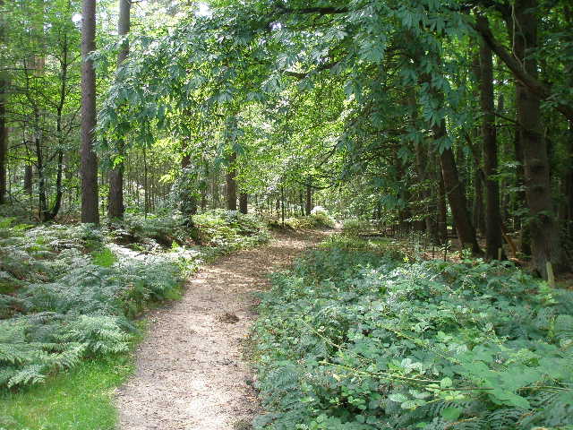
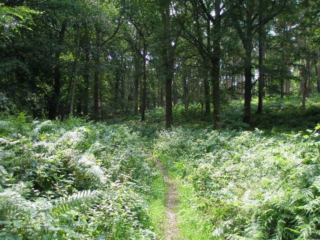
The path entered the woods, deciduous at first, and ran just inside the trees with a meadow to the left [14]. I would later see my fourth Muntjac deer of the day here. The path rose gently, soon emerging from the trees and passing through a small area of bracken (I’d later see my third Muntjac here, or at least its rear end with its distinctive white tail, disappearing rapidly into the undergrowth). This was now the section of the Milton Keynes Boundary Walk that I’d been most looking forward to, a section of sandy paths [15] through woods along the crest of the Greensand Ridge. The sandy path soon re-entered the woods, now mainly coniferous, and at a junction I turned right. The path contoured round near the top of the hill, turning slightly left with the remains of a wire fence on my right. I soon saw my first Muntjac deer of the day here. The sandy path [16] was surprisingly muddy in places and I had to occasionally edge my way past the worst sections.
[13] Looking back across Woburn Sands
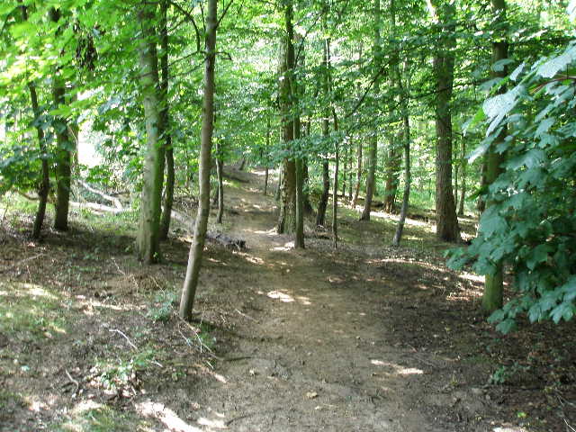
[14] Path through first wood after Woburn Sands
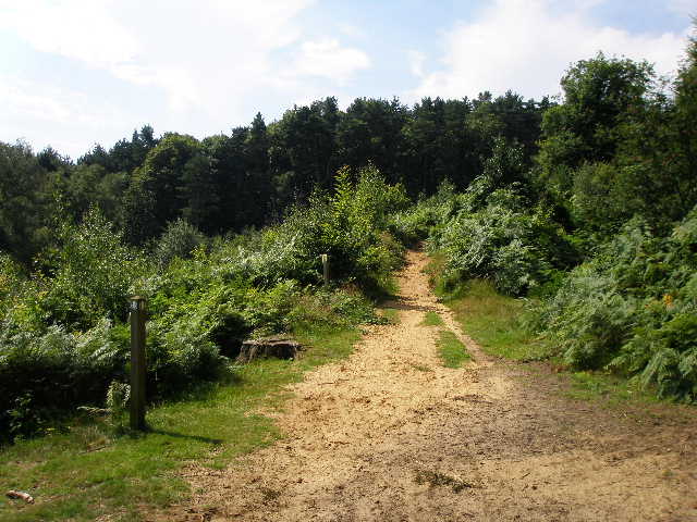
[15] Typical sandy path through the woods on the Greensand Ridge
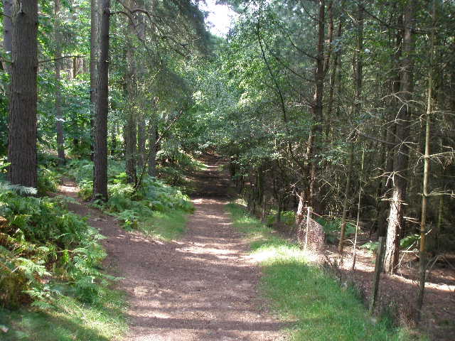
After contouring round through the trees for a few hundred yards, I turned left at a crossroads of paths, and climbed the short distance to the top of the slope, now on a broad sandy track. I soon came to another junction, where I turned right, only to turn left again very shortly afterwards at a T-junction of bridleways. The sandy bridleway ran gently downhill, with just a few trees separating it from a third golf course on the right [17]. This was the very upmarket Woburn Golf Course, which has hosted the Women’s Open and many other prestigious golf tournaments. I continued very gently downhill for almost half a mile, until I reached a very broad and sandy track that quickly brought me to a road.
I turned left – I hadn’t seen many wildflowers today, but there was Red Campion and Herb Robert here along the roadside. Where the wood on the right ended after a couple of hundred yards or so, I turned right on a footpath that ran uphill through a large grassy field beside the wood [18] – a sign warned to keep to the footpath because the field was used for training police dogs! At the top of the field I turned left on a well-made track, with another part of Woburn Golf Course on my right (I thought the club had two courses, the Duke’s and the Duchess’s, but looking on the internet there is a third, the Marquess’s). Beyond the grassy field, I had the club’s driving range on my left (I saw two people having lessons here on my way back).
[16] Path through woods on the Greensand Ridge
[17] Bridleway through woods on the Greensand Ridge, next to Woburn Golf Course

[18] The field where Police dogs are trained
At a waymark sign where the track turned left, I went right on a path of wood chippings. This crossed part of the golf course, passing a green and a tee, then re-entered the woods. It crossed a couple of paths used by the golfers and then, now the more normal mud underfoot than chippings, continued through the trees [19] a short distance to reach a road. There was a fallen tree here where I’d later eat my lunch (although it wasn’t too pleasant a place as there was a lot of litter here).
I went a few yards right along the road, then took a path forking left away from the road. Within a few yards I came to a junction where I turned left. There was more Red Campion growing here. The path initially went uphill, with a small wire fence on the right. The woods here were now more deciduous though there were still a few conifers. This was a very pleasant part of the walk, on a green path between trees and with the blue sky overhead. I soon saw my second Muntjac deer of the day, and also heard a Buzzard overhead. After about a third of a mile I came to a junction I recognised from Day 1 of my walk on the Greensand Ridge Walk. There was a large sandstone block here – very sadly, the plaque with a poem commemorating the Queen’s Golden Jubilee had disappeared (there are seven of these dotted along the route of the Greensand Ridge Walk, either on sandstone blocks or on carved posts) [20].
[19] Path through woods by Woburn Golf Course
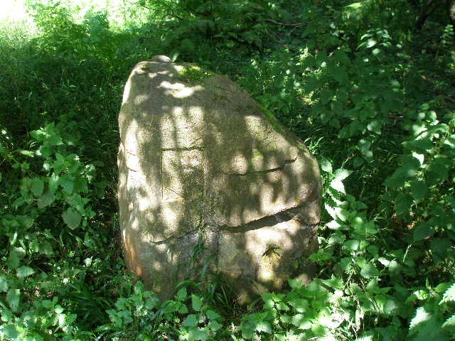
[20] Marker stone (minus plaque with poem) at junction with Greensand Ridge Walk
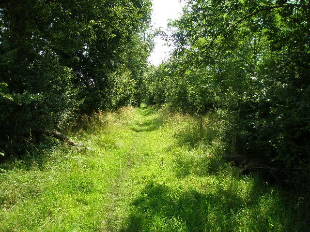
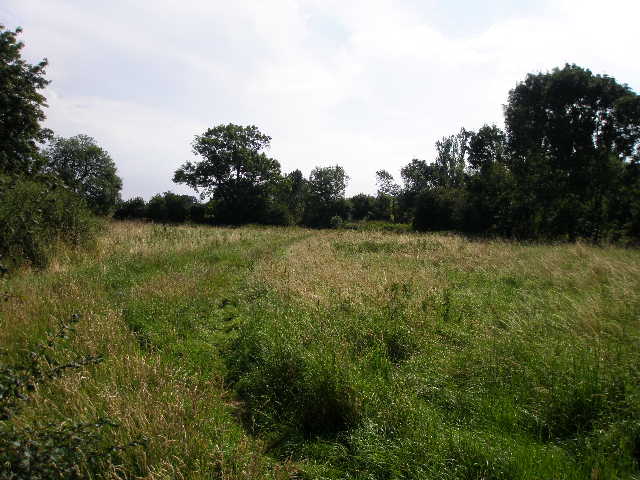
[21] Path beside Nun Wood
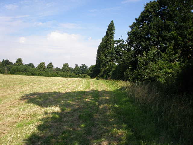
I continued ahead, now on the route of the Greensand Ridge Walk [21]. The Wood on my left soon ended, replaced by corn fields that had recently been harvested (there were some large circular straw bales). The path continued, a bit muddy in places, for about half a mile to reach a road. When I set off this morning I wasn’t sure whether I would turn round here, or half a mile further on at the A5, but as there was a convenient parking space nearby where I could park next time, I decided this would be as far as I would go today.
It had been a pleasantly warm morning with bright skies – early on I’d switched to wearing my sunglasses. It had never felt uncomfortably hot, but I was grateful for the shade of the trees as I walked through the woods. It seemed to warm up one or two degrees as I walked back, without becoming unbearably hot. I was a little surprised that the thermometer in my car said it was 26C, when I got back to Salford about 3pm.
This was a very good walk, but definitely a walk of two halves. The first section as far as Woburn Sands was nothing special at all – it started with a mile or so of road walking, then went through two golf courses which I never particularly enjoy. But beyond Woburn Sands the walk was quite delightful and lived up to my expectations. I had vague memories from my childhood of this area, sandy paths through bracken and large areas of woodland. This section of the walk was really enjoyable, and I’ll have to come back and explore this area more sometime –it’s only a half-hour drive from where I live.
Total Distance: 45.7 miles each way (approximately)