Pete's Walks - Milton Keynes Boundary Walk
If you are considering walking this route yourself, please see my disclaimer. You may also like to see these notes about the maps and GPX files.
Day 7 3/8/07 Nun Wood to Weasel Lane (7.5 miles each way)
Parked near Nun Wood.
I had a nice short journey to the start of this walk (through Dunstable, up the A5 through Hockliffe, right at the next roundabout), so I was able to start walking about 9.35am. It was already 16C when I left home, and it was obviously going to be a very warm day.
From the end of the footpath that I reached last time, I turned right along the road (Woburn was some distance behind me, ahead of me the road would reach the A5 and beyond that was Heath and Reach, on the edge of Leighton Buzzard). After a couple of hundred yards, as the road started turning left, I turned half-right by a Greensand Ridgway Walk signpost. The first field I crossed had been left fallow this year [1] – there were bits of last year’s wheat crop growing, interspersed with various wildflowers including some type of Willowherb (these are tricky to identify, as they hybridise so readily). As I crossed the field, I was lucky enough to see three Roe deer – I managed to get a distant photo of one of them [2], before they bounded off to the far side of the field. This was only the third or fourth time that I’ve seen Roe deer on my walks – I see Fallow and Muntjac deer far more frequently. [Update: I have since learnt they were actually Chinese Water Deer, which are far more common in this area than Roe deer]. Probably because I was distracted by the deer, I didn’t notice until when I returned in the afternoon that looking to the left I could see as far as the Dunstable and Whipsnade Downs, including the White Lion chalk carving at Whipsnade Zoo.
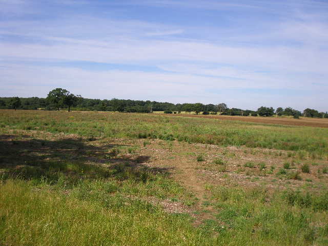
[1] The first 'fallow' field
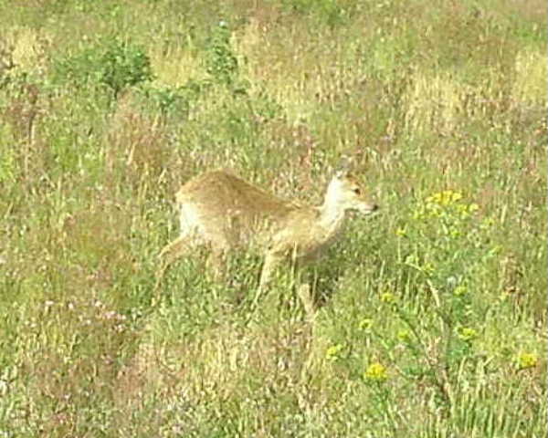
[2] A Chinese Water deer in the 'fallow' field
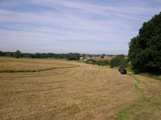
[3] Path in the large hay meadow, leading to Rammamere Farm
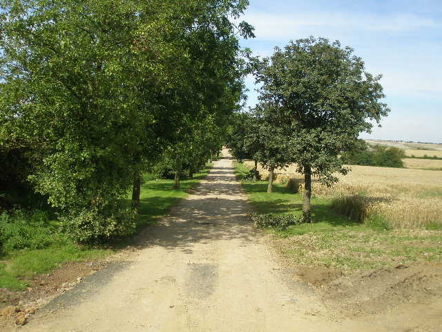
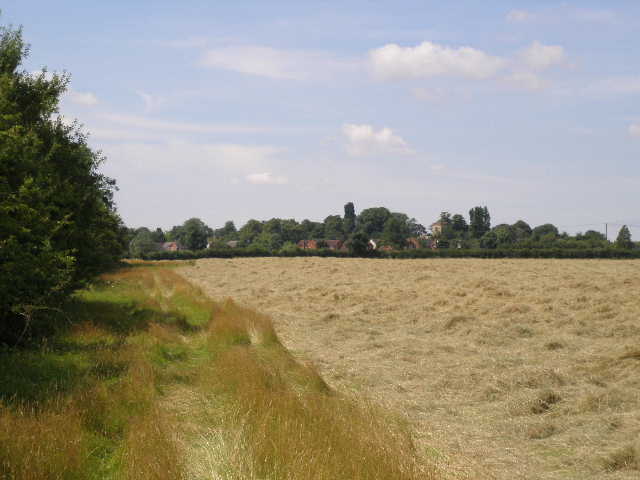
The far side of the field had been ploughed and I followed a tractor track through the bare brown earth. The next field was all long straggly grass – there was no sign of a path, but the stile on the other side was clearly visible and it was easy to make a bee-line for it. I then went down a few steps, and carefully crossed the A5. I noticed some Herb Robert growing on the embankment, as I went up the tall and steep steps the other side of the road. The Milton Keynes Boundary Walk now followed the left hand hedge of two small hay meadows – I heard and then saw a Buzzard here. Beyond the second small meadow, I turned right along a hedge, then fence, in a huge meadow [3]. I think cattle had grazed here when I came through on the Greensand Ridge Walk 15 months or so ago, but now it was a hay meadow – the grass round the edges had already been cut and collected into huge black circular plastic bags.
At the end of the meadow I went into a paddock, where there were five or six horses, then through a kissing gate into a small pasture where there were some small bullocks, mostly lying on the ground a few feet to my left. The gate wasn’t quite in the corner of their field, so as I entered the field I almost trapped one bullock in the corner – I worried that it might react rather nervously, but it stood completely impassively as I walked past inches from its nose. Rammamere farm was now behind the hedge on my right. I turned left in the corner of the field, and followed the hedge almost to the next field corner, before turning right over a stile. I was now leaving the route of the Greensand Ridge Walk, which I’d been following since Nun Wood at the end of my previous walk.
[4] Path on way to Great Brickhill
[5]Rotten Row, Great Brickhill
[6] Great Brickhill church
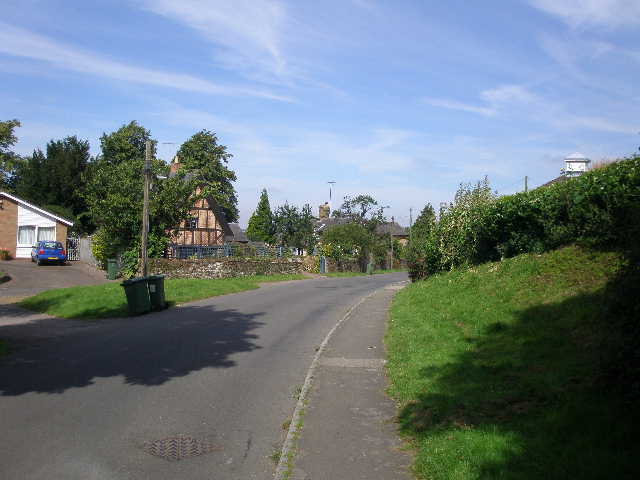
The path now followed a wide strip of grass beside a left-hand fence and then hedge, with a corn field to my right. Some rabbits scurried back to their holes as I walked through the grass. The path continued into the next similar field. Just before I reached some overhead power lines, I turned left to go over what the instructions described as a double stile in the hedge. In fact, here I met two friendly gentlemen who were in the act of replacing the stiles – having removed the old stiles, they had to cut a couple of strands of barbed wire so that I could step over the fence. They said the new stile would be ready by the time I came back in the afternoon, and true to their word there was a nice new wooden stile here when I returned. On my last walk I came across a crew of people tidying up a path at Woburn Sands – nice how people are improving the route of the Milton Keynes Boundary Walk just for me! J
I headed diagonally across an empty pasture, going over a slight rise in the ground. Over a stile, I continued on a clear path through another field of long straggly grass [4] to another stile by a gate. I then followed a nice track of cut green grass between hedges or fences, which initially passed a stand of pine trees on my right. I noticed some lovely Musk Mallow here on my way back, and think I saw a lot more of it in a field to the right. The track meandered gently for a few hundred yards, passing both Red Campion and White Campion, before rising gently to a stables and a ‘chocolate box’ thatched cottage. I went over a stile by the cottage’s gate, but then immediately went over another stile on the right. As I followed the hedge on my right, I thought I saw some young cattle in the diagonally opposite corner of the field, but as I got closer I saw that they were in fact goats. After about 100 yards, I went over a stile in the hedgerow, and turned left to follow the hedge through a large empty meadow – on the way back I saw that this connected to another field where a few horses were grazing. There was more Red Campion here – this was the ‘Flower of the day’, as I saw it in several other places too. I was going very slightly uphill here, and at the end of the field I went over a broken stile to follow a short alley beside a school on my right, which brought me into the village of Great Brickhill.
[7]View from edge of Great Brickhill
[8]Path by Jubilee Wood
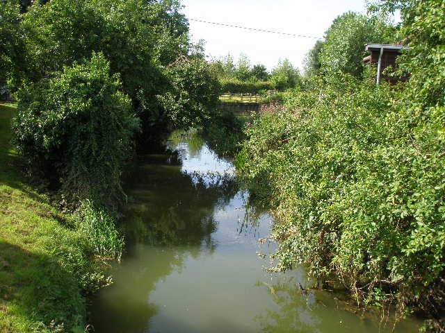
[9] River Ouzel
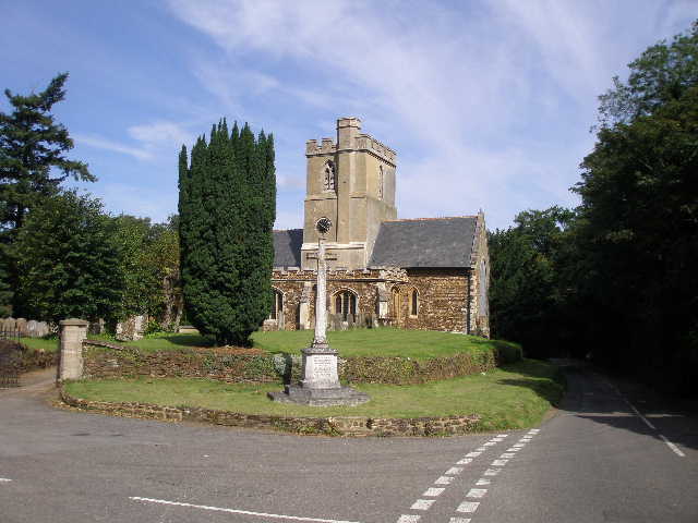
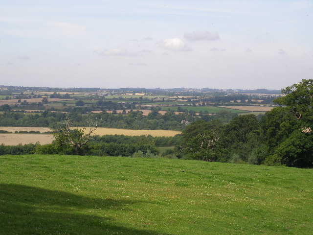
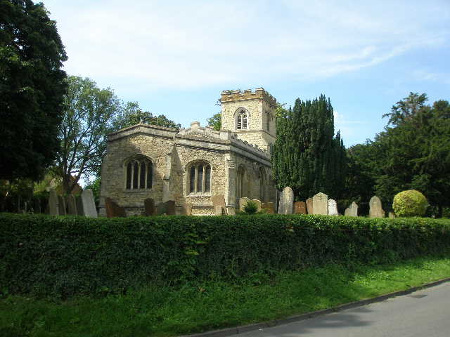
I crossed a road and took Rotten Row opposite me (I’ve come across a couple of hamlets called Rotten Row and seen it is a street name elsewhere too). This led gently downhill [5], through a mixture of old and modern residences, to a junction where I turned right. After a couple of hundred yards I turned left in front of the war memorial and the village church [6]. I soon turned half-right down a path between hedges, which quickly brought me to a stile and a large empty cattle pasture. There were nice views ahead here [7], as I was on the edge of the Greensand Ridge overlooking the plain where Milton Keynes lay below. The path followed the right-hand fence then a sturdy brick wall (obviously enclosing the grounds of a large estate), descending steadily. After going over a couple of stiles in quick succession, I continued downhill between a hedge and a wire fence on my left, with some bullocks grazing at the far side of the field beyond the fence.
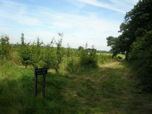
Near the bottom of the hill I turned right, passing Jubilee Wood (planted in 2002) on my left [8]. At the end of the small plantation, I turned half-left across another field that was ‘set aside’ or fallow – the ground was cloaked in clover, with last years barley crops showing through, with a few wildflowers, including Redshank. On the far side, I turned left down a lane. The morning had already warmed up now, and I was hoping it wasn’t going to get any hotter. After a while, the lane crossed over the river Ouzel [9] and a short distance further on I reached the Grand Union Canal [10]. I went down some steps to the left of a bridge, and turned right under the bridge along the towpath. I followed the canal for about half a mile – the tow-path here was a hard gravel surface that extended from a very thin strip of grass next to the water to the ivy-clad hedge on my right, so there was no real prospect of seeing any of the waterside plants I’d seen when I followed another section of the canal on Day 1 of this walk.
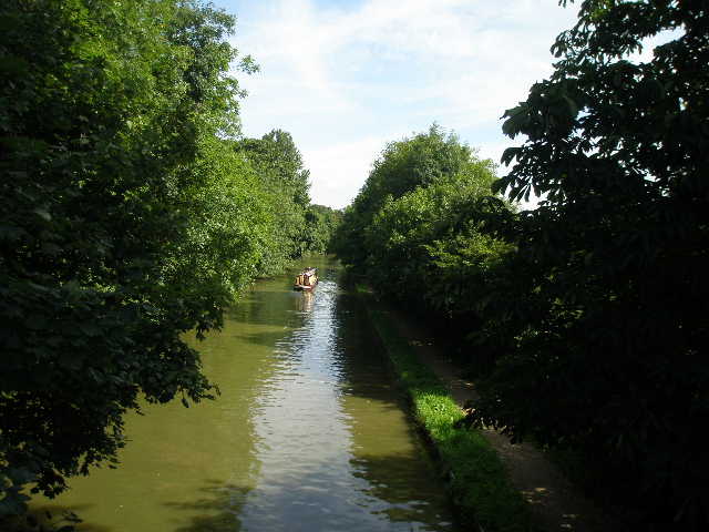
[10] The Grand Union Canal, from the first bridge
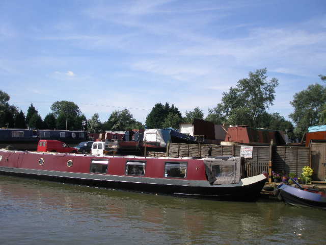
[11] Willowbridge boatyard on the Grand Union Canal
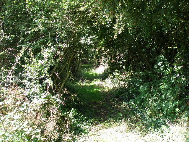
[12] Start of the long bridleway on the edge of Bletchley
I passed the Willowbridge boatyard on the other side of the canal [11], then passed under two road bridges in quick succession. I then turned off the towpath to cross the second of these bridges, coming immediately to a short road between two roundabouts. Across this, I entered a bridleway between hedges [12], with a street and the residences of part of Bletchley beyond the hedge on the right. After a few hundred yards, the left-hand hedge receded and the path widened. There was also a new main road, so recent as not to be shown on my map, a short distance to the left – it ran in a cutting, so I could hear but not see the traffic. Eventually the bridleway reached a T-junction by a metal fence bordering a railway line. I followed the fence a short distance to the right to a road, where I turned left and immediately crossed a bridge over the railway.
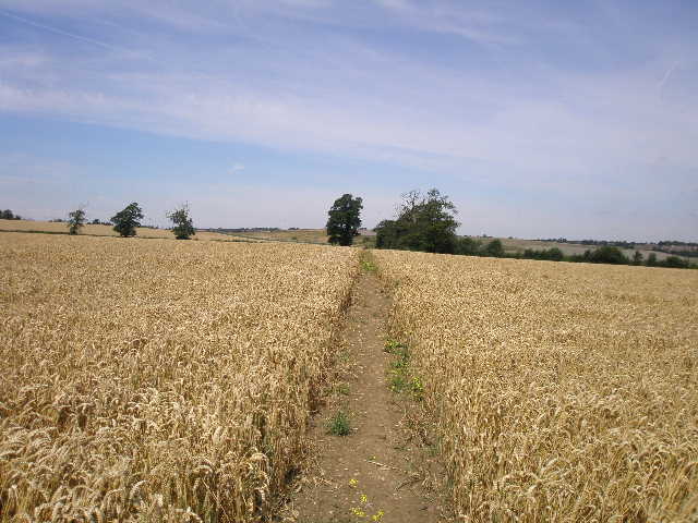
The Milton Keynes Boundary Walk now turned sharp right along the drive to Slad farm [13]. On my way back, I noticed a flower here which I later identified as Red Valerian, the first time I’d seen it. After a hundred yards or so I crossed a construction site where another new road was being built for the ever-expanding city of Milton Keynes. I followed the tree-lined drive to the farm, which I passed on my right, and continued another couple of hundred yards or so to a cottage, where an Alsatian (sorry, German Shepherd) barked aggressively. I continued on in the same direction on a clear path through a corn field [14]. I could see the outskirts of Milton Keynes to my right, and ahead could see bulldozers and other machines on a landfill site. On the far side of the field I went through a hedge gap and turned left along the edge of another corn field. In the corner I went through another gap and turned right along what looked for all the world like a lane, but was just a farm track according to the map [15].
[13] Drive to Slad Farm
[14] Path through corn field, beyond Slad Farm
[15] The farm track leading towards the landfill site
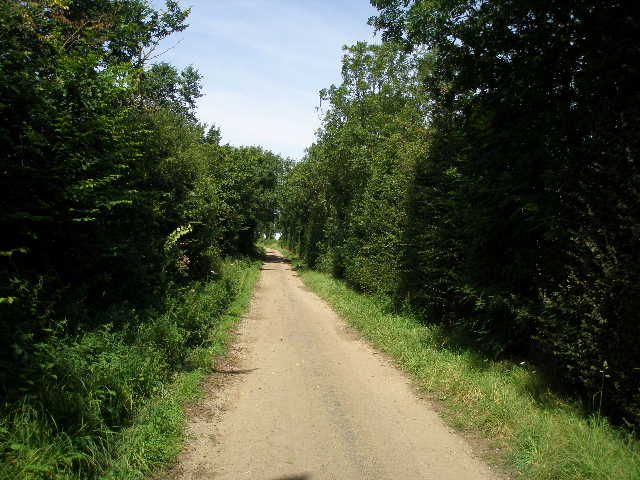
After a few hundred yards, the lane or track ended by a green metal fence that surrounded the landfill site. A tarmac path continued, going slightly left. This was heavily overgrown with nettles and brambles for 30-40 yards (I wore my waterproof trousers here on the way back, to prevent nettle stings – I really like my Mountain Equipment walking trousers, which work fine for me as either long trousers or when I zip off the legs to convert them to shorts, but they are no defence at all against nettles). The path then went over a narrow footbridge, and ran through a small area of trees or bushes to a stile (which is where I’d later stop for lunch on my way back).
Across the stile was an expansive and gorgeous hay meadow [16] – I should imagine this was what hay meadows looked like before the days of pesticides and heavy farm machinery. It was full of long grass interspersed with numerous wildflowers – including thistles, buttercups and some sort of trefoil. It was a really lovely sight. Sadly there was no sign of a path across it, so I couldn’t help but flatten some of the flowers as I made my way across to the stile on the far side – I considered walking round the field edge, but the flowers grew right up to the hedge, so I’d have walked longer and caused just as much damage going that way.
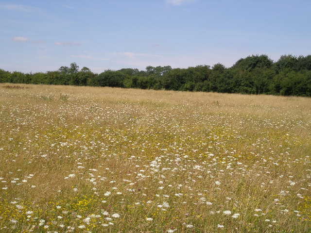
[16] The flower-filled meadow
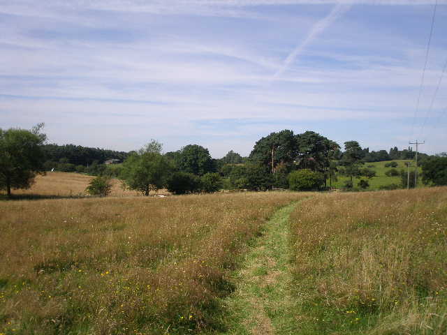
[17] Field path to Newton Longville
[18] Newton Longville church
Across the next stile, I found myself in a corner of a more typical hay meadow that had just been cut (a farmer in a tractor was working here when I came back). I turned left along the hedgerow [17], on a broad strip of uncut grass, and walked quite some way to the next corner. Over another stile, I followed the remnants of an old hedge a short distance through a sheep pasture, before following a slightly sunken path to a stile in another hedge, and then crossing another rather thistly sheep pasture with the houses of Newton Longville immediately in front of me. I crossed another stile, and turned right between garden fences and a hedge on my right to reach a road in the village.
I turned left, and then turned right at a crossroads. The road passed between the church on my left [18] and a pub that also served as a Thai restaurant. I followed the road for a quarter of a mile or so through a fairly modern part of the village, then turned right just before a second pub on the left. The footpath soon took me to a metal gate and a stile, beyond which half a dozen horses were congregated. They were a bit nervous as I made my way over the stile, and worked my way through them, to follow the path alongside the left-hand hedge. This continued through three large if slightly overgrown fields that the horses were free to wander over. I crossed a somewhat damaged footbridge over a stream [19], then went over a stile and passed under a brick tunnel through a railway embankment [20]. The path continued along another left-hand hedge, through a very large and recently harvested corn field. At the end of it, I went through a hedge gap to reach a track called Weasel Lane, which was as far as I was going today [21].
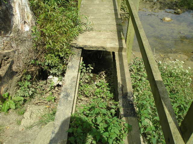
[19] Rather dodgy footbridge, near Newton Longville
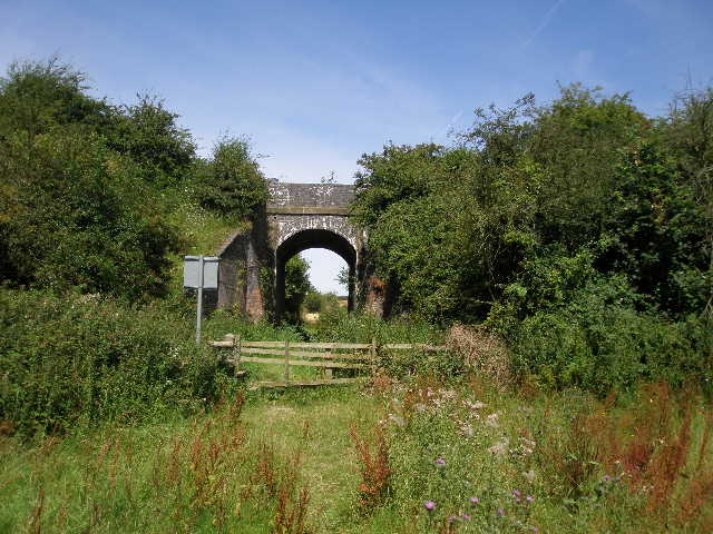
[20] Railway arch near Newton Longville
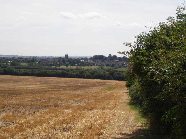
[21] Looking back from near Weasel Lane to Newton Longville
I had enjoyed the walk so far, and enjoyed the return trip, even if the temperature was a little warm (it wasn’t really that hot, and there was a bit of a breeze, but I’m better at dealing with the cold than walking in warm weather). I really enjoyed my lunch on the stile overlooking the gorgeous hay meadow. I got back to my car about 3.10pm, and was home unusually early at 3.40pm.
I found this to be a very enjoyable walk, though I’m not too sure why! It was pleasantly varied, with hay meadows and corn fields, as well as fields containing bullocks, horses, sheep and even goats, although there were no real woods to speak of. There were a couple of lanes and a section along the canal, which nicely broke up the sequence of field paths and bridleways. There was only one steepish descent, where I came down from the Greensand Ridge immediately after Great Brickhill, but the first part of the walk before that was pleasantly undulating. The unexpected sighting of the Roe deer at the start of the walk was a great start to the day!
Total Distance: 53.2 miles each way (approximately)