Pete's Walks - Milton Keynes Boundary Walk
If you are considering walking this route yourself, please see my disclaimer. You may also like to see these notes about the maps and GPX files.
Day 8 6/8/07 Weasel Lane to Stony Stratford (6.8 miles each way)
Parked at picnic site by Bottle Dump roundabout on the A421.
Today was another very pleasant day for walking, with a nice breeze keeping the temperature around 21-22C. As I couldn’t park along the track that is Weasel Lane, I parked at a picnic site just off the main road between Milton Keynes and Buckingham. I then started the walk (about 9.50am) by going back the mile or so to the path junction with Weasel Lane that I reached on my previous walk.
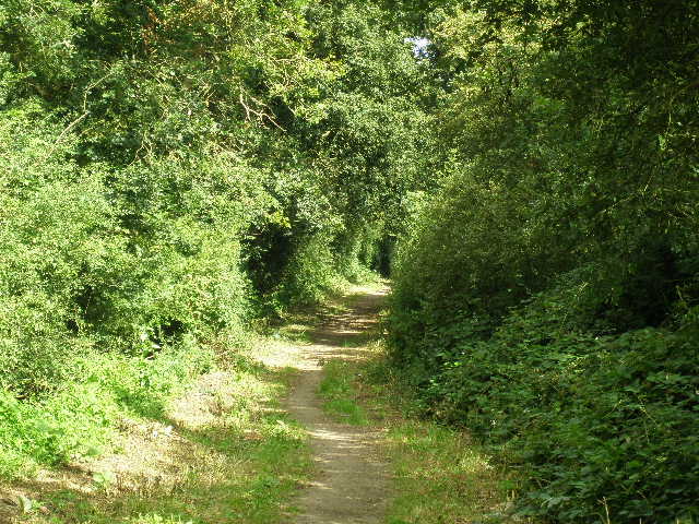
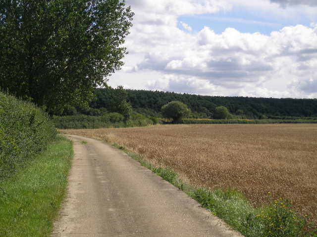
I turned left along Weasel Lane, heading west initially and then more to the southwest [1]. There was a good hard surface along here, as Weasel Lane is part of the national network of cycle routes created by SUSTRANS. The track ran between hedges on either side, with mainly corn fields on the other side of the hedges. I passed a house on the right, and after about half a mile came to a minor road where I turned right.
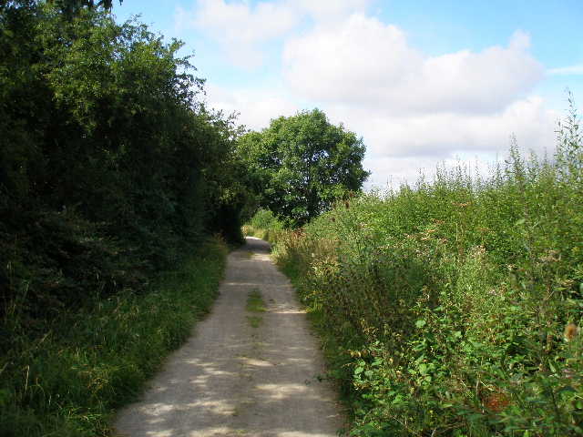
[1] Weasel Lane
[2] The first section of road walking
[3] Start of the bridleway beyond the A421
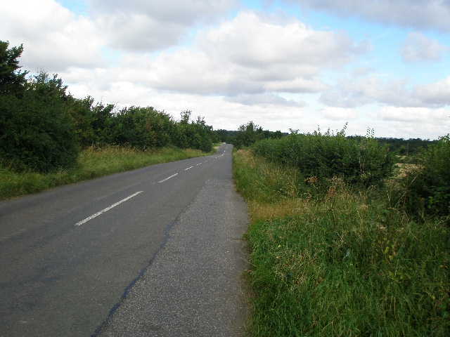
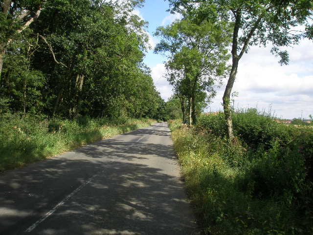
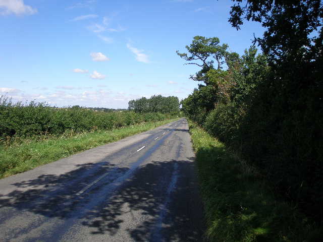
The road was surprisingly busy, and I frequently had to stop and step onto the rough verge as traffic passed [2]. The verges were very uneven and overgrown with long grass, so it wasn’t really practical to walk on them for more than a few steps. The road ran northwest in a dead straight line for almost half a mile. This was one of the more tedious bits of road walking I’ve had to do, and I was glad to get it over and done with for the day. Just before the road reached a roundabout on the A421, near where I’d parked, I turned left on an old section of road, passing a recycling company on my left. I then turned right onto a bridleway, which went through an underpass below the main road.
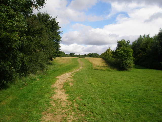
The bridleway [3] continued slightly uphill through an open area of grass with a hedge to the right and some trees to the left – when I came back in the afternoon, I saw that the grass had just been cut for hay. Just past the top of the slight rise, the trees came in from the left, and the bridleway continued along a green lane between hedges. After a short distance it reached another minor road at a bend. I followed the road ahead of me for two or three hundred yards [4] until it went slightly right. Here I continued straight ahead on another bridleway running between hedges [5].
[4] Second section of road walking
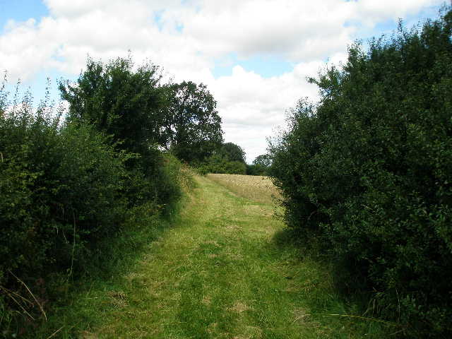
[5] Start of the long bridleway section
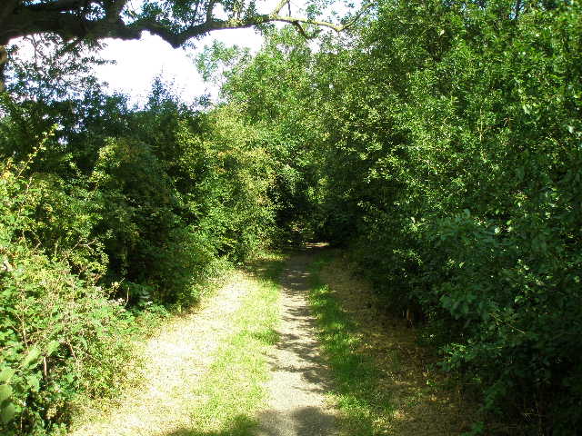
[6] The bridleway
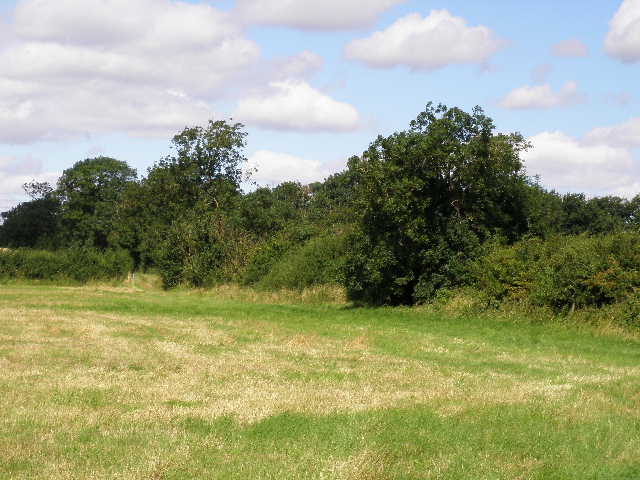
I have already joked about how people have kindly been preparing the route for me, with people clearing the path near Woburn Sands and then the new stile being built near Great Brickhill on the last walk. Well, just along here [6] I came across two people with strimmers trimming back the bushes either side of the bridleway! So kind of these people to go to so much effort just for my benefit! J After about a third of a mile, I passed a narrow wood on my left. On the far side of it was a gate into a very large cattle pasture – this was were the North Bucks Way came in, having come from Whaddon which I could see just over half a mile away to my left. So for the next mile or so along the bridleway I was on familiar territory, as I walked the North Bucks Way just under two years ago – in fact, this part of the route is also shared by the Swans Way and the Midshires Way, which I have not walked (yet!).
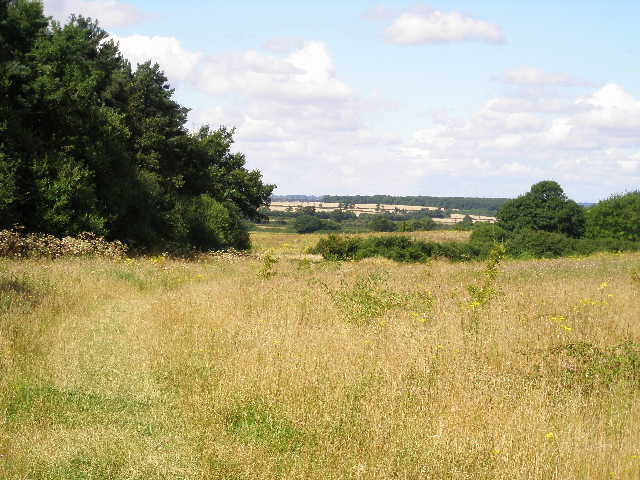
I remembered hearing the loud noises of new houses being built when I walked here before – there were now new houses just over the hedge on my right, and soon the hedge would be replaced with a temporary metal fence protecting a building site. To my left I could see across the large cattle pasture to Whaddon House on top of a gentle slope [7] – in fact, looking back later I’d see that it is on the corner of a hill, giving it extensive views in many directions. The bridleway continued on through a broad stretch of long grass, with the construction site on the right and now a corn field on the left. It then ran along through the right-hand edge of Oakhill wood [8]. This was mainly coniferous, with a few deciduous trees either side of the track. There was just a narrow belt of trees on my right, with Woodhill Prison just behind them.
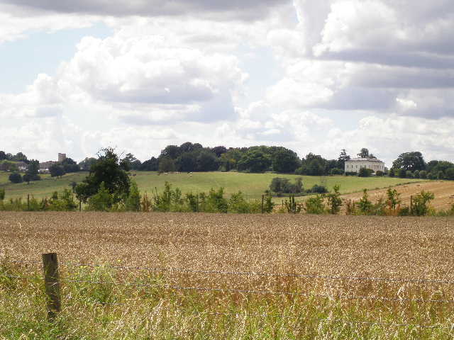
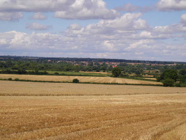
[7] View west to Whaddon church and Whaddon House
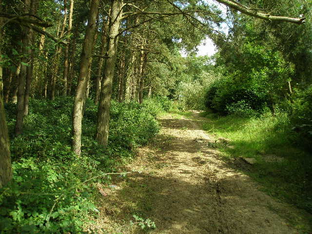
[8] The Bridleway through Oakhill Wood
[9] View from stile where I left the bridleway
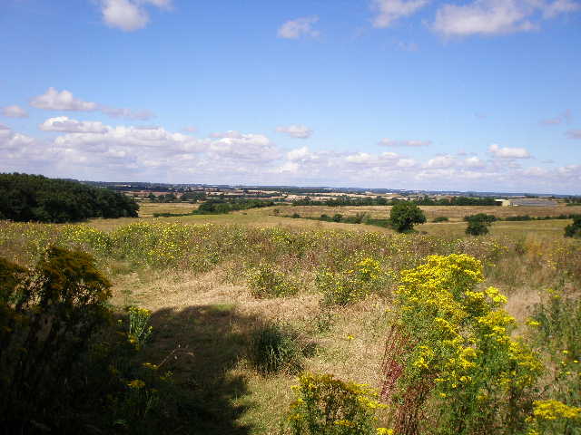
The track continued very pleasantly through the trees for about half a mile, before running between hedges again. After another two or three hundred yards, I left the route of the North Bucks Way by going over a stile in the tall hedge on my left. Having been enclosed between trees or hedges for sometime, I was pleasantly surprised to immediately see a very attractive view in front of me [9]. I was now in a large field that had been left fallow or was ‘set aside’, and was full of long grass, thistles, Ragwort and other wildflowers. There were two or three further such fields ahead and to my right, with corn field and green meadows stretching away over the lower land beyond. To my left was Oakhill wood, which extended to meet the path directly ahead of me at the bottom of a gentle slope.
I followed the clear path gently downhill ahead of me, to reach a corner of the wood [10]. Here the clear path went right, following a hedge (this was not marked as a footpath on the map). The Milton Keynes Boundary Walk continued ahead on a much less clear path through the tall grass and thistles, gradually moving away from the wood to my left [11]. The path crossed a footbridge over a small stream, and continued in the same westerly direction as before, now with the stream on the left. The path here was very sketchy indeed [12], as I stepped through the long grass, tall thistles and teasel. On the far side of the field, I came to a concrete farm drive, which went round a corner and continued in a westerly direction along the right-hand edge of a large corn field.
[10] Path near corner of Oakhill Wood
[11] Path heading to footbridge over stream
[12] Very faint path close to the stream
The concrete drive [13] terminated at a minor road, where I turned right. Again, there was a surprising number of vehicles and the verges were not really suitable for walking on [14], so this was a rather tedious section of the walk (but not too bad). Again the road was dead straight (I don’t think it was Roman, I believe a lot of these straight roads date back to the enclosures of common land that were part of the agrarian revolution of the eighteenth and nineteenth centuries). After a third of a mile or so, just after the road turned to the right, I crossed a dangerously overgrown plank bridge and a stile into a meadow. I crossed a section of the meadow that had been recently cut for hay, then ploughed on through the long grass to reach the hedge on the far side. I turned left along the hedge, soon reaching a gate and wobbly stile in the field corner. I went half right through the next large pasture, with cows over to my left, to reach the far corner. The Milton Keynes Boundary Walk now continued alongside a hedge on the right, first through an empty pasture and then through a couple of meadows [15].
[13] Looking back to Oakhill Wood from the concrete drive
[14] Third section of road walking
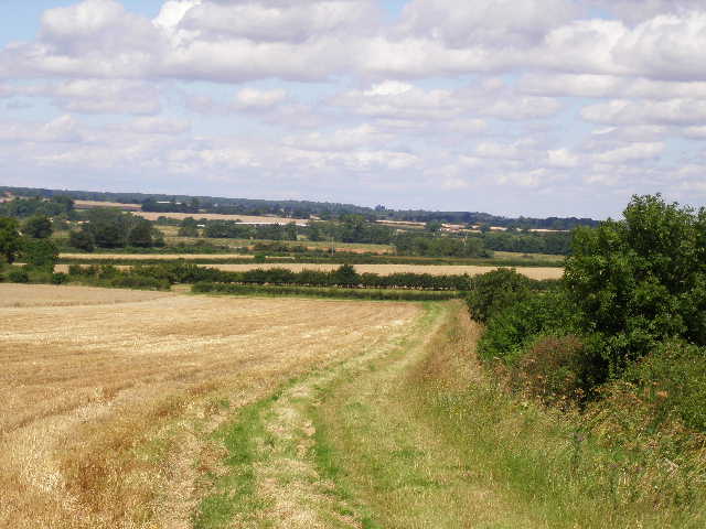
[15] Field path
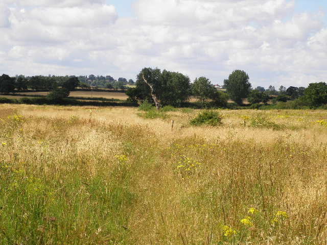
The path continued beside the hedge through a couple of corn fields, passing a copse on the right in the second one. There were pleasant views over more corn fields to the left, and looking back I could see Whaddon House again, with a ridge of hills extending westwards [16]. Through a gap in the next field corner, the path continued through another corn field, now with the hedge on the left [17]. I passed under some power lines, and in the corner of the next corn field I followed the hedge to the right a short distance to where a waymark indicated that the path turned left, to continue in the same north-westerly direction as before. I went over a stile beside a section of old stone wall, a rather unusual sight on this walk.
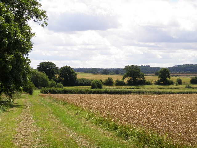
[16] Looking back towards Whaddon
[17] Path on way to Stony Stratford
[18] View towards Deanshanger and the Ouse valley, from stile at end of the sheep pasture
The Milton Keynes Boundary Walk now crossed a large sheep pasture, gradually approaching the right-hand boundary and then following it to a gate and stile in the corner. Here again I was pleasantly surprised by an unexpected view [18] – the ground now sloped down ahead of me into the valley of the Great Ouse, with the village of Deanshanger ahead of me and corn fields rising up the other side of the broad valley towards hilltop woods. The path now continued beside the right-hand hedge of a corn field [19], before going round a corner and going on through a small sheep pasture and then another corn field, now with the hedge on the left. In the next field corner, the path turned right to continue alongside the hedge on the far side of the same corn field.
At the far corner of this field, I went over a stile into an orchard and then passed by a tennis court by some outbuildings. Across another stile, I entered a large cattle pasture. I followed a wall on the right at first, then walked half-left across the pasture to reach a stile on the far side. I turned right along a road for a short distance, crossing a stream [20], bearing left at a junction. After a few yards, a signpost indicated a footpath on the left, which went almost parallel to the road and within two or three hundred yards reached the car park on Calverton Road. I had completed my clockwise circuit of Milton Keynes!
[19] Path heading towards the Ouse valley
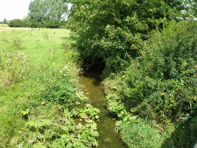
[20] Stream, from road near Stony Stratford
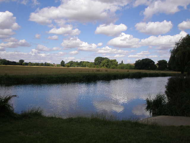
[21] View over Great Ouse from car park at end of walk (nice cloud reflections!)
It was now 12.40pm as I took a photo of the Great Ouse by the car park [21], and turned to head back to my car. I had my lunch by the stile into the sheep pasture, sitting and admiring the view over the Ouse valley. The temperatures remained very pleasant as I walked back to my car. The sun went behind a grey cloud briefly as I followed the bridleway past Oakhill Wood, but otherwise it remained bright and sunny. This was a slightly shorter walk than usual, and I got back to my car about 2.50pm.
This was a very pleasant walk, on a day almost perfect for walking. There were a couple of somewhat tedious sections of road walking, but neither were too long nor really too bad. The walks along the bridleways near the start of the walk were very good, and I enjoyed walking through the ‘set aside’ fields, even though the path was a little hard to follow in places. There were two or three places were there were good views, and overall it was a nicely varied walk. Overall, a very pleasant way to finish the Milton Keynes Boundary Walk.
Total Distance: 60 miles each way (approximately)