Pete's Walks - Thame Valley Walk
If you are considering walking this route yourself, please see my disclaimer. You may also like to see these notes about the maps and GPX files.
Day 1 3/06/10 Aylesbury to Notley Abbey (7.3 miles each way, approximately)
Parked on road in industrial estate in Aylesbury, yards from the start of the walk.
As I drove to Aylesbury, it struck me that it was a very long time since I had driven that way to do a walk. As far as I could remember, the last time I'd been out to or beyond Aylesbury was when I walked Swan's Way in September 2007 (see Day 5 of that walk). The drive took me about 40 minutes, and I managed to park right by the start of the walk, on the edge of an industrial estate on the north-western side of the town.
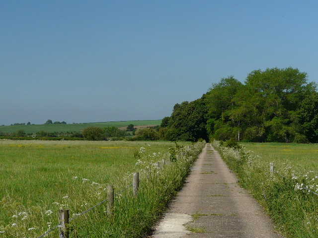
I started walking about 9.35am, heading down a tarmac drive [1] a short distance, crossing a small brook, and then turning right on a gravel path through a small area of allotments (curiously each plot seemed to have identical new-looking small sheds). The path then went a short distance through bushes, and then ran between a hedge and a wire fence[2], with houses on the edge of Aylesbury beyond the meadow on the left. The path then switched to the right of the hedge briefly, and crossed a small section of a golf course - I was a little confused here by a waymark pointing left, when in fact the path merely switched back to the left of the hedgerow.
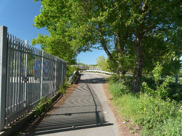
[1] Start of the walk, at Aylesbury
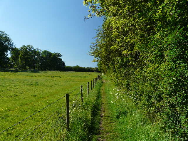
[2] Path beside meadow, on edge of Aylesbury
[3] The path towards the River Thame
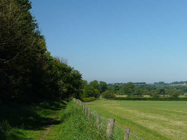
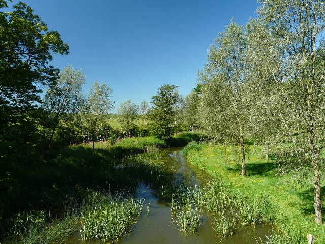
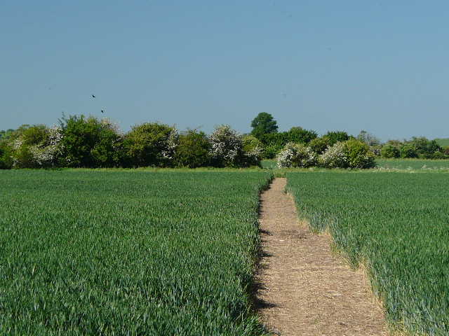
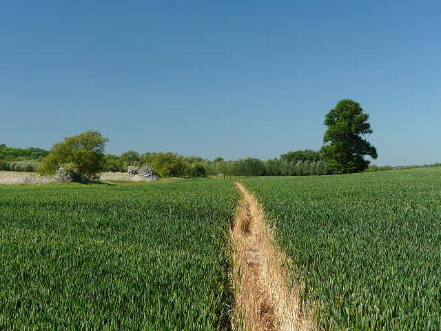
Beyond the golf course, the path descended very gently beside a hedgerow with a large mown hay meadow to my right [3]. There were quite extensive views here, out towards Quainton (where I could just about make out the windmill) and Quainton Hill [4]. I crossed a couple more similar meadows [5] to reach the River Thame for the first time on this walk [6], and the path turned left (westwards) with the river on my right.
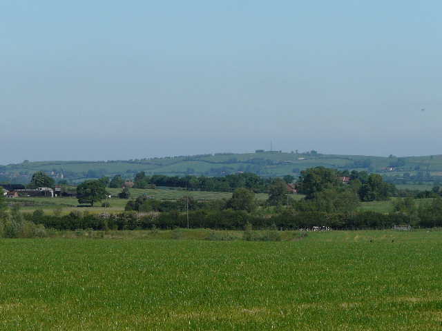
[4] Close-up shot of Quainton Hill
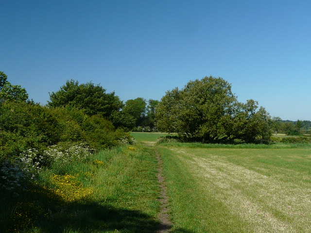
[5] The path towards the River Thame
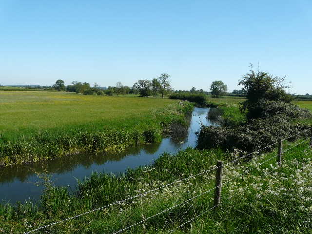
[6] Looking east along the Thame from where I first met it (I was going the other way)
But in a short distance, the path left the Thame, following the straight edge of a large corn field [7] which cut out a loop in the river. As I followed this section of path, I spotted a fox in the meadow to my right (in the curve of the river). Curiously this was my third fox sighting in about 10 days, having not previously seen one for over eleven months. After crossing a small meadow or pasture, I went over a small footbridge across a branch of the river [8] - it splits in two here, the two branches merging again after about a mile, so for the next few hundred yards I was effectively on an 'island'. The OS map shows that the remains of the mediaeval village of Eythrope lie just north of the river here, but I couldn't see anything. The Vale of Aylesbury has numerous DMV's (Deserted Mediaeval Villages), not the result of the Black Death but due to landowners enclosing land for sheep about 500 years ago, and thus requiring fewer tenants. A little further on the path joined a long straight drive (from a lodge on the Eythrope Park estate) running between two meadows [9] - I remembered it from when I walked the Bernwood Jubilee Way a few years ago. I spotted a Red Kite here, the first of several I'd see today.
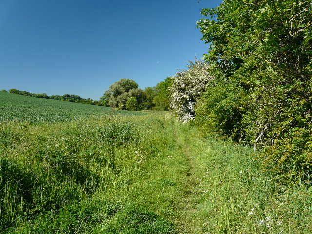
[7] Field path near Eythrope
[8] The path near Eythrope
[9] The drive near Eythrope
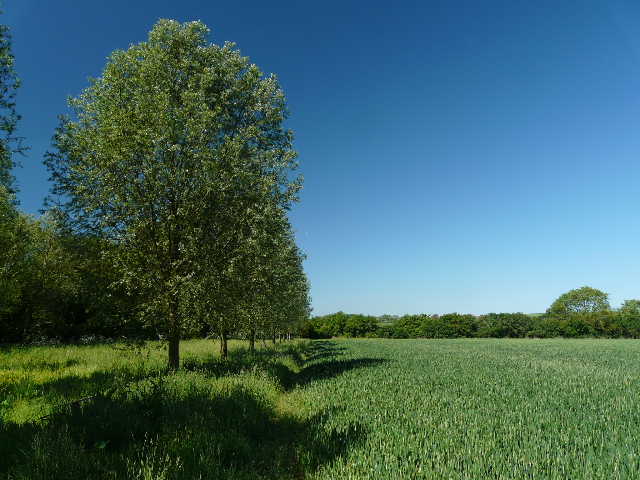
The drive then ran briefly through trees to reach a junction with another drive into the estate. I turned right, crossing a bridge over the wider branch of the river [10] (where I glimpsed a Grey Wagtail). The drive immediately turned left by another lodge, and then right. At this second turn, I went straight on along a farm track, parallel to the river. A wooden post at the junction had waymarks for all six long-distance paths that go through here - the others being the North Bucks Way (which I was now leaving), the Bernwood Jubilee Way (which I was now joining), the Aylesbury Ring, Swan's Way and the Midshires Way (which shares most of its route through Buckinghamshire with Swan's Way, but goes as far north as Stockport). I spotted my first Red Admiral of the year here.
[10] The River Thame from the bridge at Eythrope
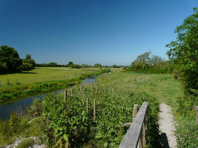
[11] Near the start of the path from Eythrope to Nether Winchendon
[12] Moated site, beside the path to Nether Winchendon
The path soon forked half-left from the farm drive, heading southwest parallel to the river. I crossed through two large fields of green corn [11], then went through a large sheep pasture where there was an obvious moated site (marked on the OS map) [12]. I followed the path across the corner of another large cornfield [13], and then along a line of young trees [14] to a stile in a field corner. I then had to cross a large pasture, full of cattle just to my right. One was obviously a bull, but fortunately he wasn't interested in chasing me - he had udder things on his mind!
[13] The path to Nether Winchendon
[14] The path to Nether Winchendon
[15] The path to Nether Winchendon, between the two cattle pastures
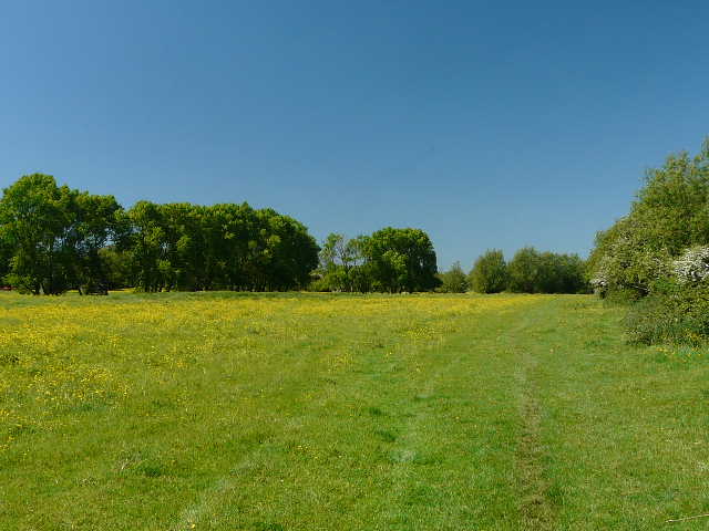
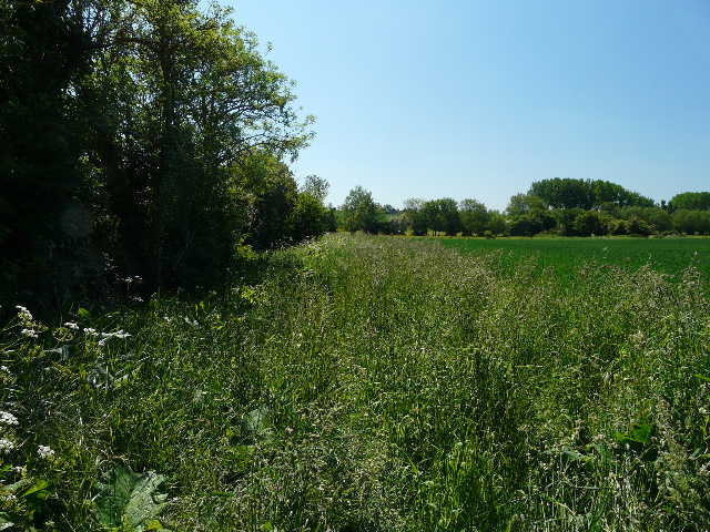
The path then went along a grass strip between a hedge and a fence [15], then a short distance along the edge of another empty pasture. Over another stile, I had to then brave a small herd of mainly young bullocks in the next pasture, but again they largely ignored me (though two initially started to follow me). There was then a short passage between a hedge and fence (I remembered this had been incredibly muddy when I walked the Bernwood Jubilee Way, but that had been at the end of winter). I spotted some Red Campion here (that and Wood Avens had been the only wildflowers I'd noticed so far), and another attractive plant that I later had identified on a wildlife website. The path then ran through a very long pasture, yellow with buttercups, that bordered the river over to my left [16].
[16] Meadow just before Nether Winchendon
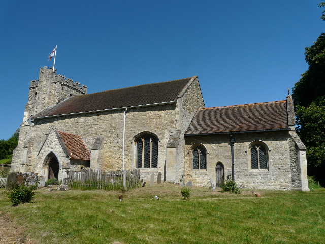
[17] Nether Winchendon church
[18] Overgrown path as I leave Nether Winchendon
The path then went through a farmyard, and the start of a lane leading into Nether Winchendon. I stopped on a bench by the church [17] to drink some water and to do some running repairs on my left foot, then continued through the village. The only time I'd been here before I thought it was one of the most attractive villages I'd visited on my walks, and it lived up to my recollections. There were numerous old and attractive cottages, as well as the grand house and ancient church. I spotted three Red Kites here, to add to its attractions.
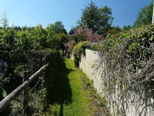
The path out of Nether Winchendon was somewhat overgrown [18], but I soon found I could just walk along the very edge of the field. On reaching a lane, I turned left (how I managed to miss the large fingerpost here and blindly go straight on the previous time I was here, goodness only knows!) and soon reached a junction with a minor road. A few yards to the right, a path left the far side of the road, going diagonally across another buttercup-rich pasture. This huge field was currently empty, but I could see cattle in an adjoining connected pasture. The path then followed a hedge or fence beside a corn field and then through two small pastures, before running past some residences [19] to reach the end of a lane in Chearsley. A wall here was made of wichert, a regional building material derived from the local white clay and chopped straw.
[19] The path entering Chearsley - the wall on the right is made of 'wichert'
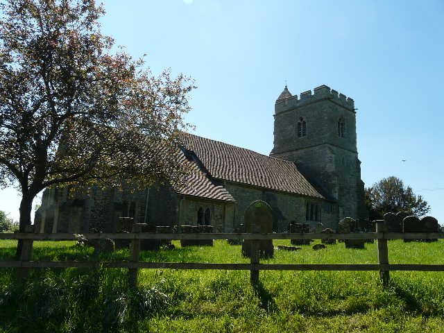
[20] Chearsley church
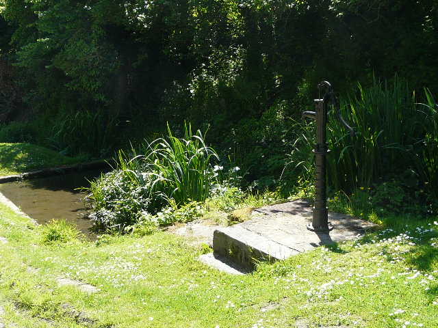
[21] Pump and Spring, Chearsley
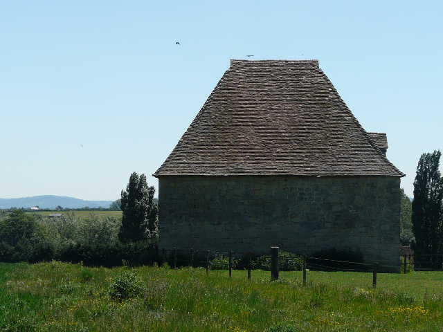
I followed the lane past the village church [20] and by a spring and old pump [21]. I turned left onto a path that crossed an attractive meadow beside the church [22], where I saw numerous Common Blue butterflies and a Small Copper. The path continued beside a corn field and then crossed a railway line in a small cutting. Beyond another arable field the path went through a small wood, crossing a tiny stream on a plank bridge. In the next irregularly shaped pasture I came across a redundant stile [23], which as usual I felt compelled to go over anyway. Curiously I totally missed the obvious notice board about Notley Abbey a bit further on until I came back, the same as had happened when I came here on the Bernwood Jubilee Way. At least I noticed the huge dovecote nearby [24].
Having gone through a farmyard I turned left towards Notley Abbey (in use from 1161 to the dissolution of the monasteries, now a private house). The path was soon running between fences with the large house to my left (it wasn't possible to get a good shot for a photo, and anyway I don't like taking shots of private houses). This was rather overgrown, with a few nettles, but I was soon over a stile and following the edge of a small paddock. I crossed the stile at the far end, but then turned round and started to make my way back. I hadn't known quite where I'd end this walk, but decided I'd turn round at 12.15pm, as I reckoned 2 hours 40 minutes is roughly the time it usually takes me to walk 7.5 miles (half the length of the Thame Valley Walk, leaving the rest of the route for another day).
[22] The path through the meadow behind Chearsley church
[23] The redundant stile on the way to Notley Abbey
[24] The dovecote near Notley Abbey
The walk back was very straightforward in the warm sunshine - as so often happens a breeze sprang up to keep the temperatures bearable. It actually felt quite strange turning round and retracing my footsteps, as this was the first time I'd done this since walking the Stevenage Outer Orbital Path (STOOP) last September. I stopped for lunch on a bench in the shade of a tree in Nether Winchendon, and got back to my car about 3pm.
This was an enjoyable walk, on a very beautiful summer's day without a cloud in the sky. The first mile and the last quarter mile were new to me, the rest of the route I'd walked once before, mainly on the Bernwood Jubilee Way. I enjoyed revisiting the route, it brought back some nice memories - it was also much nicer weather-wise this time. Of course, following a river meant that it was a very flat route with no hills at all. It was also mainly agricultural, with very little woodland walking. But despite that, I enjoyed the walk - it would be hard not to enjoy any walk on such a glorious day.