Pete's Walks - Thame Valley Walk
If you are considering walking this route yourself, please see my disclaimer. You may also like to see these notes about the maps and GPX files.
Day 2 12/06/10 Notley Abbey to Albury (7.3 miles each way, approximately)
Parked on road in Long Crendon.
I managed to park in the centre of Long Crendon, on the route of the walk. I started walking about 9.45am, first having to follow the Thame Valley Walk back to the point near Notley Abbey where I had finished my previous walk, and then turn around. It was thus about 10.10am when I resumed walking the Thame Valley Walk in the westerly direction.
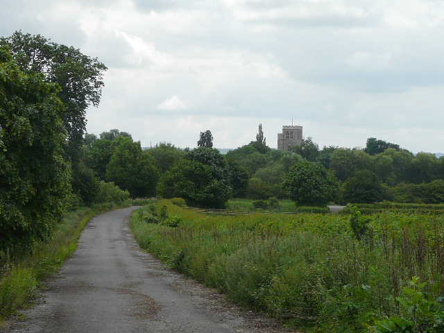
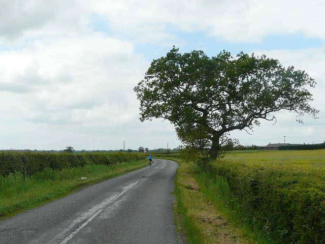
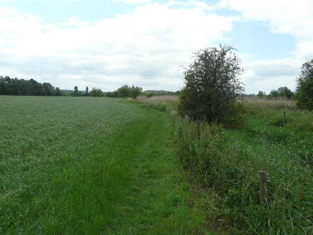
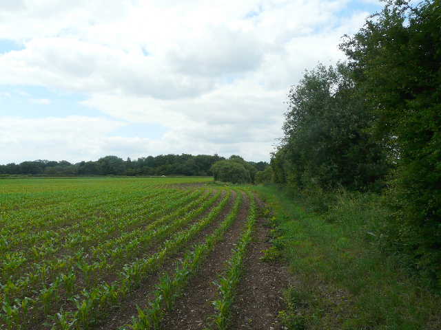
The route from Notley Abbey continued along a grassy path to the left of a very big cornfield [1], with the river Thame a short distance beyond the trees on my left. After a few hundred yards, rather curiously the path went over a stile into a riverside pasture only to cross another stile back to the cornfield a few yards further on. It now crossed the corn field diagonally to a corner [2], where it crossed the route of the Bernwood Jubilee Way (which took a straighter route from the farm by Notley Abbey, and which would miss out the large loop this route takes to visit Long Crendon).
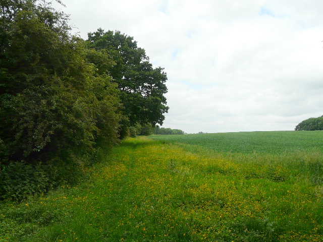
[1] Start of the walk, near Notley Abbey
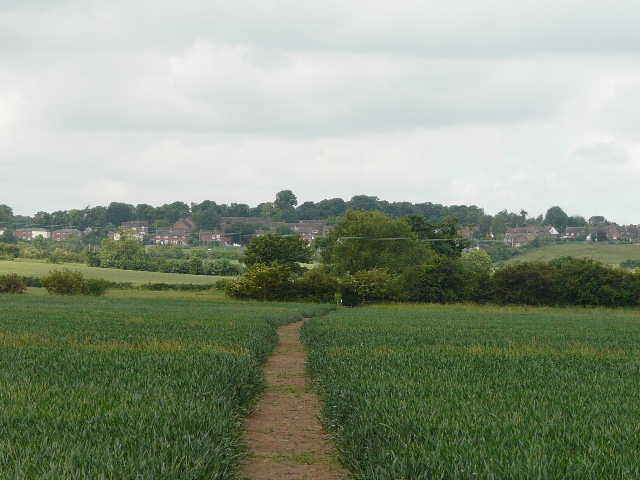
[2] Path through corn field, heading towards Long Crendon
[3] The path to Long Crendon
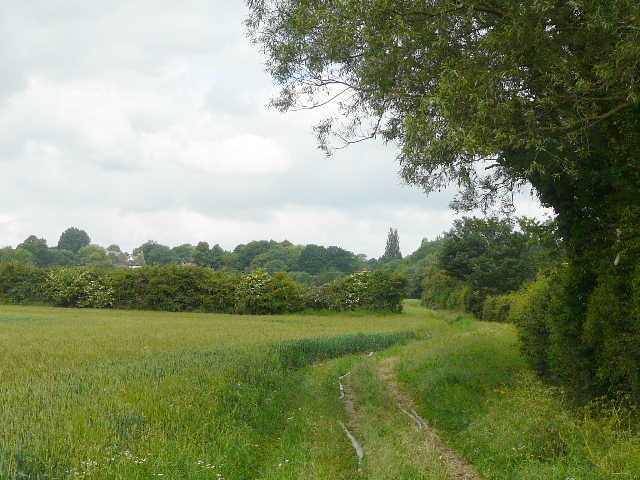
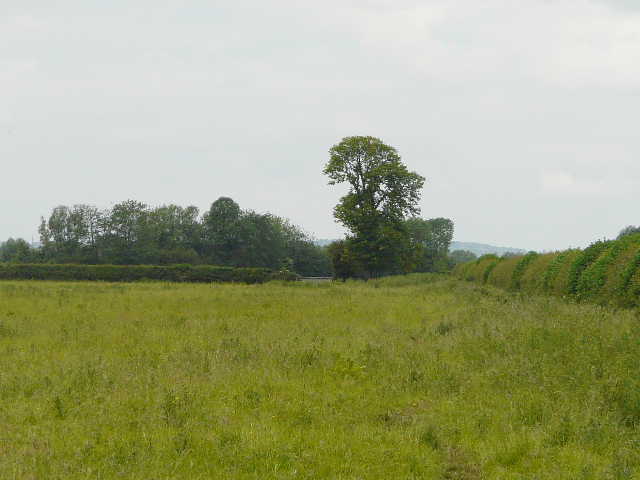
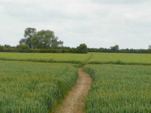
I continued onwards, following a right-hand hedgerow through more corn fields [3], until I reached an overgrown meadow, sloping upwards. [4] I saw a Common Spotted Orchid and my first Lesser Stitchwort of the year here. At the top of the meadow, the path continued between fences to reach the village of Long Crendon by the church [5].
[4] Overgrown meadow on edge of Long Crendon
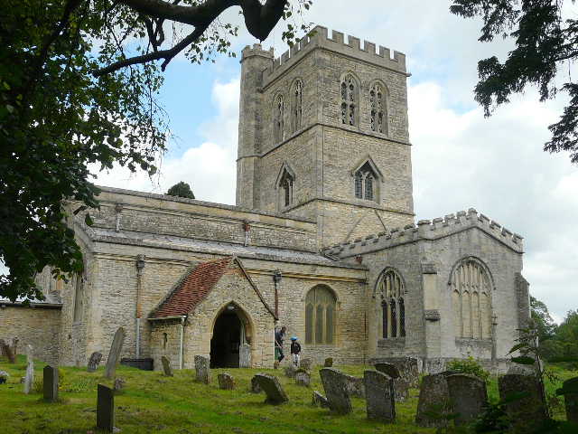
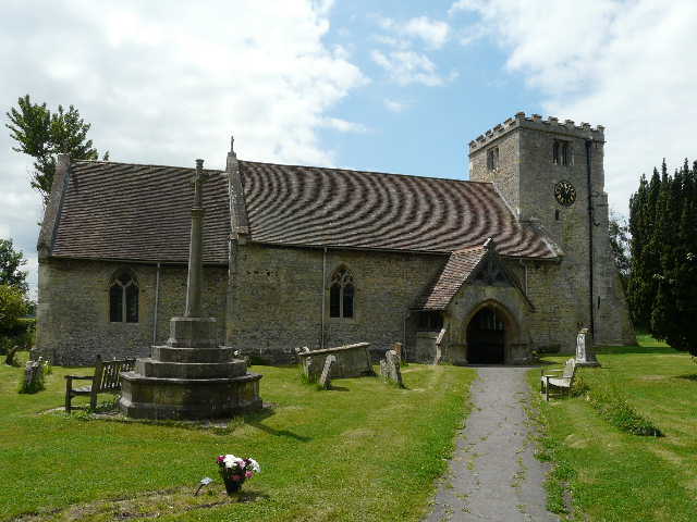
[5] Long Crendon church
[6] Long Crendon
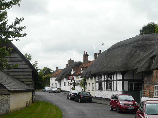
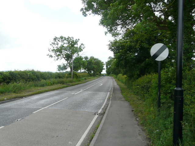
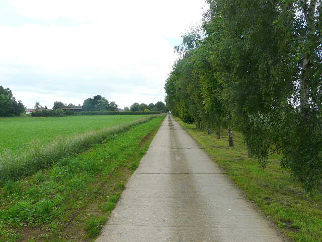
Long Crendon is a very attractive old village with a long history, and as I followed its High Street westwards I passed many thatched cottages, several of them timber-framed [6]. I also passed the village library and the adjacent Village Centre [7]. At the end of the High Street, I turned left, following the main road south from the village towards Thame. The road went downhill at first, levelling out as it left the village and reached a roundabout. Going straight on [8], I was glad there was a pavement as the road was fairly busy. This was a rather dull section of the walk, and I just concentrated on getting it over and done with. After about half a mile I reached the point where the Bernwood Jubilee Way came in from the left - I would be following its route for the next few miles to Shabbington. A little further on the road curved left, but I went straight on, following a section of what had clearly once been a road. Beyond a farm on the right, I had to go through a gate where the old road was blocked off. As I continued down the old road [9] I saw lots of Red Campion and White Campion, and even more of the 'Pink' hybrid of the two, as well as Green Alkanet and Hedgerow Cranesbill.
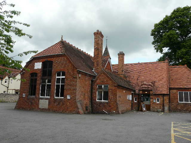
[7] Long Crendon Village Centre
[8] The road from Long Crendon to Thame
[9] The old road, Thame church ahead
Just before the end of the old road (next to the Thame bypass, with the tower of Thame church clearly visible a short distance ahead), I took a footpath on the right. This followed the right-hand hedge of a long and fairly narrow empty pasture [10], next to the bypass over to my left. As I approached the far corner, I heard and then spotted two Buzzards ahead and to the right. The next field was another pasture, where I followed a fence on my left - although this pasture was empty, there were two open gateways into the pasture to my right where there was a very obvious bull amongst the numerous brown cattle a little distance away. I then went over a double stile (there were a number of these on this section of the route) into another large pasture. There were more cattle a long way off at the far end of the pasture to my right, as I followed a fence on my left and then turned right a short distance to reach the next stile (another double, I think).
[10] The first pasture on the long path to Shabbington
[11] Path through corn and then oil-seed rape, between Thame and Shabbington
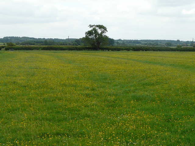
[12] Large meadow on the way to Shabbington
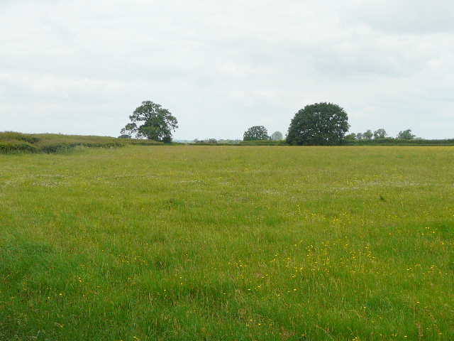
The path was now a clear brown strip through a succession of corn fields. At one point, I crossed a small strip of land that had been ploughed and planted with vegetables of some sort - I spotted my first Borage of the year here. The last corn field led straight into a field of oil-seed rape [11]. Across the next double-stile I stopped to do some repairs to my feet (ongoing minor annoyances), and then continued across a huge meadow that was yellow with buttercups [12] - I spotted a moth in the hedge here that was probably a Yellow Shell, and also saw some Common Blue and Small Copper butterflies. The next field was another cattle pasture - it had clearly once been two fields, as there was a long section of old hedge running down the middle of it. The cattle were some distance across to the right, all but one lying down.
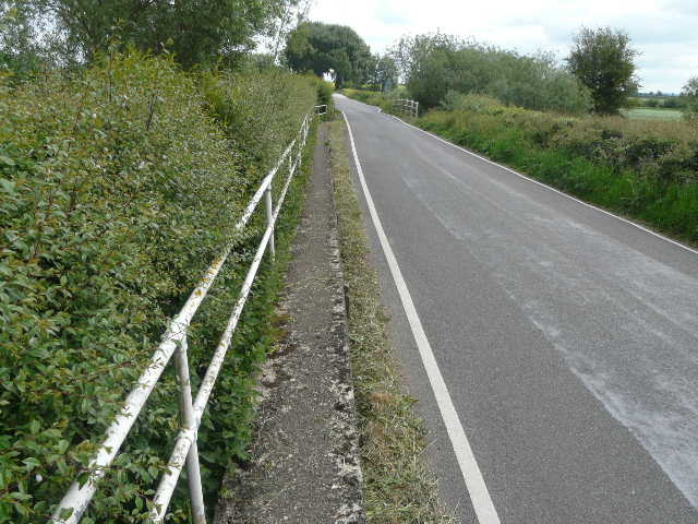
[13] Short road section on the way to Shabbington
[14] Ridge and Furrow, near Shabbington
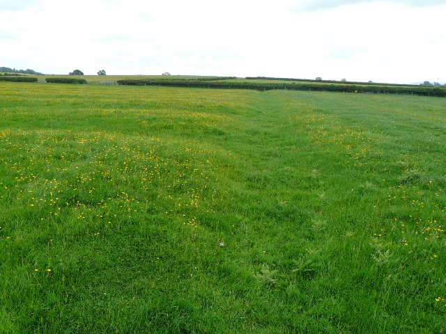
[15] Ridge and Furrow, near Shabbington
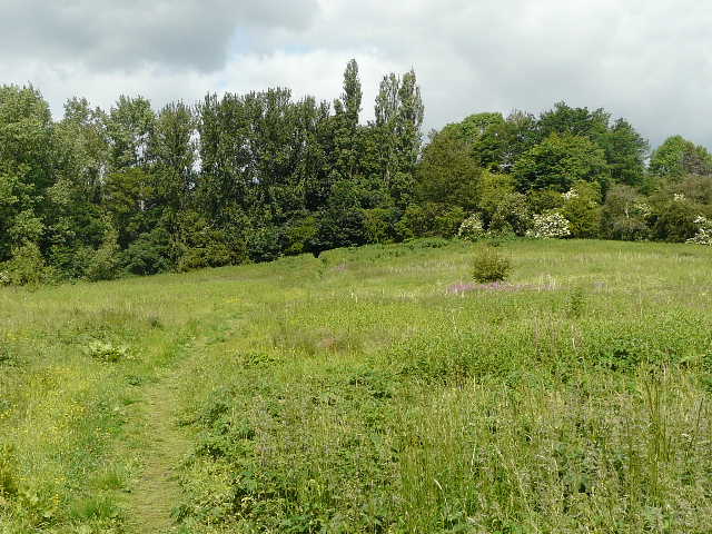
The Thame Valley Walk next turned left down a minor road for a short distance [13] - I remembered following a low-flying Red Kite along it when I walked the Bernwood Jubilee Way a few years ago. Immediately after the road turned right, I took a path on the left that went diagonally across a very large pasture or meadow, again yellow with buttercups. I remembered this field too from the Bernwood Jubilee Way, as it was the best of the many examples of 'Ridge and Furrow' I came across on that walk [14,15]. Ridge and furrow is "an archaeological pattern of ridges and troughs created by a system of ploughing used in Europe during the Middle Ages. The earliest examples date to the immediate post-Roman period and the system was used until the 17th century in some areas." - see more about it on Wikipedia. The path continued through a very large and irregularly shaped sheep pasture (also containing a single horse), and then another sheep pasture that curved slightly to to the left as I followed its left-hand boundary. The slope on my right here had also shown up Ridge and Furrow when I'd been here before, but it wasn't really visible today under the longer grass (it had been the end of winter when I did the Bernwood Jubilee Way.
[16] Approaching Shabbington
[17] Shabbington church
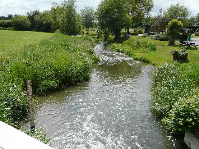
[18] Branch of the river Thame, at Shabbington
I went through a rather rough paddock with a couple of horses in it, then through a sequence of paddocks containing nothing but long grass and buttercups, all divided by electric fences [16] (I had to unhook sections using insulated handles to get through them). I had now reached the village of Shabbington, emerging opposite the church [17]. I turned left along the road (leaving the Bernwood Jubilee Way), soon leaving the village as I passed a riverside pub [18]. The Thame appears to split into at least three channels hereabouts, as the road crossed three bits of water in quick succession - a sign warned the road was liable to flooding, and a section of the pavement was raised a foot above the road surface [19].
[19] The road out of Shabbington
[20] Path beside the river Thame
[21]The river Thame
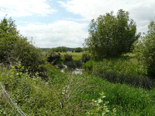
I soon turned right alongside the main branch of the river, with a meadow to my left [20]. There was a section of reeds along the river here, and I spotted a Reed Bunting and a few noisy Reed Warblers here. This was probably the most enjoyable section of the walk, as I continued alongside the river [21,22], through a number of fields that had a crop I didn't recognise [23] (possibly a very late maize crop?). I found some Great Yellow-cress alongside the river, which was a new flower for me (as usual I had to get it identified on a wildlife website!). I spotted a few Banded Demoiselle damselflies, and then, just after turning away from the river to reach a main road, I spotted a very faded Painted Lady butterfly, the first I'd seen this year (on the way back, I'd spot my first Silver-Y moth of the year in this field too).
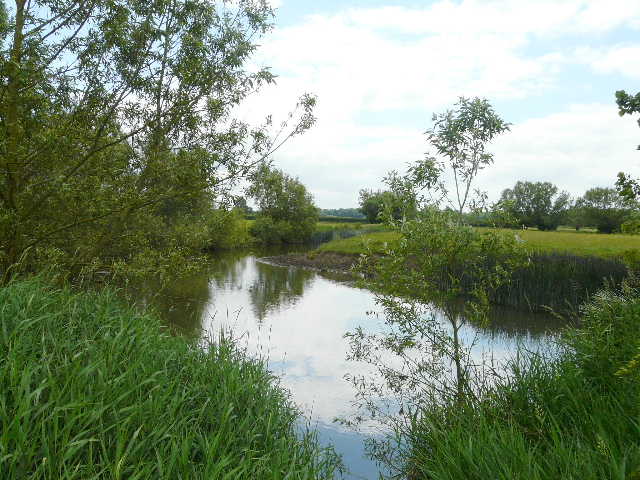
[22] The river Thame
[23] Path beside the river Thame, heading towards the main road
[24] The farm drive that is the last section of the Thame Valley Walk
Across the road, I passed through a small field of the same unknown crop, and bumped into a party of fourteen walkers coming the other way. One lady was very friendly and we chatted for a while - I think they were doing a walk from Water Perry, based on a bit of the Oxfordshire Way. The path next turned right along a broad farm track (where I saw some Creeping Cinquefoil). Beyond a wood on the left, I turned left along a concrete drive [24] that took me to Home Farm, Albury, where the Thame Valley Walk terminated at a junction with the Oxfordshire Way.
It was about 12.55pm as I turned round and headed back towards Long Crendon. After another quarter of an hour or so, I stopped for lunch beside the river Thame. The walk back was pleasant but uneventful, and I got back to my car about 3pm.
This was a fairly straightforward walk, on a pleasantly warm though rather cloudy day. There was a slight up-and-down in and out of Long Crendon, but the rest of the walk was very flat. It was all agricultural, a mixture of pastures and arable fields plus one or two large meadows, with no woodland walking at all. Much of the route was familiar to me from the Bernwood Jubilee Way, though I'd only walked it that once and that was over three years ago. The section along the river Thame after Shabbington was the most interesting bit, the riverside habitat being something I don't see often on my walks.