Pete's Walks - Ashridge Estate Boundary Trail
About the Ashridge Estate Boundary Trail
The Ashridge Estate Boundary Trail is a 16-mile circular walk that goes round the National Trust’s Ashridge Estate, on the northern edge of the Chiltern Hills in Buckinghamshire and Hertfordshire. It was created in 1995 as part of the National Trust’s Centenary celebrations. It uses public rights of way and a few permissive paths to closely follow the edges of the estate. Much of the walk is through beautiful beech woods so typical of the Chilterns, with a few sections through fields for variety, and the highlight of the walk is probably Ivinghoe Beacon, with its extensive views over the Vale of Aylesbury and towards Dunstable Downs.
Gallows Hill with Dunstable Downs beyond, from near Ivinghoe Beacon
The Ashridge Estate Boundary Trail can be walked in either a clockwise or anti-clockwise direction (it is waymarked in both directions), and can be started and finished on any point of its circular route. However, most people would probably start and finish at the Visitor Centre by the Bridgewater Monument because of its large parking space and facilities.
The Ashridge Estate publishes a small leaflet describing the Ashridge Estate Boundary Trail, with a map of the route, although when I went to get one at the Visitor Centre they only had a photocopy. The area covered by the Ashridge Estate Boundary Trail is all on OS Explorer map 181, although the route itself is not marked as such on the map. The leaflet is therefore essential.
[IMPORTANT UPDATE 29/11/25: In Autumn 2025 I discovered that the National Trust (who own the Ashridge Estate) have replaced the Ashridge Estate Boundary Trail with the
'Ashridge Estate Boundary Trail - North'
and the 'Ashridge Estate Boundary Trail - South'
(click those links to see details of the new trails on the National Trust's website). The two new trails are circular (like the original trail) and share a common section of paths
(about 0.9 miles long), so that they form a 'figure-of-eight'. The
northern trail is 9 miles long (8.8 miles on my Google map)
and the southern one 10.5 miles. So walking the 'figure-of-eight' would be about 19.5 miles, while just walking a circular route (omitting the common section twice) would be about 17.7 miles - I think
the latter option probably makes more sense for what is meant to be a 'boundary trail'. The new trails each seem to vary slightly from the route of the original Ashridge Estate Boundary Trail. The northern trail
has extended the old route by visiting Aldbury Nowers and Pitstone Hill, while the southern trail takes a slightly shorter route through Northchurch Common. Only the two new trails are now waymarked
(with Ashridge Estate Boundary Trail waymarks), so anyone wishing to walk the original trail needs to be aware that they can no longer just follow the waymarks.]
About my walk
It took me two attempts to walk the Ashridge Estate Boundary Trail. On 4th August 2006 I set out to do the walk from the Visitors Centre, but after only an hour or so my legs felt very weak and wobbly. I managed to carry on for another hour, but then cut the walk short when I reached a point quite close to where I’d started. I suspect I had a virus, as I’d felt ever so slightly ‘off-colour’ the previous couple of days and my eyes had felt tired. These symptoms persisted for some days, so I saw a doctor and had some tests taken. These all came back negative and the symptoms went away after another week or so.
After checking my fitness by doing a couple of 2-3 hour long walks over the next week, I attempted the Ashridge Estate Boundary Trail again on Tuesday 29th August 2006. I decided to start this time from near where I’d got to on the previous walk, so that if I did feel unwell again I could hopefully at least complete the section of the walk I’d not done the first time. As it turned out, I felt fine and had no problem walking the whole 16 miles of the route.
Path along Gallows Hill, looking towards Whipsnade zoo
For once, I didn’t do the walk ‘both ways’, 16 miles being quite long enough for a day’s walk for me! I did the walk in the clockwise direction, for no particular reason other than that this somehow feels more natural than going in an anti-clockwise direction.
It may seem odd to write a journal for a walk that only took one day. However, the Ashridge Estate Boundary Trail is an ‘official’ path of sorts, having been created by the National Trust, and this journal may be of use to anyone else in the area thinking of doing this walk. In any case, I enjoy writing these journals!
Click here to see a very rough map of the Ashridge Estate Boundary Trail (but only if you have already read my disclaimer and notes regarding maps).
Note: I have numbered each photograph (in red) and inserted the same number in the text to show where in the walk the photo was taken.
Note: I didn't take very many photos when I originally did this walk. I have done it a few times since and, in order to do the walk and the scenery justice, I have now added some more photos from when I walked it on November 12th, 2008. This explains the late autumn foliage in some of the photos accompanying a walk I did in August, as well as a few other discrepancies! As usual, I have indicated where the photos were taken at a different date.
Day 1 29/08/06
Parked in car park on road just west of Ringshall.
Note: I didn't take very many photos when I originally did this walk. I have done it a few times since and, in order to do the walk and the scenery justice, I have now added some more photos from when I walked it on November 12th, 2008. This explains the late autumn foliage in some of the photos accompanying a walk I did in August, as well as a few other discrepancies! As usual, I have indicated where the photos were taken at a different date.
There is now another description of this walk with far more photos from when I walked the route in April 2016.
I parked in a roadside car park just outside Ringshall, exactly on the route of the Ashridge Estate Boundary Trail. I had tried to walk this path about three weeks earlier, starting at the more obvious starting point of the Visitor Centre by the monument, but I had to give up because I wasn’t feeling well. I chose to start at this car park instead because it was only a couple of hundred yards from the furthest point I had reached on that earlier walk, so that if I felt unwell again today I could at least complete the section of the walk that I had not done before.
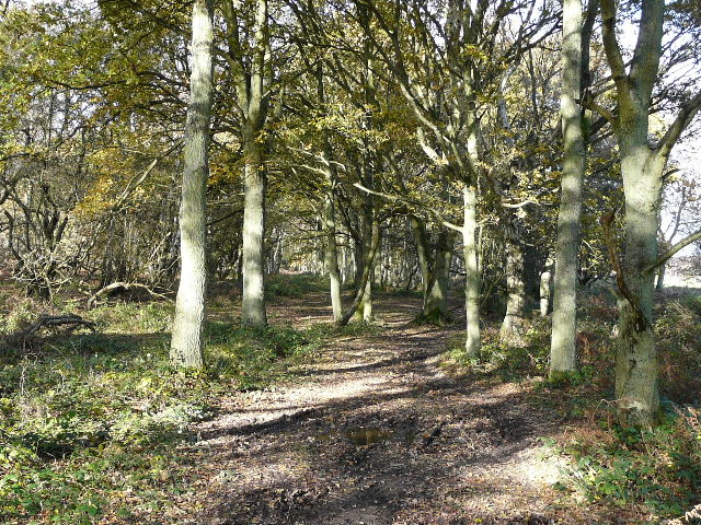
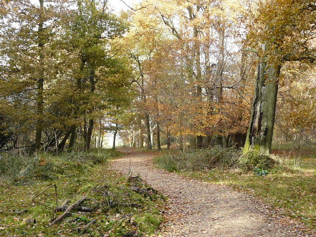
It was bright and sunny when I started out at about 9.35am, although there were several small puffy grey clouds in the sky. Across the road from the car park, the Ashridge Estate Boundary Trail ran for several hundred yards through a thin belt of trees [1], with large gardens off to the left and part of Ashridge golf course to the right. Unusually for Ashridge, there were more oak than beech trees here. Having just read a Woodland Trust leaflet on identifying trees, I tried to work out whether they were penduncular or sessile oaks – I think they were penduncular but wasn’t too sure. Later on on the walk, I was able to identify several trees as penduncular oaks - an easy way of telling is that the acorns hang on a long penduncle (hence the name!) rather than being attached almost directly to the twig. I spotted some Foxgloves on this section of the walk, something which I rather surprisingly haven’t noticed too often on my walks.
[1]Path through trees beside the golf course
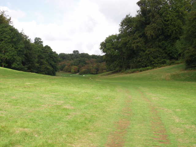
Just beyond the golf course, the Ashridge Estate Boundary Trail crossed the drive to Ashridge House, once the home to the Dukes of Bridgewater but now a Management College (there is a photo of it in the journal for Day 9 of my Hertfordshire Way walk). The next section of the walk went through Golden Valley [2] – I had seen this on the map before but had not been there, so I was intrigued to know what it was like. In fact it was a fairly small valley with short grass, obviously well-maintained, with trees along the tops of the slopes on either side. The path ran along the grass at the bottom of the valley as it grew gradually wider and deeper. I noticed a brick-built wall and bridge on my left at one point [3]. Further on I recognised where I crossed the route of the Hertfordshire Way (I hadn’t realised when I did that walk that this was part of Golden Valley). Here I was close to Ashridge House, although it was hidden from view by the trees on my right.
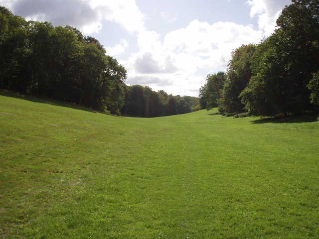
[2]Golden Valley
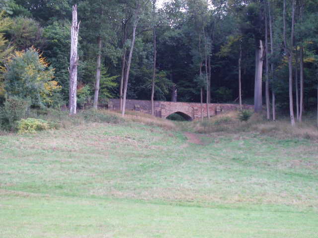
[3]Bridge beside the Golden Valley
[4]Looking back along the Golden Valley
A couple of hundred yards further on [4], the short grass ended at a fence where I entered a very large field. The wood on my left continued for some way, but the trees on my right receded to the top of the hill. There had obviously been cows in this huge pasture fairly recently, but now there were only a few rooks. I continued along the path at the bottom of the valley. The trees on my left ended after a few hundred yards, where a fence enclosed another area of rough grass. I went on along the fence at the valley bottom to reach the corner of the field I’d been crossing for about half a mile. Here the Ashridge Estate Boundary Trail turned right, following a fence uphill. I hadn’t really realised that the valley had now become quite deep, and it was quite a climb up the hillside. The path then turned left again, to continue in the same roughly south-eastwards direction I’d been walking so far.
[5]Path heading towards Frithsden (Photo taken 12/11/08)
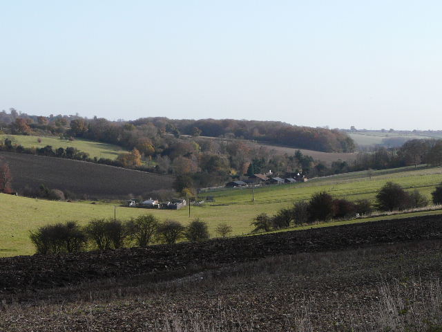
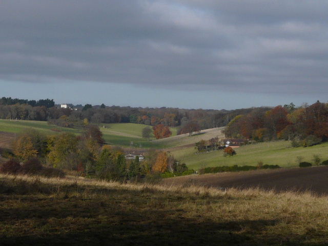
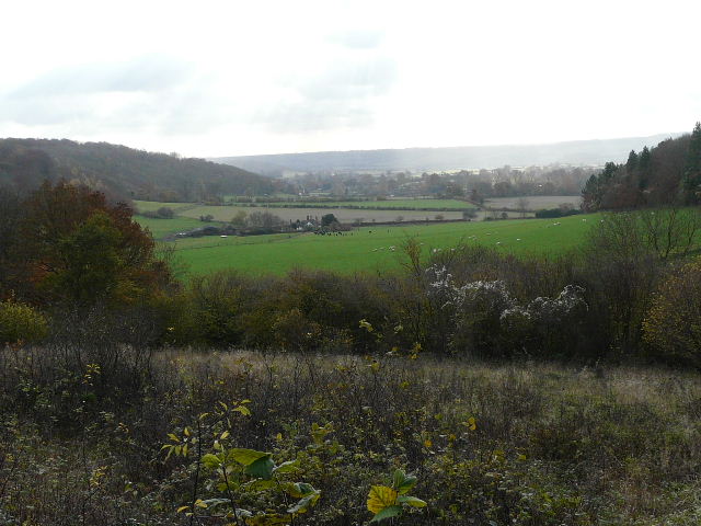
[6]View from the path, looking towards Nettleden (Photo taken 12/11/08)
[7]Looking back along the Golden Valley (Photo taken 12/11/08)
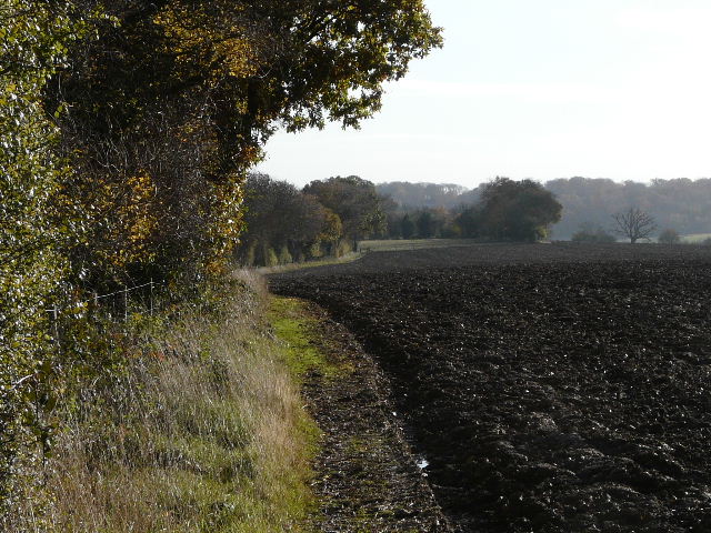
After passing through a small wood on a good path, the Ashridge Estate Boundary Trail followed a left-hand hedge beside a long field [5,6,7] that seemed to have been left fallow this year (or ‘set aside’). Across a stile in the next field corner, I had to turn to my right for a few yards to the corner of the next field (an open grass field), before turning left and following the right-hand hedge. The field was sloping down into a valley on my left, and ahead I could see the village of Nettlebed in the valley floor. Across the valley, I could see a path heading towards the village – I recognised it as part of a circular walk I do from home. At the next field boundary, I crossed a stile in a fence, and then almost immediately crossed a second stile on my right. This took me into a fenced path, with farm buildings on my right. Having been walking roughly south-east so far, I was now heading south-west for a short distance. The path continued downhill [8], partly between old fences, partly beside a left-hand hedge, to emerge onto a road on the edge of the village of Frithsden.
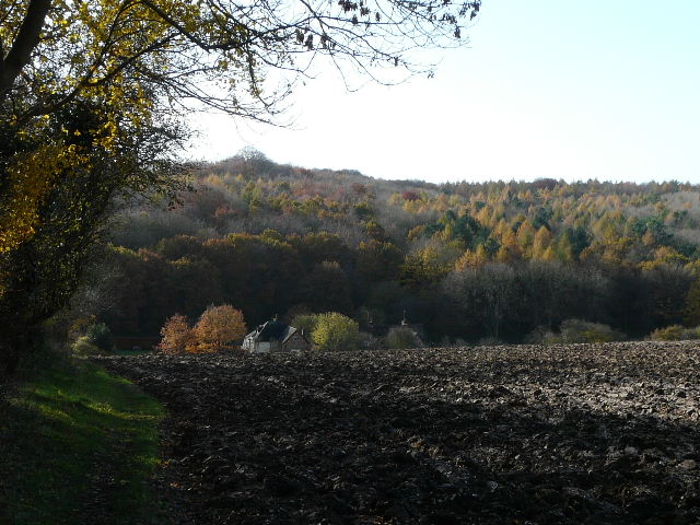
[8]Path descending to Frithsden (Photo taken 12/11/08)
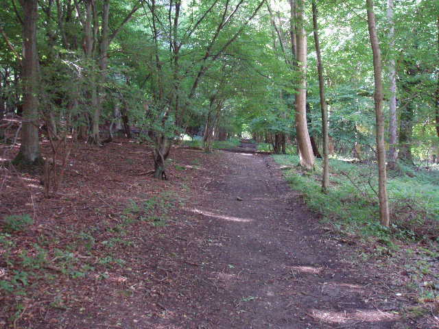
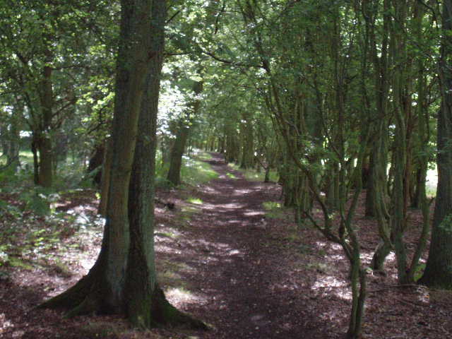
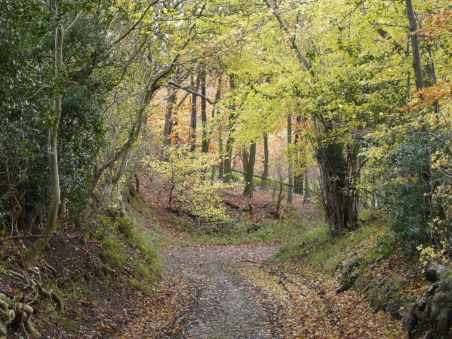
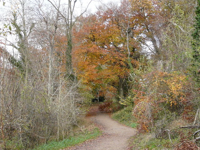
[9]Path through the woods near Frithsden
[10]Path through Berkhamsted Golf Course (Photo taken 12/11/08)
I followed the road to the right for a few yards, before turning left on a well-made track that took me back into the woods again. The track climbed gently through the trees [9] before levelling out, and reaching an alley between some tall, and evidently fairly new, wooden garden fences. This took me to another minor road in Frithsden. Across this, the Ashridge Estate Boundary Trail continued along another alley between gardens to reach a fairway on the Berkhamsted golf course. Here I turned right on a path between trees beside the fairway, now heading back in a north-westerly direction [10]. I recognised this path, as it was also part of the Hertfordshire Way. I crossed another minor road, and then crossed another fairway. The path then led through a belt of trees with fairways and greens on either side [11]. Beyond the golf course, the path continued between trees – it was actually a broad grassy track, with two muddy paths, one on either side. I saw a kestrel flying low overhead as I walked along here.
Still on the route of the Hertfordshire Way, I passed the very isolated Brickkiln Cottage. Beyond it, the path was reduced to a narrower muddy track through a fairly thin belt of beech wood, with a very large open grassy field to my right. I have walked past this field many times over the years – it is entirely enclosed by the woods of Berkhamsted Common, and contains a small copse in its middle. Near the end of this field I passed a couple of walkers with their dog. After another hundred yards or so of walking through woods again, I came to Coldharbour Farm. Here I turned left, leaving the Hertfordshire Way and heading south-west again. The path went diagonally across a small grass field, and then followed a left-hand hedge through two much larger fields, for a distance of about half a mile. The Ashridge Estate Boundary Trail then followed a well-made farm track curving left and right [12], before taking a footpath round the edge of a ploughed field. It then crossed what seemed to be a sports field of some sort, possibly a cricket pitch – a polite notice on a white post indicated that, although most walkers were responsible and well-behaved, the landowners had had problems with a couple of individuals (not me, honest, I’d never been there before!).
[11]Path through Berkhamsted Golf Course (Photo taken 12/11/08)
[12]Track between Coldharbour Farm and Northchurch Farm (Photo taken 12/11/08)
[13] Path from Northchurch Farm to the Berkhamsted-Ringshall road (Photo taken 12/11/08)
The Ashridge Estate Boundary Trail then went past Northchurch Farm before turning right, northwest again, through a short section of wood [13]. I then crossed a road (the one I had parked on, running from Ringshall to Berkhamsted) and after a few yards turned left down a drive leading to an isolated property at the foot of the hill. I managed to photograph some Fallow deer, including some fawns, as I walked down the drive. Shortly before the gates of the property, I turned right on a path heading uphill. The path was just inside the edge of a wood, with fields on my left going down towards a railway line running through the valley. I couldn’t see it, but the Grand Union Canal shares the same valley – at several points hereabouts I came across waymarks for the Grand Union Canal Circular Walk, which I will have to investigate and possibly walk sometime. The path I was now on was one I have walked several times previously. I have devised my own walk of 14-15 miles around Ashridge (well, strictly speaking it also includes Pitstone Hill which is beyond the boundaries of the Ashridge Estate) and this path forms part of that route. Generally though, it really surprised me that so little of the Ashridge Estate Boundary Trail coincided with my route.
Having climbed fairly gently for a while, the path descended more steeply – I remember walking in the other direction this Spring, when the muddy path was so slippery I had to turn almost sideways to step up the path. At the bottom, the Ashridge Estate Boundary Trail turned right through the tress and bushes for a short distance (I remembered a fleeting glimpse of a fox here many years ago), before turning left up a steep grassy slope, with trees on the left and a more open area to the right. At the top of the hill, I turned right and soon entered the trees again [14] – I was now heading north, the direction I’d now be roughly following all the way to Ivinghoe Beacon. The skies had now clouded over and there were a couple of spots of rain at this point, but fortunately it didn’t come to anything. After a short distance, the path emerged from the trees to follow the edge of Northchurch Common, a large area of grass with the road I’d crossed earlier running along the far side. After a few hundred yards, the path forked left to head back into the trees. I nearly missed the next fork – there was no sign at a junction where a much smaller path went left, but I noticed a waymark some way down that track – lucky I happened to look that way! This was one of the very few occasions on the whole walk where the waymarking could have been improved, generally it was very good indeed. Partway along this path I crossed the route of the Hertfordshire Way again, and a little further on reached a lane (going left it goes steeply downhill to Aldbury, to the right it joins the main road on which I’d parked).
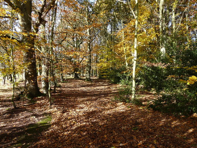
[14]Path through Northchurch Common (Photo taken 12/11/08)
[15]Path just beyond the lane to Aldbury (Photo taken 12/11/08)
[16]Aldbury Nowers and Pitstone Hill, from path just beyond the lane to Aldbury (Photo taken 12/11/08)
I continued across the lane on a clear path through the woods [15], soon passing a lonely cottage in the trees. I then had to turn sharply right [16] on to a good track (which I recognised as part of the route of the Chiltern Way) but then turned left after only a few yards, to continue in a northerly direction. The Ashridge Estate Boundary Trail was now following a very muddy bridleway through the beech wood, but I took a parallel path (for walkers only) to avoid the mud, rejoining the bridleway after a couple of hundred yards. The bridleway ran close to the top of the steep escarpment of the Chilterns, with the charming village of Aldbury somewhere below. I noticed some Deadly Nightshade next to the path, and also several instances of Herb Robert with its delicate little flowers
The bridleway ended at a junction where it met the main track coming up from Aldbury to the monument and Visitor Centre (part of the route of the Hertfordshire Way again) [17]. I turned half-right here to follow the track upwards, but just before reaching the open area of grass surrounding the monument I stopped at a bench to have my lunch. It was a little earlier than usual for my lunch stop (about 12.35pm), but I had almost reached the point where I needed to decide if I felt OK to do the whole walk or to cut it short and head back to my car (it would be a simple 20-minute walk back there from the monument). I felt fine, possibly a bit more tired than usual, but decided to see how I felt after lunch. After eating my sandwiches and apple, I decided that I felt perfectly OK to carry on – there was another point further on where I could shorten the route if necessary anyway.
[17] The main path from Aldbury to the Bridgewater Monument(Photo taken 12/11/08)
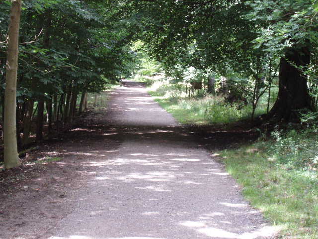
[18]The main track from the monument to Ivinghoe Beacon
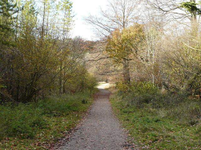
[19]The main track from the monument to Ivinghoe Beacon (Photo taken 12/11/08)
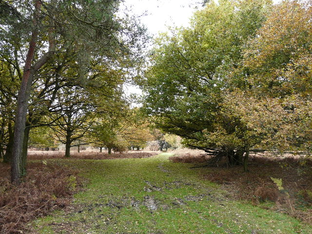
I crossed the grass in front of the monument. This very tall column was erected in honour of the third Duke of Bridgewater who was responsible for the building of much of the canal network (‘the father of inland navigation’). The Bridgewaters used to live at Ashridge House, and the pub in the nearby village if Little Gaddesden is still called the Bridgewater Arms. There were a few groups of children playing on the grass, but not as many as I’d expected considering that it was still the school holidays. The car park by the Visitor Centre looked fairly full though. Not surprisingly I passed several over people as I continued on a good track through the trees, still heading northwards towards Ivinghoe Beacon. This track through the beech trees had obviously been resurfaced with small stones fairly recently [18]. It is usable by electric invalid buggies for over a mile, and I passed a National Trust Land Rover as I walked along. Having walked this main path between the monument and Ivinghoe Beacon so often over the years, I nowadays tend to avoid it – I usually turn left, just after the monument, to descend the steep slope at an easy angle, then turn right on a footpath across two or three fields before climbing steeply back uphill through the trees to rejoin the track. This is actually slightly shorter as it is more or less a straight line, whereas the track follows a long but fairly shallow curve as it follows the top of the steep northern slope of the hills. But today I followed the route of the Ashridge Estate Boundary Trail along the main track [19, 20]. After half a mile or so I had got away from the crowds, and the only people I came across after that were a family out cycling whom I’d seen setting off from the monument ahead just ahead of me.
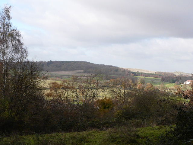
Near a hill called Clipper Down, the trees on my left gave way briefly to allow me a view over the valley on my left towards Tring Park, where I’d walked on my Berkshire-Essex walk a few weeks ago [21]. There was the usual barking from caged dogs as I passed the boarding kennels here – I think they used to be the kennels for a hunt, many years ago. The track now descended slightly and then I left it, forking left on a downhill path. This crossed a stile, where the trees gave way to more open grass and scrub [22]. I hadn’t seen too many flowers in the woods, but here there were Harebells and more Herb Robert, amongst others. This path took me down to a crossroads of paths, between Pitstone Hill over to my left and Steps Hill on my right.
[20]View towards Aldbury, from the main track from the monument to Ivinghoe Beacon (Photo taken 12/11/08)
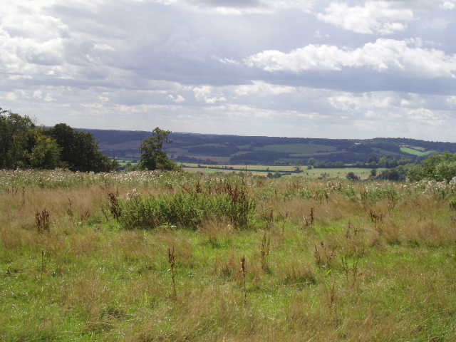
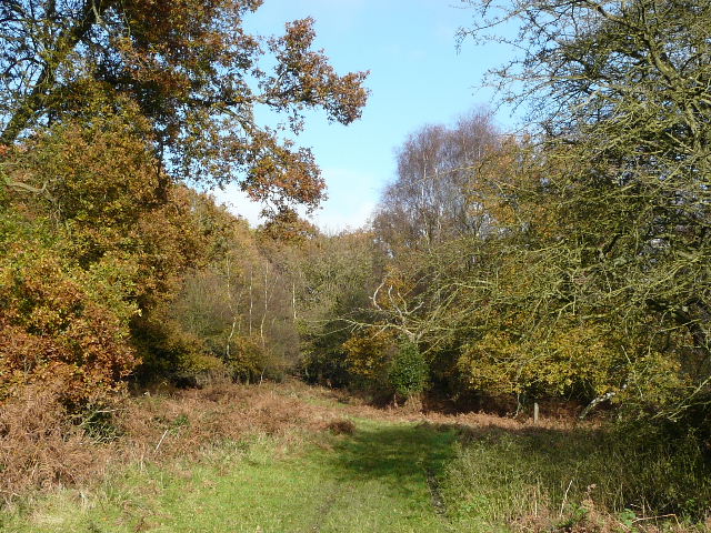
[21]View from near Clipper Down
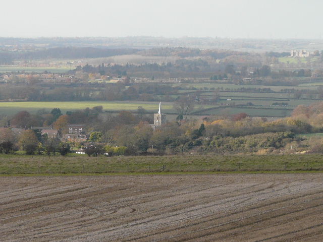
[22]Ivinghoe and the Vale of Aylesbury from just before I reached Steps Hill (Photo taken 12/11/08)
As I turned right and followed the good path heading up towards Steps Hill [23], it started to rain – I’d seen the dark grey clouds coming my way for sometime so was expecting it (the forecast had said there might be showers). It soon became quite heavy and I stopped to don my waterproofs – as I did so, a couple came running down the path, obviously in a hurry to get back to the car park below Pitstone Hill. As I struggled to pull on my water proofs, the women jokingly asked if had any spares! I carried on up the path, which turned sharply left as it climbed steadily to the top of the slope. I was now on the Ridgeway path, which I’d follow to Ivinghoe Beacon. On my left was the deep hollow of Incombe Hole [24] – when I first attempted this walk about three weeks ago I saw a red kite here, the second nearest one I have seen to my home in Kensworth. They are definitely spreading this way!
[23]The Ridgeway path heading up Steps Hill (Photo taken 12/11/08)
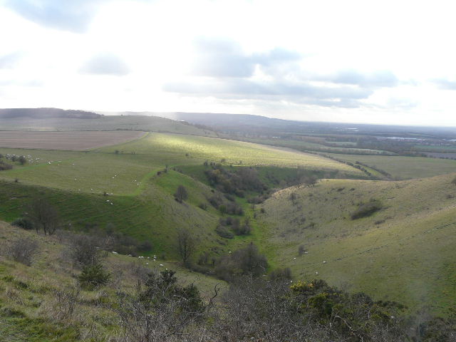
[24]Incombe Hole from Steps Hill (Photo taken 12/11/08)
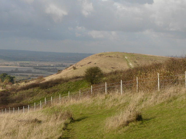
[25]Ivinghoe Beacon from Steps Hill (Photo taken 12/11/08)
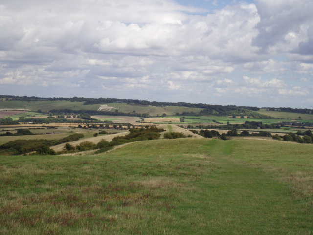
At the top of Steps Hill, the path crossed an open grassy area (a sign warned of the dangers of discarded munitions) and then through some bushes before descending slightly through scrub [25] and working its way round to the road that winds its way round the back of Ivinghoe Beacon. Again I saw more wild flowers in this area, more Harebells and some Scabious. The rain, which had been quite heavy for a few minutes, had now stopped, but I could see more grey clouds ahead so I kept my waterproofs on. I crossed the road, where a couple of cyclists had stopped, presumably to get their breath back, and followed the broad chalky track over a subsidiary bump and then up the short but steep climb to the top of Ivinghoe Beacon. The views over the Vale of Aylesbury [26] and towards the downs at Whipsnade and Dunstable were as impressive as ever, but I could see that more rain was on the way so I didn’t stop.
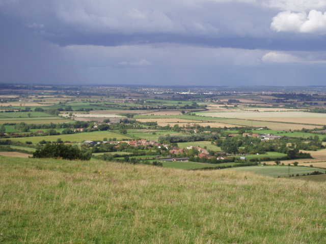
[26]View from Ivinghoe Beacon, over the Vale of Aylesbury towards Leighton Buzzard - there was definitely some rain on the way!
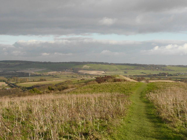
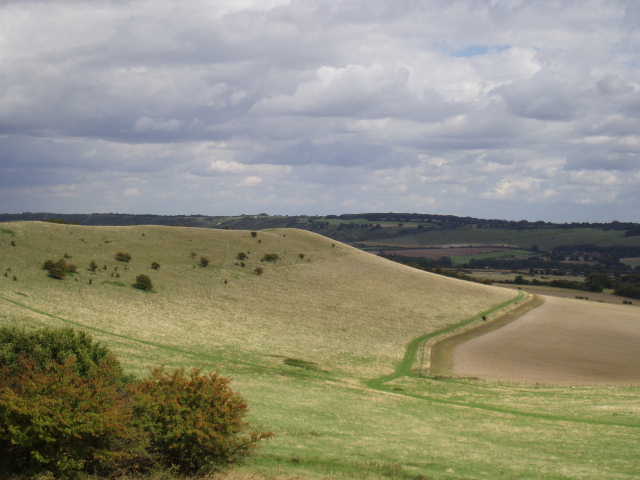
[27]The path along the top of Gallows Hill, looking towards the Downs and Whipsnade Zoo (Photo taken 12/11/08)
[28]The path about to enter the woods on the way to Ward's Hurst Farm (Photo taken 12/11/08)
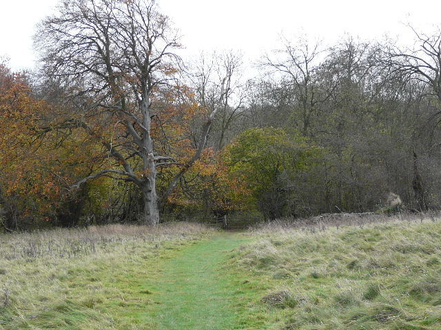
Having been walking north for several miles, I now turned to my right and headed just slightly north of east, following a good path through the grass along the lengthy ridge of Gallows Hill. Almost directly ahead of me I could see the chalk figure of a White Lion, marking the whereabouts of Whipsnade Zoo [27]. This was a very pleasant section of the walk, with steep hillsides dropping away on either side of me, and good views in most directions. After following the ridge for almost half a mile as it gradually descended, I turned right on a farm track and then right again at the next field boundary – I was now heading roughly south-east, the direction for all the rest of the walk. The path followed a left-hand hedge, and then crossed a green headland between two large ploughed fields. A kissing-gate then gave access to an open area of grassland at the foot of a steep slope, where I turned slightly left, joining the route of the Icknield Way. It was now raining again, as I passed through another kissing-gate to enter another area of woodland [28]. I got a fleeting glimpse of about a dozen Fallow deer as they ran off through the trees here. After a few hundred yards, the deciduous trees gave way to a plantation of fir trees (I always feel this section is rather ‘spooky’ compared to the rest of the woods!) for a couple of hundred yards. Beyond this, the path soon started to climb steeply uphill through the trees. After a while a field appeared on my left, and at the top of the slope the path left the trees to cross some waste ground to reach Ward’s Hurst farm.
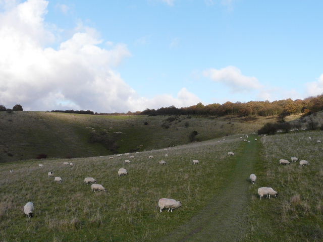
[29]The path from Ward's Hurst Farm heading towards Ringshall Coppice (Photo taken 12/11/08)
It had just about stopped raining now, as I followed the rather convoluted but well-signed route through the farmyard [UPDATE: the path here has since been re-routed and now just goes straight on, avoiding the farm yard and farm buildings]. Over a stile, I followed the path [28] through a sequence of four fields where sheep were grazing. In a wood to the left of the last of these fields I had seen a group of Fallow bucks when I first tried this walk three weeks ago. The Ashridge Estate Boundary Trail then took a fenced path beside another empty field, before turning right beside a water works and following a driveway down to a road on the edge of Ringshall (the road from Ivinghoe Beacon). Across the road I re-entered the beech woods, although there was a large open grass area with a car park over to my right. It now started raining again, quite heavily, so I was glad I’d kept my waterproofs on. The Ashridge Estate Boundary Trail was well sign-posted as it turned right, left and right again on a series of woodland paths. I soon came to the junction where I’d abandoned my earlier walk on this route - embarrassingly I had then got lost and somehow walked in a circle and came back to this point! In fact, I only needed to keep on the path that went right here and it would take me straight back to the monument where I’d parked that day. Anyway, today I just needed to carry on ahead, and within a couple of hundred yards I reached the car park and my car. It was now about 3pm. The rain was now really pouring down, and it was a wet and messy business getting my boots and waterproofs off. But this didn’t dampen my enthusiasm for what had been a very enjoyable walk.
Total Distance: 16 miles
To see this walk when I did it again on 19/3/11, click here - Ashridge Estate Boundary Trail. There is now another description of this walk with far more photos from when I walked the route in April 2016.
Post-walk comments
I actually enjoyed the Ashridge Estate Boundary Trail much more than I’d expected to. When I set off to walk it, I had a couple of slight reservations about it. Firstly, I thought that as it tried to follow the boundary of the Ashridge estate, it might seem a rather artificial walk, using paths because they followed the boundary rather than because they were a pleasure to walk. This proved not to be the case at all – all the paths taken by this walk were very enjoyable and I never got the sense that the walk was going somewhere just because it had to as that was where the boundary went. It went through a couple of farm yards and passed a water works, but otherwise didn’t pass anything that detracted from the pleasure of the walk.
My second reservation was that I might be over familiar with the route. Living locally, I must have done at least a hundred walks in Ashridge over the years. In particular, I have devised my own long circular route round the area (although including Pitstone Hill) which I have done many times now (see my Alternative Ashridge Walk). I fully expected a lot of the Ashridge Estate Boundary Trail to coincide with my route, but in fact I was pleasantly surprised how little the two routes did coincide. Much of the Ashridge Estate Boundary Trail was entirely new to me. The only bit that I found a bit boring was the main track heading from the monument towards Ivinghoe Beacon – but this would be a perfectly pleasant walk though beech woods to anyone new to it.
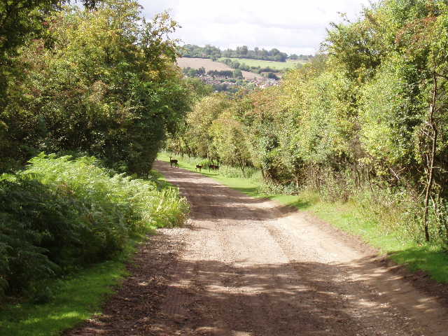
You can just about see some Fallow deer and fawns, on a track near Northchurch
So, despite the heavy showers or rain towards the end of the day, I really enjoyed this walk. As it is so close to where I live, I am sure that I will do it again sometime, possibly in the opposite direction. I always enjoy walking through the beech woods, and the sections through farmland added a nice bit of variety. There were some good views to be had at certain points on the route, especially from Ivinghoe Beacon. On this particular day I only saw Fallow deer twice and no Muntjac deer at all, which was slightly disappointing – I’m fairly sure there’d be more deer sightings if I did the walk another time.
Update - On 27th November 2006, I did this walk again but in the opposite direction, starting and finishing at the car park by the Monument and visitor centre. It was just as enjoyable walking the route in the anti-clockwise direction, although again I had one or two showers and it was very windy on Ivinghoe Beacon.
Further Update - I have since done this very enjoyable walk several times in both directions. For a brief description and photos of the walk in the anti-clockwise direction, see this walk I did on on 12th September 2009.