Pete's Walks - The Chiltern Chain Walk, Walk 14
If you are considering walking this route yourself, please see my disclaimer. You may also like to see these notes about the maps and GPX files.
Google map of the walkDownload GPX file of the walk
Walk 14 2/06/08 – West Wycombe and Fingest (14.0 miles approximately)
Parked in village car park in West Wycombe.
If you are interested in walking this route yourself, click here to see the route description (but only if you have already read my disclaimer and notes regarding route descriptions).
As you no doubt realise by now, I am very much a ‘fair-weather walker’, only venturing forth when there is a negligible chance of getting rained on. Well, as I’m fortunate enough to be able to choose which days I walk, it makes sense to select the days with the best weather. Today though I was feeling guilty about only walking once last week, so I set out this morning despite the forecast predicting a grey day with the possibility of rain by mid-afternoon.
Of course, I have to rely on weather forecasts to decide which days I will walk. I use a variety of sources - the weekly forecast on the BBC’s Country File programme on Sunday mornings, the forecasts in the Grauniad and Daily Torygraph, the BBC’s weather web site, Ceefax pages 401 and 402, and (if I remember) the forecasts on Breakfast TV before I set out. It’s surprising how they differ sometimes! Last week the presenter of the Countryfile forecast happened to present the weather after the news the following day – she’d obviously totally changed her mind!
Usually I find the forecasts are fairly accurate for the next 24 hours, a bit less reliable for the following day, and I don’t pay too much attention to any forecast beyond that. I think the forecasts tend to err on the pessimistic side, forecasting showers or rain that doesn’t materialise (I read that some owners of tourist attractions believe this and are very upset about it, as it reduces their visitor numbers). As it happened, today turned out to be one of those occasional days where the forecast proved to be slightly optimistic. It was meant to be largely overcast but dry until mid-afternoon, but there was some light rain on and off as I drove to West Wycombe. Fortunately it stopped as I put my boots on in the car park, but it was still a very grey and heavily overcast morning and I knew I’d be donning my waterproofs before too long.
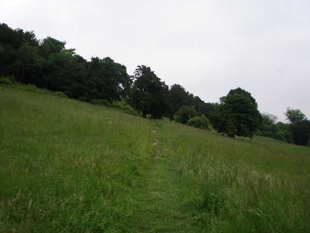
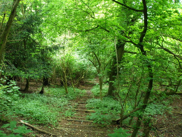
[1]The path up West Wycombe Hill
Unsurprisingly, West Wycombe lies to the west of High Wycombe. It is a very attractive village with many fine buildings from the 16th to 18th centuries dotted along the A40, the old London-Oxford road. The village was sold to the National Trust in 1929 by the Dashwood family, who needed to raise money after the Wall Street Crash. The Italianate West Wycombe Park was built for Sir Francis Dashwood in the middle of the 18th century. The church, also 18th century, stands on top of West Wycombe Hill and is a prominent landmark – the golden ball at the top of the tower seats eight people, and gives panoramic views. The hilltop was once the site of an Iron Age hill fort, and as well as the church it is now surmounted by the Dashwood family mausoleum, inspired by the Colosseum in Rome. At the foot of the hill are the Hellfire Caves – thought to be of ancient origin, they were extended by Sir Francis Dashwood in the 1740’s and later used as a meeting place for his notorious Hellfire Club.
I crossed the road from the car park and followed a clear path climbing steadily across the steep grassy slope of West Wycombe Hill [1]. There were trees further up the slope to my left, and through a gap in them I saw the circular Dashwood mausoleum. Somewhere ahead and to my right, at the foot of the hill, was the entrance to the Hellfire Caves (which I must get round to visiting sometime!). The path turned slightly left and steepened, going up a flight of wooden steps at one point. It ended at a T-junction with a wider path on a broad grass strip where I turned left to reach the mausoleum – looking back, the grass strip lined up with a long straight stretch of the A40 into High Wycombe, making the mausoleum an even more prominent landmark.
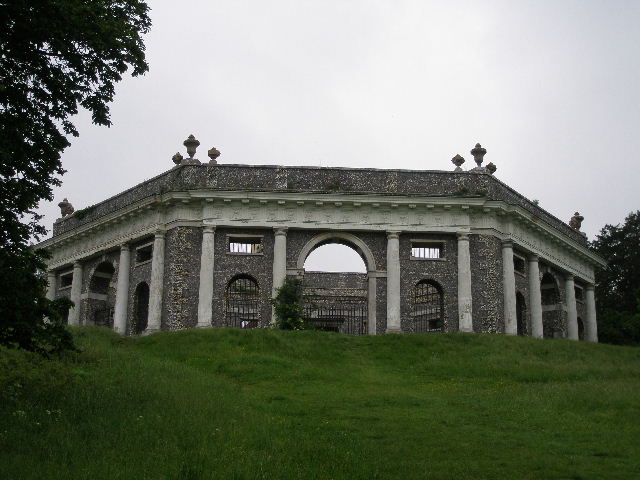
[2] The Dashwood family mausoleum on top of West Wycombe Hill
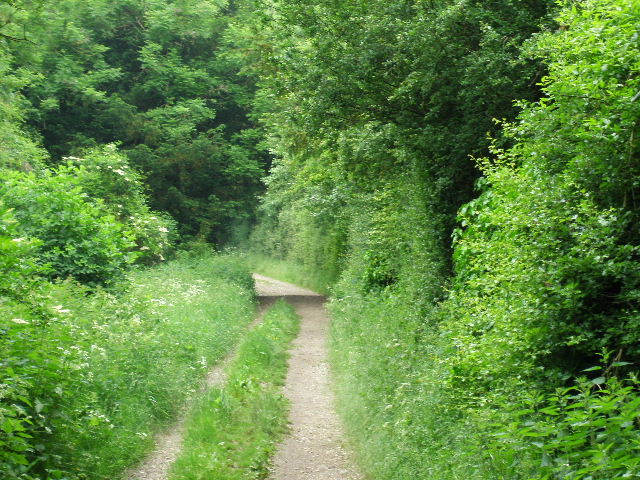
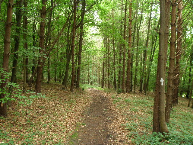
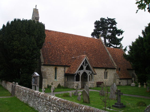
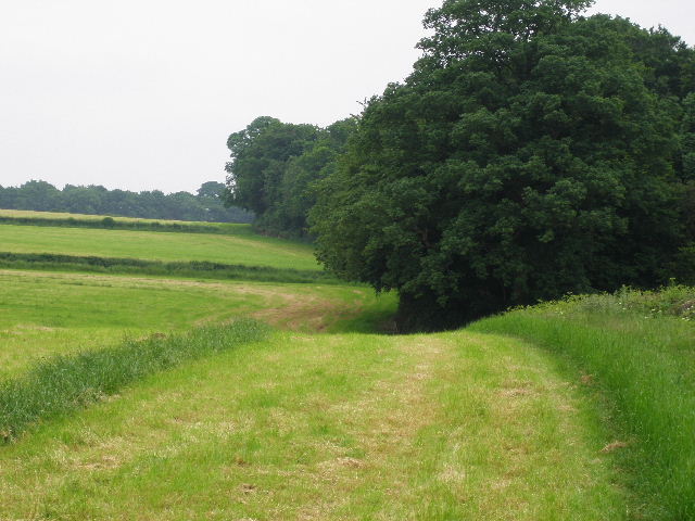
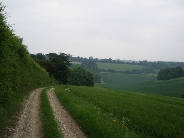
I followed a path round to the left of the mausoleum [2], which soon passed through the churchyard of St Lawrence’s church [3]. The Italianate tower with its gold ball on top is also a prominent landmark, which I’d see again later as I approached Radnage. I continued across the car park behind the church and followed a short path through grass to reach a wide track, initially beside a hedge on my right. The track would remain pretty level as I followed it for a mile or more [4] – the church and mausoleum were at the end of a ridge, which I was now following northwards. After the first hundred yards or so I rarely saw the valleys on either side, as the track was generally through woodland. I saw my first Foxgloves of the year here – I’d see them again later on in a couple of places. There were some paddocks or fields beyond a thick hedge on the right at one point, before the track continued through Hearnton Wood [5]. This was a very pleasant start to the walk, an easy level track in sylvan surroundings.
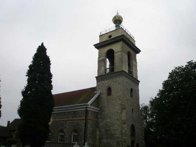
[3] St Lawrence's church on West Wycombe Hill
[4]Near the start of the track to Hearnton Wood
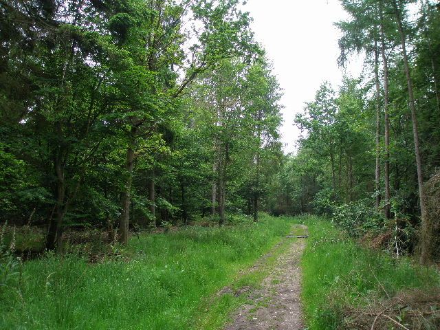
[5] The track through Hearnton Wood
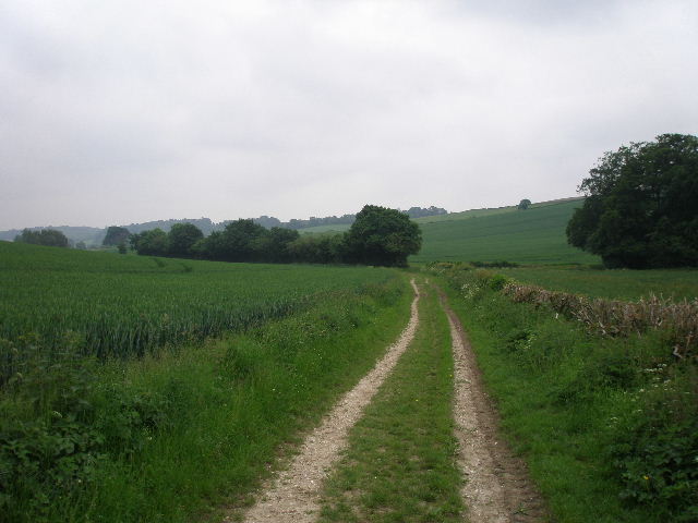
Eventually I reached a gate, beyond which a path continued ahead between a thick hedge and the wood on my right. It soon reached Nobles farm, and carried on along the farm drive. The wood was still on my right, with fields to my left. There was a small gap in the wood at one point, where I could see over the valley to my right [6] (just north of Bradenham, I could see a path I’d followed on Walk 13). A bit further along the drive I had a bit of a hold up. A lorry had tried to get to Nobles Farm, but had given up because of all the overhanging branches from the wood that were hitting its roof. It was now slowly reversing, the driver’s mate (presumably) guiding it back, trying to avoid the worst of the branches [7]. A farmer with two dogs in the back of his Land Rover was also following its progress. The lorry was going slower than my walking pace (!), so I had to wait patiently as it manoeuvred backwards. The fields on the left soon ended, and the lorry continued reversing along the drive, now in Allnutt's Wood – a van coming the other way had to go back some way to find a point where the two vehicles could pass.
[6] View from the drive from Nobles Farm, looking east across a valley just north of Bradenham
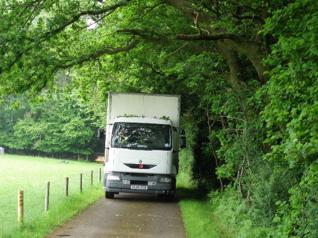
[7]The lorry that got impeded by the low branches along the drive to Nobles Farm
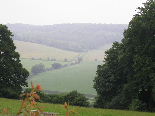
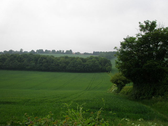
Towards the end of the wood, I turned half-left onto a footpath, leaving the lorry to reverse down the hill towards the lane near Slough Hill (where I turned left, Walk 13 had gone to the right). The path ran through some bushes and trees and over a stile, before emerging into a large meadow on a steep hillside, where I immediately spotted some Common Rock-rose. There were nice views here along and across the valley in front of me [8] – they looked good even on this very grey day, they’d be even better on a sunny day I’m sure. The path descended diagonally downhill across the meadow to a gate, where I turned left on a lane. I passed an attractive old brick-built farm complex on my left, with a dry pond in front of it (surprising given all the recent rain).
[8] View from the edge of Allnut's Wood
The lane soon turned left, and almost immediately afterwards I took a footpath on the right, following a hedge on my left uphill. I soon came to a corn field where I could see my trousers would get a soaking from the damp crop, so I stopped to put on my waterproof overtrousers (well, it had worked in preventing blisters on my last walk!). Beyond the arable field the path continued uphill through another meadow to reach the end of a lane. There were just one or two houses here as I followed the lane a short distance to the top of the hill and a road, where I turned right to enter Bledlow Ridge. I followed the road through the village for about a quarter of a mile, but turned left onto a footpath long before I reached the section of the village where I’d started and finished the previous walk.
[9]The photo doesn't show it clearly, but these steps are going very steeply downhill! Honest!
The path followed a hedgerow, with tennis courts and a children’s playground on my left at first, and then the village cricket pitch. The path continued along the hedgerow, now beside some paddocks, then descended very steeply through a small wood – so steeply that it was on a long flight of wooden steps [9]. These emerged on a quiet lane, where a bridleway continued almost opposite [10], dropping gently now along the edge of a corn field to the bottom of the valley. There were pleasant views here, though not as nice as the previous valley (though there I had the advantage of a higher viewpoint). The path ran through the end of a small narrow wood, where I paused to allow a horsewoman to overtake me. It was now starting to rain gently, and so I put on my waterproof jacket. The bridleway continued up the opposite slope of the valley, following the edge of another large corn field. Soon there was a thin belt of trees to my right – a path seemed to run through the middle of it, but the official right of way clearly ran along the field edge.
[10] View towards Radnage, from the lane at the foot of the steep steps
[11] Converted chapel in Radnage
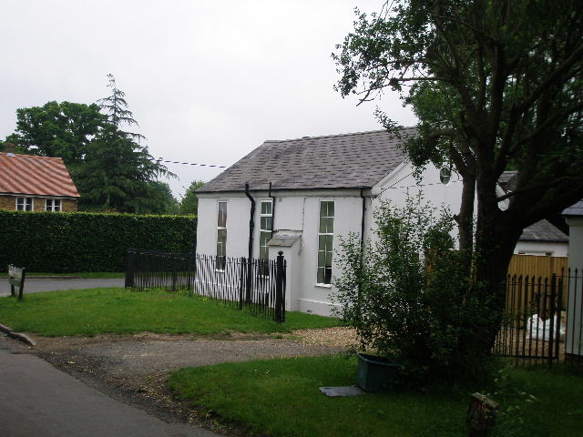
At the top of the hill I reached part of Radnage, one of those villages that is spread out in a number of ‘ends’ or hamlets. It is one of the few disappointments of this route that I didn’t manage to include Radnage church, which I passed on the Chiltern Way (it recently featured in the BBC’s excellent Cranford, I recognised it immediately). I turned left along the road for about a hundred yards, spotting a Red Kite overhead, before turning right by a white-painted chapel that had been converted to a private residence [11]. I followed the lane, passing the village hall on my right, and noticed masses of Wood Avens in the hedgerow, more than any I’d seen before. It would soon be apparent that this would be the ‘Flower of the Day’ as I seemed to see it everywhere today – not just in woods, but in almost every path I walked and, as here, in the villages I went through. The lane ended at the bottom of a small valley, where I turned left and followed a hedgerow along the valley bottom to reach Bottom Wood, a nature reserve.
[12] View looking right, from the path to Studley Green
[13] The path through the wood beyond Studley Green
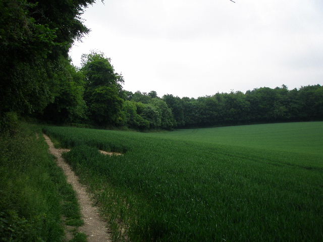
The path just went a few yards through the end of the wood, then went steeply uphill along the right edge of a pasture [12]. Through a gate at the top of the hill, I continued beside a right-hand hedge, with several more Red Kites visible ahead of me. Beyond the large corn field on my left, I crossed a small meadow to reach the old A40 immediately south of Studley Green. I went a few yards to the right, then crossed over and took a path into the wood opposite. I almost straight away came to a junction where I forked left, continuing in more or less the same direction over a couple of minor path junctions amongst the trees. When I could see a field corner just ahead and to my right, I turned left at a footpath junction indicated by white arrows on a tree. This led almost back to the A40 at one point, before veering right and going downhill, soon passing an area of conifers [13]. As well as the ubiquitous Wood Avens, I saw Wood Speedwell, Herb Robert and Greater Stitchwort along the path.
[14] The field-side track beyond the wood
[15] Forestry operations in Barn Wood
[16] Forestry track through Leygrove's Wood
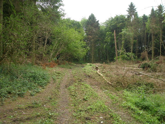
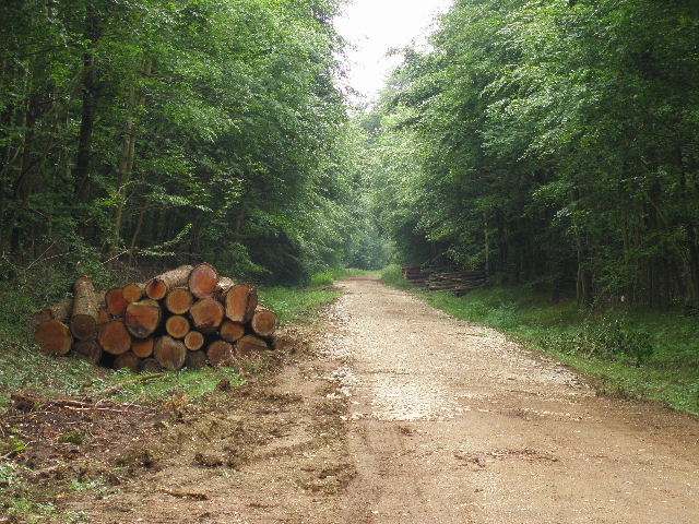
On finally leaving the wood, I turned left along a track beside a corn field [14]. The rain, which had never been very heavy, had now stopped. Where the field edge turned left after a couple of hundred yards or so, I took a path going right. This soon entered the end of a very long belt of trees, and continued through it for some distance. The path here was quite muddy in places, but not too bad. At the end of the tree belt, I went over a crossing path and continued through Barn Wood [15], and then through another broader tree belt - I was glad the path, now a broad track, wasn’t too muddy here, as last time I came here it was a right mess due to recent forestry work. The tree belt led to Leygrove’s Wood – the track was now surfaced for forestry vehicles, and there was evidence of forestry working such as piled up logs beside the track [16]. Beyond this wood there was a gap of a hundred yards or so to another wood (Pound Wood). I took a path going left, soon joining another forestry track that went downhill and through a bridge under the M40 motorway to reach a minor road in Cadmore End.
[17] Cadmore End church
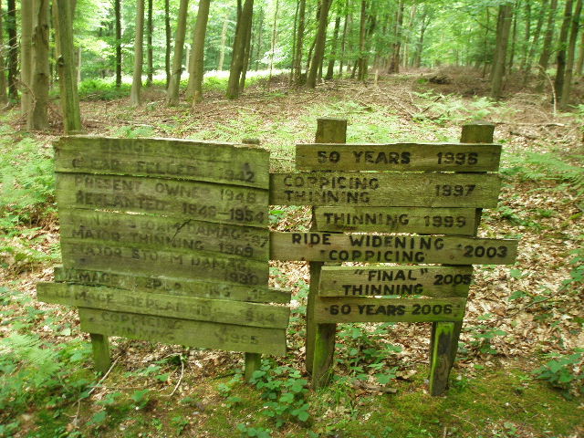
[18] Signboards showing the history of Hanger Wood since 1942
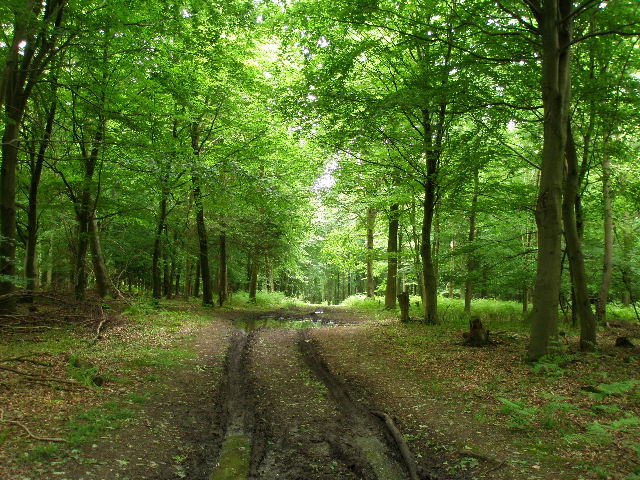
[19] The path through Hanger Wood
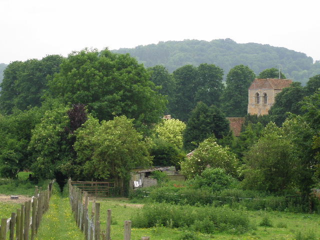
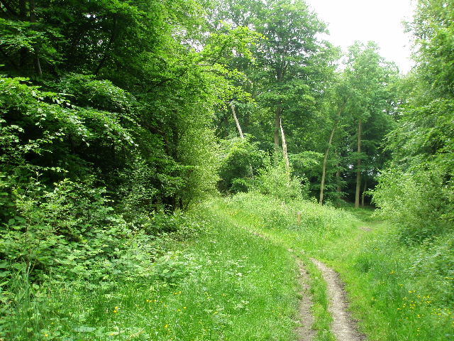
I followed the road to the right, passing the village school, then turned down a lane on the left (I could have cut across a small green here). I went by a few cottages and then the village church [17], before turning right on a bridleway, a hedge-lined track. This descended slightly and came to Hanger Wood – the bridleway ran along the edge of the wood, but I forked right on a path rising gently uphill through the wood. Part way through the wood I came to some interesting hand-made notice boards, giving the history of the wood over the last 60-70 years [18]. After a while the path [19] started to descend through the trees. On the edge of the wood I stopped for lunch on a bench (set up to commemorate the Queen’s 80th birthday), with nice views ahead over Fingest and the Hambleden valley [20].
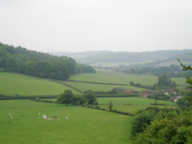
[20] View over Fingest towards Skirmett and the Hambleden Valley
[21] The path leading into Fingest
According to different sources, the name Fingest derives from the Anglo-Saxon ‘Thinghurst’ meaning ‘wooded hill where assemblies meet’, or it is from the Norse for ‘meeting place in a spinney’ – take your pick!. The church of St Bartholomew has a massive Norman tower surmounted by a double gable – there is thought to be only one other similar arrangement in the country. The tower is also unusual in being wider than the nave – these are the two oldest components of the church, the chancel being added in the 13th century. Inside the church there is a 15th century octagonal font.
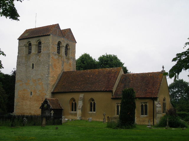
[22]Fingest church
[23]The footpath leading away from Fingest
[24] Looking back to Fingest from the lane
I then continued downhill, between a barbed wire fence and a hedge on my right. The path then continued between the wooden fences of paddocks to reach Fingest [21], opposite the impressive church [22]. I turned left to reach a T-junction opposite the village pub, and turned left to leave the village. There was soon a broad track running along the wide verge on the left – I spotted some Woody Nightshade here. After quarter of a mile or so, I turned left on a bridleway along a farm track – this soon turned right, parallel to the lane, and ran along the edge of Hanger Wood on my left (it was the continuation of the bridleway from Cadmore End). I soon came to a fork, where the wood and bridleway curved left but I went straight on along a broad footpath. I stopped and chatted for a few minutes with an elderly walker coming the other way – he was off to the Lake District in a few days, and hoped to climb Helvellyn, having had to turn back on a couple of previous attempts.
The path ran alongside the right edge of a large empty pasture [23], then went over a stile into a sheep pasture. Several lambs fled as I followed the hedge on my right as it turned sharply right. In the field corner, I left the field to reach the corner of a lane, where I went straight ahead. Where the lane [24] turned sharply to the right, I went left on a footpath rising uphill along the edge of a cattle pasture – there were some Jersey or Guernsey cows away to my left. Over a stile, the path continued between a hedge and wire fence and wood on my right. Beyond the hedge was a large meadow, recently mown. The hedge ended when I reached the end of the meadow, and I just followed the edge of the wood through the next meadow – there were three or four Red Kites here. In a field corner the path left the wood, turning left along the hedgerow [25]. It soon came to a gate that took it into a wood (Long Copse). It was only a short distance before the path emerged on the other side of the wood, where it followed the edge of the wood through two large corn fields to my right.
[25] Path approaching Long Copse
[26] Field path approaching Fining Wood
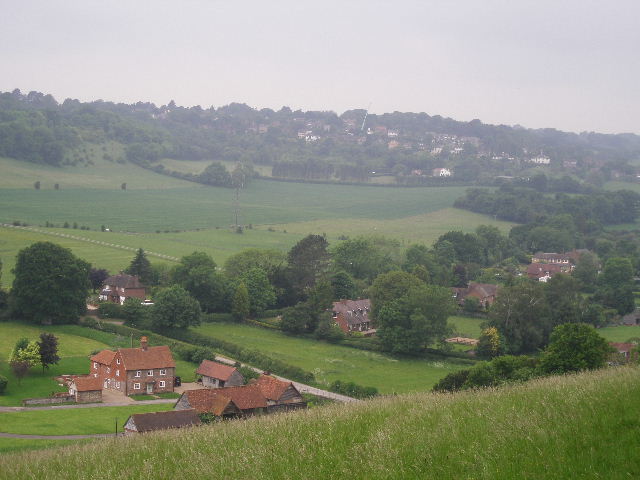
The path then went through another gate into Fining Wood [26]. I immediately turned right, following a path close to the edge of the wood on my right. As usual, the path was indicated by white arrows painted on trees. I now decided, at long last, to take off my waterproofs. A little further on, there was a fork where I went left to join a wide track, open to the skies – so of course it now started to rain again! I hurried on along the path [27], fortunately it soon narrowed and I was sheltered by the trees again. I went over a small footbridge over the course of a little stream (unusual in these chalky hills), and then the path left the wood, running through hedgerows to reach an unmade road in the hamlet of Ditchfield. I turned left, passing a pub and following the gravel road through some small industrial area to reach a road on the edge of Lane End. I crossed the road and went through a small area of trees to reach a path running along a substantial and old brick wall. I turned left along the path, but soon stopped to put my waterproofs back on as the rain was getting heavier. Beyond the end of the wall the path passed right in front of a large house, then wiggled to the right through its garden to pick up a narrow alley that led to the centre of the large village [28].
[27] Path through Fining Wood
[28] Lane End
I crossed the road to continue along an alley opposite – before entering the alley, I stepped aside to let two women with a pram coming the other way go by. They went past with not a word of thanks or acknowledgement – such ignorant rudeness really grates with me. The hard-surfaced path ran between iron fences, with some industrial units on the right, then a school and then an area of grass. I crossed over a residential street and continued along the path or alley to reach a metal kissing-gate on the edge of the village. I went a few yards further on to a second such gate on my right. Through this, I immediately forked left, on an initially very muddy path between bushes. The path continued along the right edge of a grassy meadow, with houses to my right. By a partially hidden fingerpost, I turned right on a thin path through the meadow (feeling rather glad to leave Lane End behind).
[29] Bridleway heading back towards West Wycombe
The path continued over a second smaller meadow. Over a rickety stile I reached a drive (going to a reservoir to my right – I know this from one of my exploratory walks in this area!). The path continued on the other side, running through another wood. I went left at a junction, and emerged from the wood where a private drive to some company met a minor road. I turned right along the road, straight away crossing a bridge over the M40. My route then went left, along the edge of a field with a wood on the right. Beyond the wood I carried on alongside a hedge to reach the field corner, where I went over a stile on the right into an empty paddock. I went slightly left across the paddock, to where the hedge on my left turned left. I followed it round the corner, to reach a stile in the paddock fence ahead of me. I crossed the drive to a farmhouse on my left, and continued down a track ahead of me, descending gently with pleasant views ahead [29].
When a wood started on my left, I left the bridleway and followed a parallel footpath just inside the edge of the wood. I was pleased to see a new post with waymarks indicating this junction, as it was unmarked when I first came this way. Sadly there was no such marker indicating where the path left the wood to rejoin the track beside the wood – after about quarter of a mile, there was a gateway on the right, but I left the path and made my way to the remnants of a stile a short distance further on (UPDATE 26/1/11 The exit from the wood is now a few yards further on from the broken stile). I turned left along the edge of the wood, but soon went slightly right across a grass area in the corner of the field – I saw my first Yellow Rattle of the year here.
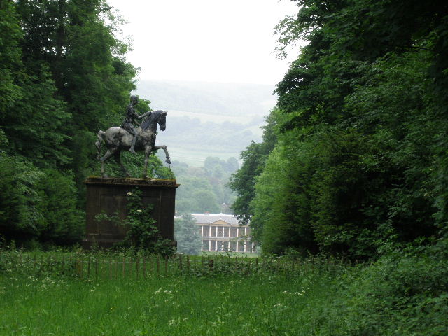
[30] Statue and West Wycombe House from Towerage
I went through a gate and followed the path steeply uphill, initially in a grass break between the trees of yet another wood. I was delighted to see some Common Spotted Orchids here, not quite in full bloom. Beyond a crossing path, I went slightly left, continuing uphill through the wood. Beyond the wood, the ground soon levelled out as I followed the edge of a ploughed field to reach a lane or drive in Towerage. I turned left here – soon there was a break in the wood on my right, where I saw an equestrian statue at the end of a grass ride leading downhill to West Wycombe House [30]. At a junction, I turned right, following a lane downhill through the woods. When the lane left the wood, I got a glimpse of West Wycombe House below and to my right. Ahead of me was a good view, where I could see the road I’d be taking back towards Princes Risborough, with Lodge Hill in the distance. As I carried on down the lane, a Red Kite flew slowly away. At the bottom of the hill, the lane reached the A40. It was then a short distance along the road to the edge of West Wycombe, where I turned left to return to the car park.
I had set out just after 10am, and it was now 3.50pm – allowing 10 minutes for my lunch break, a ridiculous five hours and forty minutes to walk 14 miles. I was quite bemused as to why it took so long, though I wasted a few minutes putting on and taking off my waterproofs. I did take almost 140 photos, but that is about the usual number nowadays.
The rain was never very heavy, and had stopped before I got back to the car. It was a shame that it was such a grey and damp day – but this hadn’t stopped me from enjoying this walk. It was a very pleasant route, quite varied with a mixture of woods and fields and numerous ups and downs. On a nice day, there would have been charming views in many spots. I was actually quite pleased with the route (apart from the dull half-mile or so through Lane End). A major problem in devising the route of the Chiltern Chain Walk was to find two ways of crossing the M40 that were quite close together – I’d tried a couple of other routes on my exploratory walks but had to reject them (bulls in a field and a very dangerous road walk were the main reasons). I think this route that I ended up was perfectly satisfactory, and I enjoyed today’s walk despite the rather grim conditions.
The next three walks are some of the very best on the Chiltern Chain Walk, so I’m hoping for some nicer weather over the next few days!
Total distance: 173.1 miles
(To see this walk repeated IN THE OPPOSITE DIRECTION on 8/12/12, CLICK HERE)